
Photo: Wikipedia
Strategic Assessment of Vigo County
Meaningful friction. Expect exposure to either population pressure, blast zones, or natural disaster risk. Consider buying a retreat property.
What does the Strategic Assessment tell us?
Our Strategic Assessment grades tactical survivability of an area. Major population centers, military targets, fallout zones, natural disasters, and border exposure all drive risk — lower exposure means a more defensible position in a crisis.
This is heavily inspired by Joel Skousen's Strategic Relocation book. Highly recommended you checkout the book ($)What does this tell us?
Our Strategic Assessment grades tactical survivability of an area. Major population centers, military targets, fallout zones, natural disasters, and border exposure all drive risk — lower exposure means a more defensible position in a crisis.
This is heavily inspired by Joel Skousen's Strategic Relocation book. Highly recommended you checkout the book ($)Strategic Pillars

Key Distances
Strategic Assessment Analysis
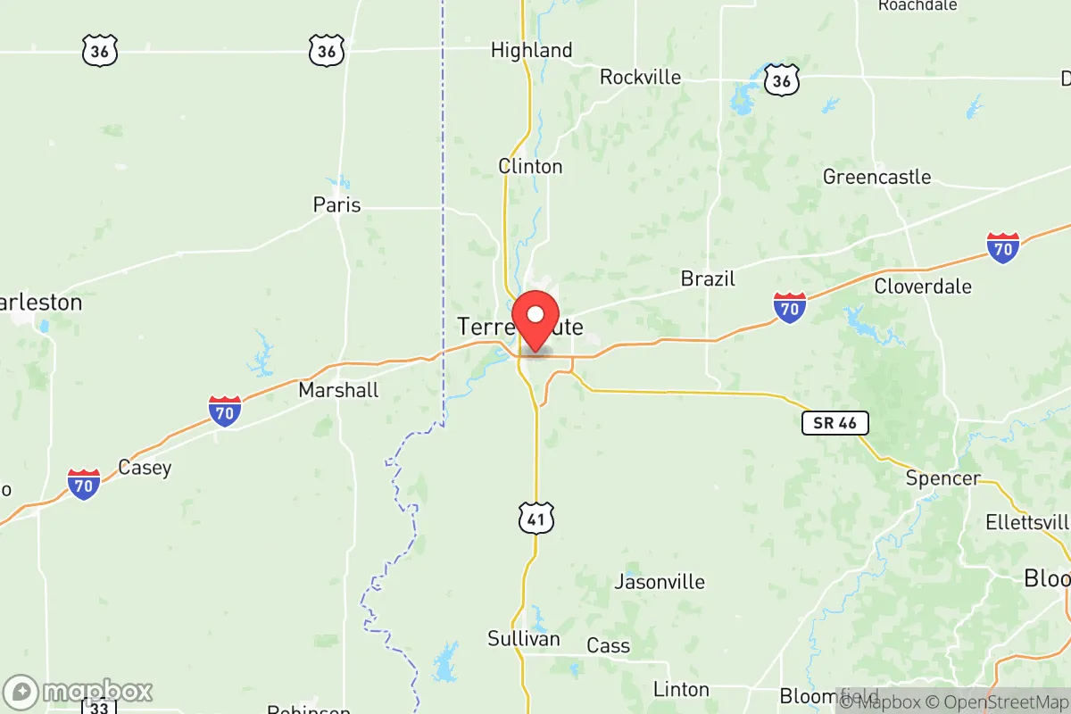
Vigo County, Indiana, anchored by the city of Terre Haute, occupies a strategic position in the Wabash River Valley that offers a compelling mix of geographic resilience and practical self-sufficiency for relocators prioritizing disaster readiness. Its location roughly 70 miles west of Indianapolis and 90 miles north of Evansville places it outside the immediate blast and fallout zones of major metropolitan targets, while still providing access to regional supply chains and healthcare infrastructure. The county’s historical role as a transportation and industrial hub—home to the Terre Haute International Airport (HUF) and major rail lines—means existing infrastructure can support resupply and mobility in a crisis, but its relatively low population density (roughly 106,000 residents across 403 square miles) reduces the risks of urban chaos and resource competition that plague larger cities.
Geographic position and natural advantages for long-term stability
Vigo County sits in a broad, fertile floodplain carved by the Wabash River, which provides both a reliable freshwater source and a natural defensive barrier to the south and west. The river’s flow is substantial enough to support small-scale irrigation and livestock watering, but the county’s elevation—averaging around 500 feet above sea level—keeps most residential areas above the 100-year floodplain, with Terre Haute’s downtown sitting at roughly 500 feet. The surrounding terrain is gently rolling, with patches of hardwood forest and agricultural land that offer cover, fuel, and building materials. To the north, the county borders the heavily forested areas of Vermillion County, which could serve as a retreat zone if needed. The region’s temperate climate, with average annual rainfall of about 42 inches and a growing season of roughly 170 days, supports year-round food production without the drought risks of the West or the hurricane exposure of the Gulf Coast. This combination of water access, arable land, and moderate climate gives Vigo County a natural resilience baseline that many Midwestern counties lack.
Risks, exposures, and proximity to fallout-relevant landmarks
No location is immune to risk, and Vigo County has several exposure points that a serious relocator must weigh. The most significant is the county’s proximity to the Duke Energy Gibson Generating Station, a massive coal-fired power plant located just across the Wabash River in neighboring Knox County, Indiana. While not a nuclear facility, its coal ash ponds and chemical storage represent a secondary hazard in the event of a major earthquake or sabotage. More critically, the county lies within roughly 200 miles of the Fort Campbell military installation (Kentucky) and the Naval Surface Warfare Center Crane (south-central Indiana), both of which are potential targets in a conflict scenario. Fallout patterns from a strike on either facility would depend heavily on wind direction, but Vigo County’s position puts it in a moderate-risk zone rather than a high-risk one. The county also sits near the Wabash Valley Fault Zone, a minor seismic zone capable of producing magnitude 4-5 earthquakes roughly once a century—not a primary concern, but worth noting for structural planning. The real risk is not a direct strike but the secondary effects of regional disruption: refugees from Indianapolis or Chicago fleeing south and west along I-70, which cuts directly through Terre Haute. This makes route control and situational awareness critical for anyone planning to ride out a crisis here.
Practical resilience for a relocator: food, water, energy, and defensibility
For a relocator focused on self-sufficiency, Vigo County offers strong fundamentals. The Wabash River provides a surface water source that can be treated with basic filtration or boiling, and the county’s groundwater aquifers are generally reliable, with well depths of 50-150 feet producing adequate yields for household use. Agricultural land is abundant and affordable—farmland in Vigo County sells for roughly $4,000–$6,000 per acre as of 2025, significantly cheaper than comparable land in the Pacific Northwest or Northeast. The county’s agricultural output includes corn, soybeans, and hay, with a growing number of small-scale vegetable farms and orchards near the towns of West Terre Haute and Seelyville. For energy, the grid is fed by the Gibson plant and several natural gas peaker plants, but solar potential is moderate (about 4.5 peak sun hours per day), and wood heating is viable given the surrounding forest cover. Defensibility is mixed: the open farmland offers clear sightlines but limited cover, while the wooded areas along the Wabash and in the county’s eastern sections provide better concealment. The ideal property for a prepared relocator would be a 5-20 acre parcel with a well, septic, and southern exposure for solar, located on a dead-end road off a county highway—avoiding the I-70 corridor and the immediate outskirts of Terre Haute. The county’s gun culture is moderate but present, with several local shooting ranges and a generally pro-Second Amendment sentiment that aligns with the conservative lean of the area.
Overall, Vigo County presents a balanced strategic picture for the disaster-conscious relocator. It avoids the high-risk zones of coastal cities, major military targets, and nuclear power plants, while offering the water, soil, and climate needed for long-term self-sufficiency. The primary trade-offs are the moderate earthquake risk, the potential for refugee flow along I-70, and the need to carefully select a property that balances access to resources with defensibility. For a single individual or family willing to invest in off-grid infrastructure and maintain a low profile, Vigo County ranks as a solid B+ option in the Midwest resilience landscape—not as remote as the Ozarks or the Upper Peninsula, but far more practical for those who still want reasonable access to healthcare, supply chains, and community support networks.

* Values derived from national, state, county, city and local statistics and may differ in a specific area. Last updated: 2026-07-09T14:48:37.000Z
Narrative content on this page is AI-generated and may contain mistakes. Verify any details that matter before acting on them.
ReloMaps may earn a commission from affiliate links at no extra cost to you.

