Photo: Wikipedia
Strategic Assessment of St Joseph County
Meaningful friction. Expect exposure to either population pressure, blast zones, or natural disaster risk. Consider buying a retreat property.
What does the Strategic Assessment tell us?
Our Strategic Assessment grades tactical survivability of an area. Major population centers, military targets, fallout zones, natural disasters, and border exposure all drive risk — lower exposure means a more defensible position in a crisis.
This is heavily inspired by Joel Skousen's Strategic Relocation book. Highly recommended you checkout the book ($)What does this tell us?
Our Strategic Assessment grades tactical survivability of an area. Major population centers, military targets, fallout zones, natural disasters, and border exposure all drive risk — lower exposure means a more defensible position in a crisis.
This is heavily inspired by Joel Skousen's Strategic Relocation book. Highly recommended you checkout the book ($)Strategic Pillars

Key Distances
Strategic Assessment Analysis
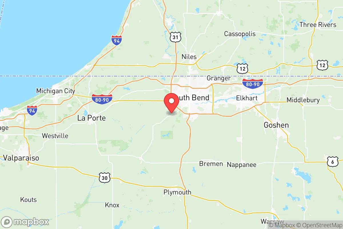
St Joseph County, anchored by South Bend and Mishawaka, offers a surprisingly resilient position for relocators prioritizing disaster readiness and self-sufficiency. Its location in northern Indiana, roughly 90 miles from Chicago and 20 miles from the Michigan state line, provides a buffer from major metropolitan fallout zones while maintaining access to critical supply chains and medical infrastructure. The county’s population of approximately 272,000 is dense enough to support robust local services but dispersed enough to avoid the concentration risks of a major city, making it a viable option for those seeking a balance between isolation and practicality.
Geographic position and natural advantages for long-term stability
St Joseph County sits within the Great Lakes watershed, with the St Joseph River running through its core and providing a reliable freshwater source. The county’s terrain is predominantly flat, with glacial till soils that support agriculture, though it lacks the defensive topography of mountainous regions. The area experiences four distinct seasons, with cold winters averaging 20°F in January and humid summers reaching 85°F in July, which poses challenges for off-grid energy systems but also reduces wildfire risk compared to western states. The proximity to Lake Michigan, about 30 miles west, moderates temperature extremes and provides an additional water reserve, though the lake-effect snow can complicate winter travel and infrastructure resilience. The county’s position in the Midwest’s agricultural belt means local food production is feasible, with surrounding farmland producing corn, soybeans, and livestock, reducing dependence on distant supply chains.
Risks, exposures, and proximity to fallout-relevant landmarks
The primary risk for St Joseph County is its proximity to Chicago, a Tier 1 metropolitan target in any major conflict scenario. The 90-mile distance places the county within the fallout plume radius of a nuclear detonation in Chicago, depending on wind patterns, though prevailing westerlies would carry contamination eastward toward Michigan rather than directly over the county. The county itself hosts several infrastructure points of interest: the Indiana Enterprise Center in South Bend is a major industrial park with logistics hubs, and the nearby Mishawaka Riverwalk area includes a hydroelectric dam on the St Joseph River that could be a target for sabotage. The South Bend International Airport (SBN) serves as a regional transport node, and the county is crisscrossed by Interstate 80/90 (the Indiana Toll Road) and US 31, which could become chokepoints during evacuation or supply disruptions. The St Joseph County Jail and South Bend Police Department headquarters are potential civil unrest targets. Natural disaster risks are moderate: tornadoes are possible (the county averages 2-3 tornado warnings per year), and flooding along the St Joseph River occurs periodically, with the 2018 flood causing $10 million in damage. The area has no significant seismic activity, no hurricane exposure, and minimal wildfire risk, making it relatively stable for natural disaster preparedness.
Practical resilience for a relocator: food, water, energy, and defensibility
For a relocator focused on self-sufficiency, St Joseph County offers mixed but workable conditions. Water access is strong: the St Joseph River provides a year-round surface water source, and the county’s groundwater table is shallow enough for well drilling in rural areas, with average well depths of 50-100 feet. The South Bend Water Works treats water from the river, but a grid-down scenario would require personal filtration or boiling. Food resilience is high due to the surrounding agricultural land; the county has over 500 farms, with farmers markets in South Bend, Mishawaka, and Granger operating seasonally. Local food co-ops and CSAs are common, and the Purdue Extension St Joseph County offers resources for home gardening and livestock. Energy infrastructure is moderately resilient: the county is served by Indiana Michigan Power (a subsidiary of American Electric Power), with the South Bend Energy Center providing natural gas peaking capacity. Solar potential is moderate (4.5 peak sun hours per day), and wind energy is viable but limited by local zoning. Wood heating is practical given the county’s 20% forest cover, but reliance on natural gas for heating (60% of homes) creates vulnerability during grid failures. Defensibility is a weakness: the flat terrain offers no natural chokepoints, and the county’s population density (about 600 people per square mile in urban areas) makes perimeter defense impractical. Rural areas north of South Bend, such as Lakeville and North Liberty, offer more defensible positions with lower density and better line-of-sight, but still lack topographic barriers. The county’s law enforcement presence is adequate for routine security, with the St Joseph County Sheriff’s Office covering unincorporated areas, but a major crisis would likely overwhelm local capacity.
Overall, St Joseph County presents a strategic trade-off for the disaster-conscious relocator. Its strengths lie in water availability, agricultural access, and moderate distance from Chicago’s immediate blast zone, while its weaknesses include flat terrain, infrastructure chokepoints, and exposure to fallout from a major metropolitan strike. For a family or individual willing to invest in off-grid water filtration, solar backup, and a rural property in the county’s northern townships, it offers a viable base for long-term resilience. However, those seeking true isolation should look further north into Michigan’s Upper Peninsula or west into the Plains states. St Joseph County is best suited for relocators who want to stay connected to regional medical and supply networks while maintaining a reasonable buffer from urban collapse scenarios.

* Values derived from national, state, county, city and local statistics and may differ in a specific area. Last updated: 2026-06-29T01:30:02.000Z
Narrative content on this page is AI-generated and may contain mistakes. Verify any details that matter before acting on them.
ReloMaps may earn a commission from affiliate links at no extra cost to you.

