
Photo: Wikipedia
Strategic Assessment of Lake County
Meaningful friction. Expect exposure to either population pressure, blast zones, or natural disaster risk. Consider buying a retreat property.
What does the Strategic Assessment tell us?
Our Strategic Assessment grades tactical survivability of an area. Major population centers, military targets, fallout zones, natural disasters, and border exposure all drive risk — lower exposure means a more defensible position in a crisis.
This is heavily inspired by Joel Skousen's Strategic Relocation book. Highly recommended you checkout the book ($)What does this tell us?
Our Strategic Assessment grades tactical survivability of an area. Major population centers, military targets, fallout zones, natural disasters, and border exposure all drive risk — lower exposure means a more defensible position in a crisis.
This is heavily inspired by Joel Skousen's Strategic Relocation book. Highly recommended you checkout the book ($)Strategic Pillars

Key Distances
Strategic Assessment Analysis
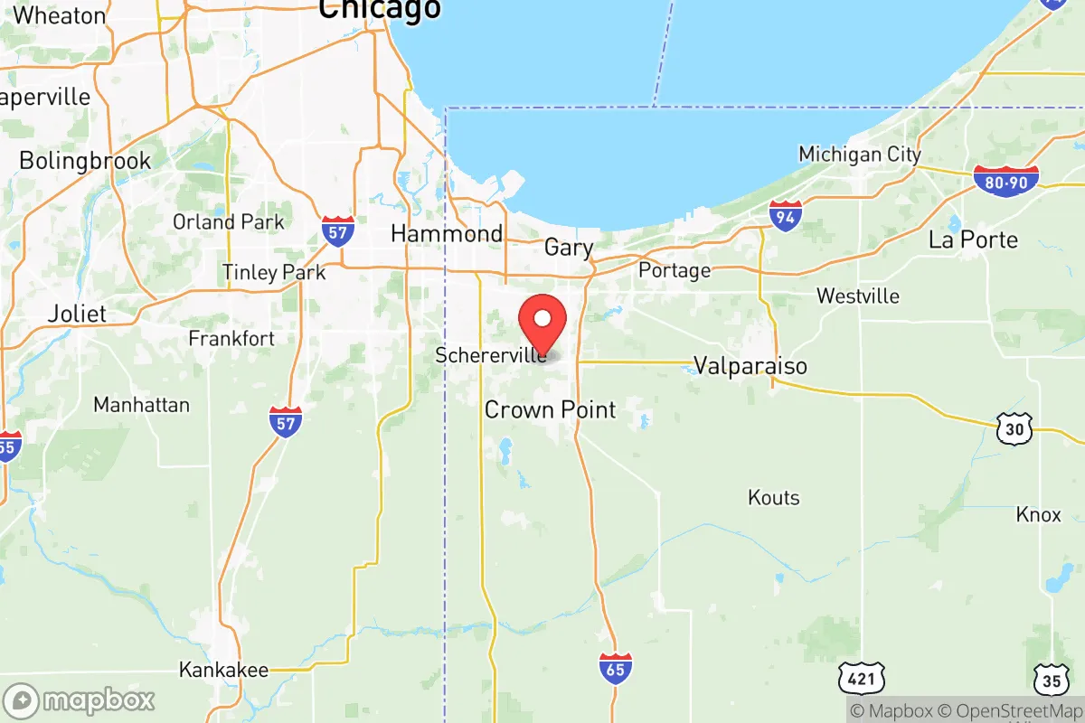
Lake County, Indiana offers a compelling but complex strategic picture for the relocator focused on resilience, self-sufficiency, and long-term preparedness. While its proximity to the Chicago metropolitan area brings inherent vulnerabilities—density, infrastructure strain, and target risk—the county’s position on the southern shore of Lake Michigan, its mix of industrial and agricultural land, and its distance from the most extreme fallout corridors create a unique set of advantages and trade-offs that demand careful assessment. This is not a remote wilderness, but a pragmatic, working-class region where strategic thinking can turn proximity into a resource rather than a liability.
Geographic position and natural advantages for a strategic relocation
Lake County occupies a distinct geographic niche that few other Midwestern locations can claim. It sits at the intersection of the Lake Michigan shoreline and the sprawling industrial-residential corridor that stretches from Gary through Hammond to the Illinois state line. The county’s most obvious natural advantage is access to the largest freshwater body in the United States—Lake Michigan. This is not a trivial point for a long-term resilience plan: a sustainable water source is the single most critical factor in any disaster scenario, and Lake County has it in abundance. The lake also moderates temperatures, keeping winters slightly milder and summers slightly cooler than inland areas, which can reduce heating and cooling demands. The county’s southern and eastern reaches, including towns like Crown Point and Lowell, transition into more rural, agricultural terrain with open farmland, woodlots, and lower population density. This creates a buffer zone that can be leveraged for food production, decentralized energy, and retreat options. The terrain is generally flat but well-drained, with the Kankakee River forming the southern boundary and providing a secondary water source and natural barrier. For a relocator, the key takeaway is that Crown Point and Lowell offer the best balance of proximity to lake water and access to rural defensibility, while staying within commuting distance of the county’s job base and services.
Risks, exposures, and proximity to fallout-relevant landmarks
The same industrial infrastructure that makes Lake County economically significant also introduces serious risk. The county is home to the BP Whiting Refinery, one of the largest oil refineries in the Midwest, located in Whiting directly on the lakefront. This facility processes roughly 430,000 barrels of crude oil per day and is a clear target for both natural disaster cascades and man-made disruption. The refinery’s proximity to Lake Michigan means that any major incident—fire, explosion, chemical release—could contaminate the water supply for hundreds of thousands of residents. Just east of the county line in Porter County lies the Bailly Nuclear Generating Station (currently decommissioned but still containing spent fuel), which introduces additional, albeit lower-probability, radiation exposure concerns. For a preparedness-minded relocator, the takeaway is straightforward: Hammond, Whiting, East Chicago, and Gary are in the highest-risk zone due to their density, industrial concentration, and proximity to the refinery and rail corridors. The Chicago metro area lies just 25 miles to the northwest, meaning that any large-scale event—whether natural (a major derecho, lake-effect blizzard, or earthquake from the Wabash Valley Seismic Zone) or man-made (grid failure, civil unrest, or a targeted strike)—would send cascading effects into Lake County. The good news is that the county’s layout offers natural separation: the Little Calumet River and the Indiana Toll Road (I-90) act as rough dividing lines between the dense industrial north and the more suburban-rural south. Lowell and Cedar Lake sit far enough south and east to reduce exposure to the refinery’s immediate blast or plume zone, and the Kankakee River provides a natural defensive boundary. Still, any relocator should plan for short-term evacuation routes that head south toward Jasper County or east toward Porter County, avoiding the bottleneck of the Borman Expressway (I-80/94) during a crisis.
Practical resilience for a relocator: food, water, energy, and defensibility
For the individual or family aiming for self-sufficiency, Lake County presents a mixed but workable picture. Water is the strongest asset: Lake Michigan provides an essentially unlimited freshwater source, but only if you have the means to access, treat, and store it. Municipal water systems in towns like Crown Point, St. John, and Lowell draw from deep aquifers and the lake, but a grid-down scenario would make these systems unreliable. A well on rural property south of Route 2, coupled with a hand pump and rainwater catchment, would provide a robust off-grid water solution. The county’s soil in the southern half is sandy loam to silty clay loam—ideal for row crops and gardens. The growing season is about 160 days, which is sufficient for corn, beans, tomatoes, squash, and leafy greens, though a hoop house extends production significantly. Local food infrastructure is solid: the Lake County Fairgrounds in Crown Point hosts regular farmers’ markets, and there are numerous U-pick farms and orchards in the Lowell area. For energy, the grid is dominated by coal and natural gas plants, but solar potential is moderate—about 4.2 peak sun hours per day—and residential solar with battery storage is increasingly common. Natural gas is widely available in suburban areas, which is a major advantage for heating and cooking during a power outage, as long as the grid is intact. Propane tanks are a viable backup. Defensibility is the weak link for most of the county: the northern towns are densely packed and difficult to secure, but the southern townships—Lowell, Eagle Creek, and West Creek—offer 5- to 20-acre parcels with tree lines, rural roads, and limited ingress points. A property with a long driveway, a pond or well, and good visibility of approach roads can be made defensible with modest effort. The county sheriff’s departments in the south are generally responsive and have a rural focus, which is a plus for those who value community watch and mutual aid networks. For the relocator serious about resilience, the strategy is clear: buy south of Route 2, invest in a well and solar array, build a root cellar, and establish relationships with neighbors in the Lowell-Cedar Lake corridor.
The overall strategic picture for Lake County is one of cautious opportunity. It is not a prepper’s utopia—the risks from industrial proximity, Chicago’s shadow, and grid dependency are real—but it offers a rare combination of freshwater access, productive farmland, and affordable land that is increasingly hard to find within a two-hour drive of a major city. The key is location: avoid the northern industrial crescent and target the southern rural townships, where the risk profile drops and the self-sufficiency potential rises. With the right property, a modest investment in off-grid systems, and a commitment to community-level preparedness, a relocator can build a genuinely resilient life here that balances access to urban resources with a defensible, self-sufficient homestead. The county’s working-class DNA means that neighbors are less likely to be hostile to practical self-reliance than in some suburban enclaves, and the local economy—rooted in logistics, manufacturing, and agriculture—provides a sturdy foundation for long-term stability. Lake County works best for the strategic relocator who sees the region not as a final destination, but as a strong base of operations.

* Values derived from national, state, county, city and local statistics and may differ in a specific area. Last updated: 2026-06-29T00:14:21.000Z
Narrative content on this page is AI-generated and may contain mistakes. Verify any details that matter before acting on them.
ReloMaps may earn a commission from affiliate links at no extra cost to you.

