
Photo: Wikipedia
Strategic Assessment of Howard County
Meaningful friction. Expect exposure to either population pressure, blast zones, or natural disaster risk. Consider buying a retreat property.
What does the Strategic Assessment tell us?
Our Strategic Assessment grades tactical survivability of an area. Major population centers, military targets, fallout zones, natural disasters, and border exposure all drive risk — lower exposure means a more defensible position in a crisis.
This is heavily inspired by Joel Skousen's Strategic Relocation book. Highly recommended you checkout the book ($)What does this tell us?
Our Strategic Assessment grades tactical survivability of an area. Major population centers, military targets, fallout zones, natural disasters, and border exposure all drive risk — lower exposure means a more defensible position in a crisis.
This is heavily inspired by Joel Skousen's Strategic Relocation book. Highly recommended you checkout the book ($)Strategic Pillars

Key Distances
Strategic Assessment Analysis
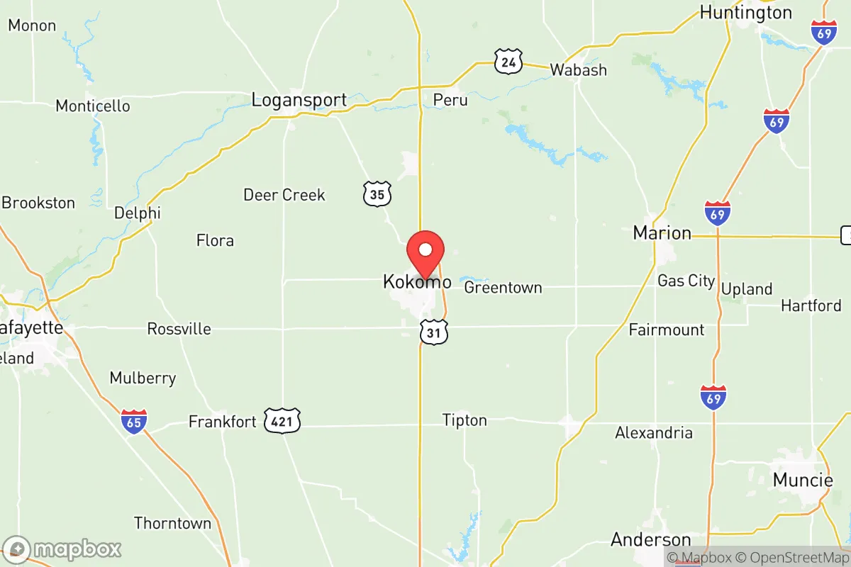
Howard County, Indiana, anchored by the city of Kokomo, presents a mixed strategic picture for relocation-minded readers who prioritize resilience and self-sufficiency. Its location roughly 50 miles north of Indianapolis and 90 miles south of the Michigan border places it within a moderate-risk zone—close enough to major urban and industrial centers to be affected by their disruptions, yet far enough to avoid the worst of immediate fallout or civil unrest. The county’s historical industrial base, centered on automotive manufacturing and metalworking, has weathered multiple economic shocks, including the 2008 recession and the 2016 closure of a major Chrysler plant, demonstrating a degree of economic adaptability that matters for long-term stability. However, for a reader thinking seriously about disaster readiness, the area’s advantages are tempered by specific exposures that require careful consideration.
Geographic position and natural advantages for disaster readiness
Howard County sits in the flat, fertile terrain of north-central Indiana, a region defined by glacial till plains and the Wildcat Creek watershed. The county’s elevation averages around 800 feet above sea level, with no significant floodplains or earthquake fault lines, making it relatively safe from the natural disasters that plague coastal or mountainous areas—hurricanes, wildfires, landslides, and tsunamis are non-issues. The climate is continental, with cold winters and warm summers, but tornadoes are a real seasonal threat; the county lies within the traditional “Hoosier Alley” of severe weather, and Kokomo has experienced multiple EF-2 and EF-3 tornadoes in the past two decades, including a deadly 2016 outbreak. For a relocator, this means a sturdy basement or storm shelter is a practical necessity, not a luxury. The area’s natural advantages include abundant groundwater from the glacial aquifer system, which supplies Kokomo’s municipal water and many rural wells, and relatively fertile soil that supports small-scale agriculture. The county’s 375 square miles include a mix of urban, suburban, and agricultural land, with the city of Kokomo occupying roughly 18 square miles and the rest dotted with small towns like Russiaville, Greentown, and Galveston. This spread-out geography offers some defensibility—a rural homestead in the county’s northern or eastern reaches can be miles from any major road or population center, reducing the risk of looting or refugee flows during a crisis.
Risks, exposures, and proximity to fallout-relevant landmarks
The most significant strategic drawback for Howard County is its proximity to multiple high-value industrial and military targets within a 100-mile radius. To the south, Indianapolis is home to the Indianapolis International Airport, a major FedEx hub, and the Eli Lilly pharmaceutical complex—all potential targets in a conflict scenario. To the west, about 70 miles away, lies the Newport Chemical Depot in Vermillion County, a former chemical weapons storage site that still contains residual contamination risks. More critically, the county sits within 150 miles of the Grissom Air Reserve Base near Peru, Indiana (about 30 miles north), which houses KC-135 refueling aircraft and is a potential target for conventional or nuclear strikes. Within Howard County itself, the Kokomo Municipal Airport is a general aviation facility with no military significance, but the city’s industrial parks—home to Chrysler’s transmission plant (now operated by Stellantis) and several metal fabrication facilities—could be secondary targets in a broader conflict. For a relocator focused on fallout avoidance, the prevailing wind patterns in central Indiana are from the west and southwest, meaning that a strike on Indianapolis or Grissom would likely carry radioactive debris northeast, away from Howard County. However, a strike on the Newport Depot or the industrial corridor along I-65 near Lafayette could deposit fallout directly over the county, depending on weather conditions. The area’s flat terrain offers no natural shielding from blast waves or fallout, so a reinforced basement or underground shelter is essential for anyone serious about long-term survival.
Practical resilience for a relocator: food, water, energy, and defensibility
For a relocator assessing day-to-day resilience, Howard County offers a mixed but workable picture. Water availability is a strong point: the glacial aquifer system provides reliable groundwater at depths of 50 to 150 feet, and many rural properties already have private wells. Kokomo’s municipal water comes from the Kokomo Reservoir and the Wildcat Creek, but a prolonged power outage or contamination event would make these sources unreliable, so a backup well or rainwater catchment system is advisable. Food security is moderate: the county has about 1,200 farms, mostly growing corn, soybeans, and wheat, with some livestock operations. The Kokomo Farmers Market operates seasonally, and local grocery chains like Kroger and Walmart provide normal supply chains, but a major disruption would strain these. For a self-sufficient household, the growing season runs from April to October, and the soil supports vegetable gardens, though the clay-heavy soil in some areas requires amendment. Energy resilience is a weak point: Howard County is served by Duke Energy and Kokomo Municipal Utilities, both of which rely on the regional grid. There are no major hydroelectric or nuclear plants nearby, and the county’s flat terrain limits wind power potential. Solar panels are viable, but the region averages only 180 sunny days per year, so battery storage is critical. Natural gas is available in urban areas, but rural properties often rely on propane or heating oil. Defensibility is situational: the county’s rural areas offer good line-of-sight and limited access points, but the flat terrain also means that any approaching group can be seen from miles away. The county sheriff’s office and Kokomo Police Department have about 150 sworn officers combined, but in a prolonged crisis, law enforcement would be stretched thin. The nearest National Guard armory is in Kokomo, which could be a source of security or a target, depending on the scenario. For a relocator, a property with a well, a garden, solar panels, and a basement in a rural township like Taylor or Monroe offers the best balance of resilience and isolation.
The overall strategic picture for Howard County is one of moderate resilience with specific, manageable vulnerabilities. Its inland location, abundant groundwater, and agricultural base provide a solid foundation for self-sufficiency, while its distance from major coastal and military targets reduces the likelihood of direct attack. However, the county’s proximity to Indianapolis, Grissom Air Reserve Base, and the Newport Chemical Depot introduces real fallout and secondary-target risks that cannot be ignored. For a relocator willing to invest in a reinforced shelter, a well, and off-grid energy, Howard County offers a defensible, resource-rich environment that balances access to urban amenities with the space to ride out a crisis. The key is to choose a location carefully—avoiding the floodplains along Wildcat Creek, staying away from the industrial corridors near Kokomo’s downtown, and prioritizing properties with natural windbreaks or existing storm shelters. In a world of increasing uncertainty, Howard County is not a fortress, but it is a viable base camp for those who plan ahead.

* Values derived from national, state, county, city and local statistics and may differ in a specific area. Last updated: 2026-07-10T05:47:51.000Z
Narrative content on this page is AI-generated and may contain mistakes. Verify any details that matter before acting on them.
ReloMaps may earn a commission from affiliate links at no extra cost to you.

