
Photo: Wikipedia
Strategic Assessment of Hancock County
Meaningful friction. Expect exposure to either population pressure, blast zones, or natural disaster risk. Consider buying a retreat property.
What does the Strategic Assessment tell us?
Our Strategic Assessment grades tactical survivability of an area. Major population centers, military targets, fallout zones, natural disasters, and border exposure all drive risk — lower exposure means a more defensible position in a crisis.
This is heavily inspired by Joel Skousen's Strategic Relocation book. Highly recommended you checkout the book ($)What does this tell us?
Our Strategic Assessment grades tactical survivability of an area. Major population centers, military targets, fallout zones, natural disasters, and border exposure all drive risk — lower exposure means a more defensible position in a crisis.
This is heavily inspired by Joel Skousen's Strategic Relocation book. Highly recommended you checkout the book ($)Strategic Pillars

Key Distances
Strategic Assessment Analysis
Hancock County, Indiana, offers a compelling strategic profile for relocators prioritizing resilience and self-sufficiency, balancing proximity to Indianapolis with a distinctly rural, defensible character. The county’s strength lies in its position as a buffer zone—close enough to urban resources but far enough from the concentrated risks of a major metro area. For those assessing long-term stability, Hancock County presents a practical blend of agricultural self-reliance, low population density, and geographic insulation from the most volatile fallout zones in the Midwest.
Geographic position and natural advantages for long-term stability
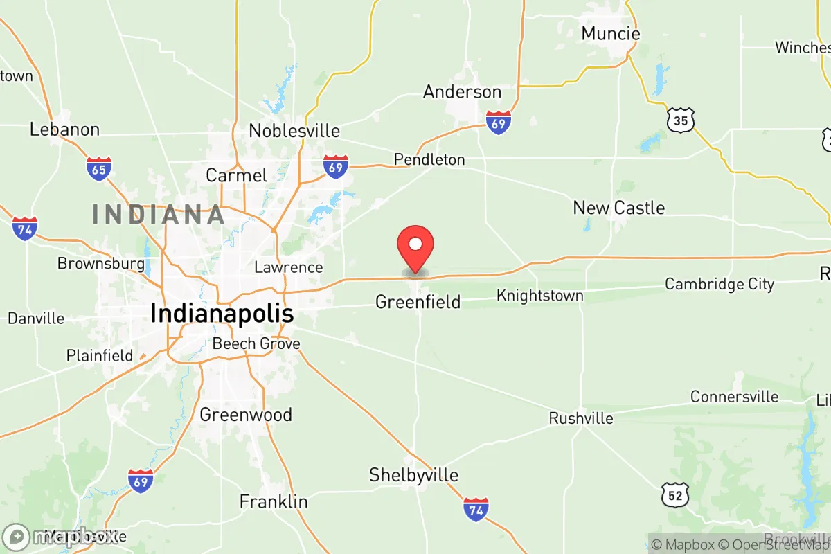
Hancock County sits about 20 miles east of downtown Indianapolis, placing it in the outer ring of the Indianapolis metropolitan area. This location offers a key advantage: the county is far enough from the city center to avoid the worst-case scenarios of a major urban disaster—whether natural or man-made—yet close enough to access medical, logistical, and supply networks when they function normally. The county’s terrain is flat to gently rolling, part of the Tipton Till Plain, which provides excellent agricultural soil and minimal flood risk compared to areas along the White River or Wabash River. The major waterway is the Buck Creek, a tributary of the White River, which runs through the county and supports local drainage but does not pose a significant flood hazard for most developed areas. The county seat, Greenfield, sits on relatively high ground, and the surrounding towns—Fortville, McCordsville, and New Palestine—are similarly situated on well-drained land. This topography reduces the risk of catastrophic flooding, a common concern in the Midwest, and supports reliable groundwater recharge for private wells. The area’s natural advantages also include a moderate climate with four distinct seasons, which, while not extreme, allows for year-round food production in protected or greenhouse settings. The county’s agricultural base—primarily corn, soybeans, and livestock—means that local food sources are abundant and accessible, a critical factor for long-term self-sufficiency.
Risks, exposures, and proximity to fallout-relevant landmarks
Hancock County’s primary risk exposure stems from its proximity to Indianapolis, a major population and industrial hub. While the county itself is not home to high-value military installations, major refineries, or nuclear power plants, it lies within the potential fallout radius of several significant targets. The most notable is the Indianapolis International Airport and the surrounding logistics and manufacturing corridor, which includes FedEx’s second-largest global hub and a concentration of defense-related contractors. A conventional or electromagnetic pulse (EMP) attack on these assets could disrupt power and communications across central Indiana, including Hancock County. Additionally, the county is roughly 60 miles from the Newport Chemical Depot (now largely decommissioned but historically a chemical weapons storage site) and about 70 miles from the Indiana Michigan Power’s Cook Nuclear Plant in Bridgman, Michigan—though prevailing winds typically carry fallout eastward, away from the county. More immediate risks include the I-70 and I-65 corridors, which run near the county’s western edge and could become choke points or targets in a conflict scenario. The county’s own infrastructure—including the Greenfield Municipal Airport and several large grain elevators—is low-profile and unlikely to be a primary target, but the presence of major rail lines (CSX and Norfolk Southern) running through Greenfield and Fortville introduces a secondary risk of hazardous material spills or derailments. Natural risks are comparatively low: tornadoes are the primary threat, with Hancock County lying in the traditional “Hoosier Alley” tornado zone, but the flat terrain and low tree density actually improve visibility for storm spotting. The county has no active fault lines, no significant wildfire risk, and minimal landslide potential. Overall, the risk profile is moderate—better than living in a major city or near a military base, but not as insulated as more remote rural counties in northern Indiana or Ohio.
Practical resilience for a relocator: food, water, energy, and defensibility
For a relocator focused on practical self-sufficiency, Hancock County offers strong fundamentals. Food security is the standout advantage: the county is one of Indiana’s top agricultural producers, with over 70% of its land area in farms. Local farmers’ markets in Greenfield and Fortville operate seasonally, and the county’s network of small-scale producers (eggs, honey, meat, vegetables) is robust. For those looking to grow their own food, the soil is fertile and well-drained, and the growing season averages 170 days—sufficient for most staple crops. Water access is generally good: the county’s aquifer is part of the White River Basin, and private wells are common in rural areas, with typical depths of 100-200 feet yielding reliable water. Municipal water in Greenfield and McCordsville comes from surface water sources (Buck Creek and the White River), which could be vulnerable to contamination or disruption, but well owners are largely independent. Energy resilience is a mixed picture: the county is served by Duke Energy and Hancock County REMC, both of which have above-average reliability for the region, but the grid is still centralized and vulnerable to cascading failures. Solar potential is moderate (about 4.5 peak sun hours per day), and many rural properties have space for ground-mounted arrays. Backup generators are common among the farming community, and propane and diesel are readily available at local co-ops. Defensibility is where Hancock County truly shines for a relocator. The county’s population density is low—roughly 200 people per square mile in the rural areas, dropping to under 50 in the eastern townships. The road network is a mix of state highways (IN-9, IN-234, IN-140) and county roads laid out in a grid pattern, which provides multiple egress routes and makes it difficult for any single point of failure to trap residents. The terrain offers no natural chokepoints, but the open farmland provides long sightlines, and the scattered woodlots offer cover. The county’s law enforcement presence is modest—the Hancock County Sheriff’s Office has about 30 deputies—but the community is tight-knit, and informal neighborhood watch networks are common. For a relocator, the key is to choose a property with good well water, south-facing roof exposure for solar, and at least 5-10 acres for food production and buffer space. Properties in the eastern part of the county, near the Henry County line, offer the best combination of low density and good soil.
The overall strategic picture for Hancock County is one of balanced resilience. It is not a remote survivalist retreat—it is a working agricultural county with a functional connection to a major city. For the relocator who wants to maintain access to urban jobs, healthcare, and supply chains while building a self-sufficient homestead, it is one of the better options in the Midwest. The risks are real but manageable: the proximity to Indianapolis is a double-edged sword, offering resources in normal times but vulnerability in crisis. The county’s agricultural base, good water access, and low-key infrastructure make it a strong candidate for those who prioritize food security and defensibility over absolute isolation. For families and individuals who are serious about preparedness but not willing to go fully off-grid, Hancock County represents a practical, data-backed choice.

* Values derived from national, state, county, city and local statistics and may differ in a specific area. Last updated: 2026-07-26T23:10:54.000Z
Narrative content on this page is AI-generated and may contain mistakes. Verify any details that matter before acting on them.
ReloMaps may earn a commission from affiliate links at no extra cost to you.

