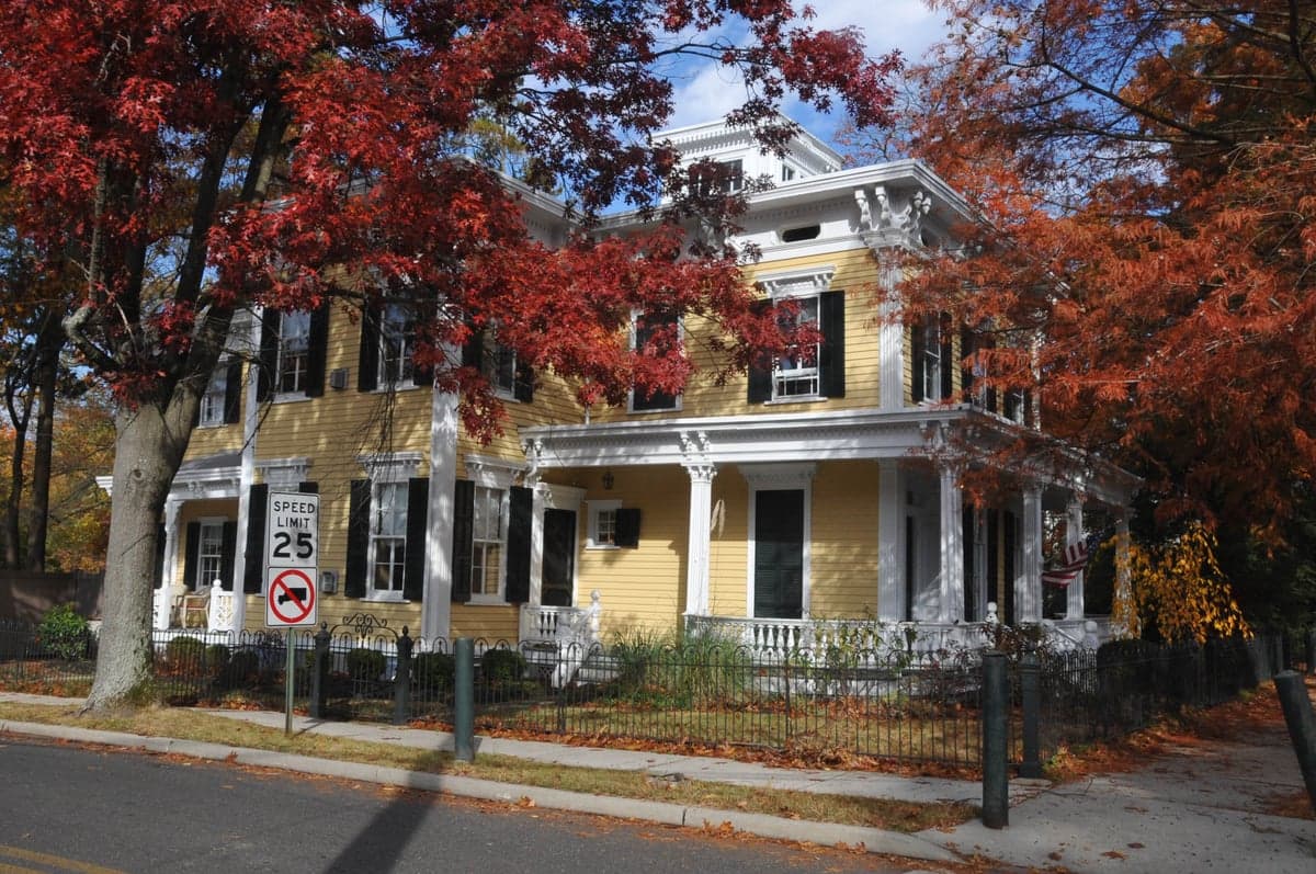
Photo: Wikipedia
Strategic Assessment of Hightstown, NJ
Multiple tactical vulnerabilities. Population density, target proximity, or disaster risk are likely compounding. A retreat property and exit planning is required.
What does the Strategic Assessment tell us?
Our Strategic Assessment grades tactical survivability of an area. Major population centers, military targets, fallout zones, natural disasters, and border exposure all drive risk — lower exposure means a more defensible position in a crisis.
This is heavily inspired by Joel Skousen's Strategic Relocation book. Highly recommended you checkout the book ($)What does this tell us?
Our Strategic Assessment grades tactical survivability of an area. Major population centers, military targets, fallout zones, natural disasters, and border exposure all drive risk — lower exposure means a more defensible position in a crisis.
This is heavily inspired by Joel Skousen's Strategic Relocation book. Highly recommended you checkout the book ($)Strategic Pillars

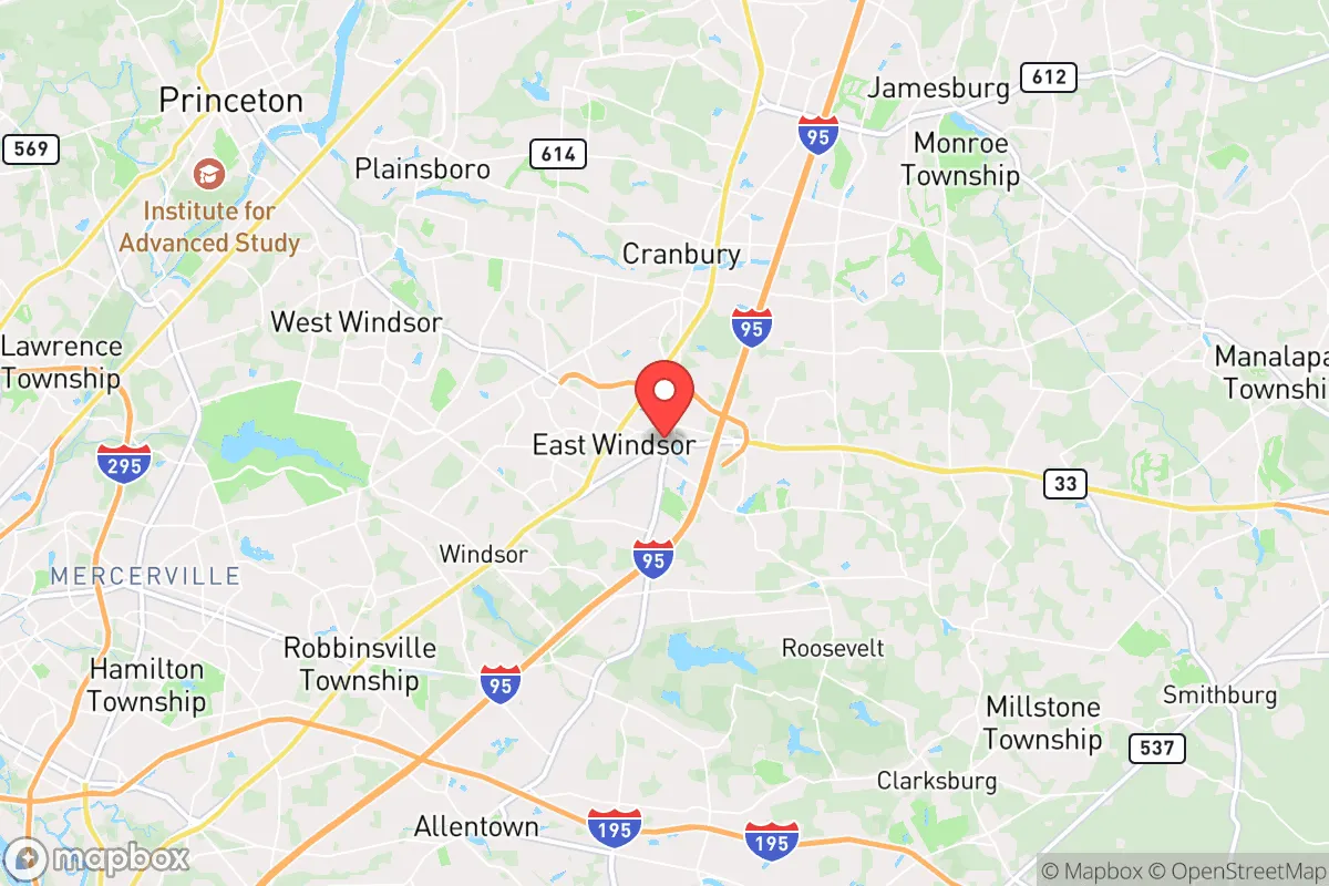
Key Distances
Regional Safe Places
Below is our recommended "safe zones" in New Jersey and the surrounding area based on our strategic heuristics. For most people, it's unrealistic to live in a “safe zone” full-time due to work, family or other personal reasons. They tend to be more rural. However, many of these areas are perfect for second homes and retreat properties that double as a vacation home or even a short-term rental.
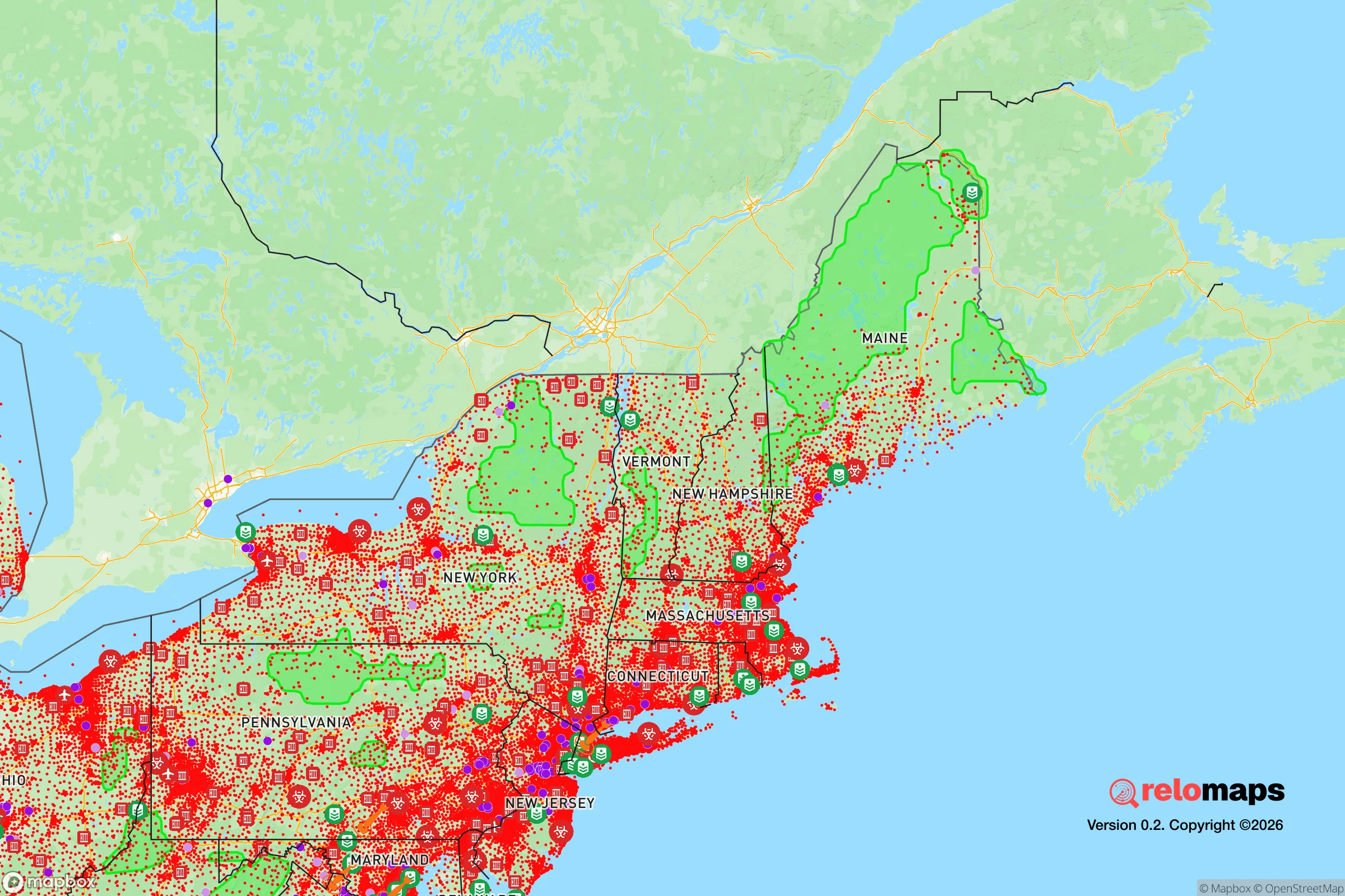
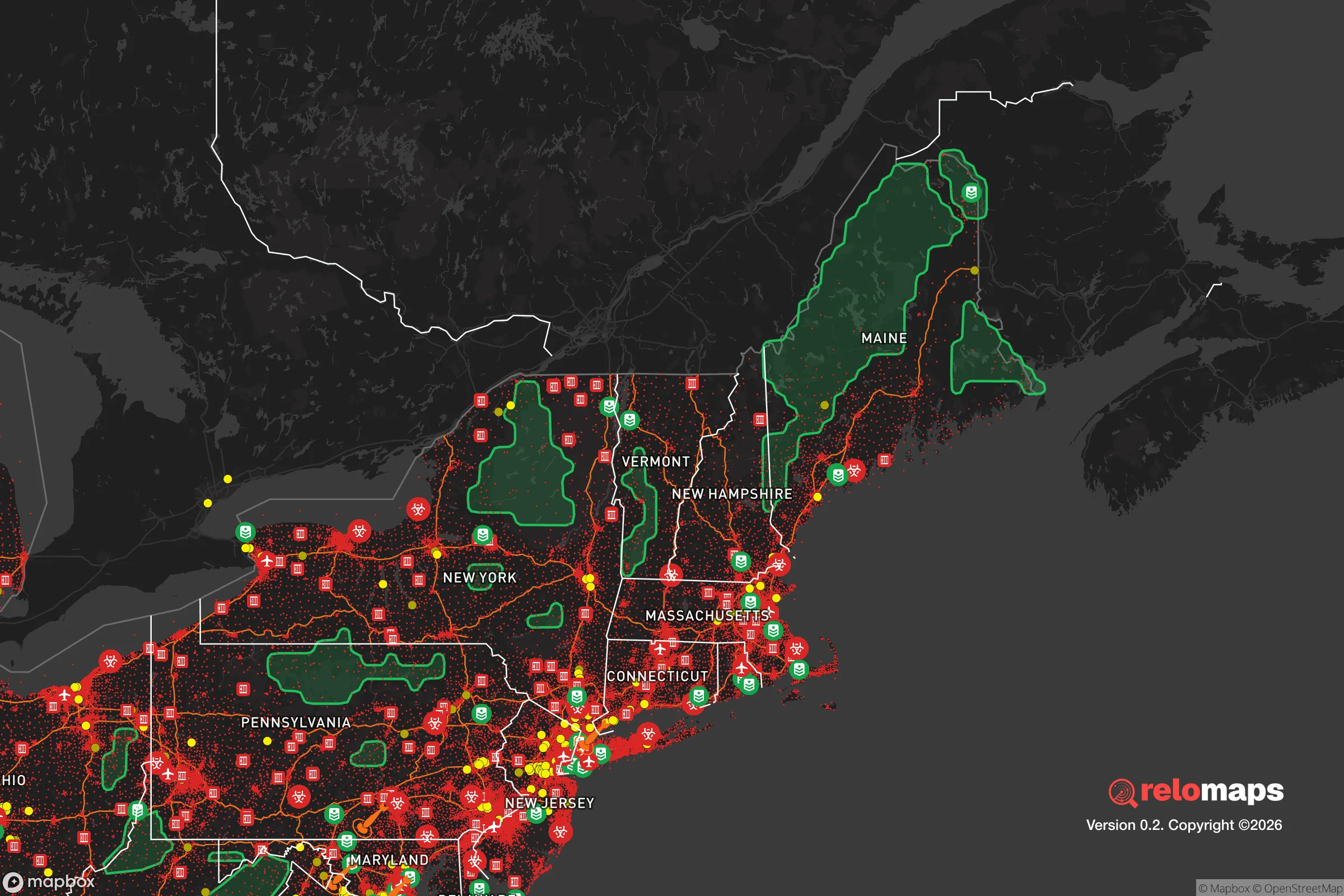


Important Note: For informational purposes only. This does not mean nothing bad ever happens in the green zones. Please use common sense. This is based on public data and modeled with AI. We tried to take a conservative approach but mistakes happen. We update this regularly as new information becomes available.
Solar Generator Recommendations
Backup power matters more here than in safer locations. We've picked three solar generators across budgets and capacity tiers — start with the budget unit if you only need a few essentials, or step up if you want to run a fridge and HVAC for days at a time.

Jackery Portable Power Station Explorer 300
Budget OptionPower on the Go: Weighing only 11 lbs, it's convenient to set up and store with book-sized foldable solar panels

BLUETTI Portable Power Station AC180
Designed for both indoor and outdoor scenarios, AC180 is highly capable as it has a robost capacity and continuous output power.

EF ECOFLOW DELTA Pro Ultra Power Station
Upgraded PickEcoFlow DELTA Pro Ultra is a whole-home energy system designed to grow with your family. Integrated with the Smart Home Panel 2, it scales to meet your evolving energy needs — keeping your home powered, intelligent, and secure through every stage of life.
We earn a commission, at no additional cost to you.
Strategic Assessment Analysis
Hightstown, New Jersey, occupies a strategic position that offers a mixed bag for the resilience-minded relocator. Its location in central Mercer County places it roughly 15 miles east of Trenton and 10 miles west of the Jersey Shore's coastal plain, giving it proximity to major infrastructure while maintaining a small-town character. For someone weighing disaster readiness and self-sufficiency, Hightstown's advantages lie in its access to regional resources and its position away from the most densely packed urban corridors, but its proximity to high-value targets and transportation hubs introduces real vulnerabilities that demand careful consideration.
Geographic position and natural advantages for self-sufficiency
Hightstown sits on the Inner Coastal Plain, a relatively flat region with fertile soils that historically supported agriculture. The area's elevation averages around 100 feet above sea level, which provides modest protection against storm surge from the Atlantic, about 30 miles to the east. The nearby Millstone River and its tributaries offer a surface water source, though these are not pristine and would require filtration and treatment for potable use. The region's temperate climate supports a growing season of roughly 180 days, making small-scale food production feasible for a household willing to invest in raised beds or greenhouse structures. The surrounding farmland—much of it still active in central Mercer and adjacent Monmouth counties—means that local food sourcing is a realistic option, with farmers' markets and CSAs operating in Hightstown and nearby towns like East Windsor and Cranbury. For the relocator prioritizing self-sufficiency, the soil quality and climate are genuine assets, though the suburban density of the area limits the acreage most households can command.
Risks, exposures, and proximity to fallout-relevant landmarks
The most significant risk for Hightstown is its location within the broader New York–Philadelphia corridor, a region dense with potential man-made hazards. The New York City metropolitan area, roughly 50 miles north, and Philadelphia, about 40 miles southwest, are both high-value targets in any conflict scenario. Hightstown sits within the fallout plume zone for a ground burst on either city, depending on wind direction. More immediately, the area is within 10 miles of the Trenton–Mercer Airport, a joint-use civil and military airfield that hosts the New Jersey Air National Guard's 108th Wing, which operates KC-135 tankers and C-17 transports. This facility is a plausible secondary target. The nearby Interstate 95 corridor and the Northeast Corridor rail line—which passes through Princeton Junction, just 5 miles north—are critical transportation links that could be disrupted or targeted. Natural hazards include nor'easters and hurricanes, with the region experiencing flooding along the Millstone River during heavy rain events. The area's flat terrain offers no natural defensibility; retreat would require moving west toward the New Jersey Highlands or Pennsylvania's Pocono region, roughly 60–80 miles away, which is a significant logistical challenge in a crisis.
Practical resilience for a relocator: food, water, energy, and defensibility
For a household looking to establish practical resilience in Hightstown, the starting point is understanding that the area is not a standalone survival redoubt but rather a base with moderate self-sufficiency potential. Food security is the strongest suit: the surrounding agricultural land means that bulk grains, produce, and livestock feed are available from local farms, and the town's zoning allows for backyard chickens and small-scale gardening in most residential areas. The Hightstown Farmers Market operates seasonally, and bulk purchasing cooperatives exist in the region. Water security is more challenging. The municipal water supply comes from surface sources (the Millstone River and the Delaware River via the New Jersey Water Supply Authority), which are vulnerable to contamination from upstream industrial sites or a chemical spill. A private well is an option only for properties outside the town's water service area, which is limited. For most residents, a rainwater catchment system and a high-quality filter (e.g., Berkey or reverse osmosis) would be necessary for independent water supply. Energy resilience is achievable but requires investment. Solar panel installations are common in the area, and net metering is available through Jersey Central Power & Light. A battery backup system (e.g., Tesla Powerwall or Generac) would provide off-grid capability for essential loads during grid outages, which occur several times a year due to storms. Natural gas is widely available for heating and cooking, but a propane backup or wood stove would add redundancy. Defensibility is the weakest category. Hightstown is a dense suburban town with a population of about 5,500, and its street grid and proximity to major roads make it difficult to secure. The town's police department is small, and reliance on county sheriff response (Mercer County) would be slow in a widespread event. For a relocator serious about security, a rural property in western Mercer or Hunterdon County would offer better standoff distance and natural barriers (wooded hills, river crossings) than Hightstown's relatively open suburban layout.
The overall strategic picture for Hightstown is one of moderate resilience with clear trade-offs. Its agricultural surroundings and temperate climate support food production and moderate self-sufficiency, and its distance from the most dense urban cores reduces—but does not eliminate—exposure to man-made risks. The proximity to Trenton-Mercer Airport and the Northeast Corridor introduces vulnerabilities that a relocator must plan for, particularly in terms of evacuation routes and fallout exposure. For a family or individual willing to invest in water filtration, solar backup, and a well-stocked pantry, Hightstown can serve as a functional base for a resilience-oriented lifestyle, provided they maintain a realistic evacuation plan for the worst-case scenarios. It is not a remote retreat, but it is a defensible suburban option for those who value access to regional resources while keeping one eye on the horizon.

* Values derived from national, state, county, city and local statistics and may differ in a specific area. Last updated: 2026-11-17T05:48:30.000Z
Narrative content on this page is AI-generated and may contain mistakes. Verify any details that matter before acting on them.
ReloMaps may earn a commission from affiliate links at no extra cost to you.

