
Photo by Matthew Lancaster on Unsplash
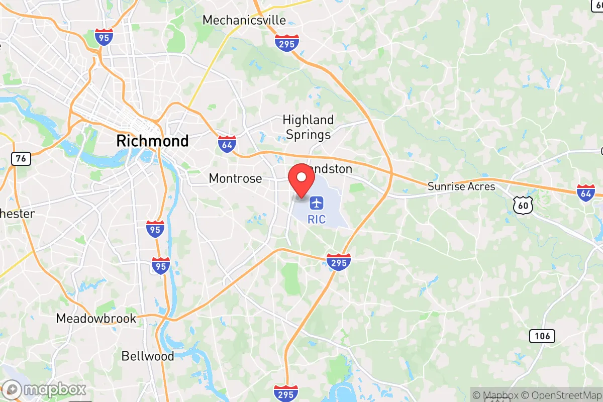
Strategic Assessment of Henrico, VA
Meaningful friction. Expect exposure to either population pressure, blast zones, or natural disaster risk. Consider buying a retreat property.
What does the Strategic Assessment tell us?
Our Strategic Assessment grades tactical survivability of an area. Major population centers, military targets, fallout zones, natural disasters, and border exposure all drive risk — lower exposure means a more defensible position in a crisis.
This is heavily inspired by Joel Skousen's Strategic Relocation book. Highly recommended you checkout the book ($)What does this tell us?
Our Strategic Assessment grades tactical survivability of an area. Major population centers, military targets, fallout zones, natural disasters, and border exposure all drive risk — lower exposure means a more defensible position in a crisis.
This is heavily inspired by Joel Skousen's Strategic Relocation book. Highly recommended you checkout the book ($)Strategic Pillars

Key Distances
Regional Safe Places
Below is our recommended "safe zones" in Virginia and the surrounding area based on our strategic heuristics. For most people, it's unrealistic to live in a “safe zone” full-time due to work, family or other personal reasons. They tend to be more rural. However, many of these areas are perfect for second homes and retreat properties that double as a vacation home or even a short-term rental.




Important Note: For informational purposes only. This does not mean nothing bad ever happens in the green zones. Please use common sense. This is based on public data and modeled with AI. We tried to take a conservative approach but mistakes happen. We update this regularly as new information becomes available.
Solar Generator Recommendations
Backup power matters more here than in safer locations. We've picked three solar generators across budgets and capacity tiers — start with the budget unit if you only need a few essentials, or step up if you want to run a fridge and HVAC for days at a time.

Jackery Portable Power Station Explorer 300
Budget OptionPower on the Go: Weighing only 11 lbs, it's convenient to set up and store with book-sized foldable solar panels

BLUETTI Portable Power Station AC180
Designed for both indoor and outdoor scenarios, AC180 is highly capable as it has a robost capacity and continuous output power.

EF ECOFLOW DELTA Pro Ultra Power Station
Upgraded PickEcoFlow DELTA Pro Ultra is a whole-home energy system designed to grow with your family. Integrated with the Smart Home Panel 2, it scales to meet your evolving energy needs — keeping your home powered, intelligent, and secure through every stage of life.
We earn a commission, at no additional cost to you.
Strategic Assessment Analysis
Henrico County, Virginia, offers a compelling mix of strategic depth and practical livability for the relocation-minded reader who prioritizes resilience and self-sufficiency. Its position as a suburban ring around Richmond provides the economic and logistical benefits of a state capital while maintaining enough geographic and infrastructural separation to avoid the worst-case scenarios of a dense urban core. For a family or individual thinking seriously about disaster readiness, Henrico presents a balanced profile: not a hardened bunker, but a defensible, resource-rich environment with a strong institutional backbone.
Geographic position and natural advantages for long-term stability
Henrico’s primary strategic asset is its location in the Piedmont region, roughly 100 miles from the Atlantic coast and 100 miles from the Blue Ridge Mountains. This interior positioning insulates the county from the most severe impacts of hurricane storm surge and coastal flooding, which are recurring threats for Tidewater communities like Norfolk and Virginia Beach. The county sits on a generally well-drained, rolling topography, with the James River forming its southern border. This river is a double-edged sword — a source of water and transport, but also a flood risk along its immediate banks — though the vast majority of Henrico’s residential and commercial land lies well above the 100-year floodplain.
The climate is humid subtropical, with four distinct seasons. Winters are mild enough that prolonged power outages from ice storms are rare but not unheard of; summers are hot and humid, placing a premium on reliable air conditioning and backup power. The county is not in a primary tornado alley, though severe thunderstorms and the occasional spin-up tornado do occur. Earthquake risk is negligible. For a relocator, the key takeaway is that Henrico avoids the most dramatic natural disaster scenarios — no Category 5 hurricane landfalls, no wildfire corridors, no seismic zones — while still demanding basic preparedness for seasonal storms and occasional flooding in low-lying areas.
Risks, exposures, and proximity to fallout-relevant landmarks
The most significant risk for Henrico residents is man-made, not natural. The county completely surrounds the city of Richmond, which is home to the Federal Reserve Bank of Richmond, multiple Fortune 500 headquarters (including Dominion Energy and Altria), and a dense concentration of state government infrastructure. In a major geopolitical disruption — whether cyberattack, conventional strike, or broader conflict — Richmond’s status as a financial and governmental node elevates the risk profile for its entire metro area, including Henrico. The county also hosts its own sensitive infrastructure: the Henrico County Government Center, major data centers, and the Richmond International Airport, which sits within Henrico’s borders and could become a military logistics hub in a crisis.
Proximity to the Defense Supply Center Richmond (DSCR) in neighboring Chesterfield County is another factor. DSCR is a critical logistics hub for the U.S. military, managing supply chains for the Army, Navy, Air Force, and Marine Corps. While this provides economic stability, it also makes the broader Richmond region a potential target in a conflict scenario. For the resilience-minded relocator, the calculus is clear: Henrico is not a primary target like Washington, D.C. (100 miles north) or Norfolk Naval Station (80 miles southeast), but it sits within the secondary ring of strategically valuable territory. A prudent resident would plan for the possibility of regional disruption, including population displacement from the coast or from D.C., rather than a direct strike on Henrico itself.
Practical resilience for a relocator: food, water, energy, and defensibility
Henrico’s practical resilience is above average for a suburban county, largely because of its size and diversity of land use. The county spans 244 square miles and includes significant agricultural acreage, particularly in the eastern and northern reaches. This means local food production is not just theoretical — there are working farms, farmers’ markets, and a strong presence of the Virginia Cooperative Extension, which offers resources for home gardening and small-scale livestock. For a family aiming to supplement their food supply, Henrico’s zoning is generally permissive for backyard chickens and small gardens in suburban lots, though larger livestock is restricted to agricultural zones.
Water security is a more nuanced picture. Henrico’s public water supply comes primarily from the James River, treated by the county’s water treatment plants. In a prolonged grid-down scenario, residents on municipal water would lose pressure quickly. However, the county’s suburban density means that most homes are within reasonable distance of the James River, numerous creeks, and several large reservoirs (including the Chickahominy Reservoir and Swift Creek Reservoir). A well-thought-out property with a private well — common in the more rural western and northern parts of the county — offers a significant resilience advantage. Rainwater catchment is legal and practical, though Virginia law places some restrictions on collection for potable use.
Energy resilience is improving but uneven. Dominion Energy, the primary utility, has a mixed reliability record during severe storms, with some outages lasting multiple days in the more wooded, less densely populated parts of the county. Solar adoption is growing, and net metering is available, but Henrico’s suburban homeowners’ associations (HOAs) can impose restrictions on panel placement. For the serious prepper, a property outside HOA jurisdiction — which exists in the unincorporated areas — is strongly advisable. Natural gas is widely available in the more developed areas, providing a backup cooking and heating option if the electric grid fails.
Defensibility is a function of layout. Henrico is not a fortress; it is a sprawling suburban county with multiple major highways (I-64, I-95, I-295) running through it, making it highly permeable in a chaotic scenario. However, its very sprawl means that a determined resident can find a relatively secluded property with good sightlines and limited through-traffic, particularly in the rural eastern end near New Kent County or the northwestern areas near Hanover. The county has a strong, well-funded police force and a low violent crime rate, which contributes to day-to-day security but should not be mistaken for a guarantee in a breakdown of civil order.
For the relocator, the practical recommendation is to target the less dense, more agricultural edges of Henrico — Varina, eastern Glen Allen, or the far western reaches near Short Pump’s rural fringe — where well water, solar feasibility, and space for food production are realistic. Avoid the dense apartment corridors along West Broad Street and the immediate airport vicinity if strategic depth is a priority.
Overall, Henrico County offers a strong strategic picture for the resilience-minded relocator who wants proximity to urban infrastructure without living inside the blast radius. It is not a remote bug-out location, but it is a well-resourced, stable, and defensible suburban environment with genuine capacity for self-sufficiency at the household level. The key is choosing the right neighborhood within the county — one that trades some convenience for space, water independence, and distance from the most obvious target sets. For a family that wants to live a normal, prosperous life while maintaining a serious preparedness posture, Henrico is one of the more sensible options in the Mid-Atlantic.

* Values derived from national, state, county, city and local statistics and may differ in a specific area. Last updated: 2026-10-11T13:05:11.000Z
Narrative content on this page is AI-generated and may contain mistakes. Verify any details that matter before acting on them.
ReloMaps may earn a commission from affiliate links at no extra cost to you.

