Photo: Wikipedia
Strategic Assessment of Heber City, UT
Strong survivability profile. Good buffer from population centers, with manageable environmental and tactical risks.
What does the Strategic Assessment tell us?
Our Strategic Assessment grades tactical survivability of an area. Major population centers, military targets, fallout zones, natural disasters, and border exposure all drive risk — lower exposure means a more defensible position in a crisis.
This is heavily inspired by Joel Skousen's Strategic Relocation book. Highly recommended you checkout the book ($)What does this tell us?
Our Strategic Assessment grades tactical survivability of an area. Major population centers, military targets, fallout zones, natural disasters, and border exposure all drive risk — lower exposure means a more defensible position in a crisis.
This is heavily inspired by Joel Skousen's Strategic Relocation book. Highly recommended you checkout the book ($)Strategic Pillars

Key Distances
Regional Safe Places
Below is our recommended "safe zones" in Utah and the surrounding area based on our strategic heuristics. For most people, it's unrealistic to live in a “safe zone” full-time due to work, family or other personal reasons. They tend to be more rural. However, many of these areas are perfect for second homes and retreat properties that double as a vacation home or even a short-term rental.


Important Note: For informational purposes only. This does not mean nothing bad ever happens in the green zones. Please use common sense. This is based on public data and modeled with AI. We tried to take a conservative approach but mistakes happen. We update this regularly as new information becomes available.
Solar Generator Recommendations
Backup power matters more here than in safer locations. We've picked three solar generators across budgets and capacity tiers — start with the budget unit if you only need a few essentials, or step up if you want to run a fridge and HVAC for days at a time.

Jackery Portable Power Station Explorer 300
Budget OptionPower on the Go: Weighing only 11 lbs, it's convenient to set up and store with book-sized foldable solar panels

BLUETTI Portable Power Station AC180
Designed for both indoor and outdoor scenarios, AC180 is highly capable as it has a robost capacity and continuous output power.

EF ECOFLOW DELTA Pro Ultra Power Station
Upgraded PickEcoFlow DELTA Pro Ultra is a whole-home energy system designed to grow with your family. Integrated with the Smart Home Panel 2, it scales to meet your evolving energy needs — keeping your home powered, intelligent, and secure through every stage of life.
We earn a commission, at no additional cost to you.
Strategic Assessment Analysis
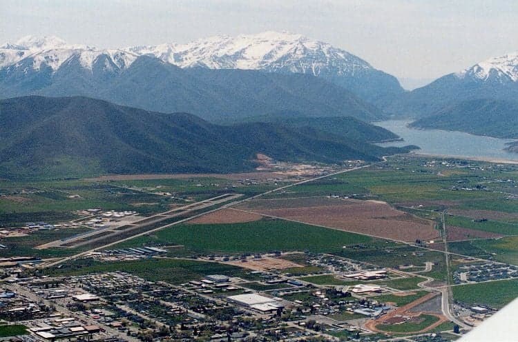
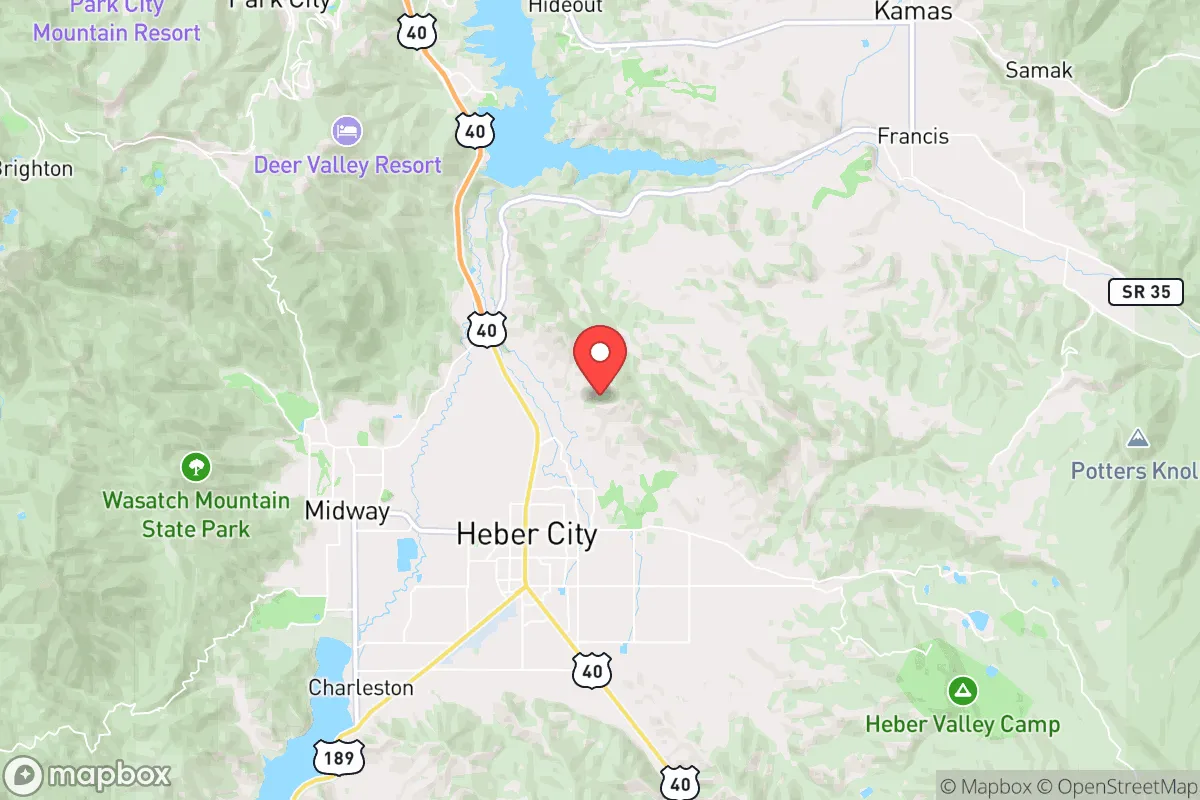
Heber City, Utah, occupies a strategic position in the Wasatch Back that offers a compelling blend of natural defensibility and practical resilience for those prioritizing disaster readiness and self-sufficiency. Nestled in the Heber Valley at roughly 5,600 feet elevation, the city sits in a mountain bowl ringed by the Wasatch Range to the west and the Uinta Mountains to the east, providing a natural buffer against many of the threats that plague more exposed or densely populated areas. Its location roughly 45 miles southeast of Salt Lake City places it far enough from the urban core to avoid the worst of a metropolitan collapse scenario, yet close enough to access critical supplies or medical evacuation if needed. For a relocator thinking seriously about long-term stability, Heber City’s geography, resource base, and community character present a nuanced but generally favorable picture—provided one understands the specific risks and trade-offs involved.
Geographic position and natural advantages for long-term stability
Heber City’s primary resilience asset is its position within a high-altitude valley that is naturally insulated from many common disaster vectors. The surrounding mountain ranges act as a physical barrier against large-scale wildfire spread from the west, while the valley’s elevation and climate reduce the likelihood of catastrophic flooding compared to lower-lying areas along the Wasatch Front. The Heber Valley is also a significant agricultural zone, with the Provo River and its tributaries providing a reliable surface water supply that is less vulnerable to drought-induced shortages than groundwater-dependent regions. The area’s proximity to the Uinta-Wasatch-Cache National Forest offers access to timber, game, and forage, which could supplement food and fuel supplies in a prolonged emergency. Additionally, the city’s position on U.S. Route 40 and State Route 189 provides two viable egress routes—east toward the Uinta Basin and south toward Provo—though both are narrow mountain passes that could become choke points during a mass evacuation. For a relocator, the key takeaway is that Heber City’s geography provides a strong baseline of natural defense, but the valley’s limited road network means that self-sufficiency, not evacuation, should be the primary planning assumption.
Risks, exposures, and proximity to fallout-relevant landmarks
No resilience analysis is complete without acknowledging the area’s vulnerabilities, and Heber City has several that a serious relocator must weigh. The most significant risk is its proximity to the Wasatch Front, a densely populated corridor of over 2.5 million people that includes Salt Lake City, Provo, and Ogden. In a major disaster—whether natural, economic, or geopolitical—this population center could become a source of mass displacement, with Heber Valley serving as a natural refuge for those fleeing the urban core. The city’s location along the Wasatch Fault Zone also introduces seismic risk; a major earthquake (magnitude 7.0 or greater) is a plausible scenario, and the valley’s alluvial soils could amplify ground shaking. Furthermore, Heber City sits within roughly 100 miles of Hill Air Force Base (a strategic nuclear and conventional weapons depot) and the Tooele Army Depot (a chemical weapons storage site), both of which are potential targets in a conflict scenario. While the prevailing winds in the region generally blow from west to east, meaning fallout from a strike on these facilities would likely move away from Heber City, the risk is not zero. For a relocator, the calculus is clear: Heber City is far safer than living directly on the Wasatch Front, but it is not a remote bunker. The area’s resilience depends on its ability to absorb displaced populations and maintain order during a crisis, which is a variable that cannot be fully controlled.
Practical resilience for a relocator: food, water, energy, and defensibility
On the practical front, Heber City offers several advantages that align with a self-sufficient lifestyle. The valley’s agricultural heritage means that local food production is viable, with existing farms producing hay, livestock, and some vegetables. The Provo River and Deer Creek Reservoir provide a robust surface water supply that is less susceptible to contamination than shallow groundwater, though treatment would be necessary for drinking. The area’s high elevation and cold winters mean that water storage and freeze protection are essential considerations for any off-grid setup. Energy resilience is mixed: Rocky Mountain Power’s grid is generally reliable, but the valley’s distance from major power plants and its exposure to winter storms can lead to outages. Solar potential is good—Heber City averages over 200 sunny days per year—but snow cover in winter can reduce panel output, making a backup generator or battery system advisable. Defensibility is a strong point: the valley’s single main road access (U.S. 40 from the east and State Route 189 from the west) means that a small group could effectively monitor and control entry points, though this also creates a vulnerability if those routes are blocked. The local community is predominantly LDS (Mormon), which often comes with a built-in network of preparedness-minded neighbors and church-based emergency response systems. For a relocator, the practical takeaway is that Heber City provides a workable foundation for self-sufficiency, but it requires active investment in water storage, alternative energy, and food production to achieve true resilience.
The overall strategic picture for Heber City is one of moderate-to-high resilience with specific, manageable risks. Its geographic isolation and agricultural base make it a strong candidate for those seeking a balance between access to urban resources and the security of a defensible, resource-rich valley. The primary downsides—proximity to a major population center, seismic risk, and limited egress routes—are real but not disqualifying for a relocator who is willing to invest in preparation and community integration. For a conservative-leaning audience that values self-reliance, local governance, and a slower pace of life, Heber City represents a solid option in the Intermountain West. It is not a remote survivalist retreat, but it is a place where a determined individual or family can build a resilient lifestyle with a reasonable expectation of stability. The key is to treat the area as a strategic asset—one that requires ongoing maintenance, awareness, and a willingness to adapt to the realities of mountain living and regional interdependence.

* Values derived from national, state, county, city and local statistics and may differ in a specific area. Last updated: 2026-10-01T16:27:04.000Z
Narrative content on this page is AI-generated and may contain mistakes. Verify any details that matter before acting on them.
ReloMaps may earn a commission from affiliate links at no extra cost to you.

