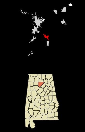
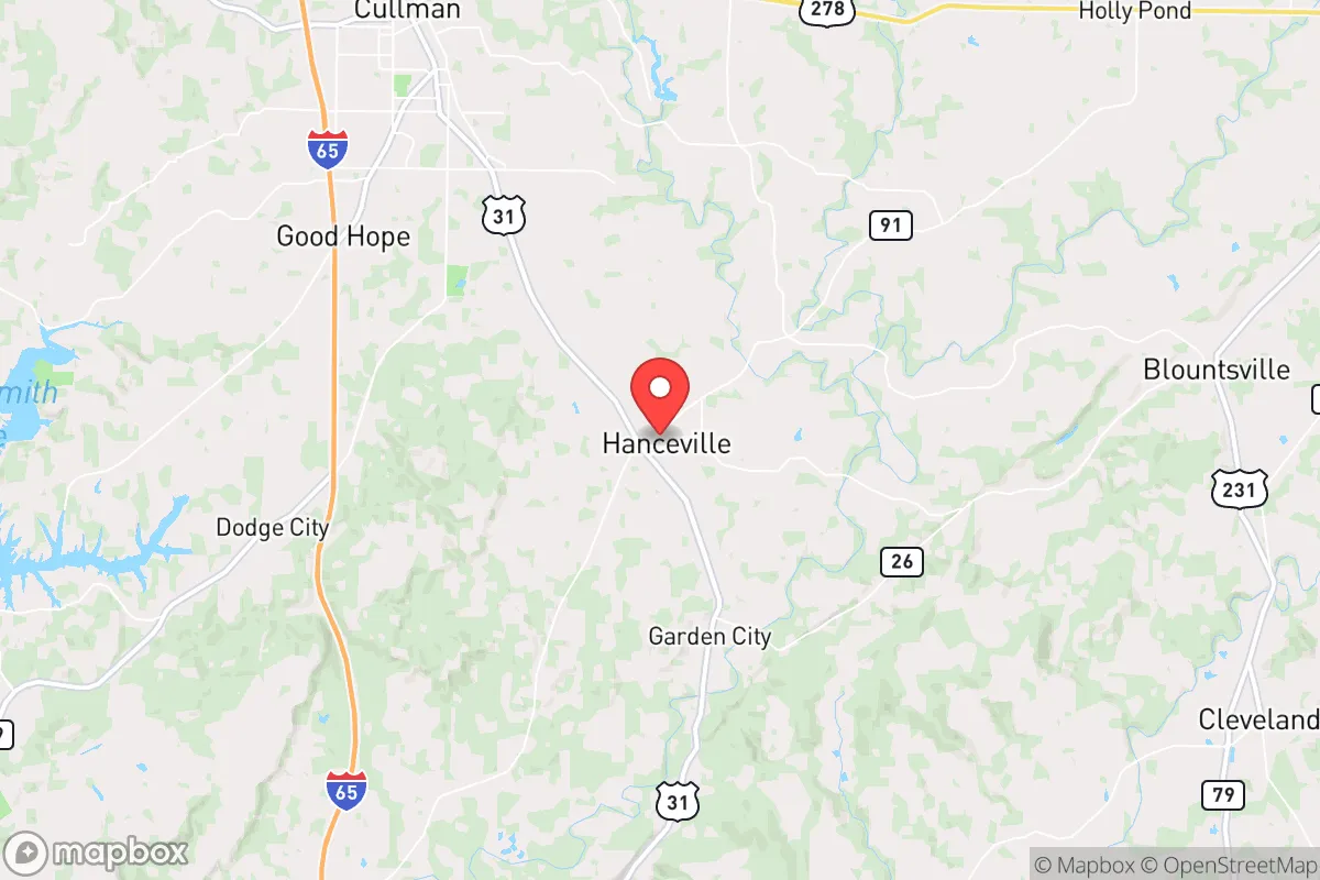
Photo: Wikipedia
Strategic Assessment of Hanceville, AL
Workable tactical position. Some exposure to population density or targets, but generally defensible in a crisis.
What does the Strategic Assessment tell us?
Our Strategic Assessment grades tactical survivability of an area. Major population centers, military targets, fallout zones, natural disasters, and border exposure all drive risk — lower exposure means a more defensible position in a crisis.
This is heavily inspired by Joel Skousen's Strategic Relocation book. Highly recommended you checkout the book ($)What does this tell us?
Our Strategic Assessment grades tactical survivability of an area. Major population centers, military targets, fallout zones, natural disasters, and border exposure all drive risk — lower exposure means a more defensible position in a crisis.
This is heavily inspired by Joel Skousen's Strategic Relocation book. Highly recommended you checkout the book ($)Strategic Pillars

Key Distances
Regional Safe Places
Below is our recommended "safe zones" in Alabama and the surrounding area based on our strategic heuristics. For most people, it's unrealistic to live in a “safe zone” full-time due to work, family or other personal reasons. They tend to be more rural. However, many of these areas are perfect for second homes and retreat properties that double as a vacation home or even a short-term rental.
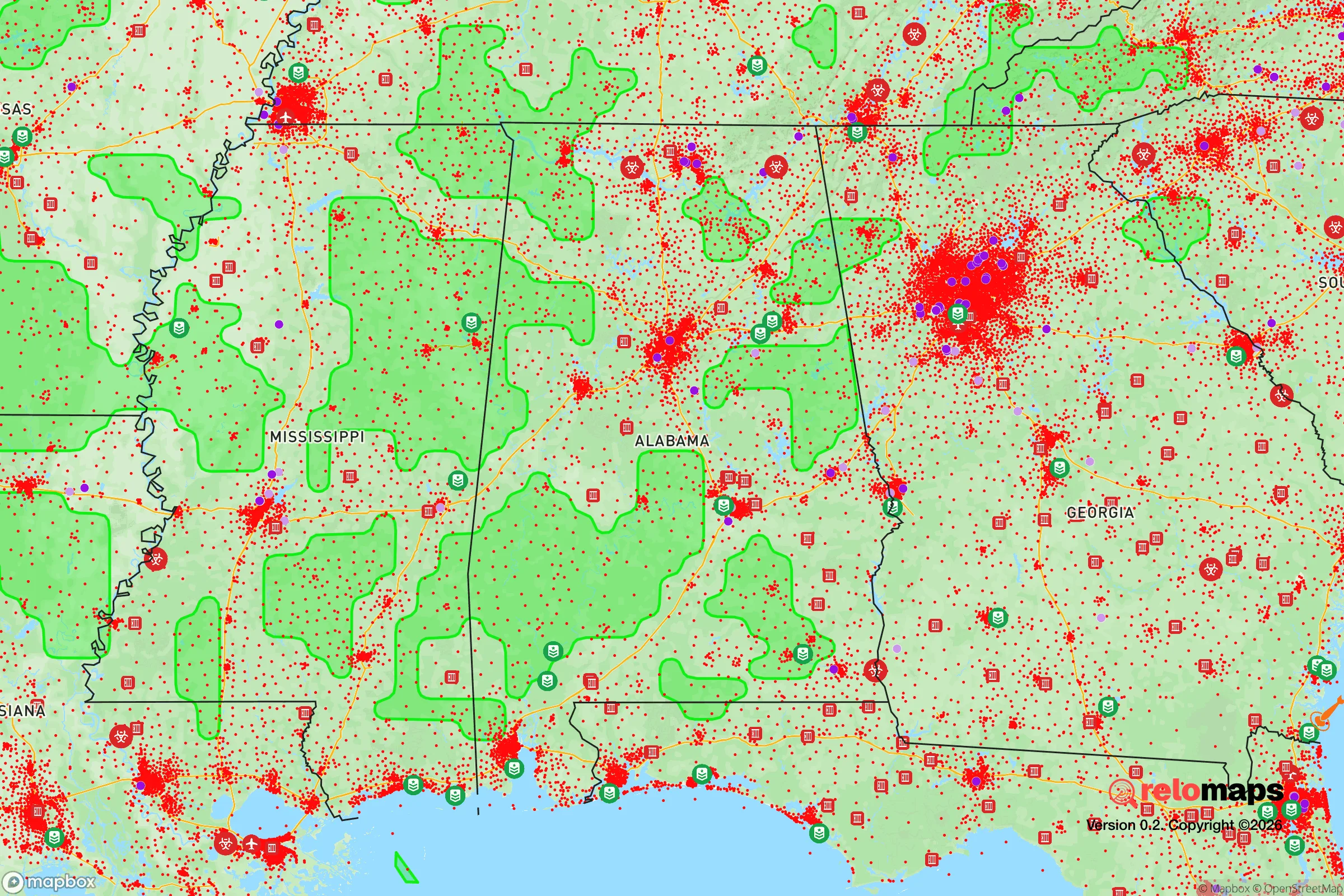
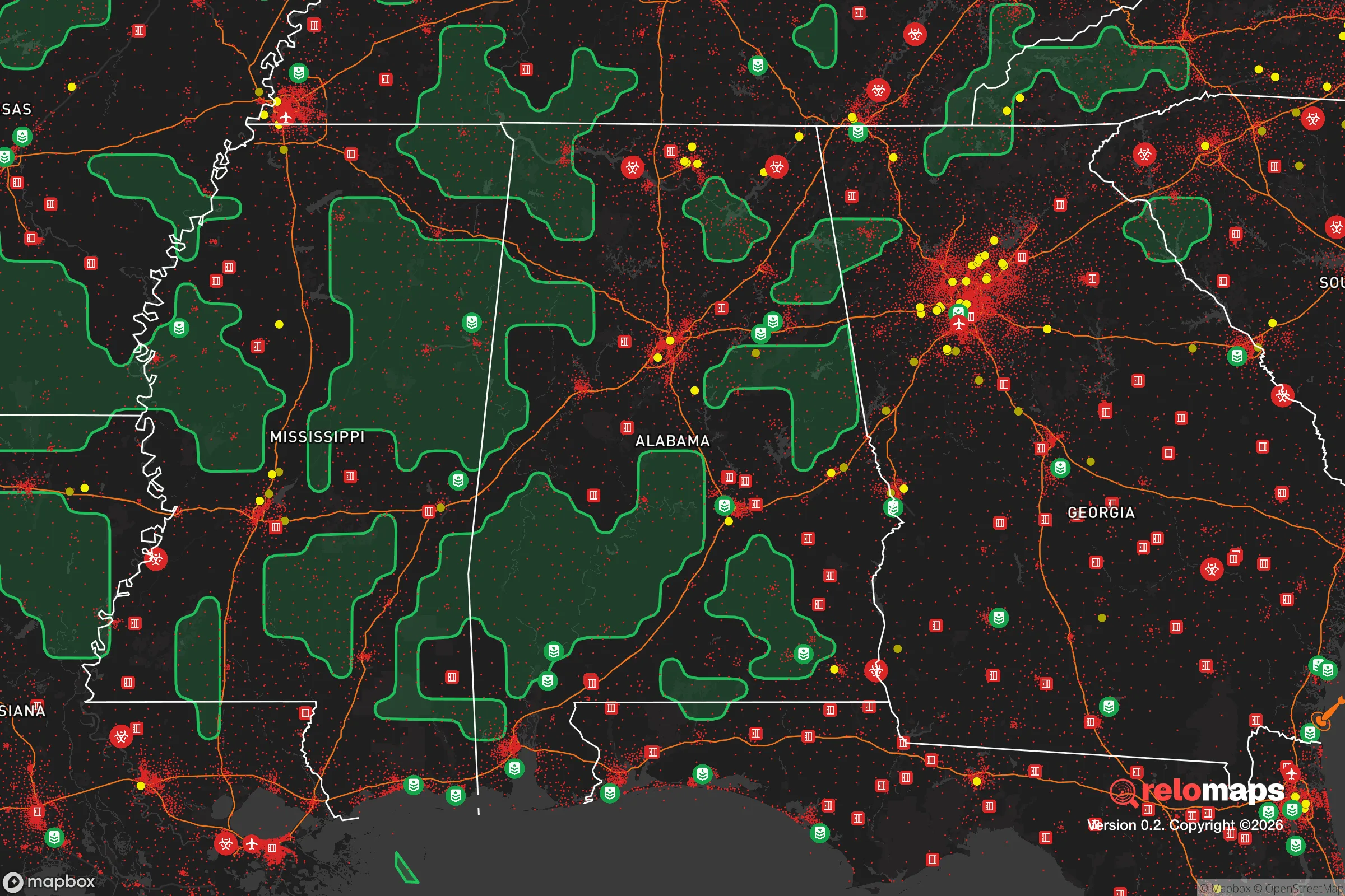


Important Note: For informational purposes only. This does not mean nothing bad ever happens in the green zones. Please use common sense. This is based on public data and modeled with AI. We tried to take a conservative approach but mistakes happen. We update this regularly as new information becomes available.
Solar Generator Recommendations
Backup power matters more here than in safer locations. We've picked three solar generators across budgets and capacity tiers — start with the budget unit if you only need a few essentials, or step up if you want to run a fridge and HVAC for days at a time.

Jackery Portable Power Station Explorer 300
Budget OptionPower on the Go: Weighing only 11 lbs, it's convenient to set up and store with book-sized foldable solar panels

BLUETTI Portable Power Station AC180
Designed for both indoor and outdoor scenarios, AC180 is highly capable as it has a robost capacity and continuous output power.

EF ECOFLOW DELTA Pro Ultra Power Station
Upgraded PickEcoFlow DELTA Pro Ultra is a whole-home energy system designed to grow with your family. Integrated with the Smart Home Panel 2, it scales to meet your evolving energy needs — keeping your home powered, intelligent, and secure through every stage of life.
We earn a commission, at no additional cost to you.
Strategic Assessment Analysis
Hanceville, Alabama, offers a strategic blend of rural self-sufficiency and practical proximity to regional resources, making it a noteworthy option for those prioritizing disaster readiness and long-term resilience. Situated in Cullman County, roughly 50 miles north of Birmingham, the town sits on the southern edge of the Appalachian foothills, providing a geographic buffer from the densest urban corridors while still allowing access to supply chains and medical facilities. For a relocator focused on preparedness, Hanceville’s position balances isolation from major metropolitan vulnerabilities with the logistical advantages of being near Interstate 65, a key north-south artery that remains functional during most regional disruptions.
Geographic position and natural advantages for self-sufficiency
Hanceville’s location in the Appalachian foothills provides meaningful natural defenses. The area’s rolling terrain and mixed hardwood forests offer cover, natural water drainage, and reduced wind exposure compared to open plains. The proximity to the Bankhead National Forest, about 30 miles to the west, and the William B. Bankhead National Forest’s extensive tracts give residents access to public lands for foraging, hunting, and emergency timber resources. The region sits atop the Cumberland Plateau, which means elevations generally range from 500 to 1,000 feet, reducing flood risk from the nearby Mulberry Fork of the Black Warrior River. The local climate is humid subtropical, with an average annual rainfall of about 55 inches, which supports year-round gardening and rainwater catchment. The growing season stretches from mid-April to late October, allowing for substantial food production. The area’s limestone bedrock also provides natural water filtration and stable well-drilling conditions, a critical advantage for off-grid water security.
Risk exposure and proximity to fallout-relevant landmarks
While Hanceville avoids the worst of urban collapse scenarios, it is not without exposure. The town lies roughly 50 miles from the Browns Ferry Nuclear Plant near Athens, Alabama, a three-unit facility that is one of the largest nuclear power plants in the country. In the event of a major accident or targeted disruption, prevailing winds from the southwest could carry fallout toward Cullman County within hours, though Hanceville’s distance and intervening terrain would reduce direct exposure compared to communities within 20 miles. The area is also within 100 miles of the Anniston Army Depot, which stores chemical weapons and conventional munitions, and the Redstone Arsenal in Huntsville, a major military and aerospace hub. These are potential secondary targets in a conflict scenario. On the natural hazard side, tornado risk is moderate to high, with Cullman County averaging about 12 tornado warnings per year. The April 2011 super outbreak produced an EF-4 tornado that struck the Hanceville area, causing significant damage. Earthquake risk is low, but the New Madrid Seismic Zone, roughly 200 miles to the northwest, could produce ground shaking that affects older masonry structures. Flooding is localized and primarily along the Mulberry Fork and its tributaries, so property selection matters.
Practical resilience for a relocator: food, water, energy, and defensibility
For someone serious about self-sufficiency, Hanceville offers strong fundamentals. Water availability is excellent: the average well depth in Cullman County is around 150 to 300 feet, with yields typically sufficient for a household and small-scale irrigation. The Mulberry Fork and several creeks provide surface water backup, though treatment would be necessary. Soil quality is variable but generally workable for gardens and small orchards, with clay-loam in the valleys and more rocky, sandy soil on the ridges. Local agricultural extension services through Auburn University offer soil testing and crop guidance. For energy resilience, solar potential is moderate, with about 4.5 peak sun hours per day, enough to offset grid dependence with a properly sized system. Wood heating is practical given the forest cover, and many rural properties already have wood stoves or fireplaces. Defensibility is a mixed picture: Hanceville itself is a small town of about 3,500 people, with a low population density that reduces competition for resources during a crisis. The surrounding countryside offers numerous remote properties with long driveways, natural screening, and limited road access. However, the town’s location along Highway 31 and near I-65 means it sits on a potential evacuation corridor from Birmingham, which could see increased traffic and transient populations during a regional emergency. Property selection should prioritize dead-end roads or properties with multiple access points to avoid being trapped. The local law enforcement presence is modest—Cullman County has about 60 deputies for 1,500 square miles—so community-based security arrangements are advisable.
The overall strategic picture for Hanceville is one of moderate resilience with clear trade-offs. It offers genuine advantages in water availability, growing conditions, and geographic buffer from the highest-risk urban and industrial targets. The proximity to nuclear and military infrastructure introduces a non-trivial risk that a relocator must weigh against the area’s practical self-sufficiency potential. For a family or individual willing to invest in well water, solar backup, and a defensible property away from main roads, Hanceville provides a viable base for long-term preparedness without the extreme isolation that complicates supply runs and medical access. The key is to choose a location that maximizes the natural advantages—elevation, forest cover, and water access—while minimizing exposure to the corridor risks and industrial fallout zones. With careful property selection and a realistic assessment of the regional hazards, Hanceville can serve as a solid anchor for a resilience-oriented lifestyle in the Southeast.

* Values derived from national, state, county, city and local statistics and may differ in a specific area. Last updated: 2026-07-15T22:09:22.000Z
Narrative content on this page is AI-generated and may contain mistakes. Verify any details that matter before acting on them.
ReloMaps may earn a commission from affiliate links at no extra cost to you.

