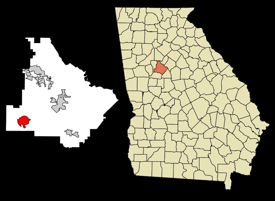
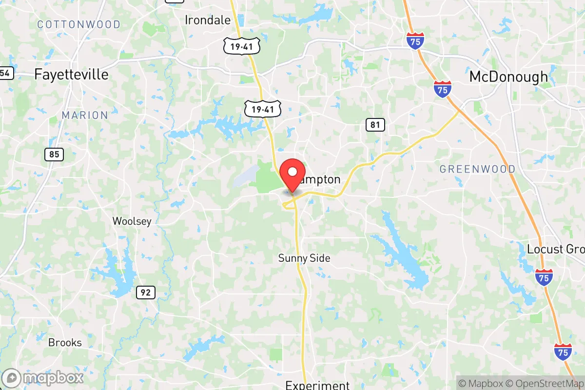
Photo: Wikipedia
Strategic Assessment of Hampton, GA
Meaningful friction. Expect exposure to either population pressure, blast zones, or natural disaster risk. Consider buying a retreat property.
What does the Strategic Assessment tell us?
Our Strategic Assessment grades tactical survivability of an area. Major population centers, military targets, fallout zones, natural disasters, and border exposure all drive risk — lower exposure means a more defensible position in a crisis.
This is heavily inspired by Joel Skousen's Strategic Relocation book. Highly recommended you checkout the book ($)What does this tell us?
Our Strategic Assessment grades tactical survivability of an area. Major population centers, military targets, fallout zones, natural disasters, and border exposure all drive risk — lower exposure means a more defensible position in a crisis.
This is heavily inspired by Joel Skousen's Strategic Relocation book. Highly recommended you checkout the book ($)Strategic Pillars

Key Distances
Regional Safe Places
Below is our recommended "safe zones" in Georgia and the surrounding area based on our strategic heuristics. For most people, it's unrealistic to live in a “safe zone” full-time due to work, family or other personal reasons. They tend to be more rural. However, many of these areas are perfect for second homes and retreat properties that double as a vacation home or even a short-term rental.
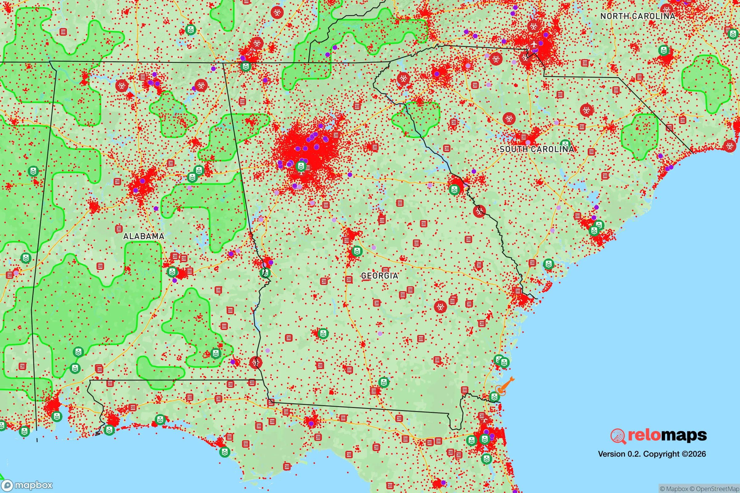
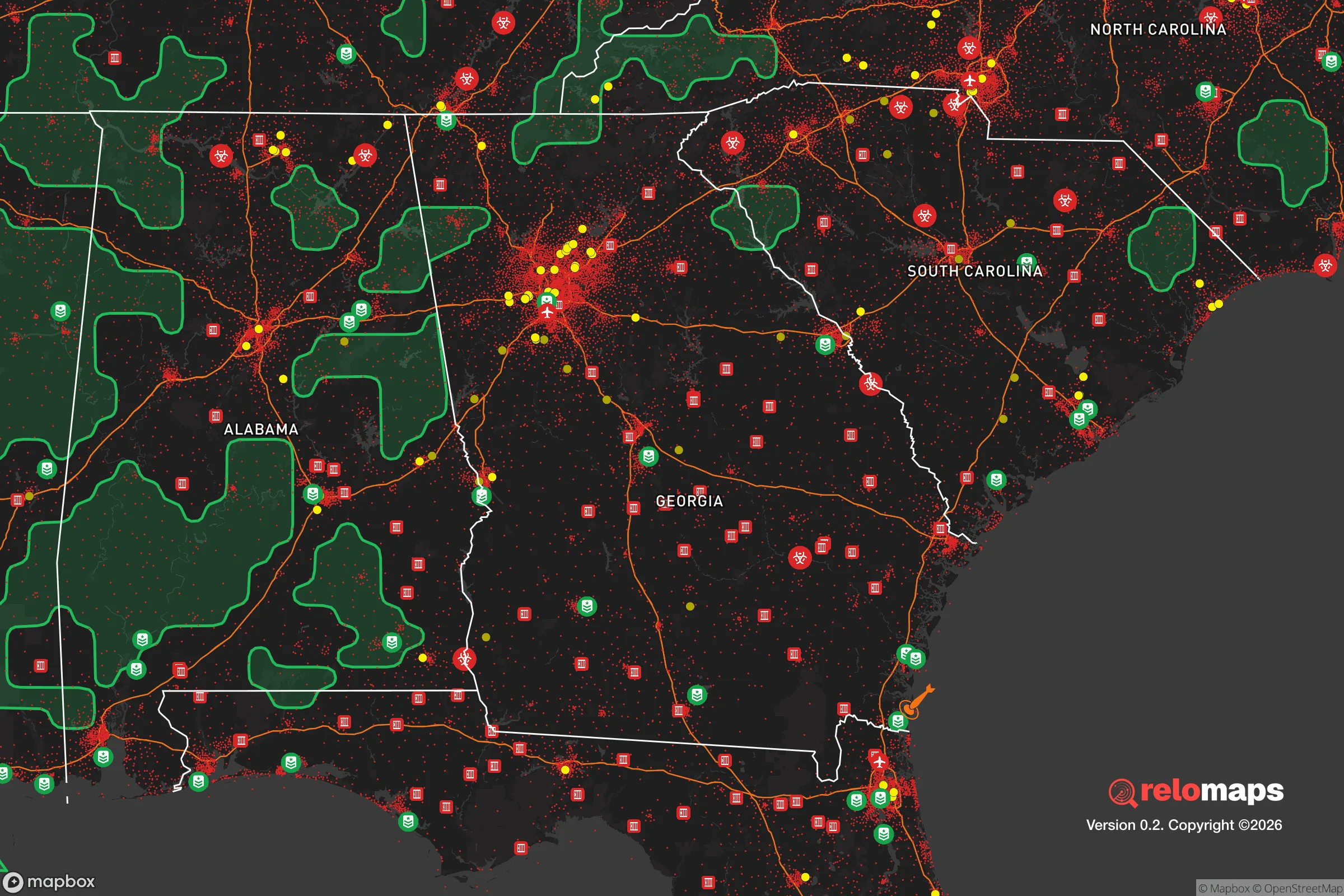


Important Note: For informational purposes only. This does not mean nothing bad ever happens in the green zones. Please use common sense. This is based on public data and modeled with AI. We tried to take a conservative approach but mistakes happen. We update this regularly as new information becomes available.
Solar Generator Recommendations
Backup power matters more here than in safer locations. We've picked three solar generators across budgets and capacity tiers — start with the budget unit if you only need a few essentials, or step up if you want to run a fridge and HVAC for days at a time.

Jackery Portable Power Station Explorer 300
Budget OptionPower on the Go: Weighing only 11 lbs, it's convenient to set up and store with book-sized foldable solar panels

BLUETTI Portable Power Station AC180
Designed for both indoor and outdoor scenarios, AC180 is highly capable as it has a robost capacity and continuous output power.

EF ECOFLOW DELTA Pro Ultra Power Station
Upgraded PickEcoFlow DELTA Pro Ultra is a whole-home energy system designed to grow with your family. Integrated with the Smart Home Panel 2, it scales to meet your evolving energy needs — keeping your home powered, intelligent, and secure through every stage of life.
We earn a commission, at no additional cost to you.
Strategic Assessment Analysis
Hampton, Georgia, offers a strategic balance of rural self-sufficiency and proximity to Atlanta’s resources, but its resilience profile is mixed for the disaster-conscious relocator. Located roughly 30 miles south of downtown Atlanta in Henry County, the area sits outside the immediate blast radius of a major metropolitan target while still being close enough to feel secondary effects like supply chain disruptions or population surges. For someone prioritizing preparedness, Hampton’s geographic position provides a moderate buffer—close enough to access medical and industrial infrastructure, far enough to avoid the worst of an urban crisis.
Geographic position and natural advantages for self-sufficiency
Hampton’s location in the Piedmont region gives it a few natural pluses. The area is inland and elevated, sitting at around 900 feet above sea level, which means it’s well clear of coastal storm surge and far from hurricane landfall zones. Flood risk is low outside of a few creek bottoms; the Flint River runs west of town but doesn’t pose a widespread hazard. The local topography is gently rolling, with mixed hardwood and pine forests that offer cover and timber for fuel or construction. Soils in Henry County are primarily sandy loam, workable for small-scale gardening but not prime farmland—you’ll need amendments and irrigation for reliable yields. Water access is a key advantage: the area sits atop the Floridan Aquifer system, and many rural properties have private wells. However, municipal water in Hampton comes from Clayton County’s system, which draws from the Chattahoochee River and is vulnerable to upstream contamination or treatment failures. For a relocator serious about self-sufficiency, a property with a tested well and a backup hand pump is a must. The climate is humid subtropical with a long growing season (roughly 220 frost-free days), supporting three-season vegetable production and perennial fruits like muscadines and figs.
Risk exposure: proximity to Atlanta and infrastructure vulnerabilities
The biggest resilience liability for Hampton is its proximity to Atlanta, a high-value target for both natural and man-made disasters. Hartsfield-Jackson Atlanta International Airport, the world’s busiest, lies just 20 miles north—a prime target for an EMP attack, conventional strike, or major accident. The I-75 corridor, which runs through Hampton, would become a choke point during any evacuation, and the area could see massive secondary displacement from Atlanta’s 6 million residents. Henry County is also home to the Atlanta Motor Speedway, a FEMA-designated staging area that could draw unwanted attention or become a logistical bottleneck during a crisis. On the natural side, tornado risk is moderate but real: Henry County averages 2-3 tornado warnings per year, and the flat terrain offers little natural deflection. The area is also within 100 miles of two nuclear facilities—Plant Vogtle (Waynesboro) and Plant Hatch (Baxley)—though prevailing winds generally carry fallout eastward. More immediate is the risk from rail and truck transport of hazardous materials along I-75 and the Norfolk Southern line that runs through town. For a relocator, the takeaway is that Hampton is not a remote hideaway; it’s a suburban-rural fringe that would face severe pressure in a regional emergency.
Practical resilience: food, water, energy, and defensibility in Hampton
For day-to-day preparedness, Hampton offers a mix of strengths and gaps. Food security is achievable: the surrounding county has active farms, farmers’ markets, and a strong hunting culture (deer and turkey are abundant). The local extension service offers classes on canning and food preservation. However, grocery supply chains are thin—the nearest major supermarkets are in Stockbridge or McDonough, both 10-15 minutes away, and would empty quickly in a panic. Water resilience depends entirely on property choice. Homes on city water are at the mercy of a centralized system; those with a well and a 12-volt pump setup can maintain supply indefinitely. Rainwater catchment is legal in Georgia, and average annual rainfall is 50 inches, making cisterns a viable backup. Energy independence is improving but not widespread. Georgia Power’s grid is aging and prone to outages from ice storms and summer thunderstorms. Solar adoption is growing, but net metering policies are mediocre; a grid-tied system without battery storage won’t help during blackouts. Off-grid solar with battery backup is feasible but requires upfront investment. Natural gas is available in parts of Hampton, but propane tanks are common in rural areas and offer a reliable cooking and heating backup. Defensibility is the weakest link. Hampton is not a defensible terrain—it’s a mix of subdivisions, strip malls, and open farmland with multiple road access points. The town’s population of about 8,000 would swell with evacuees from Atlanta. A rural property with a long driveway, tree line, and distance from main roads offers better security, but the area lacks natural barriers like mountains or rivers that create chokepoints. The local sheriff’s office is professional but understaffed for a major crisis; mutual aid agreements with Clayton and Spalding counties would be strained.
Overall, Hampton, GA, is a reasonable choice for the relocator who wants a balance of access and buffer, but it is not a bug-out location. Its strengths lie in moderate natural hazard risk, decent growing conditions, and the potential for water independence. Its weaknesses are proximity to a major target city, reliance on fragile infrastructure, and limited defensibility. For a family willing to invest in a well, solar backup, and food storage, Hampton can work as a base for a prepared lifestyle—provided they have a plan for the first 72 hours when Atlanta’s population surges south. The strategic picture is one of cautious viability: better than a dense suburb, worse than a remote mountain homestead, and requiring active preparation rather than passive safety.

* Values derived from national, state, county, city and local statistics and may differ in a specific area. Last updated: 2026-10-14T23:40:55.000Z
Narrative content on this page is AI-generated and may contain mistakes. Verify any details that matter before acting on them.
ReloMaps may earn a commission from affiliate links at no extra cost to you.

