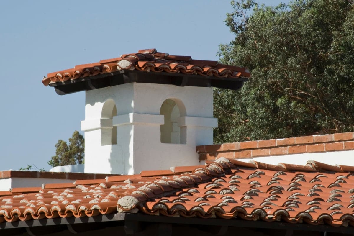
Photo: Wikipedia
Strategic Assessment of Green Valley, AZ
Workable tactical position. Some exposure to population density or targets, but generally defensible in a crisis.
What does the Strategic Assessment tell us?
Our Strategic Assessment grades tactical survivability of an area. Major population centers, military targets, fallout zones, natural disasters, and border exposure all drive risk — lower exposure means a more defensible position in a crisis.
This is heavily inspired by Joel Skousen's Strategic Relocation book. Highly recommended you checkout the book ($)What does this tell us?
Our Strategic Assessment grades tactical survivability of an area. Major population centers, military targets, fallout zones, natural disasters, and border exposure all drive risk — lower exposure means a more defensible position in a crisis.
This is heavily inspired by Joel Skousen's Strategic Relocation book. Highly recommended you checkout the book ($)Strategic Pillars

Key Distances
Regional Safe Places
Below is our recommended "safe zones" in Arizona and the surrounding area based on our strategic heuristics. For most people, it's unrealistic to live in a “safe zone” full-time due to work, family or other personal reasons. They tend to be more rural. However, many of these areas are perfect for second homes and retreat properties that double as a vacation home or even a short-term rental.
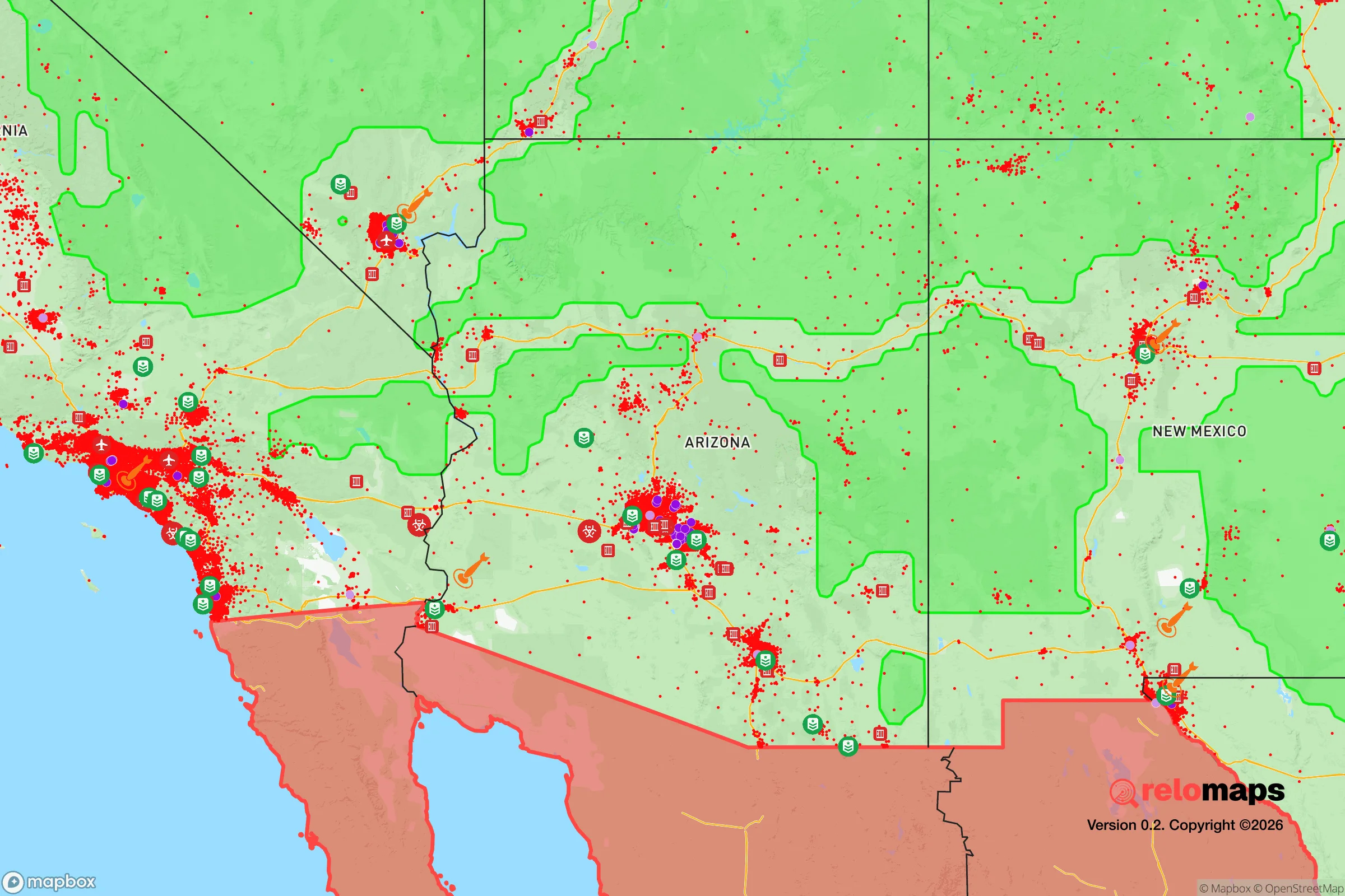
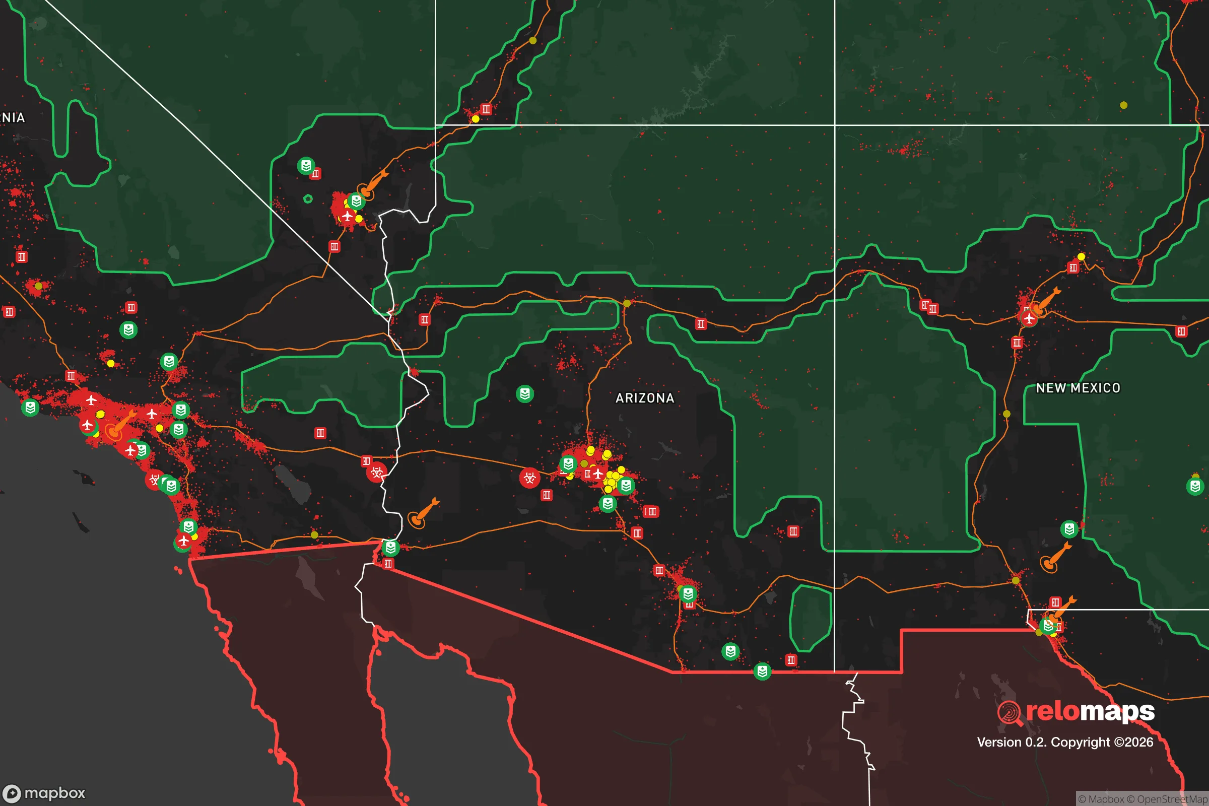


Important Note: For informational purposes only. This does not mean nothing bad ever happens in the green zones. Please use common sense. This is based on public data and modeled with AI. We tried to take a conservative approach but mistakes happen. We update this regularly as new information becomes available.
Solar Generator Recommendations
Backup power matters more here than in safer locations. We've picked three solar generators across budgets and capacity tiers — start with the budget unit if you only need a few essentials, or step up if you want to run a fridge and HVAC for days at a time.

Jackery Portable Power Station Explorer 300
Budget OptionPower on the Go: Weighing only 11 lbs, it's convenient to set up and store with book-sized foldable solar panels

BLUETTI Portable Power Station AC180
Designed for both indoor and outdoor scenarios, AC180 is highly capable as it has a robost capacity and continuous output power.

EF ECOFLOW DELTA Pro Ultra Power Station
Upgraded PickEcoFlow DELTA Pro Ultra is a whole-home energy system designed to grow with your family. Integrated with the Smart Home Panel 2, it scales to meet your evolving energy needs — keeping your home powered, intelligent, and secure through every stage of life.
We earn a commission, at no additional cost to you.
Strategic Assessment Analysis
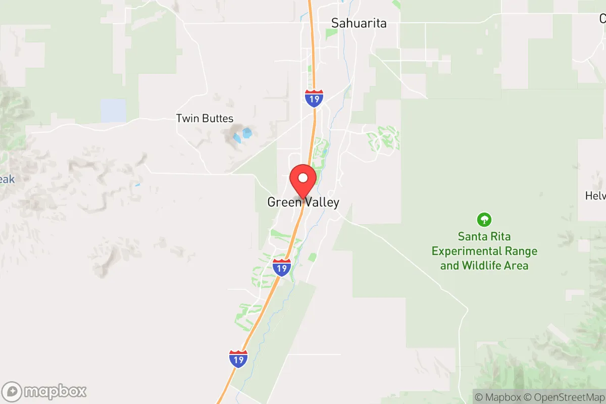
Green Valley, Arizona, sits roughly 25 miles south of Tucson in the Santa Cruz River Valley, and for a relocator thinking in terms of resilience and self-sufficiency, that positioning is a genuine strategic asset. The area combines the practical advantages of a functioning mid-sized metro (Tucson) with the physical separation and lower density that make a disruption—whether natural or man-made—easier to ride out. It is not a remote mountain redoubt, but it is also not a sprawling suburb where a single point of failure cascades across the whole community.
Geographic position and natural advantages for long-term stability
The most significant geographic advantage Green Valley offers is its elevation and climate. Sitting at roughly 2,900 feet, the area avoids the extreme summer heat of Phoenix (which regularly pushes past 110°F) while still enjoying the low humidity and abundant sunshine that make solar power a highly reliable investment. Winters are mild, with average highs in the 60s and 70s, meaning heating costs are minimal and cold-weather infrastructure failures are rare. The surrounding Santa Rita and Sierrita mountain ranges provide natural windbreaks and a visual boundary that helps define the area’s defensible perimeter, and the vast expanse of public land—Coronado National Forest to the east and the Tohono O'odham Nation to the west—acts as a buffer against unchecked urban sprawl.
Water is the obvious caveat. Green Valley relies on groundwater from the Avra Valley and Central Arizona Project water delivered via Tucson, and the region is in a long-term structural drought. However, compared to Phoenix or Las Vegas, the demand pressure here is far lower. The community’s master-planned nature, with its heavy retiree population and golf courses, does consume water, but the residential footprint is compact. For a relocator serious about self-sufficiency, the practical takeaway is that rainwater harvesting is viable (monsoon season delivers concentrated rainfall from July through September), and a deep well on a small parcel outside the main developments is a realistic option that would be prohibitively expensive or legally restricted in most other Western metros.
Risks, exposures, and proximity to fallout-relevant landmarks
No honest resilience assessment can ignore the region’s exposure profile. The primary natural risks are wildfire and extreme heat, not earthquakes or hurricanes. Wildfire risk is moderate and concentrated in the foothills and canyons east of the interstate; the valley floor itself is low-risk. Heat is a chronic stressor rather than an acute event, and the infrastructure here is built for it—power grids are designed for summer demand, and homes typically have evaporative cooling or high-efficiency AC as standard.
The man-made risk picture is more nuanced. Green Valley’s proximity to Tucson (population roughly 550,000 in the metro) is a double-edged sword. On one hand, it provides access to Davis-Monthan Air Force Base, a major logistics and aerospace hub, and the University of Arizona Medical Center, which is a Level I trauma center. On the other hand, that same proximity means the area is within the blast-and-fallout radius of a potential strategic strike on Tucson’s military and infrastructure assets. Davis-Monthan is a designated target in any peer-competitor war plan, and the prevailing winds in southern Arizona blow from the west and southwest, which would carry fallout toward the eastern suburbs—including parts of the Green Valley corridor depending on the exact detonation point. Additionally, the nearby Raytheon missile plant and the railroad mainline that runs through the valley are secondary but plausible targets. For a reader weighing this seriously, the honest assessment is that Green Valley is not a fallout-safe zone; it is a "better than Phoenix, worse than the Four Corners" location. The practical mitigation is distance and preparation, not location alone.
Practical resilience for a relocator: food, water, energy, and defensibility
For the individual or family actually moving here, the day-to-day resilience picture is strong. Food security is a genuine advantage: the Santa Cruz Valley is one of Arizona’s oldest agricultural regions, and the nearby communities of Sahuarita and Amado host working pecan orchards, pecan groves, and small-scale vegetable farms. The Green Valley Farmers Market operates year-round, and the growing season is nearly 12 months—you can plant cool-weather crops in October and harvest into May, then switch to heat-tolerant varieties for the summer. A household with a 1,000-square-foot garden and a few fruit trees (citrus, pomegranate, figs all thrive here) can realistically produce a meaningful portion of its own calories, which is not true in most of the Phoenix metro.
Energy is where Green Valley shines. The area averages over 300 sunny days per year, and rooftop solar with battery storage is both legal and common. Net metering is available through Tucson Electric Power, and the local permitting process is straightforward. A 10kW system with a 20kWh battery will cover a typical home’s baseline load indefinitely, including AC in summer if you pair it with a heat pump and good insulation. Natural gas is piped into most developments, which provides a backup cooking and heating source that is independent of the electrical grid. For water storage, the standard practice here is a 2,500-gallon above-ground tank with a simple filtration system—this is affordable, low-tech, and sufficient for a family of four for 60–90 days if rationed.
Defensibility is a mixed bag. The master-planned communities (Canoa Ranch, Quail Creek, Madera Vista) are gated with HOA security, which deters casual crime but also means you are subject to HOA rules that may restrict water tanks, solar placement, or livestock. The unincorporated areas south of the main developments—toward Arivaca Junction and Amado—offer larger parcels, no HOA, and a more self-sufficient lifestyle, but they are also farther from emergency services and have a higher incidence of border-related activity (smuggling traffic, occasional border patrol checkpoints). For most relocators, the sweet spot is a home in the eastern foothills or the unincorporated areas east of I-19, where you get the community infrastructure but retain the freedom to build out your own systems.
The overall strategic picture for a resilience-minded relocator
Green Valley is not a prepper’s paradise, and it is not a fallout shelter. It is, however, a genuinely resilient mid-tier location that balances access to critical services (Level I trauma, major airport, military logistics hub) with a low-density, high-sun, agricultural-friendly environment. The realistic threat model here is not a single catastrophic event but a cascading series of disruptions—a prolonged heat wave, a water shortage, a regional power outage—and Green Valley’s infrastructure is better positioned to absorb those than most of the Sun Belt. The community itself is a factor: the retiree-heavy demographic means a large population with time, skills, and medical knowledge, which is a soft asset that is hard to quantify but matters in a prolonged emergency. For a single individual or a family willing to invest in solar, water storage, and a serious garden, Green Valley offers a defensible, sustainable base of operations with the convenience of a major city 30 minutes away. It is not the most remote or the most hardened location in the Southwest, but it is one of the most balanced.

* Values derived from national, state, county, city and local statistics and may differ in a specific area. Last updated: 2026-10-13T01:03:45.000Z
Narrative content on this page is AI-generated and may contain mistakes. Verify any details that matter before acting on them.
ReloMaps may earn a commission from affiliate links at no extra cost to you.

