Photo: Wikipedia
Strategic Assessment of Grass Valley, CA
Meaningful friction. Expect exposure to either population pressure, blast zones, or natural disaster risk. Consider buying a retreat property.
What does the Strategic Assessment tell us?
Our Strategic Assessment grades tactical survivability of an area. Major population centers, military targets, fallout zones, natural disasters, and border exposure all drive risk — lower exposure means a more defensible position in a crisis.
This is heavily inspired by Joel Skousen's Strategic Relocation book. Highly recommended you checkout the book ($)What does this tell us?
Our Strategic Assessment grades tactical survivability of an area. Major population centers, military targets, fallout zones, natural disasters, and border exposure all drive risk — lower exposure means a more defensible position in a crisis.
This is heavily inspired by Joel Skousen's Strategic Relocation book. Highly recommended you checkout the book ($)Strategic Pillars

Key Distances
Regional Safe Places
Below is our recommended "safe zones" in California and the surrounding area based on our strategic heuristics. For most people, it's unrealistic to live in a “safe zone” full-time due to work, family or other personal reasons. They tend to be more rural. However, many of these areas are perfect for second homes and retreat properties that double as a vacation home or even a short-term rental.




Important Note: For informational purposes only. This does not mean nothing bad ever happens in the green zones. Please use common sense. This is based on public data and modeled with AI. We tried to take a conservative approach but mistakes happen. We update this regularly as new information becomes available.
Solar Generator Recommendations
Backup power matters more here than in safer locations. We've picked three solar generators across budgets and capacity tiers — start with the budget unit if you only need a few essentials, or step up if you want to run a fridge and HVAC for days at a time.

Jackery Portable Power Station Explorer 300
Budget OptionPower on the Go: Weighing only 11 lbs, it's convenient to set up and store with book-sized foldable solar panels

BLUETTI Portable Power Station AC180
Designed for both indoor and outdoor scenarios, AC180 is highly capable as it has a robost capacity and continuous output power.

EF ECOFLOW DELTA Pro Ultra Power Station
Upgraded PickEcoFlow DELTA Pro Ultra is a whole-home energy system designed to grow with your family. Integrated with the Smart Home Panel 2, it scales to meet your evolving energy needs — keeping your home powered, intelligent, and secure through every stage of life.
We earn a commission, at no additional cost to you.
Strategic Assessment Analysis
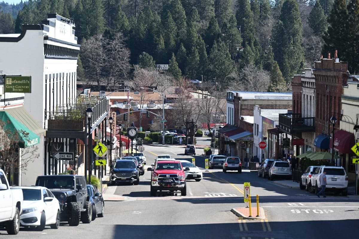
Grass Valley, California, offers a compelling mix of strategic resilience and practical self-sufficiency for those prioritizing disaster readiness, but its location in the Sierra Nevada foothills comes with distinct trade-offs. The area’s relative isolation from major metropolitan centers, combined with its access to forest, water, and defensible terrain, makes it a strong candidate for a relocation-minded individual or family. However, its proximity to critical infrastructure and potential fallout zones—particularly along the I-80 corridor and near the state capital—requires careful consideration. This assessment breaks down the geographic advantages, exposure to risks, and practical resilience factors that define Grass Valley’s strategic picture.
Geographic position and natural advantages for self-sufficiency
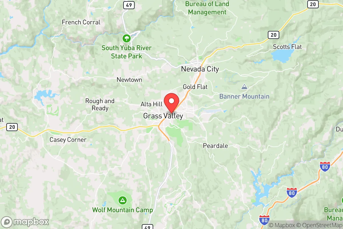
Grass Valley sits at roughly 2,500 feet elevation in the western Sierra Nevada, about 60 miles northeast of Sacramento. This positioning offers several key advantages. The elevation provides a natural buffer against the worst of California’s coastal seismic activity—major fault lines like the San Andreas are over 100 miles west—while still being far enough inland to avoid the direct impacts of sea-level rise or tsunami threats. The surrounding terrain is hilly and forested, with numerous small valleys and ridges that create natural chokepoints and defensible positions. The area’s Mediterranean climate, with hot, dry summers and cool, wet winters, supports a growing season long enough for substantial home gardening, though irrigation is essential during summer months. The Yuba River watershed, including the South Yuba River and Deer Creek, runs through the region, providing reliable surface water sources that are less prone to contamination than lowland aquifers. The historic mining infrastructure—including old ditches, flumes, and reservoirs—can be repurposed for gravity-fed water systems, a detail often overlooked by newcomers. The region’s forest cover also offers abundant firewood, building materials, and foraging opportunities, though this same forest cover introduces wildfire risk, which is addressed below.
Risks, exposures, and proximity to fallout-relevant landmarks
The most significant risk in Grass Valley is wildfire. The 2020 Jones Fire and the 2021 River Fire both burned within a few miles of the town, and the area sits in a high-risk fire zone designated by Cal Fire. The surrounding national forests—Tahoe and Plumas—are increasingly prone to large, fast-moving fires during drought years. Evacuation routes are limited: the primary arteries are Highway 49 (north-south) and Highway 20 (east-west), both two-lane roads that can become clogged quickly. A secondary concern is the area’s proximity to critical infrastructure that could become a target or a source of secondary disasters. Grass Valley is roughly 40 miles from the Sacramento Municipal Utility District’s Rancho Seco nuclear plant (now decommissioned but still containing spent fuel), and about 70 miles from the Diablo Canyon nuclear plant near San Luis Obispo—though the latter is far enough to be a low direct concern. More relevant is the area’s position relative to the I-80 corridor, a major east-west transportation artery that carries hazardous materials, including propane, ammonia, and gasoline. A major accident or intentional disruption on I-80 near Colfax (15 miles north) could cut off supply chains and create a toxic plume. Additionally, Grass Valley is within 100 miles of the Sacramento-San Joaquin Delta, a critical water infrastructure hub that is vulnerable to earthquake-induced levee failures. A major quake in the delta could disrupt water delivery to Southern California and create cascading economic effects, but the direct physical impact on Grass Valley would be minimal. For those concerned with fallout from a nuclear event—whether accidental or intentional—the prevailing winds in the Sierra foothills generally blow from west to east, meaning fallout from a Sacramento-area event would likely be carried away from Grass Valley, though a detonation in the Central Valley could still deposit particulate matter depending on weather patterns.
Practical resilience for a relocator: food, water, energy, and defensibility
Grass Valley’s practical resilience is a mixed bag. On the positive side, the area has a strong local food network. The Nevada County Agricultural Commissioner reports over 200 farms in the county, producing everything from apples and pears to livestock and honey. The Grass Valley Farmers’ Market operates year-round, and there are several local food co-ops and bulk-buying clubs. Home gardening is viable, with a frost-free season from roughly May to October, and many properties have existing orchard trees from the gold rush era. Water is generally accessible via wells, though drilling depths vary widely—some areas hit water at 50 feet, others require 300-foot wells. The average well yield in Nevada County is about 10 gallons per minute, sufficient for a household with careful use. Surface water from the Yuba River is available but requires filtration and legal access; the South Yuba River is a designated Wild and Scenic River, and water rights are tightly regulated. Rainwater catchment is legal in California, and Grass Valley’s average annual rainfall of 55 inches makes it a strong candidate for cistern systems. Energy resilience is moderate. The area is served by PG&E, which has a poor reliability record due to wildfire-related shutoffs. Solar is a strong option—the region averages 260 sunny days per year—but battery storage is essential given the fire season shutoffs. Propane is widely used for heating and cooking, and wood stoves are common. Defensibility is one of Grass Valley’s strongest attributes. The hilly terrain, narrow roads, and limited access points make it difficult for large groups to approach quickly. Many properties are set back from main roads, with long driveways that can be easily monitored. The local culture is heavily oriented toward self-reliance: there is a strong network of preppers, homesteaders, and off-grid enthusiasts, and the county has a well-organized emergency services system, including the Nevada County Office of Emergency Services, which runs a Community Emergency Response Team (CERT) program. The Grass Valley Police Department and Nevada County Sheriff’s Office are well-funded relative to rural averages, with response times in town under 10 minutes, though outlying areas can be 30 minutes or more.
The overall strategic picture for Grass Valley is one of cautious optimism for the prepared relocator. The area offers genuine advantages in water access, defensible terrain, and a self-sufficient culture, but these come with real wildfire risk and limited evacuation routes. The proximity to Sacramento and I-80 is a double-edged sword: it provides access to supplies and healthcare (the nearest major trauma center is in Roseville, 45 minutes away) but also places the area within the fallout shadow of a major urban or infrastructure target. For a family or individual willing to invest in fire-hardening, water storage, and solar backup, Grass Valley represents one of the more balanced options in California for long-term resilience. It is not a bug-out location for a short-term crisis—it is a place to build a life that can withstand disruptions

* Values derived from national, state, county, city and local statistics and may differ in a specific area. Last updated: 2026-09-22T20:12:37.000Z
Narrative content on this page is AI-generated and may contain mistakes. Verify any details that matter before acting on them.
ReloMaps may earn a commission from affiliate links at no extra cost to you.

