Photo: Wikipedia
Strategic Assessment of Grand Junction, CO
Workable tactical position. Some exposure to population density or targets, but generally defensible in a crisis.
What does the Strategic Assessment tell us?
Our Strategic Assessment grades tactical survivability of an area. Major population centers, military targets, fallout zones, natural disasters, and border exposure all drive risk — lower exposure means a more defensible position in a crisis.
This is heavily inspired by Joel Skousen's Strategic Relocation book. Highly recommended you checkout the book ($)What does this tell us?
Our Strategic Assessment grades tactical survivability of an area. Major population centers, military targets, fallout zones, natural disasters, and border exposure all drive risk — lower exposure means a more defensible position in a crisis.
This is heavily inspired by Joel Skousen's Strategic Relocation book. Highly recommended you checkout the book ($)Strategic Pillars

Key Distances
Regional Safe Places
Below is our recommended "safe zones" in Colorado and the surrounding area based on our strategic heuristics. For most people, it's unrealistic to live in a “safe zone” full-time due to work, family or other personal reasons. They tend to be more rural. However, many of these areas are perfect for second homes and retreat properties that double as a vacation home or even a short-term rental.


Important Note: For informational purposes only. This does not mean nothing bad ever happens in the green zones. Please use common sense. This is based on public data and modeled with AI. We tried to take a conservative approach but mistakes happen. We update this regularly as new information becomes available.
Solar Generator Recommendations
Backup power matters more here than in safer locations. We've picked three solar generators across budgets and capacity tiers — start with the budget unit if you only need a few essentials, or step up if you want to run a fridge and HVAC for days at a time.

Jackery Portable Power Station Explorer 300
Budget OptionPower on the Go: Weighing only 11 lbs, it's convenient to set up and store with book-sized foldable solar panels

BLUETTI Portable Power Station AC180
Designed for both indoor and outdoor scenarios, AC180 is highly capable as it has a robost capacity and continuous output power.

EF ECOFLOW DELTA Pro Ultra Power Station
Upgraded PickEcoFlow DELTA Pro Ultra is a whole-home energy system designed to grow with your family. Integrated with the Smart Home Panel 2, it scales to meet your evolving energy needs — keeping your home powered, intelligent, and secure through every stage of life.
We earn a commission, at no additional cost to you.
Strategic Assessment Analysis
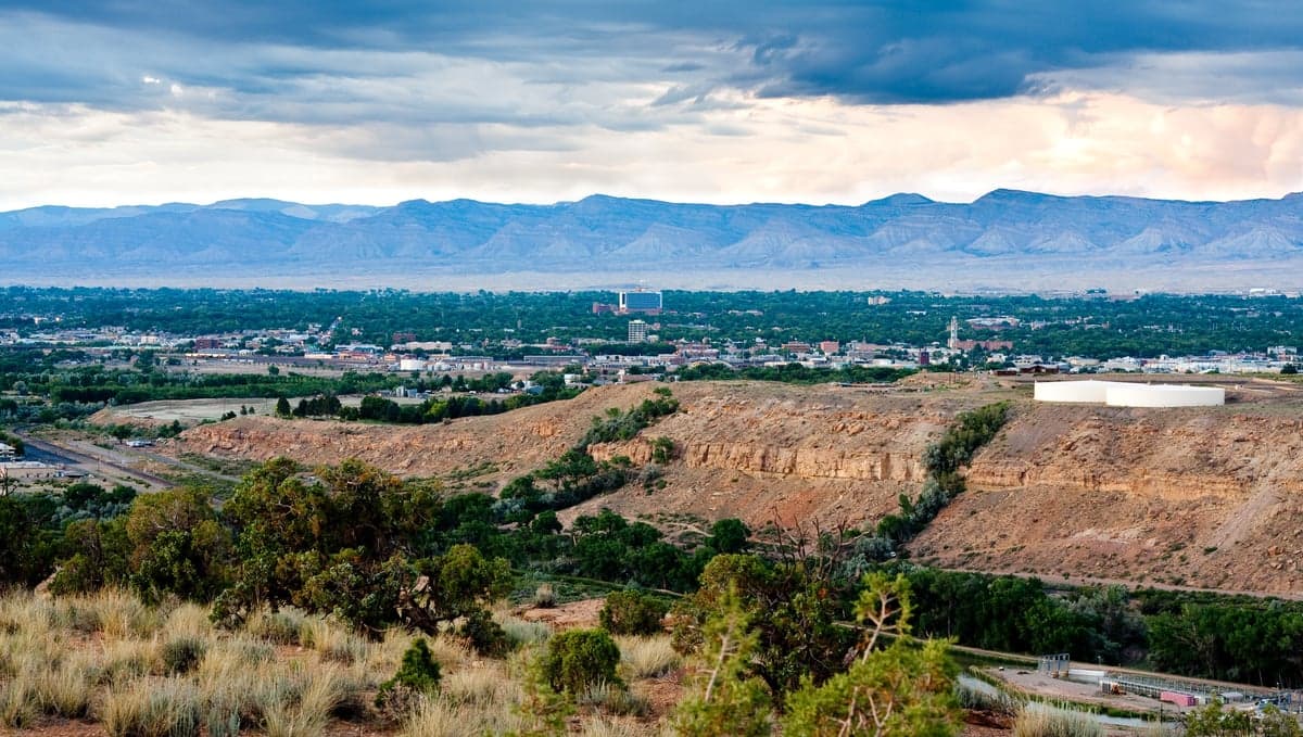
Grand Junction, Colorado, offers a compelling mix of geographic isolation and regional access that makes it a serious contender for those prioritizing long-term resilience and strategic relocation. Sitting at the confluence of the Colorado and Gunnison Rivers, this city of roughly 65,000 people is the largest population center on Colorado’s Western Slope, yet it remains far enough from the Front Range’s urban corridors to provide a meaningful buffer against the cascading effects of civil unrest, supply chain disruptions, or mass casualty events. The area’s natural defenses—mountain barriers, limited major highway access, and a semi-arid climate—combine with a local economy rooted in agriculture, energy, and healthcare to create a foundation that is both self-sufficient and strategically positioned for those who take preparedness seriously.
Geographic position and natural advantages for long-term security
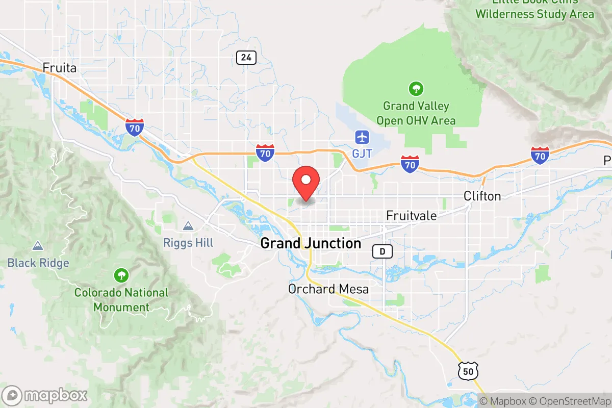
Grand Junction’s location is its strongest asset for anyone thinking in terms of strategic depth. The city sits in the Grand Valley, a broad, flat basin ringed by the Book Cliffs to the north and the Uncompahgre Plateau to the south, with the Colorado National Monument providing a rugged western barrier. This topography creates a natural choke point: the only major routes in and out are I-70 (east-west) and US-50 (south), both of which pass through narrow canyons and mountain passes that are easily monitored or, in a worst-case scenario, controlled. The nearest Front Range population centers—Denver, Colorado Springs, and Fort Collins—are all 200 to 250 miles away, separated by the Rocky Mountains and multiple high-altitude passes that become impassable in winter weather. This distance provides a critical buffer against the spillover effects of urban unrest, pandemics, or grid collapse. The region also sits at a relatively low elevation for Colorado (around 4,600 feet), which means milder winters and a longer growing season than the mountain towns to the east. The Colorado River and its tributaries provide a reliable surface water source, a luxury that many arid Western towns cannot claim. For the prepper or survivalist, this combination of defensible terrain, distance from major targets, and access to water is the trifecta of strategic relocation.
Risks, exposures, and proximity to fallout-relevant landmarks
No location is without vulnerabilities, and Grand Junction has several that demand honest assessment. The most significant risk is the presence of the Colorado River itself—while it provides water, it also means the city is downstream from any contamination event originating in the mountains or from upstream industrial sites. The area is also within the seismic shadow of the Wasatch Fault in Utah, though major quakes are rare. More immediately relevant to the prepper mindset is the proximity to the U.S. Department of Energy’s Grand Junction Office, a former uranium processing site that still has ongoing environmental remediation. While not a nuclear weapons facility, it is a federal site that could draw attention in a collapse scenario. The city also sits roughly 50 miles from the Moab, Utah, area, which includes a uranium mill tailings site and the Moab Chemical Depot—both potential targets for those looking to disrupt critical infrastructure. On the plus side, Grand Junction is far from any major military bases (the nearest is Hill AFB in Utah, about 200 miles away) and is not near any major nuclear power plants or strategic missile fields. The biggest practical risk is the area’s dependence on I-70 for resupply; if that highway is cut by a natural disaster or civil unrest, the city would need to rely on local production and stockpiles. The local airport (Grand Junction Regional Airport) is a small regional facility, not a major hub, which reduces the risk of it being a target but also limits evacuation options.
Practical resilience for a relocator: food, water, energy, and defensibility
For the individual or family looking to establish a resilient homestead, Grand Junction offers a surprisingly strong baseline. The Grand Valley is one of Colorado’s most productive agricultural regions, with a long history of fruit orchards (peaches, apples, pears), vineyards, and vegetable farming. The local farmers’ markets and U-pick operations are robust, and the soil is fertile when irrigated. Water rights are a serious consideration—the area is in a drought-prone region, and the Colorado River Compact means that water allocations are increasingly contested. Anyone buying land here should prioritize properties with senior water rights or access to a well. The city’s municipal water supply comes from the Colorado River and is treated at the Grand Junction Water Treatment Plant, but a grid-down scenario would require private storage or a backup well. Energy is a mixed bag: the area has abundant solar potential (over 300 sunny days per year), and many rural properties are already off-grid or grid-tied with solar. Natural gas is available in town, but rural areas rely on propane or electric. The local power grid is served by Xcel Energy and the Grand Valley Power cooperative, both of which have decent reliability records, but the region is not immune to winter storms that can knock out lines. Defensibility is where Grand Junction shines for the prepared individual. The surrounding public lands (Grand Mesa National Forest, Uncompahgre National Forest, and BLM land) offer vast areas for retreat, hunting, and foraging. The local gun culture is strong, with multiple shooting ranges and a pro-Second Amendment sentiment that aligns with a conservative worldview. The Mesa County Sheriff’s Office is well-regarded, and the local population is generally self-reliant, with a strong network of churches, volunteer fire departments, and community organizations that would likely mobilize in a crisis. The biggest practical challenge for a relocator is the cost of land: while cheaper than the Front Range, irrigated agricultural land still runs $10,000–$15,000 per acre, and buildable lots in town are not cheap. But for those willing to go 20–30 minutes outside the city, raw land with good water access is still available at reasonable prices.
The overall strategic picture for Grand Junction is one of cautious optimism for the serious prepper. It is not a perfect fortress—no place is—but it offers a rare combination of natural barriers, water availability, agricultural potential, and cultural alignment that makes it a strong candidate for a long-term relocation. The distance from major population centers and strategic targets provides a buffer that many other Western towns lack, while the local economy and infrastructure are robust enough to support a comfortable modern life while you build your resilience. The key is to act now, secure water rights, and establish a network of like-minded neighbors before the next crisis accelerates the migration to safer ground. Grand Junction is not a secret, but it is still underappreciated by the mainstream relocation crowd, which gives the prepared individual a window of opportunity to get established before the inevitable wave of urban refugees discovers what this valley has to offer.
* Values derived from national, state, county, city and local statistics and may differ in a specific area. Last updated: 2026-04-25T04:41:08.000Z
Narrative content on this page is AI-generated and may contain mistakes. Verify any details that matter before acting on them.
ReloMaps may earn a commission from affiliate links at no extra cost to you.