Photo: Wikipedia
Demographics of Pasco County
Affluence Level in Pasco County
A middle-class area roughly in line with national averages across income, home values, education, and employment.
People of Pasco County
Pasco County, Florida, is home to roughly 589,000 residents, a population that has transformed from a sparsely settled agricultural and ranching outpost into one of the Tampa Bay region's fastest-growing suburban frontiers. The county's identity today is defined by a predominantly white (69.3%) and increasingly Hispanic (17.7%) populace, with a notably low foreign-born share of just 4.4% and a college attainment rate of 28.0%. This is a place where the legacy of 19th-century pioneers and 20th-century snowbirds is being rapidly overlaid by the arrival of young families and remote workers seeking affordable housing in master-planned communities like Wesley Chapel and Trinity.
Settlement & growth (pre-1960)
Long before European settlement, the area now known as Pasco County was inhabited by the Tocobaga people along the Gulf coast and the Timucua-speaking groups in the interior. Spanish explorers made contact in the 1500s, but sustained colonization did not take hold. By the 1700s, disease and slave raids had largely depopulated the indigenous nations, and the region became a sparsely used hunting ground for the Seminole people who moved into Florida during the 18th and early 19th centuries.
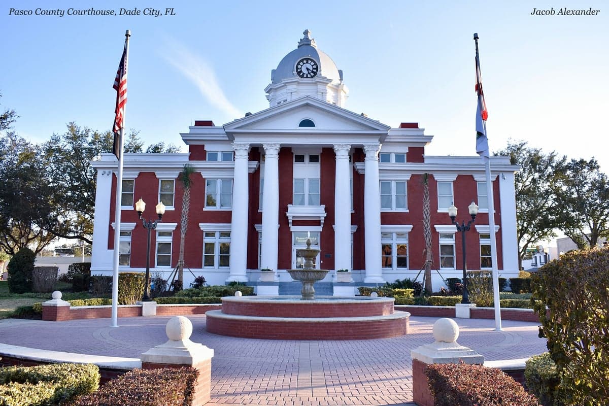
Pasco County itself was not created until 1887, carved from Hernando County and named after Samuel Pasco, a Confederate veteran and U.S. Senator. The first permanent American settlers were mostly Anglo-Southerners from Georgia, Alabama, and the Carolinas who arrived in the 1840s through 1870s, drawn by the promise of cheap land under the Armed Occupation Act of 1842 and later the Homestead Act. These families established small farming and cattle-ranching communities in places like Dade City, the county seat, and San Antonio, which became the commercial and social hubs of the eastern part of the county. The western half, including what is now New Port Richey and Port Richey, remained largely swamp and pine flatwoods, with only a handful of homesteaders and turpentine camp workers.
The arrival of the railroad in the 1880s and 1890s spurred a modest wave of settlement. The Orange Belt Railway connected the county to the rest of Florida, allowing citrus growers and timber operators to ship goods to market. Small towns like Zephyrhills were founded in the 1910s, notably by a colony of Union Army veterans from the Midwest who sought a temperate climate for health reasons. The town's name itself reflects the "zephyr" breezes that made it a haven for tuberculosis patients. Meanwhile, Hudson and Land O' Lakes remained sparsely populated crossroads well into the mid-20th century.
Through the 1940s and 1950s, Pasco County remained overwhelmingly rural and white, with a small Black population concentrated in historic settlements like St. Joseph in Dade City, where descendants of freed slaves worked as farm laborers and domestic workers. The county's economy was dominated by citrus, cattle, and timber, and its population hovered around 20,000 as late as 1950. The first hints of change came with the construction of the Suncoast Highway (U.S. 19) and the development of the Anclote River area, which began attracting winter visitors from the Midwest and Northeast.
Modern era (post-1965)
The post-1965 era brought the demographic transformation that defines Pasco County today. The 1965 Hart-Cellar Act had a limited direct effect here — the county's foreign-born population remains just 4.4%, far below the national average — but the indirect effects of Sun Belt migration were enormous. Beginning in the 1970s and accelerating through the 1990s, Pasco County became a primary destination for domestic migrants fleeing the Rust Belt and high-cost coastal metros. Retirees from New York, New Jersey, Ohio, and Michigan poured into retirement communities along the coast, particularly in New Port Richey, Hudson, and Holiday, drawn by affordable waterfront property and the promise of year-round warmth.
By the 2000s, the character of growth shifted again. The completion of the Suncoast Parkway (State Road 589) in 2001 opened up the central and eastern parts of the county to commuters working in Tampa and St. Petersburg. Master-planned communities exploded in Wesley Chapel and Trinity, which became magnets for young families seeking newer, larger homes at prices far below those in Hillsborough or Pinellas counties. This wave was overwhelmingly domestic — white and Hispanic families moving from within Florida and from other states — and it dramatically reshaped the county's age profile. Pasco County's median age dropped as the share of residents under 18 rose, and the county became one of the fastest-growing in the Tampa metro area.
Hispanic population growth has been the most significant ethnic shift of the modern era. The Hispanic share of the county rose from roughly 5% in 1990 to 17.7% today, driven primarily by Puerto Rican and Mexican-American families moving from other parts of Florida and the Northeast. These communities are dispersed rather than concentrated in a single enclave, though Wesley Chapel and Land O' Lakes have notable Hispanic populations. The Black population, at 5.8%, has grown more slowly and remains relatively small, with the largest concentrations in Dade City and Zephyrhills. East and Southeast Asian communities (1.9%) and Indian-subcontinent residents (1.2%) are small but growing, concentrated in the newer suburban developments around Wesley Chapel and Trinity, often drawn by professional jobs in healthcare and technology in the broader Tampa region.
The future
Pasco County's population is projected to continue growing rapidly, with estimates suggesting it could exceed 700,000 by 2035. The county is becoming slightly more diverse, driven primarily by Hispanic in-migration, but it remains less diverse than neighboring Hillsborough or Pinellas counties. The white non-Hispanic share, while still a majority at 69.3%, is slowly declining as younger, more diverse families replace the aging retiree population along the coast. The foreign-born share is expected to rise modestly but will likely remain below the national average, as Pasco continues to attract domestic migrants rather than international immigrants.
New communities are concentrating in the eastern and central corridors along the Suncoast Parkway and Interstate 75, with Wesley Chapel and Trinity emerging as the county's economic and demographic anchors. The coastal retirement communities in New Port Richey and Hudson are aging in place, with many homes being bought and renovated by younger families priced out of Tampa. The cultural identity of the county is evolving from a quiet retirement and rural enclave into a more suburban, family-oriented extension of the Tampa metro area, with all the growing pains that entails — traffic congestion, school crowding, and a tension between preservation and development.
For someone moving in now, Pasco County offers a middle ground: more space and lower costs than Tampa or St. Petersburg, but with a demographic profile that is still predominantly white and native-born, and a social character that leans conservative and family-focused. The county is becoming more diverse and more suburban with each passing year, but it remains a place where the dominant story is domestic migration, not international immigration, and where the fastest-growing communities are built around schools, parks, and commuter highways rather than urban density or ethnic enclaves.

* Values derived from national, state, county, city and local statistics and may differ in a specific area. Last updated: 2026-10-25T03:17:51.000Z
Narrative content on this page is AI-generated and may contain mistakes. Verify any details that matter before acting on them.
ReloMaps may earn a commission from affiliate links at no extra cost to you.

