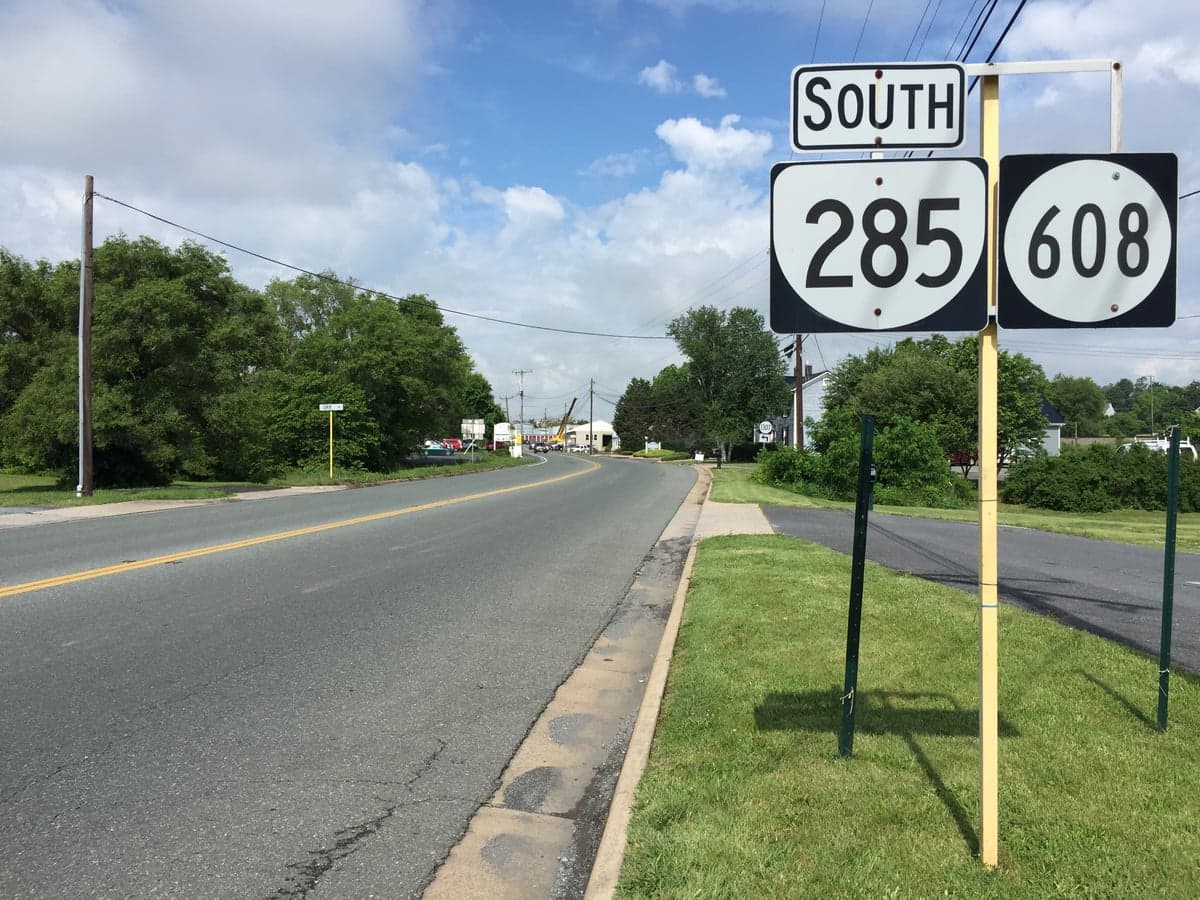
Photo: Wikipedia
Strategic Assessment of Fishersville, VA
Workable tactical position. Some exposure to population density or targets, but generally defensible in a crisis.
What does the Strategic Assessment tell us?
Our Strategic Assessment grades tactical survivability of an area. Major population centers, military targets, fallout zones, natural disasters, and border exposure all drive risk — lower exposure means a more defensible position in a crisis.
This is heavily inspired by Joel Skousen's Strategic Relocation book. Highly recommended you checkout the book ($)What does this tell us?
Our Strategic Assessment grades tactical survivability of an area. Major population centers, military targets, fallout zones, natural disasters, and border exposure all drive risk — lower exposure means a more defensible position in a crisis.
This is heavily inspired by Joel Skousen's Strategic Relocation book. Highly recommended you checkout the book ($)Strategic Pillars

Key Distances
Regional Safe Places
Below is our recommended "safe zones" in Virginia and the surrounding area based on our strategic heuristics. For most people, it's unrealistic to live in a “safe zone” full-time due to work, family or other personal reasons. They tend to be more rural. However, many of these areas are perfect for second homes and retreat properties that double as a vacation home or even a short-term rental.




Important Note: For informational purposes only. This does not mean nothing bad ever happens in the green zones. Please use common sense. This is based on public data and modeled with AI. We tried to take a conservative approach but mistakes happen. We update this regularly as new information becomes available.
Solar Generator Recommendations
Backup power matters more here than in safer locations. We've picked three solar generators across budgets and capacity tiers — start with the budget unit if you only need a few essentials, or step up if you want to run a fridge and HVAC for days at a time.

Jackery Portable Power Station Explorer 300
Budget OptionPower on the Go: Weighing only 11 lbs, it's convenient to set up and store with book-sized foldable solar panels

BLUETTI Portable Power Station AC180
Designed for both indoor and outdoor scenarios, AC180 is highly capable as it has a robost capacity and continuous output power.

EF ECOFLOW DELTA Pro Ultra Power Station
Upgraded PickEcoFlow DELTA Pro Ultra is a whole-home energy system designed to grow with your family. Integrated with the Smart Home Panel 2, it scales to meet your evolving energy needs — keeping your home powered, intelligent, and secure through every stage of life.
We earn a commission, at no additional cost to you.
Strategic Assessment Analysis
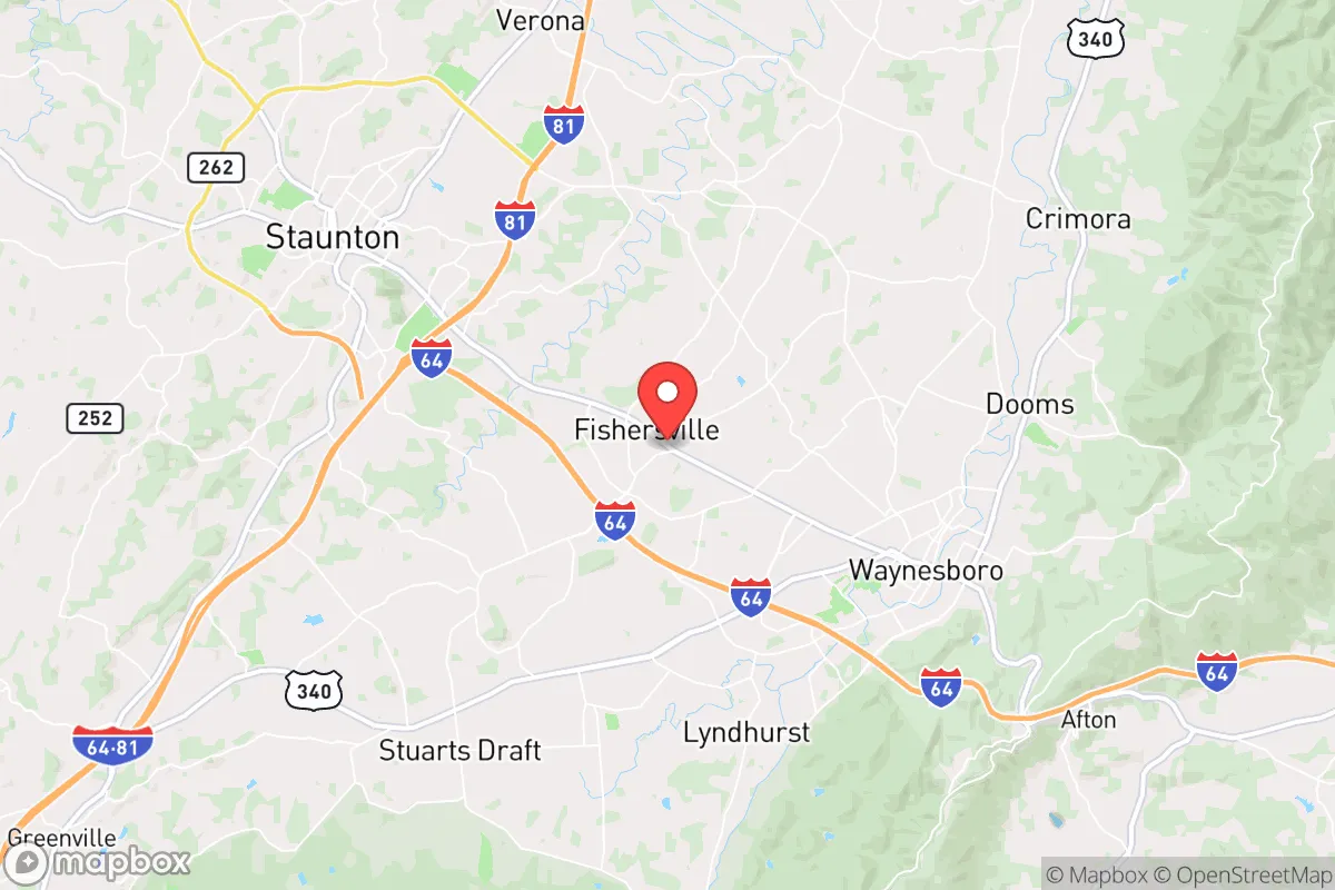
Fishersville, Virginia, sits in a sweet spot for resilience-minded relocators: close enough to civilization for supplies and healthcare, far enough from the major urban corridors to avoid the worst of a crisis. The town anchors the western edge of Augusta County, roughly 20 miles west of Charlottesville and 35 miles northwest of Lynchburg, with the Blue Ridge Mountains forming a natural barrier to the west. For a single person or family thinking seriously about disaster readiness, this is a location that offers genuine strategic depth rather than just suburban convenience.
Geographic position and natural advantages for long-term stability
The most significant resilience asset here is the Shenandoah Valley's geography itself. Fishersville sits in a broad, fertile valley flanked by the Blue Ridge to the east and the Allegheny Mountains to the west — terrain that provides natural shielding from coastal storm surges and a buffer from the denser population centers of Northern Virginia and Richmond. The valley's agricultural capacity is not theoretical; Augusta County is consistently among Virginia's top farming counties, with over 2,000 farms producing everything from poultry and cattle to apples and grains. That local food production base is a real, measurable advantage if supply chains falter.
Water is another structural plus. The area sits atop and near significant groundwater resources, with the South River running through nearby Waynesboro and the Shenandoah River system draining the valley. Private wells are common in the surrounding county, and the region's annual rainfall averages around 40 inches — enough to support rainwater catchment without the drought stress seen in the western states. The climate is moderate four-season, with winter lows rarely dropping below the teens and summer highs occasionally touching the 90s, which means heating and cooling loads are manageable for off-grid setups.
Elevation is a quieter advantage. Fishersville itself sits around 1,400 feet, with the Blue Ridge crest rising to over 3,000 feet within a 15-mile drive. That elevation keeps the area above the worst of valley fog and flooding, and it provides natural lookout points for situational awareness. The downside of the mountains is access — Interstate 64 runs through the area, but the mountain passes can close briefly during heavy snow, which is a minor inconvenience in normal times but a genuine isolation feature in a crisis.
Risks, exposures, and proximity to fallout-relevant landmarks
No honest resilience assessment ignores the region's vulnerabilities. The most significant is the proximity to Washington, D.C., and the I-95 corridor — roughly 120 miles northeast. In a major geopolitical event, that corridor is a primary target, and Fishersville sits within the secondary fallout and disruption zone. The prevailing westerly winds in this region generally push fallout eastward, which is favorable, but a nuclear exchange involving the East Coast would still put this area in a precarious position relative to the interior states. This is not a remote mountain redoubt; it is a valley town within a day's drive of multiple high-value targets.
Natural disaster exposure is comparatively mild but not zero. The area experiences occasional severe thunderstorms and the associated tornado risk is low but present — Augusta County has seen a handful of confirmed tornadoes in the past two decades, all weak. Winter ice storms are the more realistic threat, with the 2021 Valentine's Day storm knocking out power to thousands of residents for up to a week. Flooding is localized, primarily along the South River in Waynesboro, and Fishersville's higher elevation keeps it largely clear of that risk. Earthquake exposure is minimal, though the 2011 Mineral, Virginia, quake was felt here as a moderate shake.
Man-made risks beyond geopolitics include the area's transportation corridors. I-64 and the nearby rail lines carry freight, including hazardous materials, and a derailment or tanker incident could temporarily contaminate local waterways. The North Anna Nuclear Power Station sits about 60 miles east, within the 50-mile emergency planning zone, though the prevailing wind direction and the Blue Ridge barrier reduce the practical risk of a plume reaching this area in most scenarios.
Practical resilience for a relocator: food, water, energy, and defensibility
For a relocator actually planning to live here, the practical resilience picture is strong but requires deliberate effort. Food security is the standout advantage — the valley's farm economy means local produce, meat, and dairy are available at farmers markets in Fishersville, Staunton, and Waynesboro throughout the growing season. The Augusta County Extension office runs active programs on home food preservation, and the region's canning and freezing culture is well-established. A family with a half-acre lot can realistically produce a meaningful portion of its own vegetables, and the soil quality in the valley is genuinely excellent compared to the rocky Piedmont to the east.
Water is manageable with planning. Municipal water in Fishersville comes from the Augusta County service authority, which draws from the South River and local wells, and the system has backup generators for its pumping stations. For self-sufficiency, the water table in the valley is accessible — most drilled wells in the area hit good water between 100 and 300 feet, and the cost of a new well runs roughly $8,000 to $15,000. Rainwater harvesting is legal and practical here, with the 40-inch annual rainfall providing ample catchment potential for non-potable uses.
Energy resilience is a mixed bag. The grid in this part of Virginia is maintained by Dominion Energy and the Central Virginia Electric Cooperative, and outages are more frequent than in urban areas due to tree cover and winter storms. That makes a whole-home generator or a solar-plus-battery system a practical investment rather than a luxury. Solar potential is moderate — the area gets about 4.5 peak sun hours per day, comparable to much of the mid-Atlantic, and net metering is available for grid-tied systems. Wood heat is a realistic option, with firewood readily available from the surrounding national forests and local suppliers, and many older homes in the county still have functional fireplaces or wood stoves.
Defensibility is where Fishersville shows its limits. The town itself is open valley terrain, not a defensible mountain position. But the surrounding area offers options — the communities of Sherando, Lyndhurst, and the western slopes of the Blue Ridge provide higher ground with limited access points and better sightlines. The broader Augusta County area has a strong hunting and firearms culture, with the Shenandoah Valley Gun Show drawing attendees from across the region, and the local sheriff's office maintains a visible presence. For a family, the practical defensibility comes less from terrain than from community — the valley's small-town networks and church communities are tight-knit, and neighbors here still look out for each other in ways that are increasingly rare in suburban Virginia.
The overall strategic picture for Fishersville is favorable for the resilience-minded relocator who understands its limits. It offers genuine agricultural self-sufficiency, reliable water access, moderate climate, and a community culture that values preparedness — all within a reasonable drive of medical care at Augusta Health and supply hubs in Staunton and Waynesboro. Its weaknesses are the proximity to the D.C. corridor and the open valley terrain, which make it a better family homestead location than a last-stand retreat. For a single person or family looking to build a sustainable, defensible life with real food and water security, Fishersville is a solid, grounded choice — not a fantasy bunker, but a real place where resilience is practical and achievable.

* Values derived from national, state, county, city and local statistics and may differ in a specific area. Last updated: 2026-10-12T03:12:28.000Z
Narrative content on this page is AI-generated and may contain mistakes. Verify any details that matter before acting on them.
ReloMaps may earn a commission from affiliate links at no extra cost to you.

