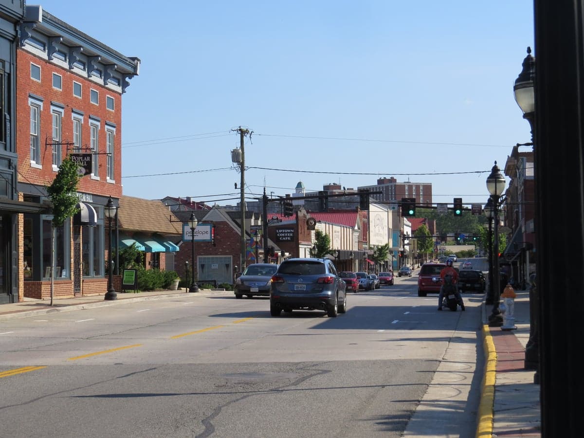
Photo: Wikipedia
Strategic Assessment of Farmville, VA
Meaningful friction. Expect exposure to either population pressure, blast zones, or natural disaster risk. Consider buying a retreat property.
What does the Strategic Assessment tell us?
Our Strategic Assessment grades tactical survivability of an area. Major population centers, military targets, fallout zones, natural disasters, and border exposure all drive risk — lower exposure means a more defensible position in a crisis.
This is heavily inspired by Joel Skousen's Strategic Relocation book. Highly recommended you checkout the book ($)What does this tell us?
Our Strategic Assessment grades tactical survivability of an area. Major population centers, military targets, fallout zones, natural disasters, and border exposure all drive risk — lower exposure means a more defensible position in a crisis.
This is heavily inspired by Joel Skousen's Strategic Relocation book. Highly recommended you checkout the book ($)Strategic Pillars

Key Distances
Regional Safe Places
Below is our recommended "safe zones" in Virginia and the surrounding area based on our strategic heuristics. For most people, it's unrealistic to live in a “safe zone” full-time due to work, family or other personal reasons. They tend to be more rural. However, many of these areas are perfect for second homes and retreat properties that double as a vacation home or even a short-term rental.




Important Note: For informational purposes only. This does not mean nothing bad ever happens in the green zones. Please use common sense. This is based on public data and modeled with AI. We tried to take a conservative approach but mistakes happen. We update this regularly as new information becomes available.
Solar Generator Recommendations
Backup power matters more here than in safer locations. We've picked three solar generators across budgets and capacity tiers — start with the budget unit if you only need a few essentials, or step up if you want to run a fridge and HVAC for days at a time.

Jackery Portable Power Station Explorer 300
Budget OptionPower on the Go: Weighing only 11 lbs, it's convenient to set up and store with book-sized foldable solar panels

BLUETTI Portable Power Station AC180
Designed for both indoor and outdoor scenarios, AC180 is highly capable as it has a robost capacity and continuous output power.

EF ECOFLOW DELTA Pro Ultra Power Station
Upgraded PickEcoFlow DELTA Pro Ultra is a whole-home energy system designed to grow with your family. Integrated with the Smart Home Panel 2, it scales to meet your evolving energy needs — keeping your home powered, intelligent, and secure through every stage of life.
We earn a commission, at no additional cost to you.
Strategic Assessment Analysis
Farmville, Virginia, offers a compelling strategic profile for the relocation-minded reader prioritizing resilience and self-sufficiency, balancing a quiet inland location with meaningful access to regional resources. Situated roughly midway between Richmond and Lynchburg, and about 70 miles west of the state capital, the area provides a buffer from the immediate blast and fallout zones of major metropolitan targets while remaining close enough for supply runs or medical evacuations. Its position in the Piedmont region, away from the coast and major fault lines, reduces exposure to hurricanes and seismic events, making it a defensible choice for those serious about long-term preparedness.
Geographic position and natural advantages for disaster readiness
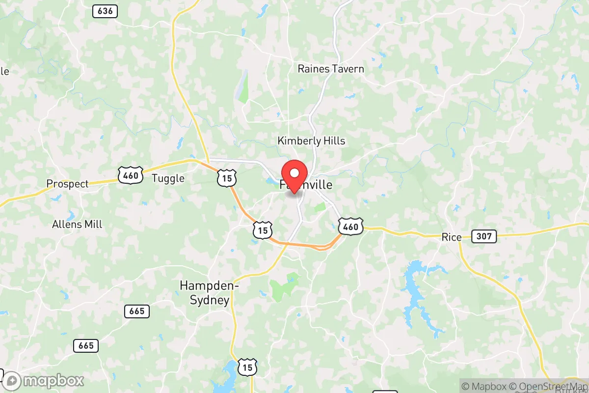
Farmville’s geographic setting is a key asset for resilience planning. The town sits in the rolling hills of central Virginia, an area characterized by moderate elevation, abundant hardwood forests, and a temperate climate that supports year-round agriculture. The Appomattox River runs through the town, providing a surface water source, while the region’s deep soils and reliable rainfall (averaging around 45 inches annually) make it viable for small-scale farming and gardening. The terrain itself offers natural defensibility: the hills and wooded areas provide cover and reduce line-of-sight vulnerabilities, while the lack of dense urban development means lower population density and less competition for resources in a crisis. For a relocator, the ability to blend into a rural landscape with access to multiple state and county roads (US-15, US-460, and VA-45) offers egress options without funneling through a single choke point. The area’s distance from the coast—over 100 miles inland—also eliminates storm surge risk and significantly reduces hurricane wind damage compared to Tidewater communities.
Risks, exposures, and proximity to fallout-relevant landmarks
No location is without vulnerabilities, and Farmville’s strategic picture includes several notable exposures. The most significant risk is its proximity to potential high-value targets in the Richmond-Petersburg corridor, which lies roughly 70 miles to the east. Richmond hosts critical infrastructure including the Federal Reserve Bank, major transportation hubs, and defense-related industries; a nuclear or conventional strike on the capital could produce fallout patterns that, depending on wind direction, might affect central Virginia. Similarly, Lynchburg (40 miles west) contains industrial and energy facilities, including a nuclear research reactor at the University of Lynchburg and the Central Virginia Training Center, which could be secondary targets. Farmville itself is not a likely primary target, but its location between two mid-sized cities places it within a potential fallout zone under certain meteorological conditions. Natural risks are comparatively mild: the area experiences occasional tornadoes (typically EF0-EF2), flash flooding along the Appomattox River, and winter ice storms that can knock out power for days. The region’s wildfire risk is low to moderate, though dry spells can elevate it. For the preparedness-minded relocator, the primary man-made concern is the possibility of grid-down scenarios from cyberattacks or EMP events, given the area’s reliance on regional power transmission lines that pass through rural corridors.
Practical resilience for a relocator: food, water, energy, and defensibility
Farmville’s practical resilience profile is strong, particularly for those willing to invest in off-grid infrastructure. The area is surrounded by active farmland—soybeans, corn, wheat, and livestock operations—which means local food production is a reality, not a hypothetical. The town hosts a weekly farmers’ market from April through November, and several u-pick orchards and CSAs operate within a 20-minute drive. For water security, the Appomattox River and numerous creeks and ponds provide surface sources, though treatment and filtration would be necessary. Groundwater access via wells is feasible in most rural parcels, with typical depths of 100-300 feet yielding adequate flow for a household. The local utility, Dominion Energy, maintains the electrical grid, but tree cover and ice storms cause frequent outages; many long-term residents already own generators or have installed solar panels. Solar viability is good, with the region averaging 200 sunny days per year, and net metering policies allow grid-tied systems to offset costs. For defensibility, the area’s low crime rate (Prince Edward County’s violent crime rate is roughly half the national average) and strong community ties reduce the need for hard security measures, though rural properties benefit from natural buffers like tree lines and long driveways. The presence of Longwood University and a stable healthcare system (Centra Southside Community Hospital) adds institutional resilience, providing a base for medical care and community coordination during emergencies.
The overall strategic picture for Farmville is one of balanced, moderate resilience with clear trade-offs. It is not a remote bunker location—it is a working rural town with enough infrastructure to support a comfortable modern life while offering the space and resources for serious self-sufficiency. The primary drawback is its position between two cities that could become fallout sources, but this is a risk shared by most of central Virginia and is mitigated by the area’s distance from primary targets like Washington DC or Norfolk. For a relocator who values community, agricultural potential, and a lower cost of entry than more famous preparedness destinations in the mountains, Farmville represents a practical, defensible choice that does not require complete isolation. The key is to secure a property with good water access, south-facing roof exposure for solar, and enough acreage for a garden and small livestock—then build relationships with neighbors who have been living this way for generations.

* Values derived from national, state, county, city and local statistics and may differ in a specific area. Last updated: 2026-10-12T12:58:41.000Z
Narrative content on this page is AI-generated and may contain mistakes. Verify any details that matter before acting on them.
ReloMaps may earn a commission from affiliate links at no extra cost to you.

