
Strategic Assessment of Daleville, VA
Strong survivability profile. Good buffer from population centers, with manageable environmental and tactical risks.
What does the Strategic Assessment tell us?
Our Strategic Assessment grades tactical survivability of an area. Major population centers, military targets, fallout zones, natural disasters, and border exposure all drive risk — lower exposure means a more defensible position in a crisis.
This is heavily inspired by Joel Skousen's Strategic Relocation book. Highly recommended you checkout the book ($)What does this tell us?
Our Strategic Assessment grades tactical survivability of an area. Major population centers, military targets, fallout zones, natural disasters, and border exposure all drive risk — lower exposure means a more defensible position in a crisis.
This is heavily inspired by Joel Skousen's Strategic Relocation book. Highly recommended you checkout the book ($)Strategic Pillars

Key Distances
Regional Safe Places
Below is our recommended "safe zones" in Virginia and the surrounding area based on our strategic heuristics. For most people, it's unrealistic to live in a “safe zone” full-time due to work, family or other personal reasons. They tend to be more rural. However, many of these areas are perfect for second homes and retreat properties that double as a vacation home or even a short-term rental.




Important Note: For informational purposes only. This does not mean nothing bad ever happens in the green zones. Please use common sense. This is based on public data and modeled with AI. We tried to take a conservative approach but mistakes happen. We update this regularly as new information becomes available.
Solar Generator Recommendations
Backup power matters more here than in safer locations. We've picked three solar generators across budgets and capacity tiers — start with the budget unit if you only need a few essentials, or step up if you want to run a fridge and HVAC for days at a time.

Jackery Portable Power Station Explorer 300
Budget OptionPower on the Go: Weighing only 11 lbs, it's convenient to set up and store with book-sized foldable solar panels

BLUETTI Portable Power Station AC180
Designed for both indoor and outdoor scenarios, AC180 is highly capable as it has a robost capacity and continuous output power.

EF ECOFLOW DELTA Pro Ultra Power Station
Upgraded PickEcoFlow DELTA Pro Ultra is a whole-home energy system designed to grow with your family. Integrated with the Smart Home Panel 2, it scales to meet your evolving energy needs — keeping your home powered, intelligent, and secure through every stage of life.
We earn a commission, at no additional cost to you.
Strategic Assessment Analysis
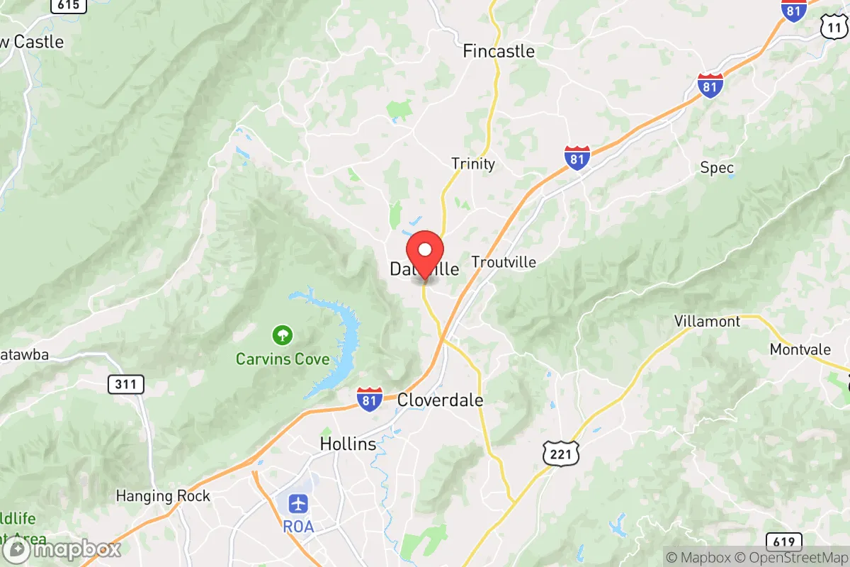
Daleville, Virginia, offers a compelling strategic position for those prioritizing resilience and self-sufficiency, blending the practical advantages of a small town with proximity to the logistical and medical resources of the Roanoke Valley. Its location in Botetourt County, nestled between the Blue Ridge and Allegheny mountain ranges, provides natural barriers and a temperate climate that supports year-round subsistence activities. For a relocator weighing disaster readiness, Daleville presents a balanced profile: it is far enough from major metropolitan targets to reduce fallout exposure, yet close enough to essential infrastructure to avoid the isolation of deeper rural areas. The area’s historical stability, low population density, and access to the James River watershed make it a defensible and resource-rich choice for families and individuals seeking a prepared lifestyle.
Geographic position and natural advantages for self-sufficiency
Daleville sits at the intersection of I-81 and US-220, roughly 10 miles north of Roanoke, placing it within a 30-minute drive of a regional medical center and major supply chains while remaining outside the immediate blast radius of any high-value target. The surrounding Botetourt County is characterized by rolling hills, hardwood forests, and fertile valleys, offering ample opportunities for small-scale agriculture, foraging, and timber management. The James River, a major tributary of the Chesapeake Bay, runs through the county, providing a reliable surface water source that is less prone to drought than many southeastern locations. The area’s elevation—around 1,300 feet—reduces flood risk compared to low-lying river towns, and the mountain ridges offer natural windbreaks and defensible terrain. For a relocator, this geography means multiple escape routes (via I-81 north/south or US-220 east/west) and abundant natural resources for long-term subsistence, including deer, turkey, and edible plants like ramps and blackberries. The climate is moderate, with average annual rainfall of 40 inches and a growing season of roughly 180 days, allowing for reliable garden production without the extreme heat or cold that stresses crops in other regions.
Risks, exposures, and proximity to fallout-relevant landmarks
While Daleville’s rural character is a strength, its location along I-81—a major freight corridor connecting the Northeast to the Southeast—introduces risks tied to transportation accidents and infrastructure failure. The interstate carries hazardous materials daily, and a derailment or truck incident could disrupt supply lines or contaminate local water sources. More critically, the area lies within 100 miles of several potential high-value targets: the Roanoke-Blacksburg Regional Airport (a regional hub), the Radford Army Ammunition Plant (about 40 miles southwest), and the Norfolk Southern rail yards in Roanoke. In a major conflict scenario, these sites could draw conventional or electromagnetic attacks, though Daleville’s distance and mountain shielding would likely mitigate direct fallout. The nearest nuclear power plant is the North Anna facility near Richmond, roughly 150 miles east—outside the most severe fallout zones for a worst-case release, but within a plausible evacuation shadow. Natural risks are modest: the region experiences occasional ice storms and heavy snow (averaging 20 inches annually), which can knock out power for days, and the New River Valley has a low-to-moderate seismic risk. Flooding is limited to low-lying areas near the James River, but most of Daleville sits on elevated ground. For a relocator, the primary man-made risk is proximity to Roanoke’s population center (about 100,000 residents), which could generate refugee flows during a regional crisis, though Botetourt County’s limited road network and natural choke points would slow movement.
Practical resilience for a relocator: food, water, energy, and defensibility
Daleville’s practical resilience is strong for those willing to invest in off-grid systems. The area’s water resources are abundant: the James River and its tributaries (like Catawba Creek) provide year-round flow, and groundwater is accessible via wells at depths of 100–300 feet, with typical yields of 5–15 gallons per minute. Rainwater harvesting is viable, given the region’s consistent precipitation, and many existing homes in Botetourt County already rely on private wells and septic systems. For food security, the county has a robust agricultural base, with dozens of small farms producing beef, poultry, vegetables, and apples within a 20-mile radius. The Daleville Farmers Market operates seasonally, and the nearby Roanoke Co+Op offers bulk staples. For long-term self-sufficiency, the growing season supports three-season gardening, and the surrounding national forests (George Washington and Jefferson) allow for legal foraging and hunting with a license. Energy resilience is more variable: the local grid is served by Appalachian Power, which has a mixed reliability record during storms, but solar potential is good (roughly 4.5 peak sun hours per day), and many rural properties already use propane or wood for heating. Defensibility is a key advantage: the area’s terrain—narrow valleys, forested ridges, and limited road access—creates natural chokepoints. A property on a dead-end road or at the end of a long driveway offers significant security against unwanted movement. The local law enforcement presence is modest (Botetourt County Sheriff’s Office has about 40 deputies for 550 square miles), so community self-reliance is the norm. For a relocator, the practical steps are clear: secure a property with a well and septic, install a solar array with battery backup, stockpile wood for heating, and build relationships with neighbors who share a preparedness mindset.
The overall strategic picture for Daleville is one of balanced opportunity: it offers a defensible, resource-rich environment with low exposure to the worst-case scenarios that plague denser or more strategically significant locations. Its proximity to Roanoke provides a safety net for medical emergencies and supply runs, while its mountain buffers and rural character reduce the likelihood of being caught in a direct strike or refugee surge. The area’s main vulnerabilities—grid dependency, transportation corridor risks, and moderate winter weather—are manageable with standard preparedness measures like backup power, stored food, and a reliable vehicle. For a family or individual serious about disaster readiness, Daleville represents a pragmatic middle ground: not as remote as the deep Appalachians, but far more resilient than a suburban subdivision. The key is to act early, secure a property with independent water and heat, and integrate into the local community of like-minded residents who already value self-sufficiency. In a world of increasing uncertainty, Daleville’s combination of natural advantages, practical resources, and strategic positioning makes it a strong candidate for a long-term relocation.

* Values derived from national, state, county, city and local statistics and may differ in a specific area. Last updated: 2026-10-06T21:24:16.000Z
Narrative content on this page is AI-generated and may contain mistakes. Verify any details that matter before acting on them.
ReloMaps may earn a commission from affiliate links at no extra cost to you.

