
Photo: Wikipedia
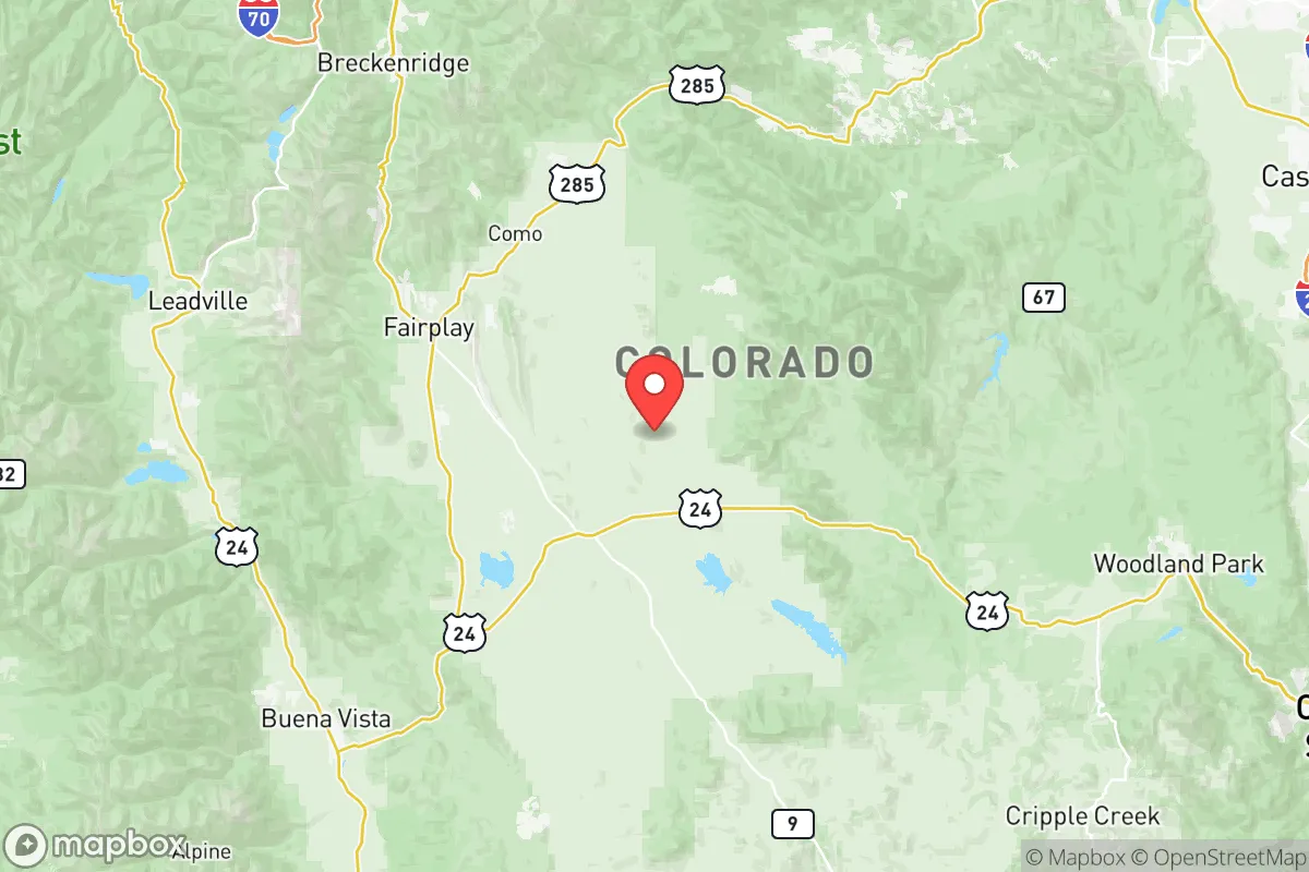
Strategic Assessment of Park County
Strong survivability profile. Good buffer from population centers, with manageable environmental and tactical risks.
What does the Strategic Assessment tell us?
Our Strategic Assessment grades tactical survivability of an area. Major population centers, military targets, fallout zones, natural disasters, and border exposure all drive risk — lower exposure means a more defensible position in a crisis.
This is heavily inspired by Joel Skousen's Strategic Relocation book. Highly recommended you checkout the book ($)What does this tell us?
Our Strategic Assessment grades tactical survivability of an area. Major population centers, military targets, fallout zones, natural disasters, and border exposure all drive risk — lower exposure means a more defensible position in a crisis.
This is heavily inspired by Joel Skousen's Strategic Relocation book. Highly recommended you checkout the book ($)Strategic Pillars

Key Distances
Strategic Assessment Analysis
Park County, Colorado, offers a compelling strategic position for those prioritizing resilience and self-sufficiency in an uncertain future. Nestled in the heart of the Rocky Mountains, this high-altitude county—home to the towns of Fairplay, Alma, and Jefferson—sits at a deliberate distance from major population centers like Denver (roughly 90 miles east) and Colorado Springs (about 70 miles southeast), while still being accessible via U.S. Highway 285. Its elevation, averaging over 9,000 feet, provides a natural buffer against many low-altitude threats, and the county's low population density (around 17,000 residents across 2,200 square miles) means fewer targets and less competition for resources in a crisis. For a relocator with a conservative, prepper mindset, Park County represents a balance of remoteness and practicality—close enough to resupply, far enough to breathe.
Geographic position and natural advantages for long-term security
Park County’s geography is its primary asset. The county sits in the South Park basin, a high-elevation valley ringed by the Mosquito Range to the west and the Front Range to the east. This natural bowl provides a degree of topographic isolation—approaches are limited to a handful of passes and highways, making the area inherently defensible. The headwaters of the South Platte River originate here, offering a reliable, if seasonal, water source that is less contested than Front Range watersheds. Fairplay, the county seat, sits at 9,953 feet, while Alma, at 10,361 feet, is one of the highest incorporated towns in North America. These elevations mean cooler summers and harsh winters, but also a lower risk of wildfire spread compared to lower-elevation foothills like those near Conifer or Bailey. The surrounding Pike and San Isabel National Forests provide a vast, sparsely populated buffer zone—over 1.5 million acres of public land that can serve as a resource cache or escape corridor if needed. For a relocator, this is not just scenery; it’s strategic depth.
Risks, exposures, and proximity to fallout-relevant landmarks
No location is without vulnerabilities, and Park County has specific exposures that a strategic relocator must weigh. The most immediate risk is the county’s proximity to the Denver-Aurora metropolitan area, a population center of nearly 3 million people. In a scenario involving civil unrest, mass casualty events, or a major disaster, U.S. 285 and Colorado 9 would become choke points for evacuees fleeing the Front Range. Fairplay and Alma could see a surge of refugees, straining local resources. Additionally, the county lies within 100 miles of the Rocky Flats National Wildlife Refuge—the former nuclear weapons production site—and roughly 120 miles from the U.S. Air Force Academy and Peterson Space Force Base near Colorado Springs. While these are not immediate fallout zones, they are potential targets in a conflict scenario. The county also sits near the Continental Divide, which means prevailing westerly winds could carry fallout from a distant event in the western U.S. or even from a high-altitude detonation over the Rockies. The key takeaway: Park County is not a fallout-free zone, but its distance from major military and industrial targets—like the refineries near Denver or the rail hubs in Pueblo—reduces the likelihood of a direct hit. The real danger is the human wave from the east.
Practical resilience for a relocator: food, water, energy, and defensibility
For a relocator serious about self-sufficiency, Park County offers a mixed but workable picture. Water is the strongest asset: the South Platte River and its tributaries (like the Middle Fork and Tarryall Creek) run year-round, and groundwater is accessible via wells in the valley floors. Fairplay’s municipal water comes from Montgomery Reservoir, a high-altitude source less vulnerable to contamination than Front Range reservoirs. Food production is limited by the short growing season—frost can occur any month—but cold-hardy crops (potatoes, kale, root vegetables) and greenhouse setups can extend yields. The county has a small but active ranching community, and local meat (bison, beef, elk) is available through private sales and the Fairplay Farmers Market. Energy is a vulnerability: the grid is supplied by Xcel Energy via lines that run through mountain passes, which are prone to ice storms and wind damage. Solar is viable but requires battery storage due to heavy snow cover in winter; micro-hydro from creek flows is a more reliable off-grid option for those with year-round water access. Defensibility is high: the county’s terrain—steep ridges, narrow valleys, and limited road access—makes it easy to monitor and control movement. Properties in the Mosquito Range or along the Platte River corridor offer natural chokepoints. The local sheriff’s office in Fairplay is small but responsive, and the county’s conservative culture means a high rate of private firearm ownership and a general distrust of overreach—factors that align with a prepper’s priorities. However, medical infrastructure is thin: the nearest hospital with trauma capability is in Breckenridge (40 minutes) or Denver (90 minutes), so a relocator must plan for self-care and stockpile supplies.
The overall strategic picture for Park County is one of calculated trade-offs. It is not a fortress—no place is—but it offers a rare combination of natural isolation, water security, and topographic defensibility that few Front Range counties can match. For a conservative-leaning individual or family looking to step away from the volatility of urban centers, this high-altitude basin provides a viable base of operations. The winters are brutal, the growing season is short, and the threat of a Denver exodus is real, but the county’s low profile, limited infrastructure targets, and self-reliant population make it a strong candidate for long-term resilience. If you’re willing to trade convenience for security and learn to live with snow, Park County deserves a serious look.
* Values derived from national, state, county, city and local statistics and may differ in a specific area. Last updated: 2026-06-04T04:18:23.000Z
Narrative content on this page is AI-generated and may contain mistakes. Verify any details that matter before acting on them.
ReloMaps may earn a commission from affiliate links at no extra cost to you.