
Photo: Wikipedia
Strategic Assessment of Garfield County
Strong survivability profile. Good buffer from population centers, with manageable environmental and tactical risks.
What does the Strategic Assessment tell us?
Our Strategic Assessment grades tactical survivability of an area. Major population centers, military targets, fallout zones, natural disasters, and border exposure all drive risk — lower exposure means a more defensible position in a crisis.
This is heavily inspired by Joel Skousen's Strategic Relocation book. Highly recommended you checkout the book ($)What does this tell us?
Our Strategic Assessment grades tactical survivability of an area. Major population centers, military targets, fallout zones, natural disasters, and border exposure all drive risk — lower exposure means a more defensible position in a crisis.
This is heavily inspired by Joel Skousen's Strategic Relocation book. Highly recommended you checkout the book ($)Strategic Pillars

Key Distances
Strategic Assessment Analysis
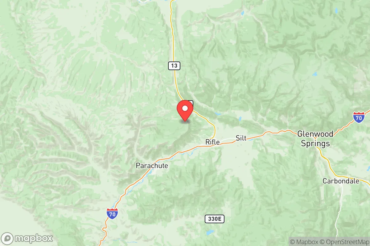
Garfield County, Colorado, offers a compelling mix of geographic isolation and practical self-sufficiency that appeals to relocation-minded individuals and families prioritizing resilience. Anchored by the towns of Glenwood Springs, Rifle, and Carbondale, the county sits in a high-desert valley along the I-70 corridor, roughly 160 miles west of Denver and 50 miles east of the Utah border. Its position provides a buffer from major metropolitan fallout zones while still granting access to critical infrastructure, making it a strategic choice for those who value both security and livability.
Geographic position and natural advantages for long-term security
Garfield County’s primary resilience advantage is its location within the Rocky Mountain region, far from the nation’s most vulnerable coastal and industrial corridors. The county is cradled by the White River National Forest to the north and the Grand Mesa to the south, creating a natural barrier that limits easy access from major population centers. The Colorado River runs through the heart of the county, providing a reliable surface water source—a critical asset in any long-term disruption scenario. The terrain is a mix of high desert and alpine forest, with elevations ranging from 5,500 feet in Glenwood Springs to over 10,000 feet in the surrounding mountains. This elevation offers a cooler climate and reduced wildfire risk compared to lower-elevation Front Range communities, though it does introduce winter weather challenges. The county’s agricultural potential is limited by short growing seasons and arid conditions, but the presence of the Colorado River and its tributaries supports irrigated hay and pasture operations, particularly near Rifle and Silt. For a relocator, the ability to access fresh water and defensible terrain is a significant plus, though the area is not a food-production powerhouse.
Risks, exposures, and proximity to fallout-relevant landmarks
While Garfield County is distant from major metropolitan targets, it is not without its own risk profile. The county sits within the Piceance Basin, a region rich in oil and natural gas reserves. The town of Rifle is home to a major natural gas processing facility, and the surrounding area has hundreds of active well pads. In a conflict or economic collapse scenario, these energy assets could become secondary targets or points of contention. Additionally, the I-70 corridor is a critical east-west transportation artery, and its bridges and tunnels—particularly the Glenwood Canyon stretch—are vulnerable to both natural disasters and deliberate disruption. A major landslide or structural failure in the canyon could isolate the county from the Front Range for days or weeks. The county also lies within the Intermountain Seismic Belt, and while large earthquakes are rare, the region has experienced minor seismic events linked to oil and gas operations. For a reader concerned about fallout from distant nuclear events, Garfield County’s prevailing westerly winds and mountain barriers offer some protection from airborne contamination originating from the Front Range or the Midwest. However, the county’s own energy infrastructure and transportation chokepoints are realistic concerns that require contingency planning.
Practical resilience for a relocator: food, water, energy, and defensibility
Garfield County’s practical resilience is a mixed bag, but it scores well on several key fronts. Water is the county’s strongest asset: the Colorado River and its tributaries provide a year-round, gravity-fed supply that is unlikely to be disrupted by grid failures. Many rural properties have senior water rights, and the county’s irrigation districts are well-established. For a relocator, securing a property with a private well or a direct river diversion is a high-priority move. Energy is another strength: the county is a net energy producer, with natural gas, oil, and some coalbed methane extraction. Local utilities like Xcel Energy and Holy Cross Energy maintain a robust grid, but off-grid solar is viable given the region’s 300+ sunny days per year. Food production is the weak link. The growing season is short (typically 90-120 days), and the soil is alkaline and low in organic matter. Local food production is limited to small-scale market gardens, orchards, and livestock operations. The county’s grocery supply chain relies on I-70 trucking, which could be disrupted. A relocator should plan for significant food storage and consider greenhouse or hydroponic systems to extend the growing season. Defensibility is moderate: the county’s population is spread across several small towns, with Glenwood Springs (pop. ~10,000) as the largest. The terrain offers natural chokepoints, but the I-70 corridor also provides easy access for outsiders. Rural properties in the Roaring Fork Valley or along the Colorado River offer better defensibility than suburban subdivisions near Rifle or Carbondale. The county’s law enforcement presence is adequate for routine matters, but in a prolonged crisis, residents would need to rely on community networks and personal preparedness.
Overall, Garfield County presents a balanced strategic picture for the resilience-minded relocator. Its geographic isolation, reliable water supply, and local energy production are strong positives, while its dependence on a single transportation corridor and limited local food production are notable vulnerabilities. The county is not a survivalist’s paradise—it has real exposure to energy infrastructure risks and winter weather—but it offers a realistic, livable option for those who want to be far from the most likely fallout zones without being completely cut off from civilization. For a family or individual willing to invest in food storage, water security, and community ties, Garfield County is a solid, defensible choice in the intermountain West.

* Values derived from national, state, county, city and local statistics and may differ in a specific area. Last updated: 2026-07-18T14:02:29.000Z
Narrative content on this page is AI-generated and may contain mistakes. Verify any details that matter before acting on them.
ReloMaps may earn a commission from affiliate links at no extra cost to you.

