 Popular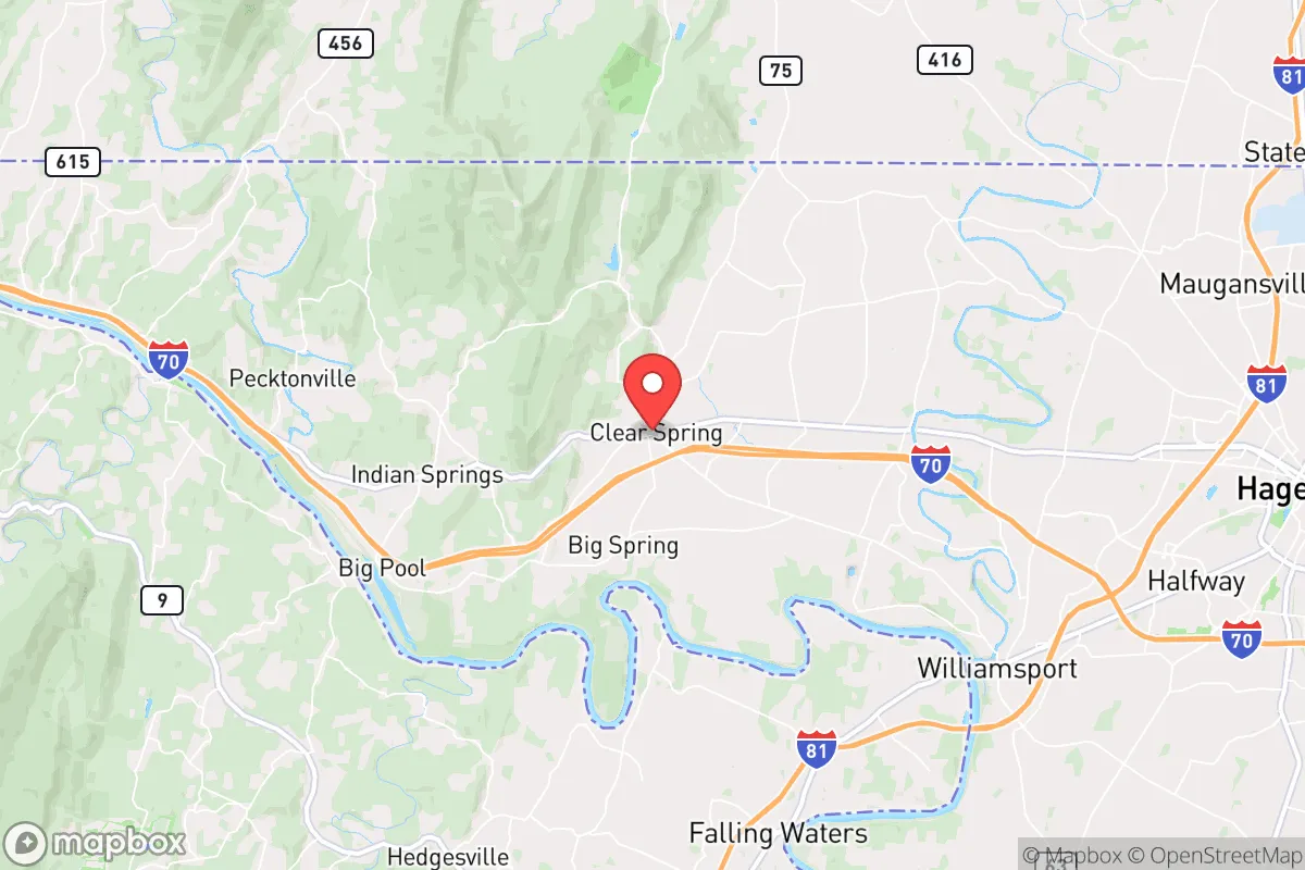
Photo: Wikipedia
Strategic Assessment of Clear Spring, MD
Meaningful friction. Expect exposure to either population pressure, blast zones, or natural disaster risk. Consider buying a retreat property.
What does the Strategic Assessment tell us?
Our Strategic Assessment grades tactical survivability of an area. Major population centers, military targets, fallout zones, natural disasters, and border exposure all drive risk — lower exposure means a more defensible position in a crisis.
This is heavily inspired by Joel Skousen's Strategic Relocation book. Highly recommended you checkout the book ($)What does this tell us?
Our Strategic Assessment grades tactical survivability of an area. Major population centers, military targets, fallout zones, natural disasters, and border exposure all drive risk — lower exposure means a more defensible position in a crisis.
This is heavily inspired by Joel Skousen's Strategic Relocation book. Highly recommended you checkout the book ($)Strategic Pillars

Key Distances
Regional Safe Places
Below is our recommended "safe zones" in Maryland and the surrounding area based on our strategic heuristics. For most people, it's unrealistic to live in a “safe zone” full-time due to work, family or other personal reasons. They tend to be more rural. However, many of these areas are perfect for second homes and retreat properties that double as a vacation home or even a short-term rental.




Important Note: For informational purposes only. This does not mean nothing bad ever happens in the green zones. Please use common sense. This is based on public data and modeled with AI. We tried to take a conservative approach but mistakes happen. We update this regularly as new information becomes available.
Solar Generator Recommendations
Backup power matters more here than in safer locations. We've picked three solar generators across budgets and capacity tiers — start with the budget unit if you only need a few essentials, or step up if you want to run a fridge and HVAC for days at a time.

Jackery Portable Power Station Explorer 300
Budget OptionPower on the Go: Weighing only 11 lbs, it's convenient to set up and store with book-sized foldable solar panels

BLUETTI Portable Power Station AC180
Designed for both indoor and outdoor scenarios, AC180 is highly capable as it has a robost capacity and continuous output power.

EF ECOFLOW DELTA Pro Ultra Power Station
Upgraded PickEcoFlow DELTA Pro Ultra is a whole-home energy system designed to grow with your family. Integrated with the Smart Home Panel 2, it scales to meet your evolving energy needs — keeping your home powered, intelligent, and secure through every stage of life.
We earn a commission, at no additional cost to you.
Strategic Assessment Analysis
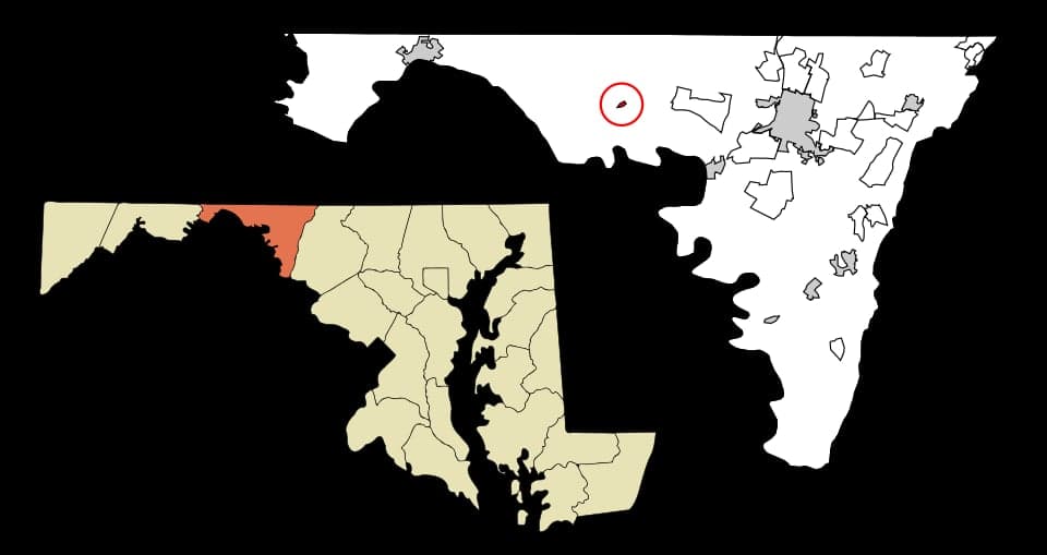
Clear Spring, Maryland, offers a compelling mix of strategic depth and quiet resilience for those prioritizing disaster readiness and self-sufficiency, though it is not without its trade-offs. Situated in Washington County, roughly 75 miles west of Baltimore and 90 miles northwest of Washington, D.C., this small town of roughly 2,000 residents sits at a critical inflection point between the densely populated I-95 corridor and the more sparsely developed Appalachian region. Its location provides a meaningful buffer from the immediate blast and fallout zones of major metropolitan targets, while still being close enough to access critical supplies and medical infrastructure if those routes remain open. For a relocator weighing security against convenience, Clear Spring represents a calculated middle ground—close enough to matter, far enough to survive.
Geographic position and natural advantages for long-term security
Clear Spring’s geography is its primary strategic asset. The town lies in the Great Appalachian Valley, flanked by the Blue Ridge Mountains to the east and the Allegheny Mountains to the west. This positioning offers natural terrain shielding—hills and ridges that can attenuate blast overpressure, disrupt fallout patterns, and provide defensible high ground for those who know how to use it. The area is part of the larger Chesapeake Bay watershed, with the Potomac River roughly 10 miles south and Conococheague Creek running nearby, providing reliable surface water sources that are less likely to be contaminated by upstream industrial runoff than more urbanized waterways. The local topography also limits the number of approach routes into the town, which is a double-edged sword: it makes Clear Spring easier to defend but also harder to evacuate if a threat comes from the wrong direction. The underlying geology is primarily limestone and dolomite, which supports good groundwater recharge and well yields, a critical factor for off-grid water security. The climate is temperate, with average annual precipitation around 40 inches, spread evenly enough to support rain catchment systems and small-scale agriculture without the drought risks seen in the western U.S. The growing season runs roughly from mid-April to mid-October, long enough for a serious garden or small farm operation.
Risks, exposures, and proximity to fallout-relevant landmarks
The most significant risk for Clear Spring is its proximity to multiple high-value targets along the Eastern Seaboard. The Washington, D.C. metropolitan area, home to the federal government, Pentagon, and numerous military installations, is within a 90-minute drive under normal conditions. In a major conflict scenario, prevailing westerly winds would carry fallout from a D.C.-area strike generally eastward, which somewhat spares Clear Spring, but a ground burst at a target like Fort Detrick in Frederick (roughly 25 miles east) or the Raven Rock Mountain Complex (about 30 miles northeast) could produce local fallout patterns that affect the area depending on wind direction. The town is also within 20 miles of the Hagerstown Regional Airport, which could become a secondary target or staging area. On the natural disaster front, Clear Spring faces moderate risks. The area is in Seismic Zone 2, meaning minor earthquakes are possible but destructive ones are rare. Flooding is the primary natural hazard, particularly along the Conococheague Creek and its tributaries; the town experienced significant flooding during Hurricane Agnes in 1972 and again during remnants of Hurricane Lee in 2011. Tornado risk is low but not zero—Washington County averages one tornado every 5-10 years, typically EF0 or EF1. Winter storms can be disruptive, with average annual snowfall around 30 inches, but power outages are usually restored within 24-48 hours due to robust local infrastructure. The area has no nuclear power plants within 50 miles (the nearest is Three Mile Island, roughly 80 miles northeast), and no major chemical storage facilities nearby, reducing the risk of industrial accidents.
Practical resilience for a relocator: food, water, energy, and defensibility
For someone serious about self-sufficiency, Clear Spring offers a workable baseline but requires active investment. The local agricultural base is strong—Washington County has over 1,200 farms, many producing corn, soybeans, hay, and livestock. The nearby Hagerstown Farmers Market and local CSAs provide direct access to fresh food, and the soil quality in the valley is generally good for home gardening, though it tends to be alkaline and may require amendment for acid-loving crops. Water is the area's strongest suit: the underlying karst aquifer system provides reliable well water at typical depths of 100-300 feet, with yields averaging 10-20 gallons per minute. Surface water from Conococheague Creek is also available but requires filtration and treatment due to agricultural runoff. Rainwater harvesting is viable, with a 1,000-square-foot roof yielding roughly 600 gallons per inch of rain. Energy infrastructure is moderately resilient. The local grid is served by Potomac Edison, part of FirstEnergy, which has a mixed reliability record—outages during storms are common but usually short. Solar potential is decent, with the area receiving about 4.5 peak sun hours per day, though tree cover in the more wooded lots can reduce panel efficiency. Wood heating is practical, with abundant hardwood forests within a 30-minute drive, but air quality regulations in the county limit outdoor wood boiler use. Defensibility is where Clear Spring shines relative to more open terrain. The town's layout, with its historic core clustered along the old National Pike (U.S. Route 40) and newer subdivisions spreading into the surrounding hills, offers multiple natural chokepoints. The surrounding ridges provide observation points, and the limited road network—primarily U.S. 40, I-70, and a handful of state routes—means that a small, determined group could effectively control access. However, the same terrain that aids defense also complicates escape; there are only a few viable egress routes, and all of them pass through other small towns that could become congested or contested. The local population is predominantly rural and self-reliant by culture, with a strong hunting and firearms tradition, which can be an asset for community defense but also means that newcomers should invest in building trust and relationships before expecting mutual aid.
The overall strategic picture for Clear Spring is one of moderate resilience with clear trade-offs. It avoids the worst of the urban target risks while retaining enough proximity to the Eastern Seaboard's infrastructure to be useful for resupply and information flow in a crisis. Its natural advantages—reliable water, defensible terrain, a supportive climate for agriculture—are genuine and not easily replicated in flatter, more exposed parts of the Mid-Atlantic. The downsides are real but manageable: the fallout risk from D.C.-area targets is non-trivial, the road network is fragile, and the local economy is not particularly diversified, meaning that a long-term disruption could strain community resources. For a relocator who is willing to invest in well water, solar backup, and local relationships, Clear Spring offers a defensible, sustainable base that balances security with accessibility better than most options within two hours of the capital. It is not a fortress, but it is a viable long-term position for those who treat preparedness as an ongoing practice rather than a one-time purchase.

* Values derived from national, state, county, city and local statistics and may differ in a specific area. Last updated: 2026-07-21T20:10:46.000Z
Narrative content on this page is AI-generated and may contain mistakes. Verify any details that matter before acting on them.
ReloMaps may earn a commission from affiliate links at no extra cost to you.

