
Photo: Wikipedia
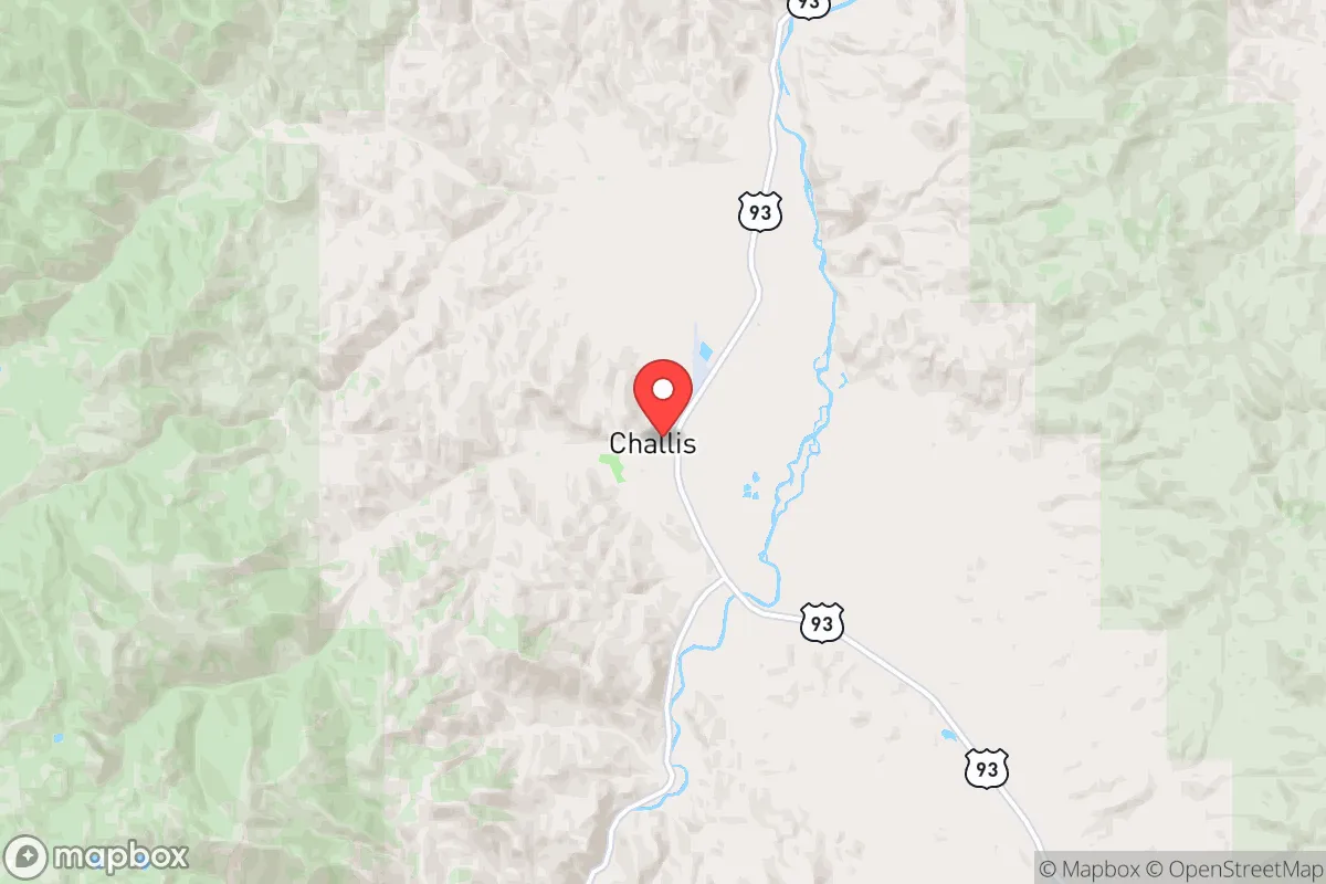
Strategic Assessment of Challis, ID
Strong survivability profile. Good buffer from population centers, with manageable environmental and tactical risks.
What does the Strategic Assessment tell us?
Our Strategic Assessment grades tactical survivability of an area. Major population centers, military targets, fallout zones, natural disasters, and border exposure all drive risk — lower exposure means a more defensible position in a crisis.
This is heavily inspired by Joel Skousen's Strategic Relocation book. Highly recommended you checkout the book ($)What does this tell us?
Our Strategic Assessment grades tactical survivability of an area. Major population centers, military targets, fallout zones, natural disasters, and border exposure all drive risk — lower exposure means a more defensible position in a crisis.
This is heavily inspired by Joel Skousen's Strategic Relocation book. Highly recommended you checkout the book ($)Strategic Pillars

Key Distances
Regional Safe Places
Below is our recommended "safe zones" in Idaho and the surrounding area based on our strategic heuristics. For most people, it's unrealistic to live in a “safe zone” full-time due to work, family or other personal reasons. They tend to be more rural. However, many of these areas are perfect for second homes and retreat properties that double as a vacation home or even a short-term rental.


Important Note: For informational purposes only. This does not mean nothing bad ever happens in the green zones. Please use common sense. This is based on public data and modeled with AI. We tried to take a conservative approach but mistakes happen. We update this regularly as new information becomes available.
Solar Generator Recommendations
Backup power matters more here than in safer locations. We've picked three solar generators across budgets and capacity tiers — start with the budget unit if you only need a few essentials, or step up if you want to run a fridge and HVAC for days at a time.

Jackery Portable Power Station Explorer 300
Budget OptionPower on the Go: Weighing only 11 lbs, it's convenient to set up and store with book-sized foldable solar panels

BLUETTI Portable Power Station AC180
Designed for both indoor and outdoor scenarios, AC180 is highly capable as it has a robost capacity and continuous output power.

EF ECOFLOW DELTA Pro Ultra Power Station
Upgraded PickEcoFlow DELTA Pro Ultra is a whole-home energy system designed to grow with your family. Integrated with the Smart Home Panel 2, it scales to meet your evolving energy needs — keeping your home powered, intelligent, and secure through every stage of life.
We earn a commission, at no additional cost to you.
Strategic Assessment Analysis
Challis, Idaho sits as one of the most resilient relocation options in the Lower 48 for those serious about long-term preparedness. Tucked into the Salmon River Valley and surrounded by the Salmon-Challis National Forest, this community of roughly 1,000 people offers genuine isolation from the chaos of urban collapse while still providing access to essential resources. For the prepper-minded individual or family looking to ride out national-scale disruptions — whether from civil unrest, economic collapse, or a cascading disaster — Challis presents a compelling balance of remoteness, natural resources, and low strategic value to outside threats. But like any location, it comes with trade-offs that need to be understood before committing your future to this high-desert valley.
Why Challis’s geographic isolation and natural barriers work in your favor
Challis occupies a narrow valley carved by the Salmon River at roughly 5,000 feet elevation, hemmed in by the Lost River Range to the east and the Pahsimeroi Mountains to the west. That geography delivers a major defensive advantage: approaching the town from any direction requires traversing high mountain passes or long, sparsely populated highways. The nearest significant population center is Boise, over 150 miles southwest — a drive that takes nearly three and a half hours in good weather. Salmon, the next real town, is 65 miles north on US-93. That distance is a strength. In any scenario involving mass evacuation from metropolitan areas, Challis sits far enough away from major corridors like I-84 or I-15 to avoid the worst of the fleeing crowds. The surrounding national forest — over 4 million acres of public land — provides a buffer zone of rugged terrain that effectively filters out casual travelers and looters. The area’s natural barriers also mean that anyone trying to reach Challis during a crisis would have to navigate limited access routes that are easy to monitor and defend. From a pure tactical standpoint, this is about as good as it gets without moving into the absolute wilderness of northern Alaska.
Risks, exposures, and proximity to fallout-relevant landmarks you need to know
No location is without vulnerability, and Challis has two main exposures that a relocator must weigh carefully. First is the Idaho National Laboratory (INL), located roughly 100 miles southeast near Idaho Falls. INL is a major nuclear research facility with experimental reactors and waste storage. In the event of a large-scale conflict or terrorist attack targeting critical infrastructure, INL is a plausible target for sabotage or conventional strike. Challis lies upwind of prevailing weather patterns that would carry fallout from that direction — typically west-to-east in this region — but a worst-case release could still affect the valley’s water and grazing lands. Second, the region sits in active seismic country. The 1983 Borah Peak earthquake (magnitude 6.9) centered just 50 miles away killed two people and caused visible surface rupture. Older buildings in Challis are unreinforced masonry, and the town’s water system relies on spring-fed pipes that can break in a major shake. Additionally, wildfire risk is genuine: dry summers and dense forest surrounding the valley have produced multiple evacuation-level fires in the last decade, including the 2013 Beaver Creek Fire that threatened Challis itself. These risks are manageable with proper preparation — redundant water storage, fire-resistant construction, and a fallout shelter plan — but they cannot be ignored. The silver lining is that Challis is far from the high-probability targets of the West Coast, the Midwest’s food belt, or the DC-Boston corridor. No major military bases, no critical ports, no high-value economic nodes sit within 200 miles. That makes it a low-priority location in any strategic bombing or terror campaign.
How Challis stacks up for practical resilience: food, water, energy, and defensibility
Water is the first and strongest asset. The Salmon River runs year-round through Challis, a major tributary of the Snake River with reliable flow from snowmelt. A handful of seasonal creeks also drain into the valley. The water table is high enough for shallow wells in most of the valley bottom, though drilling deeper is required on bench lands. The local municipal supply comes from Springs Creek and is gravity-fed, meaning it could function without power for some time. For a relocator, securing a property with a well and a backup hand pump or solar-pumped system is a top priority. On food production, Challis’s high elevation and short growing season (roughly 90 frost-free days) severely limit annual crops. You won’t be growing corn or tomatoes in bulk. Root vegetables, cold-hardy greens, and hay for livestock are the reality. The area’s open-range grazing makes cattle and sheep ranching viable — ranchers run herds on BLM and forest allotments — so a small homestead with a few head of livestock or even meat goats is realistic. Hunting is a major protein source: mule deer, elk, and antelope are abundant in the surrounding national forests, and the Salmon River offers trout and steelhead. For long-term storage, you’ll still need to rely on bulk purchasing and deep pantries. Energy is a hybrid story. The grid is provided by Fall River Electric, a cooperative. Outages happen in winter storms and during fire seasons. Solar potential is decent — Challis averages 200+ sunny days per year — but winter days are short and snow cover can limit panel output. A wood stove is almost mandatory for winter heating; the national forest permits firewood cutting, giving you a local fuel source. Propane delivery is available but dependent on road access. Defensibility: the valley’s single main entrance from the south is US-93 through the Yankee Fork corridor, which can be blocked or observed easily. Neighbors in a small town tend to know every vehicle, so strangers get noticed fast. That informal social monitoring is a security asset that no camera system can replace.
The strategic picture for Challis is strong but not flawless. It offers the kind of remote, defensible location that appeals to those who see the nation’s trajectory heading toward greater instability. The water, space, and low exposure to major threats make it a better bet than 95% of places in the Lower 48. The trade-offs — short growing season, wildfire risk, distant medical care, and the shadow of INL — demand that a relocator arrive with skills and supplies, not just intentions. If you’re willing to put in the work to set up a resilient homestead, build relationships with the tight-knit local community, and create redundancy for power and water, Challis can be a legitimate haven. But this is not a place to flee to empty-handed. It’s a place to build into — slowly, deliberately, and with clear eyes on the exposure it still carries.
* Values derived from national, state, county, city and local statistics and may differ in a specific area. Last updated: 2026-06-01T23:49:26.000Z
Narrative content on this page is AI-generated and may contain mistakes. Verify any details that matter before acting on them.
ReloMaps may earn a commission from affiliate links at no extra cost to you.