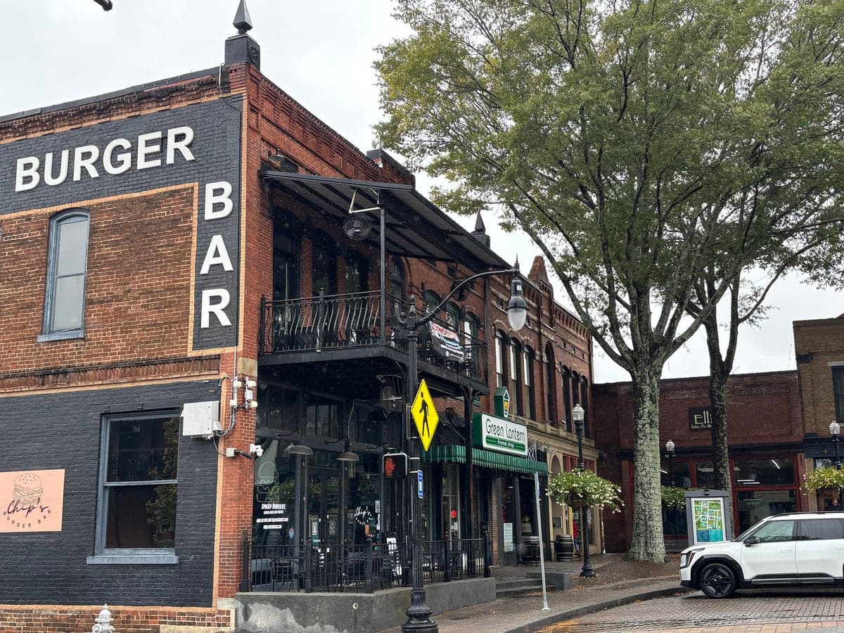
Photo: Wikipedia
Strategic Assessment of Carrollton, GA
Workable tactical position. Some exposure to population density or targets, but generally defensible in a crisis.
What does the Strategic Assessment tell us?
Our Strategic Assessment grades tactical survivability of an area. Major population centers, military targets, fallout zones, natural disasters, and border exposure all drive risk — lower exposure means a more defensible position in a crisis.
This is heavily inspired by Joel Skousen's Strategic Relocation book. Highly recommended you checkout the book ($)What does this tell us?
Our Strategic Assessment grades tactical survivability of an area. Major population centers, military targets, fallout zones, natural disasters, and border exposure all drive risk — lower exposure means a more defensible position in a crisis.
This is heavily inspired by Joel Skousen's Strategic Relocation book. Highly recommended you checkout the book ($)Strategic Pillars

Key Distances
Regional Safe Places
Below is our recommended "safe zones" in Georgia and the surrounding area based on our strategic heuristics. For most people, it's unrealistic to live in a “safe zone” full-time due to work, family or other personal reasons. They tend to be more rural. However, many of these areas are perfect for second homes and retreat properties that double as a vacation home or even a short-term rental.
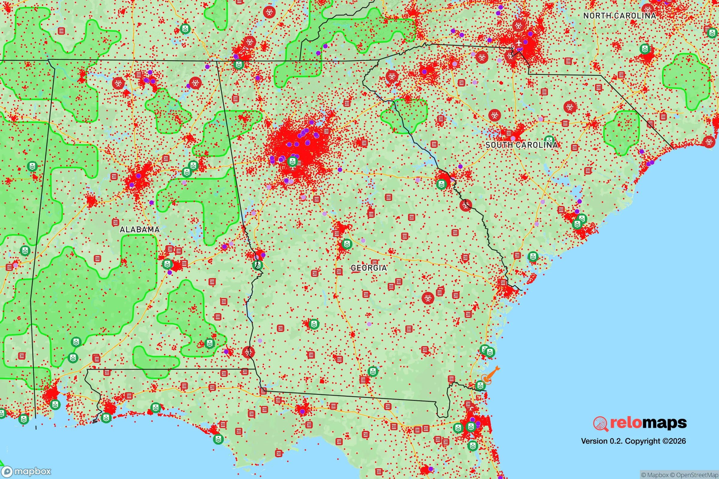
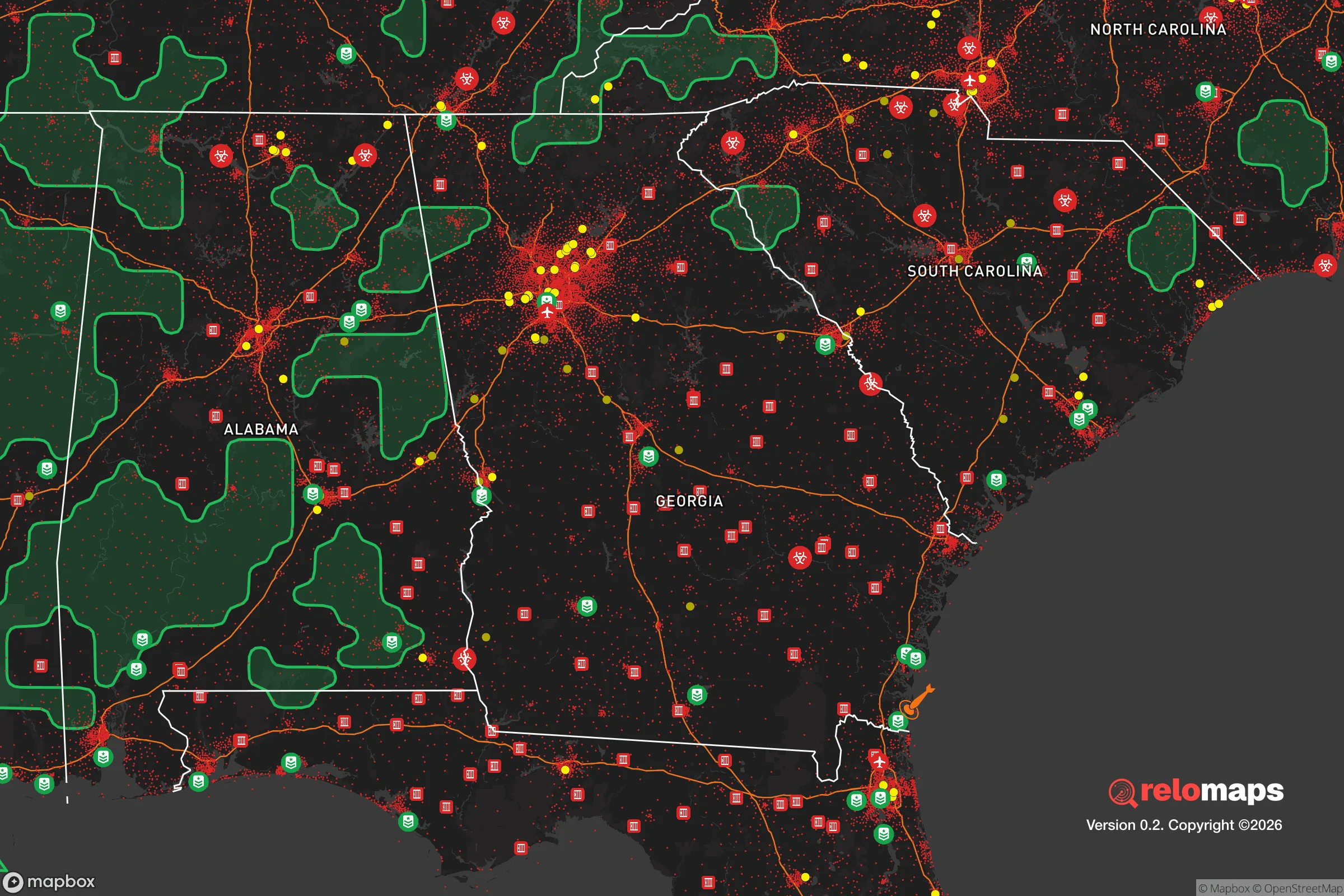


Important Note: For informational purposes only. This does not mean nothing bad ever happens in the green zones. Please use common sense. This is based on public data and modeled with AI. We tried to take a conservative approach but mistakes happen. We update this regularly as new information becomes available.
Solar Generator Recommendations
Backup power matters more here than in safer locations. We've picked three solar generators across budgets and capacity tiers — start with the budget unit if you only need a few essentials, or step up if you want to run a fridge and HVAC for days at a time.

Jackery Portable Power Station Explorer 300
Budget OptionPower on the Go: Weighing only 11 lbs, it's convenient to set up and store with book-sized foldable solar panels

BLUETTI Portable Power Station AC180
Designed for both indoor and outdoor scenarios, AC180 is highly capable as it has a robost capacity and continuous output power.

EF ECOFLOW DELTA Pro Ultra Power Station
Upgraded PickEcoFlow DELTA Pro Ultra is a whole-home energy system designed to grow with your family. Integrated with the Smart Home Panel 2, it scales to meet your evolving energy needs — keeping your home powered, intelligent, and secure through every stage of life.
We earn a commission, at no additional cost to you.
Strategic Assessment Analysis
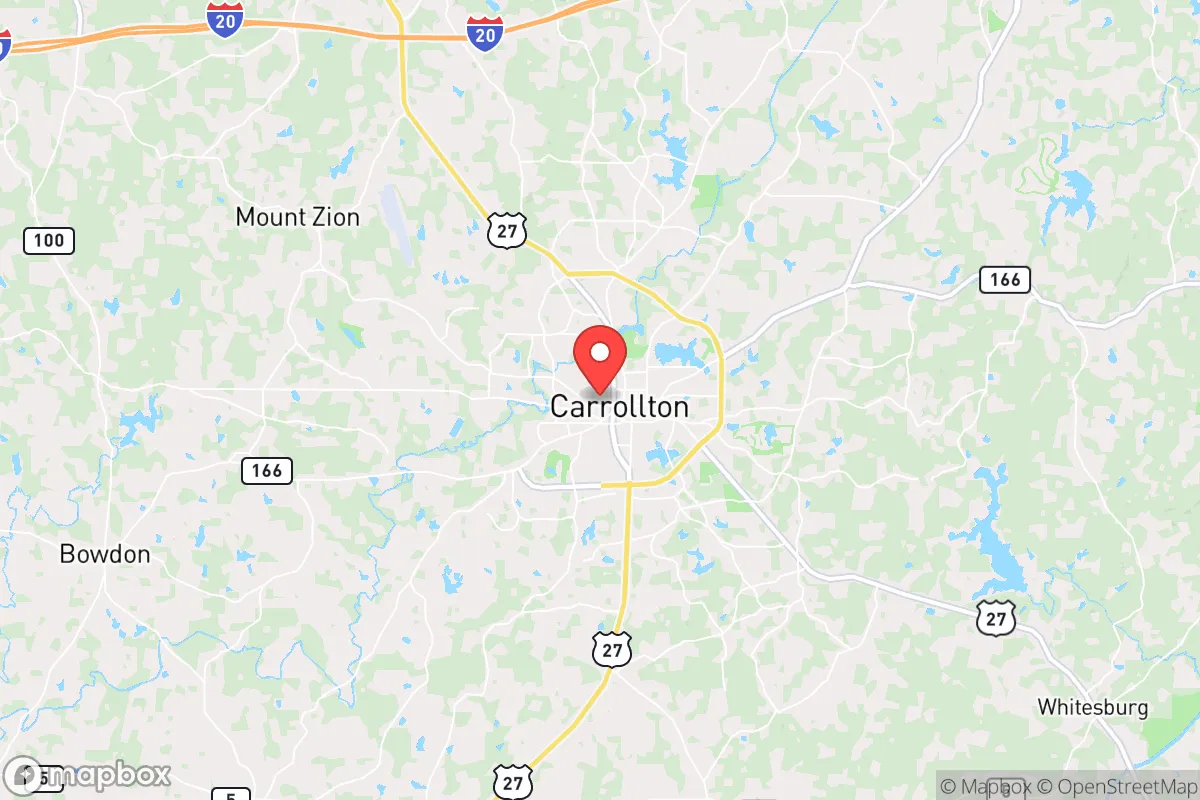
Carrollton, Georgia, presents a mixed strategic picture for the relocation-minded reader focused on resilience and self-sufficiency. Its position roughly 45 miles west of Atlanta offers a meaningful buffer from the immediate fallout of a major metropolitan crisis, while still providing access to regional resources and infrastructure. The city’s location in Carroll County, near the Alabama line, places it at a crossroads of two states, offering both advantages and specific exposures that a serious preparedness-minded individual should weigh carefully.
Geographic position and natural advantages for long-term stability
Carrollton sits in the Piedmont region of western Georgia, a landscape of rolling hills, mixed hardwood forests, and clay-based soils. This topography provides natural defensibility—the hills offer good vantage points and the forest cover can aid concealment and resource gathering. The area is not prone to the major natural disasters that plague other parts of the country: hurricanes lose steam by the time they reach this far inland, tornadoes are possible but not frequent, and the region has no significant earthquake or wildfire history. The climate is humid subtropical, with hot summers and mild winters, meaning a year-round growing season for food production. The average annual rainfall is around 50 inches, which is ample for rain catchment and gardening. The primary natural advantage is water: Carrollton sits near the headwaters of the Little Tallapoosa River, and the area has numerous creeks, ponds, and small lakes. The city’s water supply comes from the Carrollton Water and Sewer Authority, which draws from the Little Tallapoosa and the nearby Lake Carroll, but a relocator should note that private wells are common in the surrounding county, offering a decentralized water option. The soil is acidic and clay-heavy, requiring amendment for serious agriculture, but with proper management, it can support a wide range of crops.
Risks, exposures, and proximity to fallout-relevant landmarks
The most significant risk for Carrollton is its proximity to Atlanta. While 45 miles provides a buffer, it is not a safe distance from a major event—whether a natural disaster, a terrorist attack, or a grid-down scenario. Atlanta is a primary target for any large-scale disruption, and the resulting chaos, refugee flow, and resource competition would ripple outward. Carrollton sits along U.S. Route 27 and is near Interstate 20, both major evacuation corridors. In a crisis, these roads could become clogged with people fleeing the metro area, making ingress and egress difficult. The city itself has a population of roughly 27,000, but Carroll County’s population is over 120,000, meaning the area is not remote. There are no nuclear power plants within immediate striking distance—the closest is Plant Vogtle near Augusta, about 150 miles east—but the Hartsfield-Jackson Atlanta International Airport is a major potential target. Additionally, the presence of the Atlanta metropolitan area means that any large-scale biological or chemical event would have downstream effects on the region. The area is also within a few hours’ drive of the Savannah River Site (a nuclear weapons facility) and the Centers for Disease Control and Prevention in Atlanta, both of which could be points of interest in a crisis. On a more local level, Carrollton has a small industrial base, including a few chemical and manufacturing plants, but nothing that poses a catastrophic risk under normal circumstances. The real exposure is the human factor: being close to a major city means being close to the problems that come with it.
Practical resilience for a relocator: food, water, energy, and defensibility
For a relocator serious about self-sufficiency, Carrollton offers a mixed bag. Food production is feasible but requires work. The growing season runs from April to October, and with a greenhouse, year-round production is possible. The local soil is clay-heavy and acidic, so raised beds or extensive amending with compost and lime are necessary. The area has a strong agricultural tradition—Carroll County is home to several farms, farmers’ markets, and a local food co-op—meaning knowledge and supplies are available. Hunting is possible in the surrounding national forests and wildlife management areas, with deer, turkey, and small game present. Water is the area’s strongest asset. The Little Tallapoosa River and its tributaries provide surface water, and groundwater is accessible via wells at depths of 100-300 feet. Rainwater catchment is viable given the annual rainfall. The city’s municipal water system is well-maintained, but a relocator should plan for a backup well or catchment system. Energy is a concern. Carrollton is served by Georgia Power, which relies heavily on coal and natural gas, with some nuclear from Plant Vogtle. The grid is stable under normal conditions, but the area is not immune to outages from storms or strain. Solar potential is moderate—the region gets about 4.5 peak sun hours per day, which is enough for a well-designed off-grid system but not optimal. Wood heating is a viable backup, as firewood is abundant in the surrounding forests. Defensibility is the weakest point. Carrollton is a typical small city with a grid street layout, not a fortress. The surrounding countryside offers better options: rural properties with acreage, good sightlines, and limited road access are available within 15-20 minutes of town. The local law enforcement presence is adequate but not overwhelming—the Carrollton Police Department and Carroll County Sheriff’s Office are professional but would be stretched thin in a crisis. The community itself is generally conservative and self-reliant, with a strong church and civic network that could be a resource for mutual aid. However, the area is not isolated, and a determined group would find it difficult to secure a large perimeter.
The overall strategic picture for Carrollton is one of moderate resilience with significant caveats. It is not a bug-out location for a hardcore prepper seeking total isolation, but it is a viable option for a family or individual who wants a balance of access to urban resources and a reasonable buffer from major risks. The key is to buy land outside the city limits, secure a private water source, and build a defensible property. The proximity to Atlanta is the double-edged sword: it provides economic opportunity and medical access under normal conditions, but it is a liability in a crisis. For the reader who is serious about preparedness but not ready to move to the remote mountains, Carrollton offers a middle ground—a place where you can build a resilient lifestyle without cutting ties to the modern world entirely. The area’s natural advantages in water and climate are real, but the human geography demands careful planning and a realistic assessment of the risks that come with being within an hour of a major metropolitan area.

* Values derived from national, state, county, city and local statistics and may differ in a specific area. Last updated: 2026-10-17T00:06:09.000Z
Narrative content on this page is AI-generated and may contain mistakes. Verify any details that matter before acting on them.
ReloMaps may earn a commission from affiliate links at no extra cost to you.

