Photo: Wikipedia
Strategic Assessment of Ventura County
Multiple tactical vulnerabilities. Population density, target proximity, or disaster risk are likely compounding. A retreat property and exit planning is required.
What does the Strategic Assessment tell us?
Our Strategic Assessment grades tactical survivability of an area. Major population centers, military targets, fallout zones, natural disasters, and border exposure all drive risk — lower exposure means a more defensible position in a crisis.
This is heavily inspired by Joel Skousen's Strategic Relocation book. Highly recommended you checkout the book ($)What does this tell us?
Our Strategic Assessment grades tactical survivability of an area. Major population centers, military targets, fallout zones, natural disasters, and border exposure all drive risk — lower exposure means a more defensible position in a crisis.
This is heavily inspired by Joel Skousen's Strategic Relocation book. Highly recommended you checkout the book ($)Strategic Pillars

Key Distances
Strategic Assessment Analysis
Ventura County offers a compelling strategic position for relocators prioritizing resilience and self-sufficiency, balancing proximity to the economic engine of Southern California with a distinct geographic buffer from its densest urban cores and most exposed infrastructure. The county’s strength lies not in isolation, but in its layered advantages: a diverse topography that provides natural defensibility, a climate that supports year-round local food production, and a location that places key resources—water, energy, and transportation corridors—within a manageable distance while keeping the most acute fallout risks of the Los Angeles basin at arm’s length. For a conservative-leaning audience weighing disaster readiness, this is a region where the trade-offs between access and security are unusually well-balanced, provided one understands the specific vulnerabilities baked into the landscape.
Geographic position and natural advantages for disaster readiness
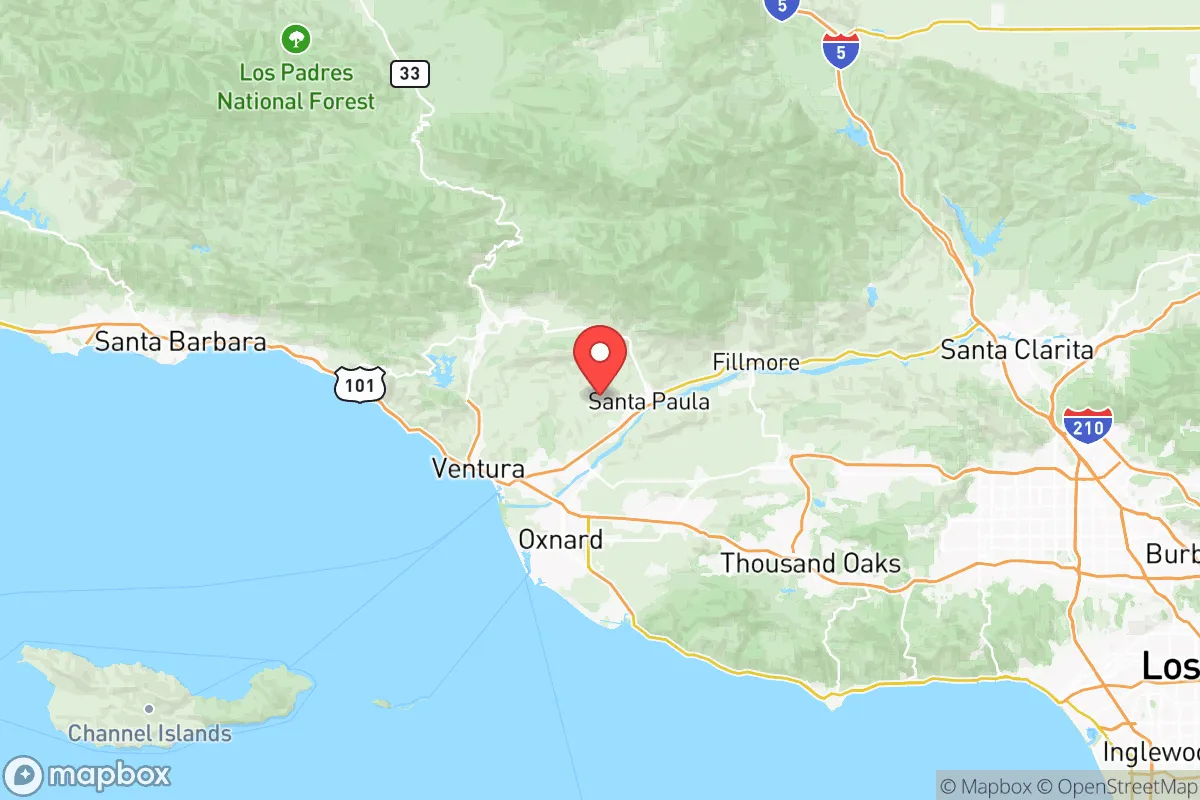
Ventura County’s geography is its primary strategic asset. Bounded by the Pacific Ocean to the southwest and the transverse ranges of the Topatopa Mountains and Los Padres National Forest to the north and east, the county forms a natural amphitheater that channels movement and limits exposure. The Oxnard Plain, the county’s agricultural heartland, sits behind a coastal strip that is narrow enough to be defensible but wide enough to support significant farming operations. The Santa Clara River Valley provides a natural corridor inland, connecting the coast to the interior valleys—a route that avoids the chokepoints of the Grapevine or the Cajon Pass. For a relocator, the key takeaway is that the county’s major population centers—Ventura, Oxnard, Camarillo, and Thousand Oaks—are all positioned within a 15- to 30-mile band from the coast, with the mountains acting as a barrier against the sprawl of the San Fernando Valley. This means that while Los Angeles is only 60 miles southeast, the terrain creates a meaningful separation: a major disruption in the LA basin would not automatically cascade into Ventura County, especially if the county’s own road and rail links remain intact. The climate is Mediterranean, with mild, wet winters and dry summers, which reduces the risk of prolonged power outages from winter storms (common in the Sierra foothills) and supports rain-fed agriculture in normal years. The county also sits outside the highest-risk zones for major earthquakes—the San Andreas Fault runs east of the county, with the local Oak Ridge and San Cayetano faults posing lower-probability threats—and its coastal elevation (mostly 0–500 feet) means tsunami risk is limited to low-lying harbor areas like Channel Islands Harbor and Ventura Harbor.
Risks, exposures, and proximity to fallout-relevant landmarks
No strategic assessment is honest without naming the liabilities. Ventura County’s most significant man-made risk is its proximity to the Port of Hueneme, the only deep-water port between Los Angeles and San Francisco. While not a primary military target, Hueneme is a critical logistics node for the U.S. Navy’s Seabees and handles significant commercial cargo, including automobiles and perishable goods. A conventional or cyber attack on the port could disrupt supply chains for weeks. More concerning is the county’s position relative to the Naval Base Ventura County (NBVC), which includes Point Mugu (a major naval air warfare center) and the San Nicolas Island test range. NBVC is a high-value target in any peer-state conflict scenario, and its location on the Oxnard coast means that a strike aimed at the base could produce fallout patterns affecting Oxnard, Port Hueneme, and parts of Camarillo. Additionally, the county sits within 100 miles of the Los Angeles refinery corridor (including the Wilmington and Carson refineries) and the San Onofre Nuclear Generating Station (now decommissioned but still storing spent fuel). While Ventura County itself has no active nuclear plants, the prevailing onshore winds from the ocean mean that a release from San Onofre (south) would likely be carried away from the county, but a release from the LA basin refineries could drift northwest under Santa Ana conditions. Wildfire is the most immediate natural risk: the 2017 Thomas Fire (which burned 281,000 acres) and the 2018 Woolsey Fire (which destroyed 1,600 structures in Ventura and Los Angeles counties) demonstrated that the wildland-urban interface in the Santa Monica Mountains and the hills above Ojai is highly vulnerable. Flooding is localized to the Santa Clara River floodplain and low-lying areas of Oxnard, but modern levees and the Matilija Dam (which is being removed to restore sediment flow) have reduced the worst-case scenario. For a relocator, the practical takeaway is that the county’s risks are real but geographically concentrated: the safest residential zones are the inland valleys (Santa Paula, Fillmore) and the higher-elevation communities (Ojai, but with fire risk), while the coastal strip from Oxnard to Ventura carries the highest exposure to both military-target fallout and tsunami inundation.
Practical resilience for a relocator: food, water, energy, and defensibility
Ventura County is one of the most agriculturally productive counties in the United States, ranking in the top 10 nationally for crop value. This is not a suburban bedroom community that imports all its food—it is a working landscape. The Oxnard Plain and the Santa Clara River Valley produce strawberries, lemons, avocados, celery, and nursery crops on a massive scale. For a relocator thinking about food security, this means that local farmers’ markets (in Ventura, Oxnard, and Camarillo) operate year-round, and that the county’s agricultural infrastructure—packing houses, cold storage, and distribution networks—is robust enough to supply the region even if interstate trucking is disrupted. Water is the critical constraint. The county relies heavily on the State Water Project (via Lake Casitas and the Ventura River) and on local groundwater basins. The Lake Casitas reservoir, which serves the Ojai Valley and parts of Ventura, has historically been a reliable source, but the 2012–2016 drought drew it down to 30% capacity. The county’s groundwater basins are overdrafted, and the Sustainable Groundwater Management Act is forcing reductions in pumping. For a relocator, the practical implication is that any property with a private well or access to a mutual water company is a significant resilience asset; properties relying solely on municipal water from the Ventura River or State Water Project are more exposed to drought-year cutbacks. Energy is a mixed picture: the county has no major power plants within its borders, but it is connected to the statewide grid via Southern California Edison lines that run through the Tejon Pass and the Grapevine—both chokepoints vulnerable to wildfire and seismic disruption. Solar is a strong option, with the county averaging 280 sunny days per year, and net metering policies (though being phased down) still make rooftop solar economically viable. Defensibility is the county’s hidden strength. The terrain—with the mountains to the north and east, the ocean to the south, and the Santa Clara River Valley as the primary inland corridor—means that a determined group could secure a defensible perimeter around the Oxnard Plain or the Ojai Valley with relatively few chokepoints. The Highway 101 corridor is the main artery, but it is vulnerable to landslides and bridge failures; the alternative routes (Highway 126 through Fillmore, Highway 33 through Ojai, and Highway 150 to Santa Barbara) are narrow and easily monitored. For a family or small group, the most defensible locations are the inland valleys (Santa Paula, Fillmore, Piru) where the population density is lower, the agricultural base is strong, and the road network offers multiple escape routes into the Los Padres National Forest.
The overall strategic picture for Ventura County is one of a region that offers genuine resilience advantages—productive farmland, a moderate climate, and a geography that buffers it from the worst of Southern California’s urban and industrial risks—but that is not immune to the vulnerabilities that come with being part of the state’s economic and military infrastructure. For a relocator who is serious about self-sufficiency, the county rewards those who choose their specific location carefully: the inland valleys and higher-elevation communities provide the best balance of food access, water security, and defensibility, while the coastal strip and areas near NBVC carry elevated risk. The county’s political culture is more moderate than Los Angeles or San Francisco—Ventura County voted for Joe Biden by 12 points in 2020, but the inland areas (Simi Valley, Moorpark, Thousand Oaks) lean conservative—which means that local governance is generally pragmatic on issues like water rights, property rights, and emergency preparedness. For a conservative-leaning family or individual, Ventura County is not a retreat into the wilderness, but it is a strategically sound base of operations that offers the resources to weather a wide range of disruptions without requiring a complete break from the economic opportunities of the broader region. The key is to treat the county as a network of micro-regions, each with its own risk profile and resilience characteristics, and to choose accordingly.

* Values derived from national, state, county, city and local statistics and may differ in a specific area. Last updated: 2026-06-15T19:36:17.000Z
Narrative content on this page is AI-generated and may contain mistakes. Verify any details that matter before acting on them.
ReloMaps may earn a commission from affiliate links at no extra cost to you.

