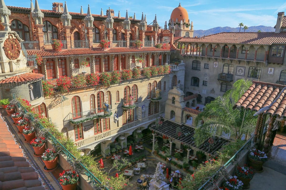
Photo: Wikipedia
Demographics of Riverside County
Affluence Level in Riverside County
A middle-class area roughly in line with national averages across income, home values, education, and employment.
People of Riverside County
Riverside County's 2.45 million residents form one of the most demographically complex regions in California: a majority-Hispanic population (50.6%) living alongside a 32.0% white non-Hispanic base, with significant Black (6.1%) and East/Southeast Asian (5.7%) communities, plus a smaller but growing Indian-subcontinent population (1.1%). The county is a study in contrasts—sprawling desert suburbs, dense inland-empire cities, and agricultural valleys—where a 25.1% college-educated rate sits below the state average, reflecting a historically working-class, family-oriented character. Today's Riverside County is defined by its role as a more affordable, politically moderate alternative to coastal Southern California, attracting both domestic migrants from higher-cost metros and international immigrants seeking suburban space.
Settlement & growth (pre-1960)
Long before European contact, the region was home to the Cahuilla, Serrano, Luiseño, and Chemehuevi peoples, who lived in seasonal villages across the desert, mountain, and valley zones. Spanish colonization arrived in the late 18th century with Mission San Luis Rey de Francia (1798) and Mission San Gabriel, whose ranching and farming operations drew indigenous labor into the mission system. After Mexican independence (1821), large land grants—like the 48,000-acre Rancho Jurupa and Rancho San Jacinto—were awarded to Mexican settlers, establishing the cattle-ranching economy that dominated until the U.S. takeover in 1848.
The American period began in earnest with the California Gold Rush, but Riverside County's real settlement wave came later, driven by agriculture. In the 1870s, the Southern California Colony Association, led by John Wesley North, founded the city of Riverside as a planned utopian colony centered on citrus. By the 1880s, the navel orange boom transformed the region: Midwestern and Eastern families—many of them white Protestants from Iowa, Illinois, and New York—purchased small citrus groves in Riverside, Corona, and Arlington. The arrival of the Santa Fe Railroad in 1885 accelerated growth, bringing both Anglo settlers and Mexican laborers who built the tracks and worked the harvests. By 1900, Riverside was one of the wealthiest per-capita cities in the U.S., its economy built on the "Washington" navel orange.
The early 20th century saw diversification. The 1900s-1910s brought Japanese immigrants, who initially worked as farm laborers and later established truck farms and citrus operations in the Coachella Valley, particularly around Indio and Thermal. The 1910s-1920s saw Dust Bowl migrants—"Okies" from Oklahoma, Arkansas, and Texas—arrive via Route 66, settling in the western county (Perris, Lake Elsinore, Hemet) as farmworkers and later as small-town tradespeople. World War II transformed the region: March Air Force Base (near Riverside) and Camp Haan (near Perris) brought thousands of military personnel and defense workers, many of whom stayed after the war. The 1950s saw the first major suburban push, as white families from Los Angeles moved east along the 60 and 91 freeways into developing communities like Riverside, Corona, and Norco, seeking larger lots and lower housing costs.
Modern era (post-1965)
The 1965 Hart-Cellar Act fundamentally reshaped Riverside County's demographics. Prior to 1965, the county was roughly 85-90% white non-Hispanic; by 2020, that share had fallen to 32.0%. The primary driver was Mexican and Central American immigration, which accelerated dramatically after 1965 and continued through the 1980s and 1990s. These immigrants concentrated in the eastern Coachella Valley (Coachella, Indio, Mecca, Thermal) as agricultural laborers, and in the western county's older suburbs (Perris, Hemet, San Jacinto) as service and construction workers. By 2000, the Hispanic share had surpassed 40%; today it stands at 50.6%, making Riverside County one of the few California counties where Hispanics form an outright majority.
Domestic migration also reshaped the county. Beginning in the 1970s and accelerating through the 2000s, white and Black families from Los Angeles and Orange County moved eastward in search of affordable single-family homes. This "Inland Empire" boom turned former farm towns into sprawling suburbs: Murrieta and Temecula in the southwest grew from a few thousand residents in 1980 to over 110,000 each by 2020, attracting middle-class families—many of them white and Hispanic—priced out of coastal markets. The 1990s and 2000s also saw significant Black migration from Los Angeles into Moreno Valley, Perris, and Riverside, raising the county's Black share from roughly 4% in 1980 to 6.1% today.
East and Southeast Asian communities (5.7%) grew more gradually, concentrated in Riverside, Corona, and Eastvale. Vietnamese and Filipino families arrived in the 1980s and 1990s, often as second-movers from Orange County's Little Saigon and Los Angeles's Historic Filipinotown. The Indian-subcontinent population (1.1%) is newer and smaller, clustering in the technology-adjacent suburbs of Corona, Eastvale, and Temecula, drawn by engineering and healthcare jobs. The foreign-born share (9.5%) is notably lower than California's statewide average of 27%, reflecting the county's character as a destination for domestic migrants rather than primary international arrivals.
The future
Riverside County is projected to continue growing, adding roughly 300,000-400,000 residents by 2040, driven by natural increase among the young Hispanic population and continued domestic in-migration from coastal California. The county is becoming more diverse in absolute terms, but the trend is toward Hispanic majority-stable rather than rapid diversification: the white non-Hispanic share is slowly declining, while East/Southeast Asian and Indian shares are rising modestly. New communities are dispersing rather than concentrating: the fastest-growing cities are the southwestern suburbs (Temecula, Murrieta, Wildomar) and the desert resort areas (Palm Desert, La Quinta, Cathedral City), while older agricultural towns like Coachella and Mecca remain predominantly Hispanic and lower-income.
Culturally, the county is evolving from a white-majority, conservative-leaning region into a Hispanic-majority, politically mixed one. The Hispanic population is increasingly native-born, English-bilingual, and suburban, blurring older ethnic boundaries. The county's identity is shifting toward a "Inland Empire" pragmatism—less culturally tied to Los Angeles or San Diego, more focused on affordable homeownership, family life, and local employment in logistics, healthcare, and education. The next decade will likely see continued suburban infill, with new master-planned communities in Menifee, Jurupa Valley, and Beaumont absorbing much of the growth.
For someone moving in now, Riverside County offers a demographic middle ground: majority-Hispanic but not overwhelmingly so, with substantial white, Black, and Asian minorities living in largely integrated suburbs. It is a place where the classic California suburban dream—a house with a yard, good schools, and a manageable commute—remains attainable for middle-class families, even as the state's coastal areas become increasingly unaffordable. The county's future is one of gradual, stable diversification, with no single group dominating the cultural or political landscape, making it one of California's most representative regions of where the state as a whole is heading.

* Values derived from national, state, county, city and local statistics and may differ in a specific area. Last updated: 2026-06-16T00:32:27.000Z
Narrative content on this page is AI-generated and may contain mistakes. Verify any details that matter before acting on them.
ReloMaps may earn a commission from affiliate links at no extra cost to you.

