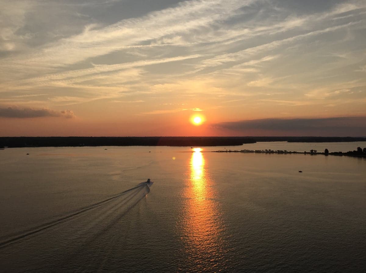
Photo: Wikipedia
Strategic Assessment of California, MD
Meaningful friction. Expect exposure to either population pressure, blast zones, or natural disaster risk. Consider buying a retreat property.
What does the Strategic Assessment tell us?
Our Strategic Assessment grades tactical survivability of an area. Major population centers, military targets, fallout zones, natural disasters, and border exposure all drive risk — lower exposure means a more defensible position in a crisis.
This is heavily inspired by Joel Skousen's Strategic Relocation book. Highly recommended you checkout the book ($)What does this tell us?
Our Strategic Assessment grades tactical survivability of an area. Major population centers, military targets, fallout zones, natural disasters, and border exposure all drive risk — lower exposure means a more defensible position in a crisis.
This is heavily inspired by Joel Skousen's Strategic Relocation book. Highly recommended you checkout the book ($)Strategic Pillars

Key Distances
Regional Safe Places
Below is our recommended "safe zones" in Maryland and the surrounding area based on our strategic heuristics. For most people, it's unrealistic to live in a “safe zone” full-time due to work, family or other personal reasons. They tend to be more rural. However, many of these areas are perfect for second homes and retreat properties that double as a vacation home or even a short-term rental.
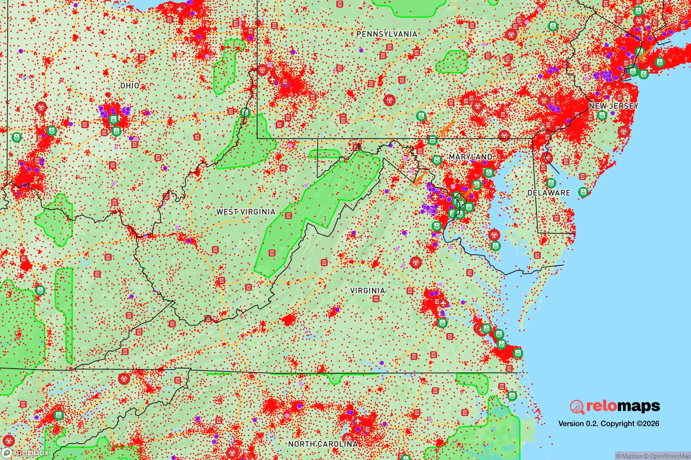
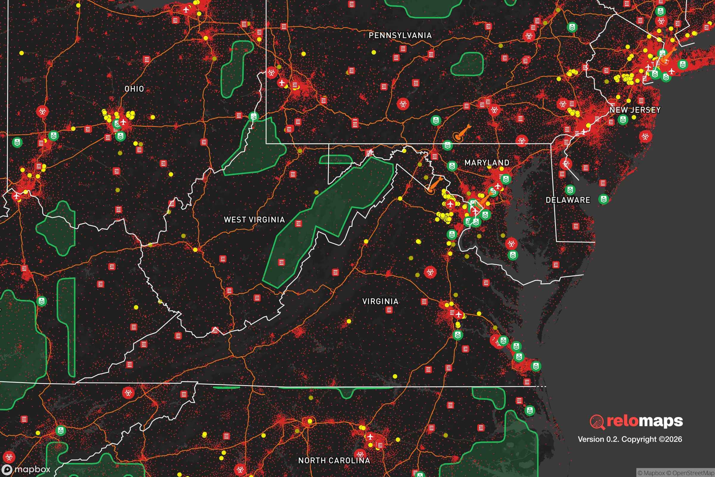


Important Note: For informational purposes only. This does not mean nothing bad ever happens in the green zones. Please use common sense. This is based on public data and modeled with AI. We tried to take a conservative approach but mistakes happen. We update this regularly as new information becomes available.
Solar Generator Recommendations
Backup power matters more here than in safer locations. We've picked three solar generators across budgets and capacity tiers — start with the budget unit if you only need a few essentials, or step up if you want to run a fridge and HVAC for days at a time.

Jackery Portable Power Station Explorer 300
Budget OptionPower on the Go: Weighing only 11 lbs, it's convenient to set up and store with book-sized foldable solar panels

BLUETTI Portable Power Station AC180
Designed for both indoor and outdoor scenarios, AC180 is highly capable as it has a robost capacity and continuous output power.

EF ECOFLOW DELTA Pro Ultra Power Station
Upgraded PickEcoFlow DELTA Pro Ultra is a whole-home energy system designed to grow with your family. Integrated with the Smart Home Panel 2, it scales to meet your evolving energy needs — keeping your home powered, intelligent, and secure through every stage of life.
We earn a commission, at no additional cost to you.
Strategic Assessment Analysis
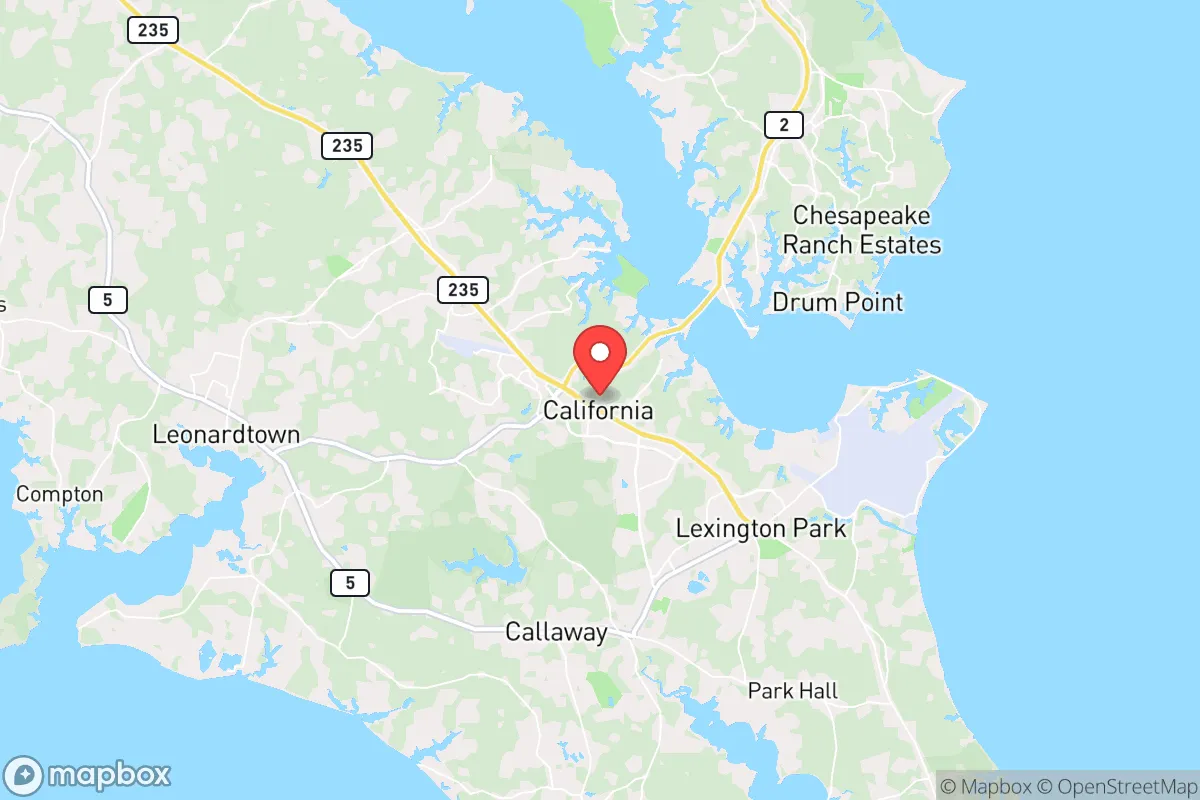
California, Maryland, offers a strategic paradox for the relocation-minded reader focused on resilience: it sits within the Chesapeake Bay region’s natural buffer zones yet lies within a 90-minute drive of Washington, D.C., and the Patuxent River Naval Air Station. For a conservative-leaning individual or family weighing disaster readiness, the area’s primary advantage is its position in a relatively low-density part of St. Mary’s County, where access to the Patuxent River and Chesapeake Bay provides both a natural resource buffer and a potential evacuation corridor by water. However, the same proximity to high-value federal and military targets—including the Pax River base and the D.C. metro area—introduces risks that demand careful consideration. This assessment evaluates California, MD, through the lens of geographic advantages, exposure to natural and man-made threats, and practical self-sufficiency factors, keeping the analysis grounded in observable realities rather than alarmist speculation.
Geographic position and natural advantages for long-term stability
California’s location on a peninsula between the Patuxent River and the Chesapeake Bay gives it a distinct geographic buffer that many inland or coastal-adjacent areas lack. The region is not directly on the Atlantic coast, which reduces the worst storm surge impacts from hurricanes, though it remains vulnerable to tropical storms and nor’easters that push water up the bay. The surrounding landscape is a mix of forested tracts, farmland, and tidal wetlands, which historically have slowed the spread of wildfires and provided natural water filtration. For a relocator, the area’s low population density relative to the D.C. suburbs—St. Mary’s County has roughly 115,000 residents spread over 360 square miles—means less competition for resources during a crisis. The Chesapeake Bay and Patuxent River offer abundant fishing, crabbing, and potential water collection, though saltwater intrusion limits direct drinking water sources. The region’s temperate climate supports year-round gardening, with a growing season from April to October, and the local soil in non-wetland areas is workable for small-scale agriculture. One underappreciated advantage is the area’s limited number of major highway chokepoints: Route 235 and Route 4 are the primary arteries, but the peninsula’s geography means that a single accident or bridge failure can isolate the area, which is both a defensive feature and a logistical risk.
Risks, exposures, and proximity to fallout-relevant landmarks
The most significant risk for California, MD, is its proximity to high-value targets that could be relevant in a conflict or major terrorist event. The Patuxent River Naval Air Station (NAS Pax River), located roughly 10 miles north, is a key hub for naval aviation testing and electronic warfare systems. This makes it a plausible target for a kinetic or cyber attack, and the fallout—whether physical debris, electromagnetic pulse effects, or secondary hazards—could affect downwind areas, including California. Additionally, the area lies within 70 miles of the Pentagon, the White House, and other D.C. landmarks, placing it in a zone that could experience cascading effects from a strike on the capital, such as gridlock, communications blackouts, or refugee movement. St. Mary’s County is also home to the Calvert Cliffs Nuclear Power Plant, about 25 miles north, which, while well-regulated, represents a potential radiological risk in the event of a severe accident or sabotage. On the natural disaster front, the region faces moderate risks from hurricanes (Category 1-2 storms historically), flooding from the bay and river systems, and occasional tornadoes. The area’s flat terrain and high water table mean that flooding is the most probable natural hazard, particularly in low-lying neighborhoods near the Patuxent River. For a relocator, the key takeaway is that while California is not a primary target itself, its location within the D.C.-Baltimore-Norfolk corridor means it would be affected by any major event targeting the federal government or military infrastructure.
Practical resilience for a relocator: food, water, energy, and defensibility
For someone serious about self-sufficiency, California offers a mixed picture. Water is the most critical vulnerability: the area relies on a combination of municipal water from the St. Mary’s County Metropolitan Commission and private wells. In a prolonged grid-down scenario, well owners with hand pumps or solar-powered pumps have a significant advantage, but those on municipal supply would face rapid depletion of stored water. The Patuxent River and Chesapeake Bay are abundant but require treatment—boiling, filtration, or desalination—to be potable, which is energy-intensive. Food production is more feasible: the county has several active farms, farmers’ markets, and a strong hunting culture (deer, waterfowl). A relocator with acreage could establish a substantial garden, and the local climate supports fruit trees like apples and pears. However, the growing season is shorter than in the Deep South, and soil in some areas is heavy clay, requiring amendment. Energy resilience is a bright spot: solar potential is moderate (about 4.5 peak sun hours per day), and the area’s relatively low tree cover in developed parts allows for rooftop panels. Backup generators are common among rural residents, and propane is widely available. Defensibility is a double-edged sword: the peninsula geography means that a determined group could control access points (bridges over the Patuxent, Route 4 choke points), but it also means that escape routes are limited. Neighbors in St. Mary’s County tend to be more self-reliant and community-oriented than in suburban D.C., with a strong tradition of mutual aid among farming and hunting families. For a relocator, the practical recommendation is to secure a property with a well, install a solar array with battery storage, and build relationships with local growers and hunters before a crisis hits.
Overall, California, MD, presents a viable option for the resilience-minded relocator who values natural buffers and a slower pace but is willing to accept the risks of living near high-value federal and military infrastructure. The area’s strengths—water access, agricultural potential, and a community with a self-sufficient ethos—are balanced by its vulnerabilities: proximity to D.C. and Pax River, flood risk, and limited evacuation routes. For a family or individual who can invest in well water, solar power, and food storage, and who is prepared to monitor regional threats, California offers a defensible position that is not so remote as to be impractical for work or supply runs. The strategic calculus ultimately depends on the reader’s risk tolerance: if the goal is to be far from any target, look farther west or north; if the goal is to be within a day’s drive of the capital but with a solid fallback plan, California is a reasonable choice. The key is to treat the area as a base for layered preparedness, not a guaranteed safe haven, and to stay informed about developments at Pax River and the Calvert Cliffs plant. In a world of increasing uncertainty, this peninsula community offers a middle ground—neither a fortress nor a bullseye, but a place where a prepared individual can make a stand.

* Values derived from national, state, county, city and local statistics and may differ in a specific area. Last updated: 2026-11-18T00:35:20.000Z
Narrative content on this page is AI-generated and may contain mistakes. Verify any details that matter before acting on them.
ReloMaps may earn a commission from affiliate links at no extra cost to you.

