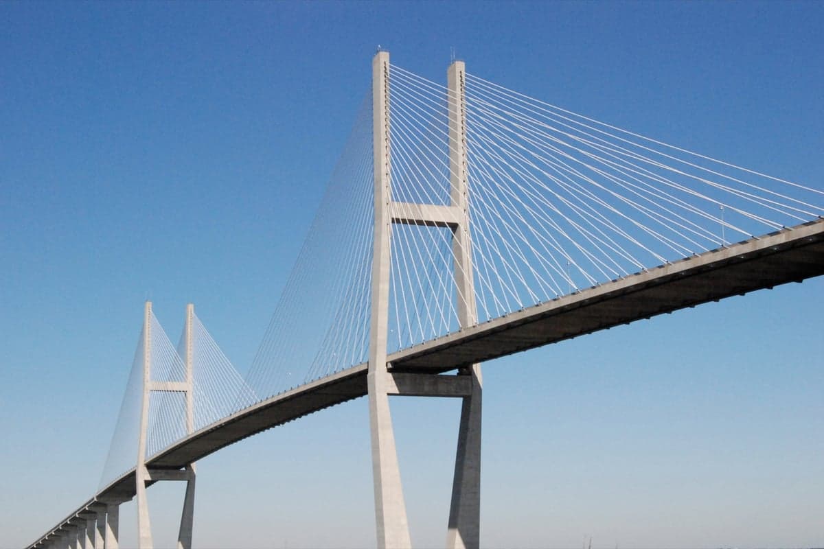
Photo: Wikipedia
Strategic Assessment of Brunswick, GA
Multiple tactical vulnerabilities. Population density, target proximity, or disaster risk are likely compounding. A retreat property and exit planning is required.
What does the Strategic Assessment tell us?
Our Strategic Assessment grades tactical survivability of an area. Major population centers, military targets, fallout zones, natural disasters, and border exposure all drive risk — lower exposure means a more defensible position in a crisis.
This is heavily inspired by Joel Skousen's Strategic Relocation book. Highly recommended you checkout the book ($)What does this tell us?
Our Strategic Assessment grades tactical survivability of an area. Major population centers, military targets, fallout zones, natural disasters, and border exposure all drive risk — lower exposure means a more defensible position in a crisis.
This is heavily inspired by Joel Skousen's Strategic Relocation book. Highly recommended you checkout the book ($)Strategic Pillars

Key Distances
Regional Safe Places
Below is our recommended "safe zones" in Georgia and the surrounding area based on our strategic heuristics. For most people, it's unrealistic to live in a “safe zone” full-time due to work, family or other personal reasons. They tend to be more rural. However, many of these areas are perfect for second homes and retreat properties that double as a vacation home or even a short-term rental.
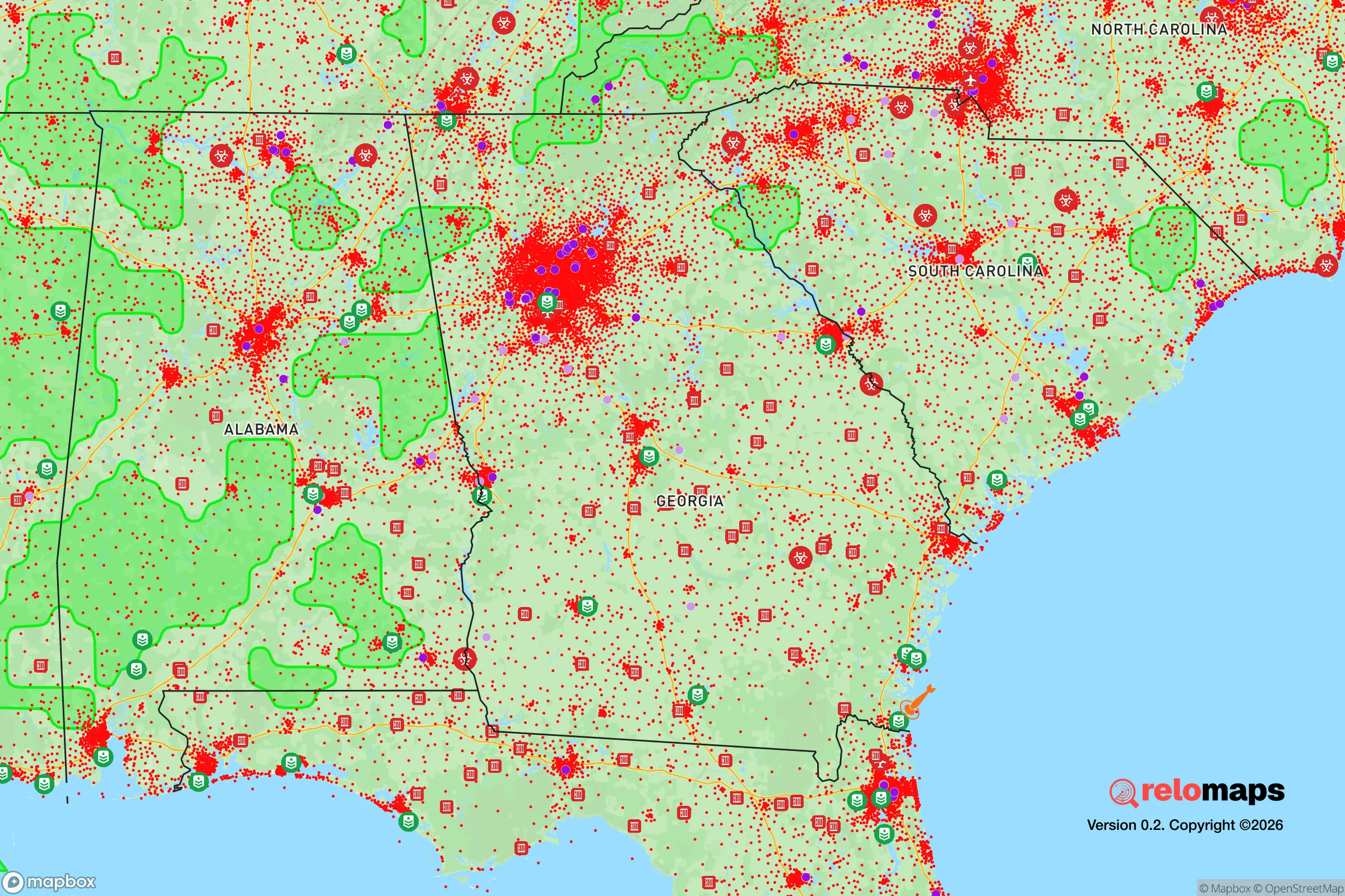
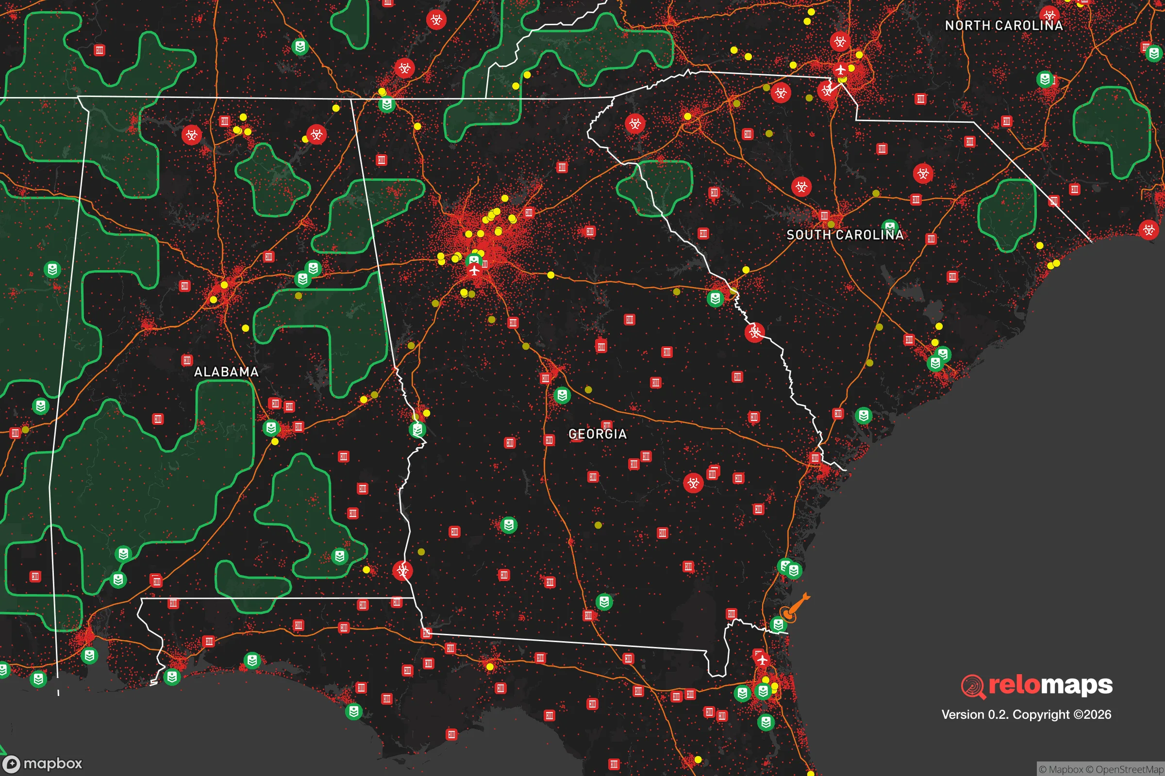


Important Note: For informational purposes only. This does not mean nothing bad ever happens in the green zones. Please use common sense. This is based on public data and modeled with AI. We tried to take a conservative approach but mistakes happen. We update this regularly as new information becomes available.
Solar Generator Recommendations
Backup power matters more here than in safer locations. We've picked three solar generators across budgets and capacity tiers — start with the budget unit if you only need a few essentials, or step up if you want to run a fridge and HVAC for days at a time.

Jackery Portable Power Station Explorer 300
Budget OptionPower on the Go: Weighing only 11 lbs, it's convenient to set up and store with book-sized foldable solar panels

BLUETTI Portable Power Station AC180
Designed for both indoor and outdoor scenarios, AC180 is highly capable as it has a robost capacity and continuous output power.

EF ECOFLOW DELTA Pro Ultra Power Station
Upgraded PickEcoFlow DELTA Pro Ultra is a whole-home energy system designed to grow with your family. Integrated with the Smart Home Panel 2, it scales to meet your evolving energy needs — keeping your home powered, intelligent, and secure through every stage of life.
We earn a commission, at no additional cost to you.
Strategic Assessment Analysis
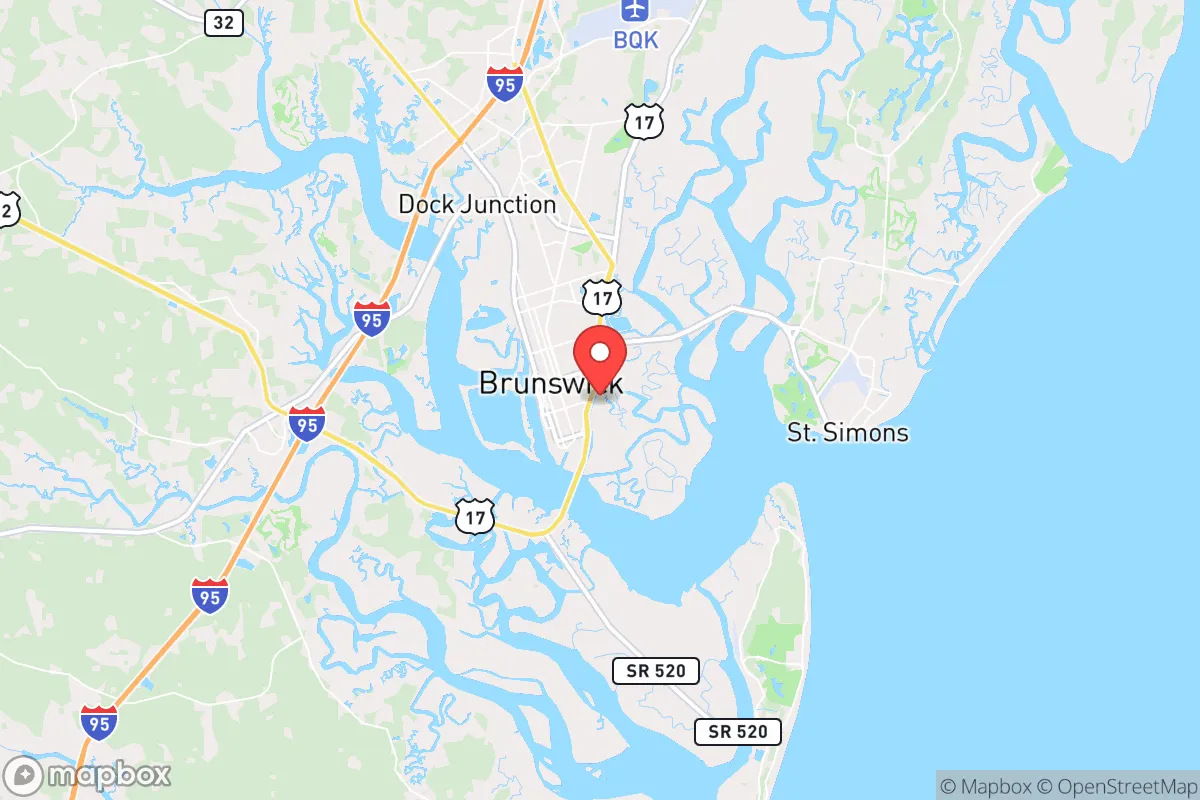
Brunswick, Georgia, occupies a strategic position along the southeastern coast that offers a mix of genuine resilience advantages and notable vulnerabilities for those prioritizing disaster readiness and self-sufficiency. Its location roughly 60 miles south of Savannah and 70 miles north of Jacksonville places it within a corridor of significant population and infrastructure, but also at a meaningful distance from the immediate blast zones and fallout patterns of major metropolitan targets. The area's natural geography—bounded by the Atlantic Ocean, the Marshes of Glynn, and the vast Okefenokee Swamp to the west—creates a buffer that complicates large-scale movement and provides natural barriers, though these same features introduce their own risks. For a relocator weighing long-term security, Brunswick presents a nuanced picture: it is not a hardened bunker, but it offers a workable baseline for those willing to invest in preparation and understand the local landscape.
Geographic position and natural advantages for long-term security
Brunswick's most compelling resilience asset is its position within the Golden Isles, a chain of barrier islands that includes St. Simons Island, Sea Island, and Jekyll Island. These islands, along with the extensive salt marshes, create a layered coastal defense against storm surge and provide multiple escape routes by water if roadways become compromised. The Intracoastal Waterway runs directly through the area, offering a navigable inland route that bypasses many of the choke points on Highway 17 and I-95. The surrounding terrain is predominantly flat, low-lying coastal plain, which limits defensible high ground but also means the area is not prone to landslides, seismic activity, or wildfire corridors that plague other regions. The proximity to the Okefenokee Swamp—a massive 438,000-acre wetland—acts as a natural barrier to westward overland approach and provides a vast, relatively inaccessible wilderness for foraging, hunting, and water collection, though it also harbors alligators, snakes, and dense vegetation that require familiarity to navigate safely. The climate is humid subtropical, with mild winters and long growing seasons that support year-round agriculture, a critical factor for food self-sufficiency. The area's relatively low population density compared to Atlanta or Jacksonville—Glynn County has roughly 85,000 residents—means less competition for resources in a crisis, though the seasonal tourist influx can temporarily swell the population by tens of thousands, straining local supplies.
Risks, exposures, and proximity to fallout-relevant landmarks
The most significant risk for Brunswick is its exposure to Atlantic hurricanes and tropical storms. The area has been directly impacted by major storms, including Hurricane Irma in 2017 and Hurricane Matthew in 2016, both of which caused widespread flooding, power outages, and infrastructure damage. Storm surge from a Category 3 or higher hurricane could inundate large portions of the city, particularly the downtown historic district and low-lying neighborhoods near the Turtle River and the East River. Evacuation routes are limited: I-95 north and south, and Highway 341 west toward Baxley, all of which can become gridlocked during mandatory evacuations. For a relocator, this means that a robust plan for sheltering in place or early departure is essential. Beyond natural hazards, Brunswick's proximity to military and industrial targets introduces man-made risks. The city is home to the Port of Brunswick, one of the busiest automobile ports in the United States, and is within 30 miles of Naval Submarine Base Kings Bay, a strategic nuclear submarine base. Kings Bay is a high-value target in any conflict scenario, and its proximity means that a nuclear detonation or conventional strike could produce fallout patterns that affect Brunswick depending on wind direction. Additionally, the area hosts several chemical plants and a large paper mill, which could release hazardous materials if damaged. While Brunswick is not a primary target like Washington, D.C., or New York, its role as a logistics hub and its proximity to military assets elevate its risk profile above that of a purely rural retreat.
Practical resilience for a relocator: food, water, energy, and defensibility
For those serious about self-sufficiency, Brunswick offers a mixed bag. The growing season runs from March to November, allowing for two full crop cycles of staples like corn, beans, squash, and sweet potatoes. The local soil is sandy and acidic, typical of coastal Georgia, so raised beds or container gardening with amended soil are more productive than direct ground planting. The area has abundant freshwater sources, including the Satilla River, the Altamaha River, and numerous creeks and artesian wells, but surface water requires treatment due to agricultural runoff and brackish intrusion in tidal zones. Rainwater collection is viable, with an average annual rainfall of 50 inches, but cisterns must be protected from mosquito breeding and salt spray. Energy resilience is a challenge: the local grid is vulnerable to storm damage, and natural gas infrastructure is limited. Solar panels are a strong option given the region's 215 sunny days per year, but they must be secured against hurricane-force winds. Backup generators running on propane or diesel are common among prepared residents. Defensibility is moderate. The city's layout—a grid of streets with multiple access points—makes it difficult to secure a single perimeter, but the surrounding marshes and waterways create natural chokepoints. A relocator would be better served by choosing a property on higher ground, ideally with a well, septic system, and a clear line of sight to approach routes. The local culture is generally friendly and community-oriented, with a strong hunting and fishing tradition that means many residents already possess practical outdoor skills. However, the area also has a significant transient population due to tourism and military rotations, which can make vetting neighbors and building a trusted network more time-consuming than in a more insular rural community.
Overall, Brunswick presents a viable but not ideal strategic picture for the disaster-conscious relocator. Its geographic advantages—coastal access, natural barriers, long growing season, and moderate population density—are offset by real hurricane risks, limited evacuation routes, and proximity to high-value military and industrial targets. The area is not a hidden gem for those seeking complete isolation from modern vulnerabilities, but it offers a workable foundation for a prepared individual or family willing to invest in robust infrastructure, develop local knowledge, and maintain a flexible evacuation plan. For the reader who values coastal living and is willing to accept a moderate risk profile in exchange for access to water, fertile land, and a supportive community, Brunswick deserves serious consideration. For those seeking maximum distance from all potential threats, the interior of the state or the Appalachian foothills would be a more conservative choice. The key takeaway is that Brunswick's resilience is conditional: it rewards preparation but punishes complacency.

* Values derived from national, state, county, city and local statistics and may differ in a specific area. Last updated: 2026-10-29T21:43:08.000Z
Narrative content on this page is AI-generated and may contain mistakes. Verify any details that matter before acting on them.
ReloMaps may earn a commission from affiliate links at no extra cost to you.

