Photo: Wikipedia
Strategic Assessment of Brookings, OR
Workable tactical position. Some exposure to population density or targets, but generally defensible in a crisis.
What does the Strategic Assessment tell us?
Our Strategic Assessment grades tactical survivability of an area. Major population centers, military targets, fallout zones, natural disasters, and border exposure all drive risk — lower exposure means a more defensible position in a crisis.
This is heavily inspired by Joel Skousen's Strategic Relocation book. Highly recommended you checkout the book ($)What does this tell us?
Our Strategic Assessment grades tactical survivability of an area. Major population centers, military targets, fallout zones, natural disasters, and border exposure all drive risk — lower exposure means a more defensible position in a crisis.
This is heavily inspired by Joel Skousen's Strategic Relocation book. Highly recommended you checkout the book ($)Strategic Pillars

Key Distances
Regional Safe Places
Below is our recommended "safe zones" in Oregon and the surrounding area based on our strategic heuristics. For most people, it's unrealistic to live in a “safe zone” full-time due to work, family or other personal reasons. They tend to be more rural. However, many of these areas are perfect for second homes and retreat properties that double as a vacation home or even a short-term rental.


Important Note: For informational purposes only. This does not mean nothing bad ever happens in the green zones. Please use common sense. This is based on public data and modeled with AI. We tried to take a conservative approach but mistakes happen. We update this regularly as new information becomes available.
Solar Generator Recommendations
Backup power matters more here than in safer locations. We've picked three solar generators across budgets and capacity tiers — start with the budget unit if you only need a few essentials, or step up if you want to run a fridge and HVAC for days at a time.

Jackery Portable Power Station Explorer 300
Budget OptionPower on the Go: Weighing only 11 lbs, it's convenient to set up and store with book-sized foldable solar panels

BLUETTI Portable Power Station AC180
Designed for both indoor and outdoor scenarios, AC180 is highly capable as it has a robost capacity and continuous output power.

EF ECOFLOW DELTA Pro Ultra Power Station
Upgraded PickEcoFlow DELTA Pro Ultra is a whole-home energy system designed to grow with your family. Integrated with the Smart Home Panel 2, it scales to meet your evolving energy needs — keeping your home powered, intelligent, and secure through every stage of life.
We earn a commission, at no additional cost to you.
Strategic Assessment Analysis
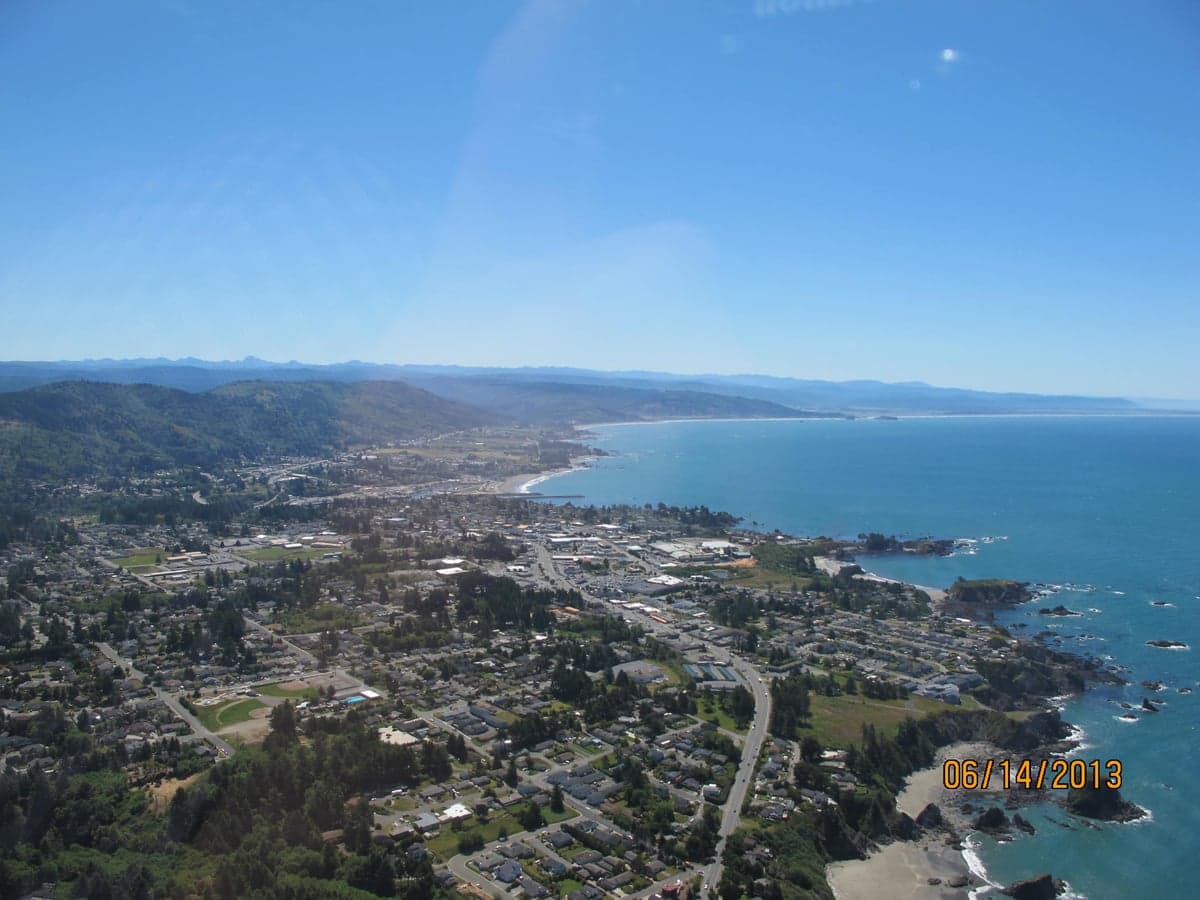
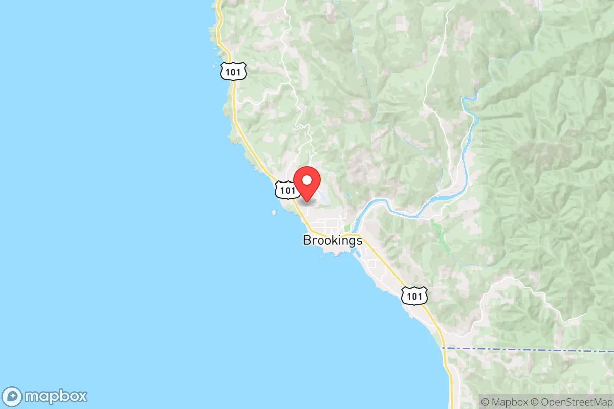
Brookings, Oregon, occupies a uniquely resilient position on the southern Oregon coast, offering a blend of geographic isolation and practical self-sufficiency that appeals to relocators prioritizing disaster readiness. Its location, roughly 20 miles north of the California border and nestled between the Pacific Ocean and the rugged Coast Range, provides a natural buffer against many of the risks that plague inland or densely populated areas. For a single individual or family thinking seriously about long-term preparedness, Brookings presents a strategic option that balances access to resources with a lower exposure profile than most coastal towns.
Geographic position and natural advantages for long-term stability
Brookings’ most significant strategic asset is its position within the Banana Belt of the Oregon coast, a microclimate that delivers milder winters, less fog, and more sunshine than communities just 30 miles north. This weather pattern supports year-round gardening and reduces the energy demands of heating, a practical advantage for anyone aiming to lower their reliance on external grids. The town sits at the mouth of the Chetco River, which provides a reliable freshwater source—critical for both daily use and emergency scenarios. The surrounding Coast Range creates a natural barrier to the east, limiting easy overland access from the interior and making the area inherently more defensible than a flat, open plain. The nearest major population center is Medford, roughly 90 miles east over the winding and seasonally treacherous Highway 199, which itself can be a chokepoint in a crisis. This distance from a city of 85,000 means that Brookings is not a primary target for any large-scale evacuation or resource rush, unlike towns closer to Portland or the Willamette Valley. The Pacific Ocean to the west offers a potential escape route or supply corridor, though it also introduces maritime risks.
Risks, exposures, and proximity to fallout-relevant landmarks
No location is without vulnerabilities, and Brookings has several that a relocator must weigh. The most immediate natural threat is a Cascadia Subduction Zone earthquake and subsequent tsunami. The town’s low-lying coastal areas, including much of the downtown and harbor district, sit within the tsunami inundation zone. A full-rupture event would likely destroy these areas within 15–30 minutes, making elevation a non-negotiable factor in property selection. Homes above the 100-foot contour line, particularly on the hillsides east of Highway 101, are far safer. Wildfire risk is moderate but growing, as the surrounding forests have seen increased dry spells; the 2022 Rum Creek Fire burned roughly 30 miles inland, and smoke events are common in late summer. From a man-made risk perspective, Brookings’ distance from major strategic targets is a clear positive. The nearest significant military installation is the Naval Air Station in Lemoore, California, over 300 miles south, and the nearest major port is Coos Bay, 90 miles north. No nuclear power plants, major dams, or large chemical facilities sit within a 100-mile radius. The closest plausible fallout-relevant landmark would be the Portland metro area (300+ miles north) or the San Francisco Bay Area (400+ miles south), both of which are far enough that any fallout plume would be highly diluted by the time it reached the coast, assuming prevailing westerly winds. This isolation from high-value targets is a major strategic advantage for a preparedness-minded relocator.
Practical resilience for a relocator: food, water, energy, and defensibility
Brookings offers a surprisingly strong foundation for practical self-sufficiency. The Chetco River, combined with numerous smaller creeks and a high annual rainfall (averaging 70–80 inches), means fresh water is abundant for those with a well or a catchment system. The mild climate allows for extended growing seasons; many residents maintain productive vegetable gardens year-round, and the area’s berry crops (especially blueberries and strawberries) are well-established. The local fishing industry, centered on the harbor, provides a direct protein source—salmon, crab, and tuna are regularly available. For energy, the region’s hydroelectric potential is limited by the small size of local rivers, but solar is viable despite the coastal cloud cover; many off-grid homes in the hills rely on solar arrays with battery backup. Wood heating is common and practical, given the surrounding forests, though it requires proper stove maintenance and a secure fuel supply. Defensibility is a mixed picture. The town’s single main artery, Highway 101, can be easily monitored and potentially blocked, which is good for controlling access but bad if a rapid evacuation is needed. The population of roughly 6,700 is small enough that community cohesion is possible, but the area also has a transient element tied to the marijuana industry (legal in Oregon), which can introduce social instability. The local economy is heavily reliant on tourism and fishing, meaning that in a prolonged crisis, external supply chains for fuel, medical supplies, and manufactured goods would be thin. The nearest hospital is Curry General Hospital in Gold Beach (25 miles north), a small critical-access facility; serious trauma care requires a helicopter or a long drive to Medford.
The overall strategic picture for Brookings is one of moderate-to-high resilience with specific, manageable trade-offs. It is not a fortress, but it is far better positioned than 90% of West Coast towns for a scenario where you need to ride out a disruption without being in the path of a major population exodus or a direct strike. The key for a relocator is to choose property above the tsunami zone, secure a reliable water source (a well is ideal), and build a local network before a crisis hits. The isolation that makes it safe also makes it hard to get supplies in a hurry. For a family willing to invest in elevation, water storage, and community ties, Brookings offers a defensible, resource-rich base that balances coastal living with genuine preparedness. It is not a bug-out location for a weekend—it is a place to build a life that can withstand shocks, provided you respect its limits.

* Values derived from national, state, county, city and local statistics and may differ in a specific area. Last updated: 2026-10-05T17:11:09.000Z
Narrative content on this page is AI-generated and may contain mistakes. Verify any details that matter before acting on them.
ReloMaps may earn a commission from affiliate links at no extra cost to you.

