Photo: Wikipedia
Strategic Assessment of Biltmore Forest, NC
Workable tactical position. Some exposure to population density or targets, but generally defensible in a crisis.
What does the Strategic Assessment tell us?
Our Strategic Assessment grades tactical survivability of an area. Major population centers, military targets, fallout zones, natural disasters, and border exposure all drive risk — lower exposure means a more defensible position in a crisis.
This is heavily inspired by Joel Skousen's Strategic Relocation book. Highly recommended you checkout the book ($)What does this tell us?
Our Strategic Assessment grades tactical survivability of an area. Major population centers, military targets, fallout zones, natural disasters, and border exposure all drive risk — lower exposure means a more defensible position in a crisis.
This is heavily inspired by Joel Skousen's Strategic Relocation book. Highly recommended you checkout the book ($)Strategic Pillars

Key Distances
Regional Safe Places
Below is our recommended "safe zones" in North Carolina and the surrounding area based on our strategic heuristics. For most people, it's unrealistic to live in a “safe zone” full-time due to work, family or other personal reasons. They tend to be more rural. However, many of these areas are perfect for second homes and retreat properties that double as a vacation home or even a short-term rental.

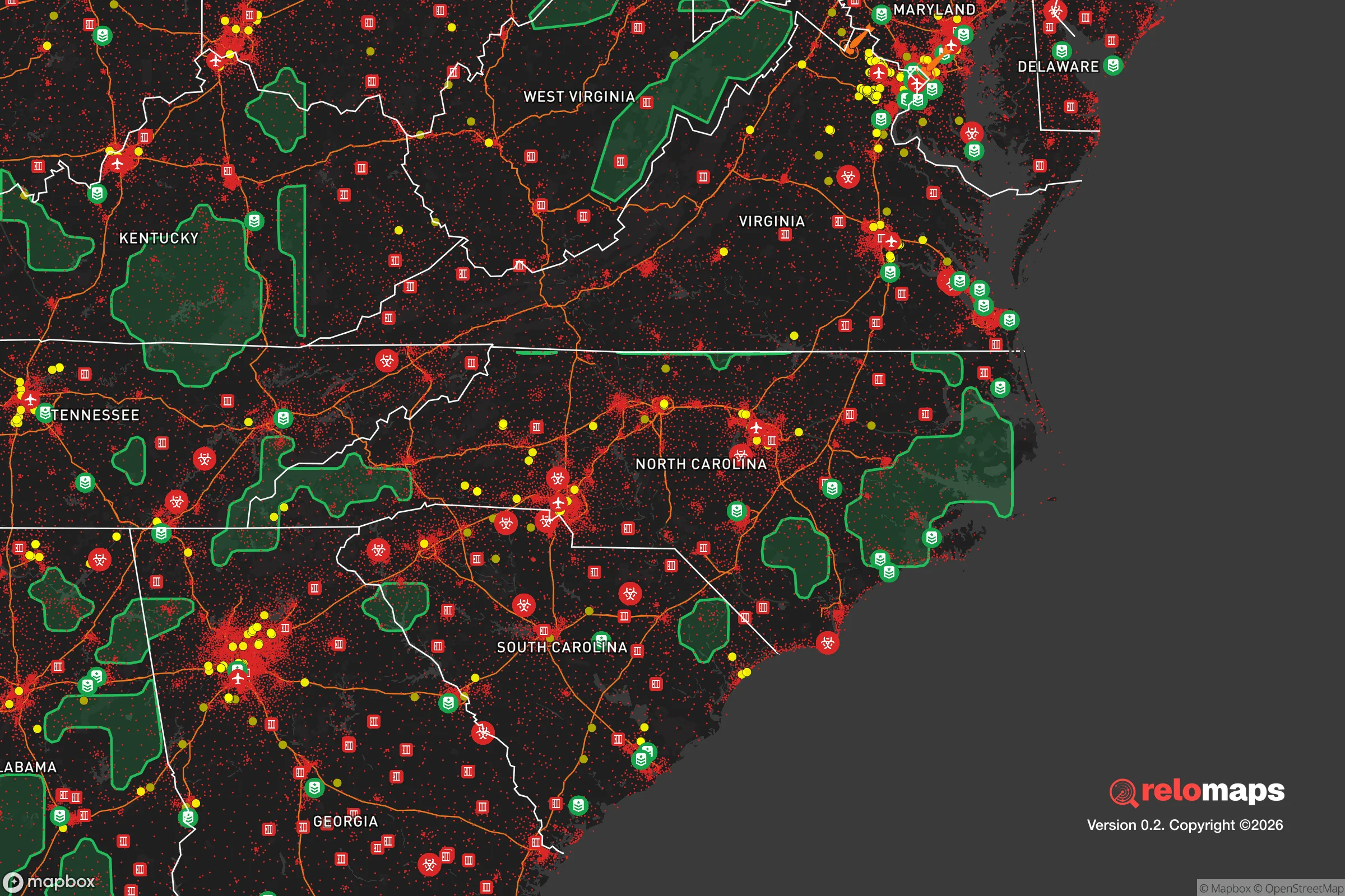


Important Note: For informational purposes only. This does not mean nothing bad ever happens in the green zones. Please use common sense. This is based on public data and modeled with AI. We tried to take a conservative approach but mistakes happen. We update this regularly as new information becomes available.
Solar Generator Recommendations
Backup power matters more here than in safer locations. We've picked three solar generators across budgets and capacity tiers — start with the budget unit if you only need a few essentials, or step up if you want to run a fridge and HVAC for days at a time.

Jackery Portable Power Station Explorer 300
Budget OptionPower on the Go: Weighing only 11 lbs, it's convenient to set up and store with book-sized foldable solar panels

BLUETTI Portable Power Station AC180
Designed for both indoor and outdoor scenarios, AC180 is highly capable as it has a robost capacity and continuous output power.

EF ECOFLOW DELTA Pro Ultra Power Station
Upgraded PickEcoFlow DELTA Pro Ultra is a whole-home energy system designed to grow with your family. Integrated with the Smart Home Panel 2, it scales to meet your evolving energy needs — keeping your home powered, intelligent, and secure through every stage of life.
We earn a commission, at no additional cost to you.
Strategic Assessment Analysis
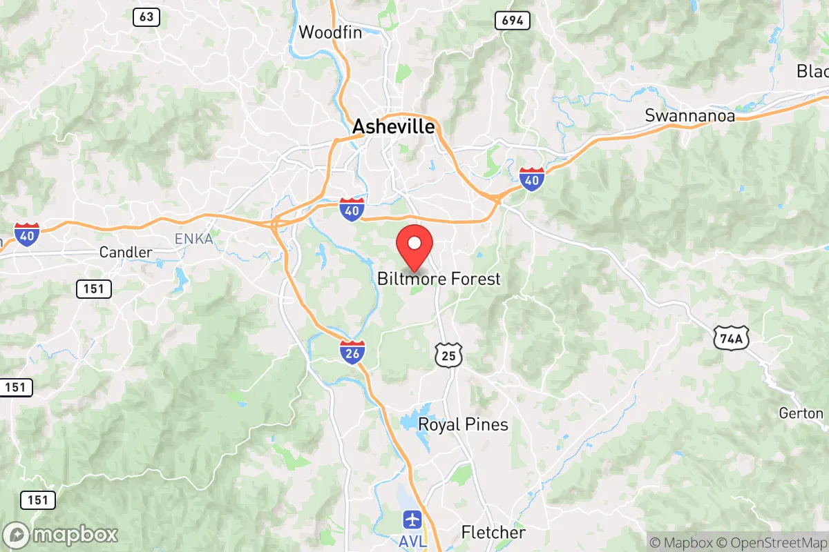
Biltmore Forest, North Carolina, occupies a strategic position in the Blue Ridge Mountains that offers a compelling mix of natural defensibility and access to critical infrastructure, making it a noteworthy option for those prioritizing disaster readiness and long-term self-sufficiency. Its location roughly 10 miles south of Asheville places it within a moderate buffer zone—close enough to a regional hub for supplies and medical care, yet far enough to avoid the immediate chaos of a major urban collapse. The town’s elevation of approximately 2,200 feet and its placement within the French Broad River valley provide natural advantages against many common threats, though the same geography introduces specific vulnerabilities that any relocator must weigh carefully.
Geographic position and natural advantages for long-term security
Biltmore Forest sits on the eastern edge of the Pisgah National Forest, a vast 500,000-acre expanse of rugged terrain that acts as a natural barrier to large-scale population movement. This adjacency provides a significant strategic buffer—any potential threat approaching from the west would need to navigate dense, mountainous forestland, slowing both natural disasters and human-driven disruptions. The area’s elevation also places it above the inversion layer that traps pollutants in the Asheville basin, meaning air quality remains consistently high even during regional wildfire events. The local topography, characterized by steep ridges and narrow valleys, creates natural chokepoints that would be difficult for large groups to traverse, offering a degree of defensibility that flatland suburbs simply cannot match. Additionally, the region’s temperate climate—with average highs in the 80s in summer and lows in the 20s in winter—reduces the risk of extreme heat events that plague lower-elevation areas, while the deep soil and abundant rainfall support robust local agriculture.
Risk exposures, natural hazards, and proximity to fallout-relevant landmarks
No location is without risk, and Biltmore Forest’s mountain setting comes with specific exposures that demand attention. The primary natural threat is flash flooding from the French Broad River and its tributaries, particularly during heavy rain events or rapid snowmelt. While the town itself sits on higher ground, lower-lying areas along the river corridor—including parts of the Biltmore Estate grounds and nearby Biltmore Village—have experienced significant flooding historically, most notably during Hurricane Helene in 2024. Wildfire risk is moderate but real, especially during dry spells when the surrounding national forest becomes tinder; the 2016 Party Rock Fire near Lake Lure demonstrated how quickly mountain fires can spread. Seismic activity is minimal, with the region experiencing only minor tremors, and tornadoes are rare due to the mountainous terrain disrupting storm formation. From a man-made risk perspective, the area’s primary vulnerability is its proximity to Asheville’s infrastructure. Asheville is home to the Asheville Regional Airport (AVL) and a major interstate junction (I-40 and I-26), both of which could become targets or chokepoints during a national crisis. The French Broad River also hosts the Asheville Water Treatment Plant, a critical node whose disruption would affect the entire region. While Biltmore Forest is not near any nuclear power plants (the closest is Oconee in South Carolina, roughly 60 miles away), its position within a 50-mile radius of a mid-sized city means it would not be immune to fallout from a broader societal collapse—though the mountain barriers would significantly attenuate any blast or radiation effects compared to open terrain.
Practical resilience for a relocator: food, water, energy, and defensibility
For someone serious about self-sufficiency, Biltmore Forest offers a mixed but generally favorable picture. Water availability is excellent: the area receives roughly 45 inches of rainfall annually, and numerous springs and streams feed into the French Broad watershed. Many properties in Biltmore Forest have private wells, and the town’s water supply comes from a combination of groundwater and surface sources, reducing dependence on a single municipal system. However, the town is not entirely off-grid—most homes are connected to the Asheville water system, which could be compromised during a prolonged emergency. Food production potential is strong due to the region’s fertile mountain soil and long growing season (roughly 180 days). The surrounding area is dotted with small farms, orchards, and community gardens, and the nearby Asheville City Market provides access to local produce. For those willing to invest, the land supports fruit trees (apples, pears, peaches), berries, and cold-hardy vegetables. Energy resilience is a weaker point: the grid is served by Duke Energy, and while outages are common during winter storms, the town’s tree-lined streets mean falling limbs frequently take down power lines. Solar potential is moderate—the region gets about 200 sunny days per year, less than the Southwest but enough for a well-designed off-grid system with battery storage. Defensibility is where Biltmore Forest truly shines. The town is a gated community with a single main entrance off Hendersonville Road (US 25), and the surrounding terrain creates natural barriers. The Biltmore Forest Police Department provides a dedicated law enforcement presence, and the town’s low crime rate (violent crime is virtually nonexistent) means that in a crisis, the community would likely organize effectively rather than descend into chaos. The Biltmore Estate itself, with its 8,000 acres of private land, serves as a de facto buffer zone to the north, limiting access from that direction. For a relocator, the key trade-off is between the security of a gated, affluent community and the potential vulnerability of being tied to a regional infrastructure hub—but for those who can afford the premium, the defensibility is hard to beat.
The overall strategic picture for Biltmore Forest is one of calculated advantage with manageable trade-offs. It offers a rare combination of natural barriers, water abundance, and community cohesion that makes it a strong candidate for those prioritizing long-term resilience over urban convenience. The primary downsides—flood risk in lower areas, moderate wildfire exposure, and dependence on Asheville’s infrastructure—are not dealbreakers for a prepared relocator, especially one willing to invest in backup systems (solar, well, food storage) and choose a property on higher ground. For a single individual or family with the resources to secure a home in this enclave, Biltmore Forest provides a defensible, resource-rich base that balances proximity to civilization with genuine strategic depth. It is not a remote survivalist retreat, but rather a well-positioned outpost for those who want to be ready for whatever comes without abandoning the comforts of modern life.

* Values derived from national, state, county, city and local statistics and may differ in a specific area. Last updated: 2026-10-15T16:38:07.000Z
Narrative content on this page is AI-generated and may contain mistakes. Verify any details that matter before acting on them.
ReloMaps may earn a commission from affiliate links at no extra cost to you.

