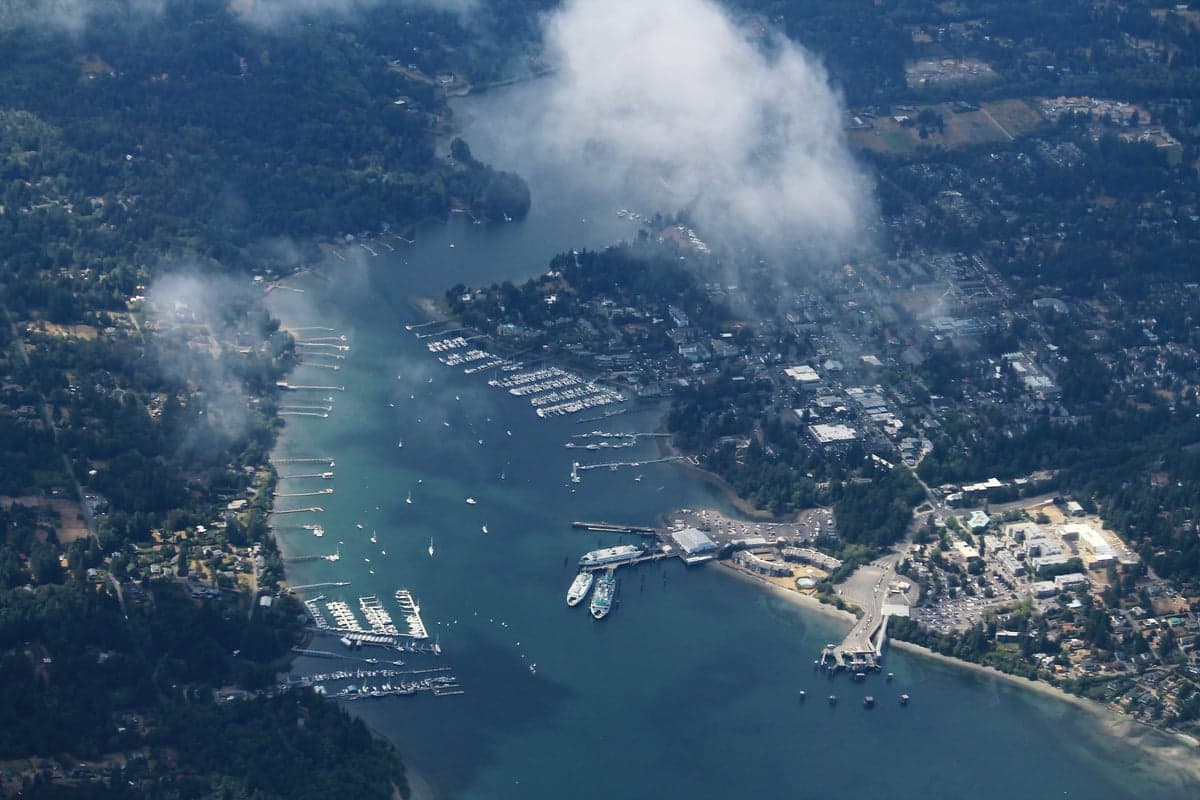
Photo: Wikipedia
Strategic Assessment of Bainbridge Island, WA
Multiple tactical vulnerabilities. Population density, target proximity, or disaster risk are likely compounding. A retreat property and exit planning is required.
What does the Strategic Assessment tell us?
Our Strategic Assessment grades tactical survivability of an area. Major population centers, military targets, fallout zones, natural disasters, and border exposure all drive risk — lower exposure means a more defensible position in a crisis.
This is heavily inspired by Joel Skousen's Strategic Relocation book. Highly recommended you checkout the book ($)What does this tell us?
Our Strategic Assessment grades tactical survivability of an area. Major population centers, military targets, fallout zones, natural disasters, and border exposure all drive risk — lower exposure means a more defensible position in a crisis.
This is heavily inspired by Joel Skousen's Strategic Relocation book. Highly recommended you checkout the book ($)Strategic Pillars

Key Distances
Regional Safe Places
Below is our recommended "safe zones" in Washington and the surrounding area based on our strategic heuristics. For most people, it's unrealistic to live in a “safe zone” full-time due to work, family or other personal reasons. They tend to be more rural. However, many of these areas are perfect for second homes and retreat properties that double as a vacation home or even a short-term rental.
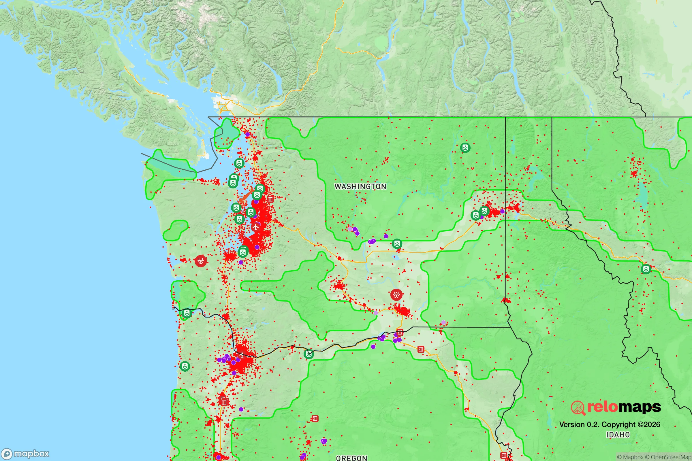
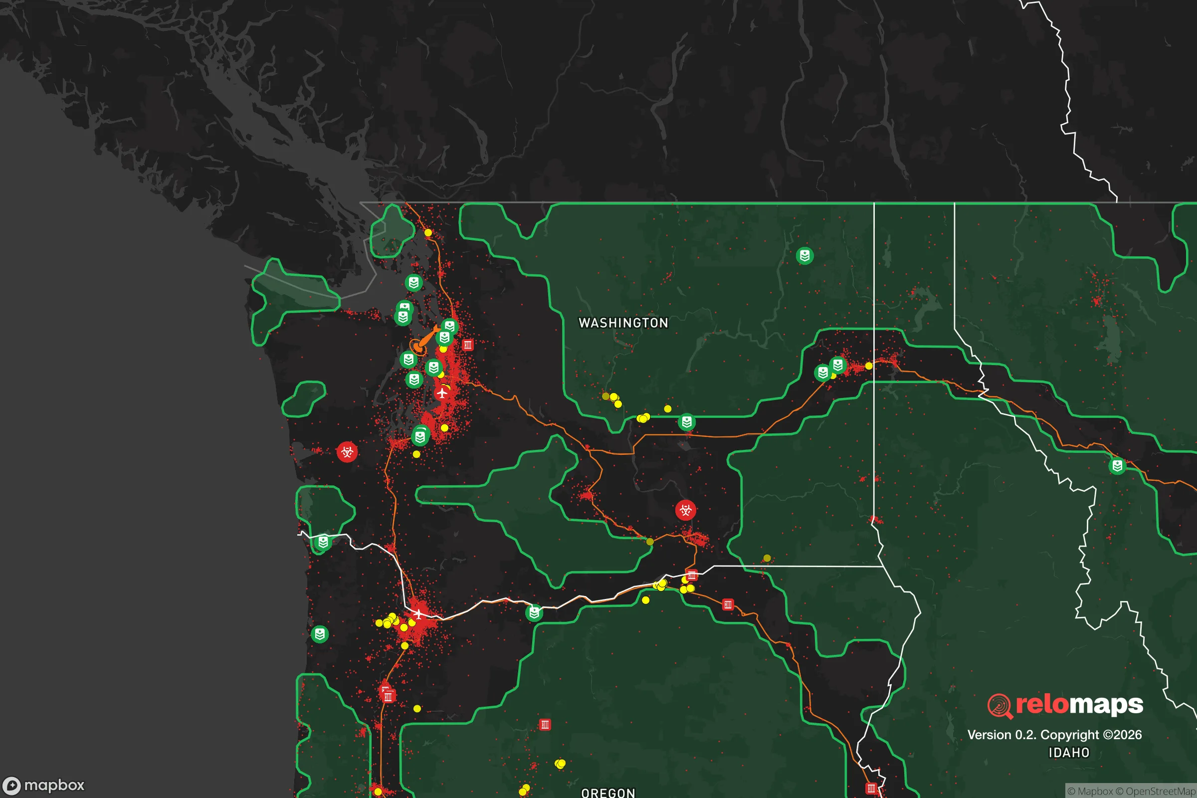


Important Note: For informational purposes only. This does not mean nothing bad ever happens in the green zones. Please use common sense. This is based on public data and modeled with AI. We tried to take a conservative approach but mistakes happen. We update this regularly as new information becomes available.
Solar Generator Recommendations
Backup power matters more here than in safer locations. We've picked three solar generators across budgets and capacity tiers — start with the budget unit if you only need a few essentials, or step up if you want to run a fridge and HVAC for days at a time.

Jackery Portable Power Station Explorer 300
Budget OptionPower on the Go: Weighing only 11 lbs, it's convenient to set up and store with book-sized foldable solar panels

BLUETTI Portable Power Station AC180
Designed for both indoor and outdoor scenarios, AC180 is highly capable as it has a robost capacity and continuous output power.

EF ECOFLOW DELTA Pro Ultra Power Station
Upgraded PickEcoFlow DELTA Pro Ultra is a whole-home energy system designed to grow with your family. Integrated with the Smart Home Panel 2, it scales to meet your evolving energy needs — keeping your home powered, intelligent, and secure through every stage of life.
We earn a commission, at no additional cost to you.
Strategic Assessment Analysis
Bainbridge Island sits in a genuinely unusual strategic position for the Pacific Northwest: close enough to Seattle for economic access, yet separated by enough saltwater to function as a distinct operational zone. For a relocator thinking about resilience, the island's core advantage is that it is a landmass with a single, controllable point of entry—the Washington State Ferries terminal at Winslow—which fundamentally changes the security calculus compared to a mainland suburb. The trade-off is that you are betting on maritime logistics, and that bet deserves serious scrutiny before you commit.
Geographic position and natural advantages for long-term stability
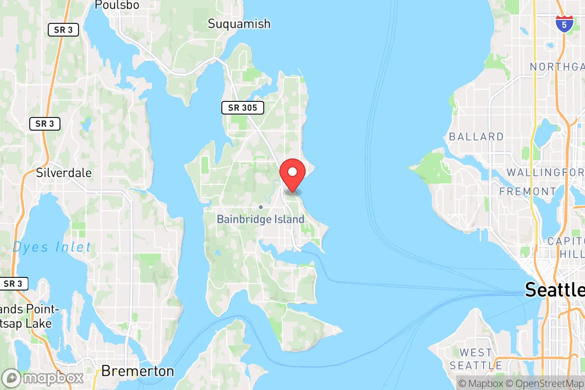
The island spans roughly 28 square miles in central Puget Sound, positioned about 8 miles west of downtown Seattle and a similar distance from the Kitsap Peninsula. Its topography is rolling hills, forested ridges, and roughly 53 miles of shoreline, with the majority of development clustered around Winslow, the island's only incorporated town. This is not flat, exposed terrain; the island's natural relief provides some shielding and multiple microclimates, which matters for both water catchment and passive defense.
The most significant natural advantage is the water barrier itself. Puget Sound is cold, deep, and fast-moving in places, and the island has no bridge—only ferry service. That means any disruption to ferry operations, whether from a seismic event, fuel shortage, or civil unrest, immediately reduces both inbound threats and outbound options. For a family, this is a double-edged sword: it is excellent for keeping problems out, but it can trap you in if you have not planned for extended self-sufficiency. The island's soils are generally workable for small-scale agriculture, and the maritime climate—cool, wet winters and mild, dry summers—supports year-round food production with proper infrastructure.
Risk exposure and proximity to fallout-relevant landmarks
Here is where the analysis gets serious. Bainbridge Island is 8 miles from Seattle, 12 miles from Bremerton's Puget Sound Naval Shipyard, and roughly 20 miles from Joint Base Lewis-McChord, one of the largest military installations on the West Coast. In a conflict scenario involving nuclear exchange, these are primary or secondary targets. The prevailing winds in Puget Sound generally blow from the southwest, which means fallout from a strike on Bremerton or Seattle would likely drift toward the east and northeast—potentially sparing the island from the heaviest deposition, but this is a probabilistic assessment, not a guarantee. The island's position in the central Sound means it is downwind of some targets and upwind of others, and no one can predict wind patterns at altitude in a crisis.
Beyond nuclear concerns, the island sits in a seismically active zone. The Seattle Fault runs roughly east-west through the southern portion of Puget Sound, and the Cascadia Subduction Zone offshore poses a credible threat of a magnitude 9.0 earthquake and subsequent tsunami. The island's western shoreline is exposed to the Strait of Juan de Fuca's fetch, and a tsunami generated by a subduction-zone rupture could reach the island's western beaches within 30 to 60 minutes. The eastern side, facing Seattle, is more sheltered. Landslide risk exists on steep slopes, particularly after heavy rain, and the island's many shoreline homes are vulnerable to sea-level rise and storm surge.
Practical resilience for a relocator: food, water, energy, and defensibility
For a family serious about self-sufficiency, Bainbridge offers a mixed but workable picture. The island has no municipal water utility for most residents—the majority rely on private wells, which is a genuine resilience asset because you control your water source. Well depth and yield vary significantly across the island, so a pre-purchase well test is non-negotiable. The island's aquifer is generally healthy, but saltwater intrusion is a documented concern in some coastal areas, and a major seismic event could disrupt groundwater flow patterns. Rainwater catchment is legal and practical here, with the island receiving roughly 35-40 inches of precipitation annually, concentrated from October through May.
Food security is achievable but requires effort. The island has a strong agricultural heritage, with several working farms, a robust farmers market in Winslow, and a community of home gardeners. The growing season is moderate—roughly 150-180 frost-free days—and cool-weather crops thrive. However, the island is not a net food producer; it imports the vast majority of its calories via ferry, and a multi-week disruption to ferry service would empty grocery shelves within days. A serious relocator should plan for at least 90 days of stored food per person, plus the ability to grow and preserve a meaningful portion of annual calories.
Energy is the island's weakest link. There is no natural gas pipeline to Bainbridge; most homes rely on electricity from Puget Sound Energy, delivered via underwater cables, or on heating oil and propane. A Cascadia event would likely knock out power for weeks, and the island's distribution system is not hardened for a major seismic event. Solar with battery storage is the most viable path to energy independence, and the island's summer sun is adequate for a well-designed system, though winter generation drops significantly. Wood heat is a practical supplement, and the island has ample forest cover for sustainable firewood harvesting.
Defensibility is where the island shines. The ferry terminal is the only public vehicle access, and it is a choke point that could be secured with minimal force. Private boats and kayaks offer secondary access points, but the cold water and strong currents make casual entry difficult. The island's road network is limited, with a few main arteries and many dead-end rural roads, which complicates movement for any outsider. For a family that has prepared—with stored supplies, a community network, and a defensible property—Bainbridge offers a level of physical security that few mainland locations can match.
The overall strategic picture is nuanced. Bainbridge Island is not a remote survivalist retreat; it is a wealthy, well-connected suburb with a ferry dependency and proximity to high-value targets. But for a relocator who understands the trade-offs, it offers a rare combination: a controllable perimeter, a viable agricultural base, private water sources, and a community that is generally educated and prepared. The key is to treat the island as a maritime outpost, not a mainland suburb. That means planning for ferry disruption, building energy independence, storing food, and establishing relationships with neighbors before a crisis. If you do that, Bainbridge is one of the stronger resilience bets in the Puget Sound region. If you do not, the island's advantages evaporate quickly when the boats stop running.

* Values derived from national, state, county, city and local statistics and may differ in a specific area. Last updated: 2026-10-29T04:38:01.000Z
Narrative content on this page is AI-generated and may contain mistakes. Verify any details that matter before acting on them.
ReloMaps may earn a commission from affiliate links at no extra cost to you.

