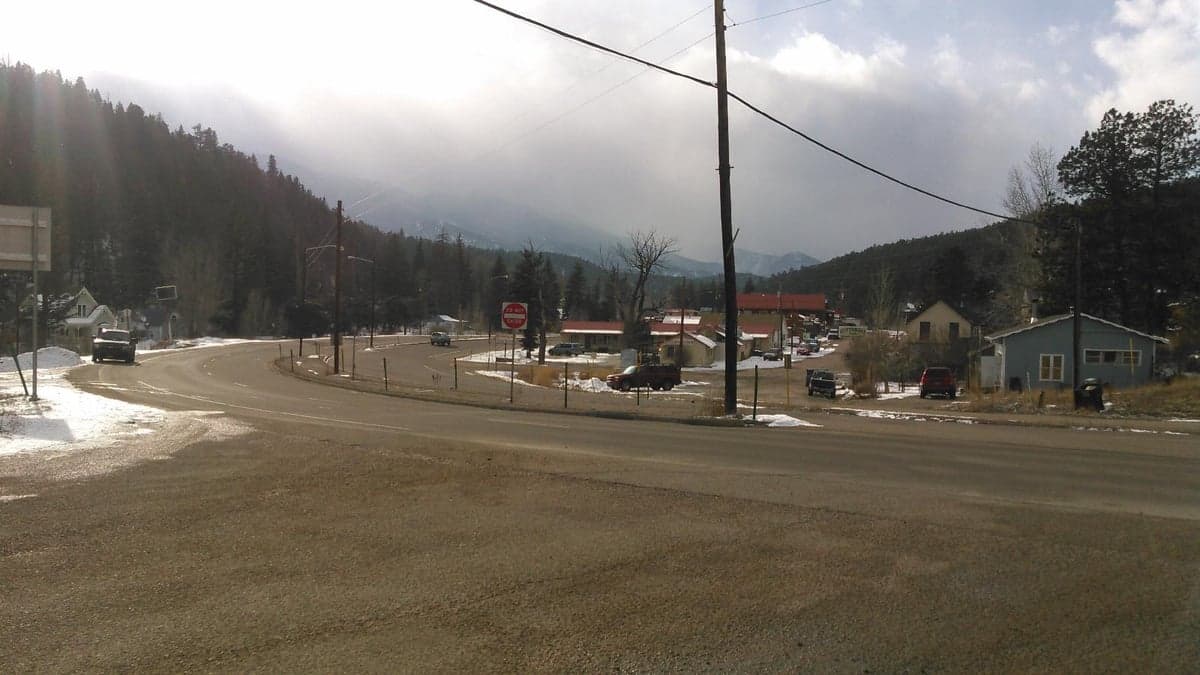
Photo: Wikipedia
Strategic Assessment of Bailey, CO
Workable tactical position. Some exposure to population density or targets, but generally defensible in a crisis.
What does the Strategic Assessment tell us?
Our Strategic Assessment grades tactical survivability of an area. Major population centers, military targets, fallout zones, natural disasters, and border exposure all drive risk — lower exposure means a more defensible position in a crisis.
This is heavily inspired by Joel Skousen's Strategic Relocation book. Highly recommended you checkout the book ($)What does this tell us?
Our Strategic Assessment grades tactical survivability of an area. Major population centers, military targets, fallout zones, natural disasters, and border exposure all drive risk — lower exposure means a more defensible position in a crisis.
This is heavily inspired by Joel Skousen's Strategic Relocation book. Highly recommended you checkout the book ($)Strategic Pillars

Key Distances
Regional Safe Places
Below is our recommended "safe zones" in Colorado and the surrounding area based on our strategic heuristics. For most people, it's unrealistic to live in a “safe zone” full-time due to work, family or other personal reasons. They tend to be more rural. However, many of these areas are perfect for second homes and retreat properties that double as a vacation home or even a short-term rental.
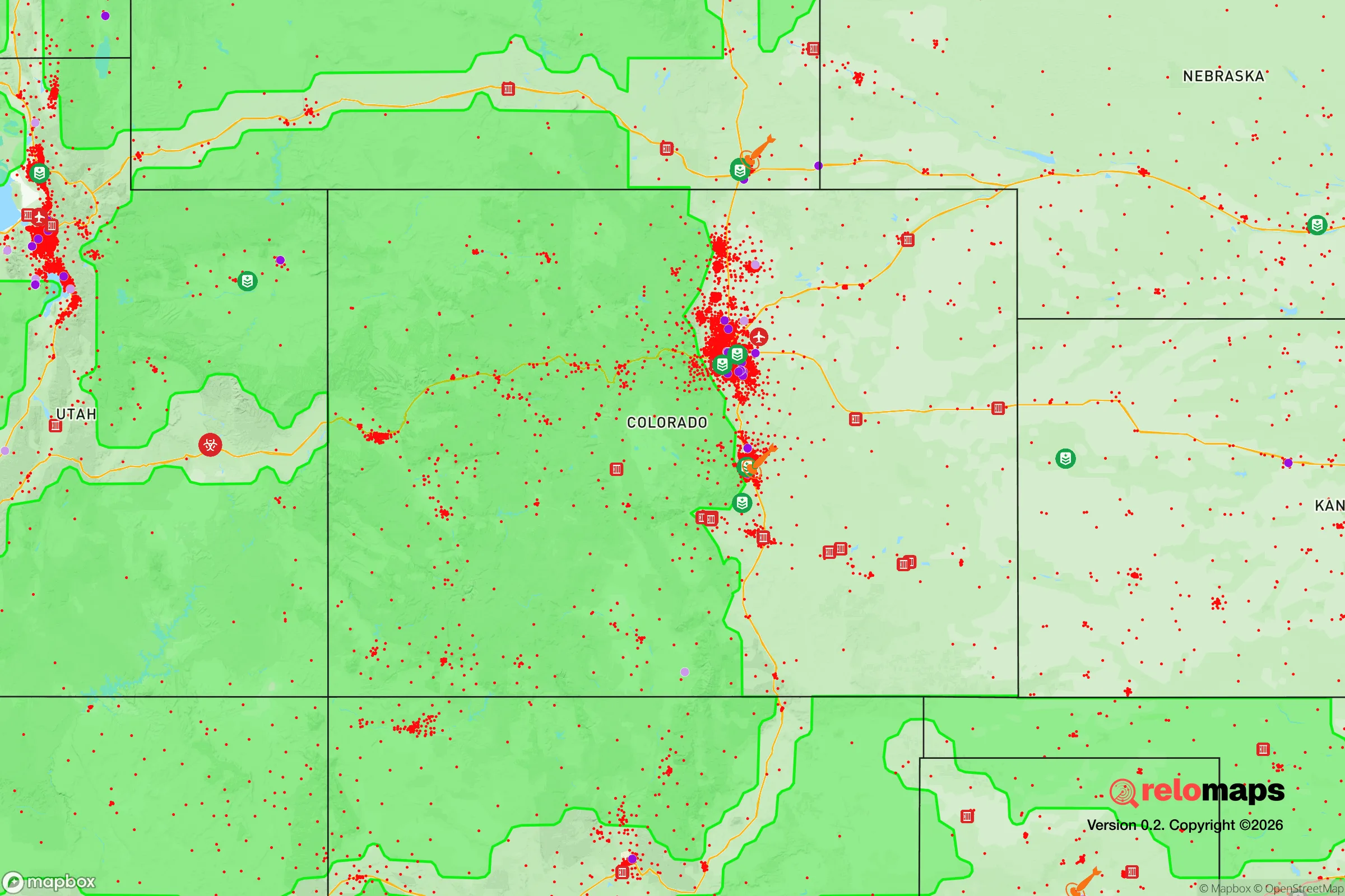
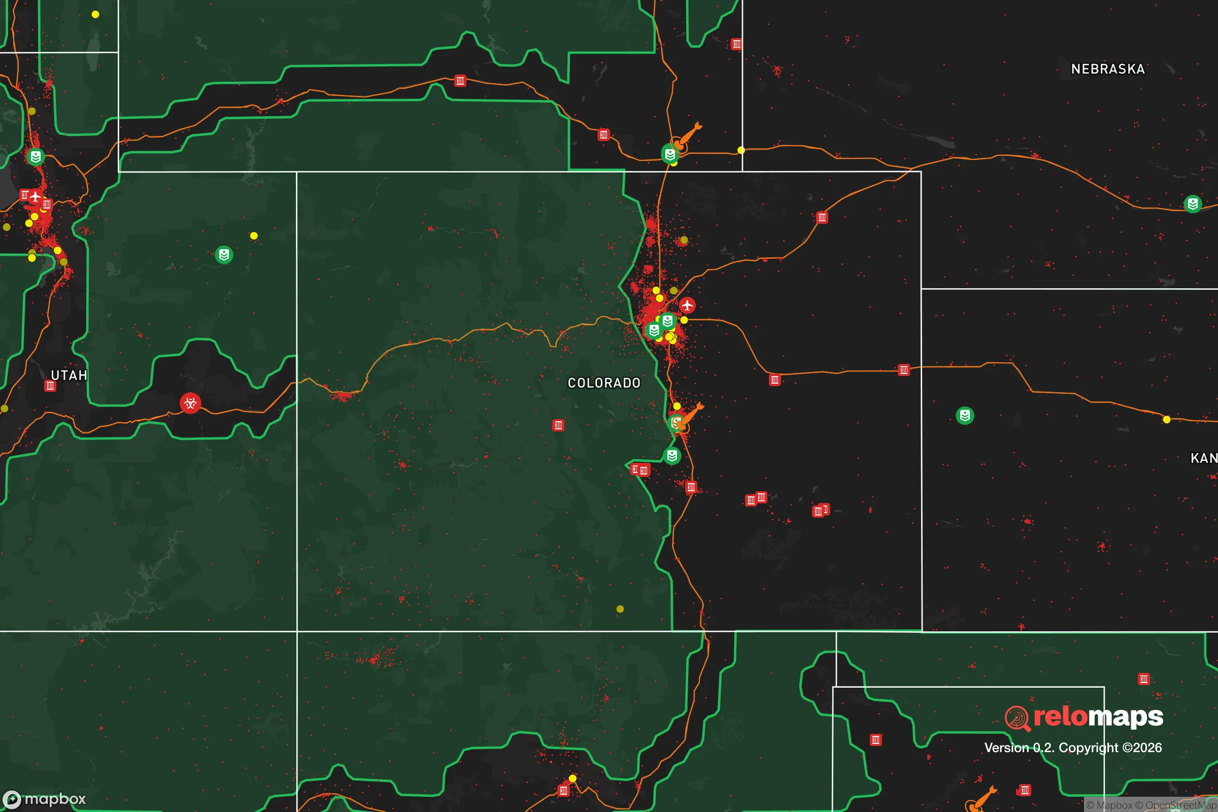


Important Note: For informational purposes only. This does not mean nothing bad ever happens in the green zones. Please use common sense. This is based on public data and modeled with AI. We tried to take a conservative approach but mistakes happen. We update this regularly as new information becomes available.
Solar Generator Recommendations
Backup power matters more here than in safer locations. We've picked three solar generators across budgets and capacity tiers — start with the budget unit if you only need a few essentials, or step up if you want to run a fridge and HVAC for days at a time.

Jackery Portable Power Station Explorer 300
Budget OptionPower on the Go: Weighing only 11 lbs, it's convenient to set up and store with book-sized foldable solar panels

BLUETTI Portable Power Station AC180
Designed for both indoor and outdoor scenarios, AC180 is highly capable as it has a robost capacity and continuous output power.

EF ECOFLOW DELTA Pro Ultra Power Station
Upgraded PickEcoFlow DELTA Pro Ultra is a whole-home energy system designed to grow with your family. Integrated with the Smart Home Panel 2, it scales to meet your evolving energy needs — keeping your home powered, intelligent, and secure through every stage of life.
We earn a commission, at no additional cost to you.
Strategic Assessment Analysis
Bailey, Colorado, offers a genuinely strong strategic position for a relocator focused on resilience, sitting at roughly 7,700 feet in the South Platte River corridor of Park County. The town’s core advantage is its combination of mountain seclusion and practical access—about 45 miles southwest of Denver via U.S. 285, yet far enough into the Front Range foothills that it avoids the suburban sprawl and congestion of the metro area. For a single individual or family weighing disaster readiness, Bailey provides a defensible, resource-rich base with real trade-offs in winter access and proximity to a major metropolitan target zone.
Geographic position and natural advantages for long-term security
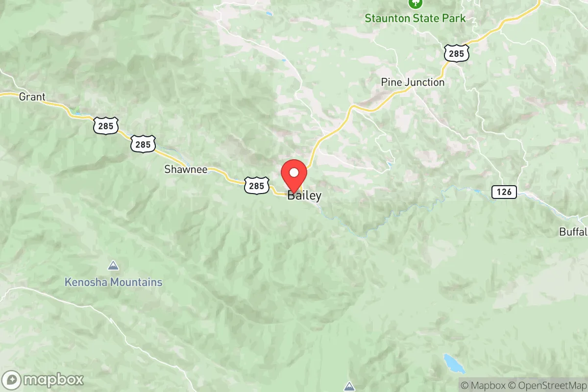
Bailey’s geography is its first and most important asset. The town sits in a narrow valley flanked by the Pike National Forest and the Kenosha Mountains, with the North Fork of the South Platte River running through it. That valley setting offers natural chokepoints—U.S. 285 is the primary artery, and secondary routes like County Road 43 and 126 provide limited but usable egress. For a resilience-minded reader, this means the area is inherently harder to reach than open plains or suburban subdivisions, which cuts both ways: it slows unwanted visitors but also complicates rapid evacuation.
The surrounding national forest land is a double-edged sword. On one hand, it provides a massive buffer of undeveloped, publicly owned terrain that will never be subdivided, giving Bailey a permanent rural character and reducing the risk of dense encroachment. On the other, that same forest is a fuel load for wildfire, and the town’s tree-lined lots and pine stands mean many homes sit in the wildland-urban interface. Elevation is a genuine advantage for climate resilience—summers are mild, with highs typically in the 70s and 80s, and the area avoids the extreme heat waves that increasingly plague lower-elevation Front Range cities. Water is relatively abundant from the South Platte and its tributaries, though the system is shared and heavily allocated downstream.
Risks, exposures, and proximity to fallout-relevant landmarks
The most significant strategic vulnerability for Bailey is its proximity to the Denver metropolitan area, which is roughly 45 miles northeast as the crow flies. In a major conflict scenario involving nuclear exchange, Denver is a plausible target given its concentration of military, government, and infrastructure assets—including Buckley Space Force Base in Aurora and the U.S. Northern Command at Peterson Space Force Base in Colorado Springs, about 70 miles south. Bailey sits outside the likely immediate blast and thermal zones for a Denver strike, but fallout patterns are wind-dependent, and the prevailing westerlies in this region actually work in Bailey’s favor, pushing contamination eastward away from the mountains. Still, a relocator should not assume the town is immune; a ground burst upwind could deposit measurable fallout within hours.
Beyond man-made risks, the natural hazard profile is manageable but real. Wildfire is the top seasonal threat, with the 2020 Williams Fork Fire and the 2018 Buffalo Mountain Fire serving as nearby reminders of how quickly conditions can turn. The town’s narrow canyon and limited road network mean a fast-moving fire could trap residents, so defensible space and a pre-planned evacuation route are non-negotiable. Winter is the other major factor—Bailey receives roughly 60-80 inches of snow annually, and U.S. 285 can close for hours during blizzards, isolating the town for short periods. That isolation is a resilience feature if you are prepared, but a liability if you are not. Seismic risk is low, and the area is not prone to tornadoes or hurricanes, making it a relatively stable geological choice.
Practical resilience for a relocator: food, water, energy, and defensibility
For a serious self-sufficiency plan, Bailey’s practical resilience is above average for a mountain town but requires deliberate effort. Water is the strongest suit: private wells are common in the surrounding areas, and the South Platte provides a surface source, though treatment is necessary. The town’s municipal water system serves the core, but a well-equipped property with a backup pump and storage tanks is the gold standard here. Food security is more challenging—the growing season is short, roughly 60-90 days, and the high elevation and cool nights limit what can be cultivated. Cold-hardy crops like potatoes, root vegetables, and leafy greens do well, and greenhouse or hoop-house production extends the season, but full self-sufficiency in food is unrealistic for most households. The area does have local agricultural producers, including ranches and small farms in the South Park basin to the west, which can supplement supplies.
Energy resilience is a mixed picture. Bailey is served by the Intermountain Rural Electric Association, which has a decent reliability record, but mountain power lines are vulnerable to ice, wind, and wildfire damage. Solar is viable—the area gets over 300 days of sunshine annually—and a grid-tied system with battery backup is a practical investment. Propane is the common heating fuel for off-grid and semi-rural homes, and a 500-gallon tank with a full supply can carry a household through a long winter. Wood stoves are widespread and provide both heat and a cooking source, making them a staple of the local resilience culture. Defensibility is inherent to the terrain: the valley walls and forested ridges create natural sightlines and chokepoints, and the low population density—Park County has roughly 17,000 residents across 2,200 square miles—means neighbors are spaced far enough apart to avoid the cascading failures of dense communities.
One practical note for relocators: Bailey’s proximity to Denver cuts both ways for supply runs. A 45-minute drive to the metro for bulk supplies is feasible in normal times, but in a crisis, that corridor will be congested and potentially contested. Building a 30-90 day supply of food, water, fuel, and medical essentials is the baseline recommendation, not an extreme measure. The local community is small but active, with a strong culture of mutual aid among long-term residents, and the Park County Office of Emergency Management runs regular preparedness programs, including CERT training and community alert systems.
The overall strategic picture for Bailey is favorable for a resilience-focused relocator, with clear caveats. It offers a defensible, water-rich, low-density mountain environment with genuine natural advantages—elevation, climate stability, and abundant public land buffers—while sitting close enough to the Front Range for practical access to jobs, healthcare, and supplies. The primary risks are wildfire, winter isolation, and the theoretical fallout exposure from a Denver-area strike, all of which are manageable with preparation. For a single individual or family willing to invest in well water, solar backup, a wood stove, and a serious supply stockpile, Bailey represents a solid, grounded choice—not a bunker fantasy, but a real, livable position with meaningful strategic depth.

* Values derived from national, state, county, city and local statistics and may differ in a specific area. Last updated: 2026-10-15T02:37:20.000Z
Narrative content on this page is AI-generated and may contain mistakes. Verify any details that matter before acting on them.
ReloMaps may earn a commission from affiliate links at no extra cost to you.

