
Photo: Wikipedia
Strategic Assessment of Crittenden County
Meaningful friction. Expect exposure to either population pressure, blast zones, or natural disaster risk. Consider buying a retreat property.
What does the Strategic Assessment tell us?
Our Strategic Assessment grades tactical survivability of an area. Major population centers, military targets, fallout zones, natural disasters, and border exposure all drive risk — lower exposure means a more defensible position in a crisis.
This is heavily inspired by Joel Skousen's Strategic Relocation book. Highly recommended you checkout the book ($)What does this tell us?
Our Strategic Assessment grades tactical survivability of an area. Major population centers, military targets, fallout zones, natural disasters, and border exposure all drive risk — lower exposure means a more defensible position in a crisis.
This is heavily inspired by Joel Skousen's Strategic Relocation book. Highly recommended you checkout the book ($)Strategic Pillars

Key Distances
Strategic Assessment Analysis
Crittenden County, Arkansas, occupies a strategic position in the lower Mississippi River Valley that offers a mix of genuine resilience advantages and notable exposure risks for a relocator prioritizing self-sufficiency and disaster readiness. The county’s location, anchored by the city of West Memphis and the smaller communities of Marion and Earle, places it at the crossroads of major transportation corridors—Interstates 40 and 55—while still providing access to the agricultural and water resources of the Arkansas Delta. For a reader thinking seriously about long-term stability, Crittenden County presents a workable base with solid fundamentals, but it requires clear-eyed awareness of the vulnerabilities that come with proximity to major urban and industrial centers.
Geographic position and natural advantages for self-sufficiency
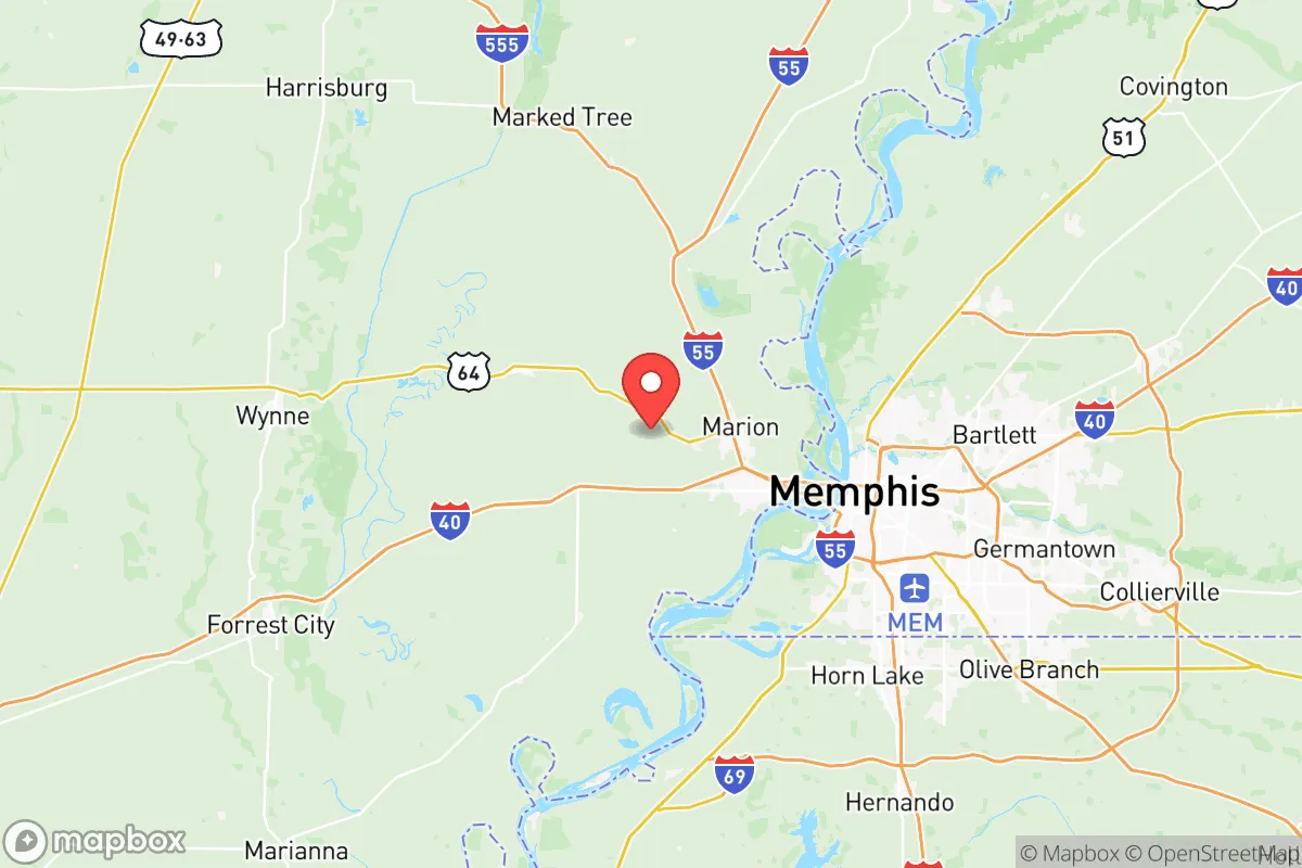
Crittenden County sits on the eastern edge of Arkansas, directly across the Mississippi River from Memphis, Tennessee. This location gives residents access to the river’s vast freshwater supply—a critical asset for any long-term resilience plan. The county’s topography is predominantly flat, fertile floodplain, which historically supported robust agriculture. For a relocator aiming to grow food or raise livestock, the soil here is among the richest in the region, with a long growing season that supports row crops like soybeans, rice, and corn, as well as smaller-scale market gardens. The area’s groundwater is generally abundant and accessible via shallow wells, though water quality can vary due to agricultural runoff and proximity to the river. The Mississippi River itself is a double-edged sword: it provides a reliable water source and a natural transportation corridor, but it also imposes a significant flood risk. The county is protected by a system of levees, but these are not infallible, and the 2011 and 2019 flood events demonstrated that large-scale inundation remains a real possibility. For a relocator, choosing a homesite on higher ground—such as the bluffs near Marion or the slightly elevated areas around the small town of Crawfordsville—can mitigate this risk. The county’s position also means it is far from earthquake-prone zones, though it lies within the New Madrid Seismic Zone’s reach, which could produce significant ground shaking and liquefaction in a major event.
Risks, exposures, and proximity to fallout-relevant landmarks
The most significant strategic drawback of Crittenden County is its proximity to Memphis, a major metropolitan area of roughly 1.3 million people. In a widespread crisis—whether natural disaster, economic collapse, or a larger-scale event—Memphis would likely become a source of population displacement, resource competition, and potential civil unrest. The county’s position as a primary east-west corridor via I-40 and I-55 means it would be a funnel for refugees fleeing the city, which could overwhelm local infrastructure and law enforcement. More specifically, Crittenden County is within 50 miles of several high-value industrial and military targets. The Memphis International Airport is a major FedEx hub, and the city hosts a significant concentration of chemical plants, refineries, and rail yards. The nearby Memphis Defense Depot and the Naval Support Activity Mid-South in Millington, Tennessee, are military installations that could be primary or secondary targets in a conflict scenario. Additionally, the Arkansas Nuclear One power plant near Russellville, about 150 miles west, is a potential fallout source, though prevailing winds would likely carry contamination eastward, away from Crittenden County. The county itself contains no major military bases or nuclear facilities, but its location on the Mississippi River makes it a potential chokepoint for river traffic, which could be a target for sabotage or disruption. For a relocator, the key takeaway is that while Crittenden County is not a primary target, it sits in the shadow of one of the region’s most critical logistics and transportation hubs, which elevates the risk of secondary effects like supply chain disruptions, population influx, and infrastructure strain.
Practical resilience for a relocator: food, water, energy, and defensibility
For a relocator serious about self-sufficiency, Crittenden County offers a mixed but workable picture. Food production is the strongest asset: the county’s agricultural base means that local farmers’ markets, roadside stands, and direct-from-farm sales are common, and the soil is suitable for home gardens and small-scale livestock. The town of Marion has a growing network of community gardens and a farmers’ market that operates from spring through fall. Water access is generally good, with many rural properties having access to groundwater via wells, though well depth and yield vary. The Mississippi River is a backup source, but treatment would be necessary for drinking. Energy resilience is a weaker point. The county is served by the Entergy Arkansas grid, which is reliable under normal conditions but vulnerable to storm-related outages. Solar potential is moderate—the region gets about 210 sunny days per year, slightly below the national average—but battery storage and backup generators are advisable for anyone seeking true independence. Defensibility is challenging due to the flat, open terrain. The county lacks natural barriers like mountains or dense forests that would provide cover or chokepoints. However, rural properties with good sightlines, perimeter fencing, and a well-stocked armory can be made reasonably secure. The small towns of Earle and Crawfordsville offer a more isolated, low-profile option compared to the more populous West Memphis and Marion. The county’s law enforcement presence is modest, with the Crittenden County Sheriff’s Office and local police departments covering a large area, so self-reliance in security is a practical necessity. For a relocator, the best strategy is to choose a property on the western side of the county, away from the river and the Memphis metro area, where land is cheaper, neighbors are fewer, and the risk of being caught in a population surge is lower.
Overall, Crittenden County is a viable but not ideal location for a relocator focused on strategic resilience. Its agricultural potential and water access are genuine advantages, and the low cost of land and housing make it accessible for those building a self-sufficient homestead. However, the proximity to Memphis and the associated risks of population displacement, infrastructure targeting, and supply chain disruption cannot be ignored. For a single individual or family willing to invest in flood mitigation, backup power, and a solid security plan, the county offers a reasonable base of operations. The key is to avoid the riverfront and the I-40/I-55 corridor, and instead focus on the quieter, more rural areas around Earle or Crawfordsville, where the land is cheap, the soil is rich, and the neighbors are few. Crittenden County is not a fortress, but it is a place where a prepared relocator can build a functional, long-term home with a clear understanding of both the opportunities and the risks.

* Values derived from national, state, county, city and local statistics and may differ in a specific area. Last updated: 2026-07-24T06:40:17.000Z
Narrative content on this page is AI-generated and may contain mistakes. Verify any details that matter before acting on them.
ReloMaps may earn a commission from affiliate links at no extra cost to you.

