
Strategic Assessment of Wrangell City And County
Deep buffer from population centers and strategic targets. Low natural disaster risk and minimal exposure to border or coastal threats.
What does the Strategic Assessment tell us?
Our Strategic Assessment grades tactical survivability of an area. Major population centers, military targets, fallout zones, natural disasters, and border exposure all drive risk — lower exposure means a more defensible position in a crisis.
This is heavily inspired by Joel Skousen's Strategic Relocation book. Highly recommended you checkout the book ($)What does this tell us?
Our Strategic Assessment grades tactical survivability of an area. Major population centers, military targets, fallout zones, natural disasters, and border exposure all drive risk — lower exposure means a more defensible position in a crisis.
This is heavily inspired by Joel Skousen's Strategic Relocation book. Highly recommended you checkout the book ($)Strategic Pillars

Key Distances
Strategic Assessment Analysis
Wrangell City and Borough, Alaska, occupies a unique position in the resilience landscape: it is a remote, island-bound community with a deep-water port, a working timber and fishing economy, and a population of roughly 2,100 people. For a relocator prioritizing disaster readiness and self-sufficiency, Wrangell offers genuine geographic isolation without being cut off from essential supply chains, as it sits along the Inside Passage and serves as a regional hub for the Stikine River corridor. Its small scale, maritime climate, and distance from major population centers make it a serious candidate for those seeking a defensible, low-exposure base in the Pacific Northwest.
Geographic position and natural advantages for long-term security
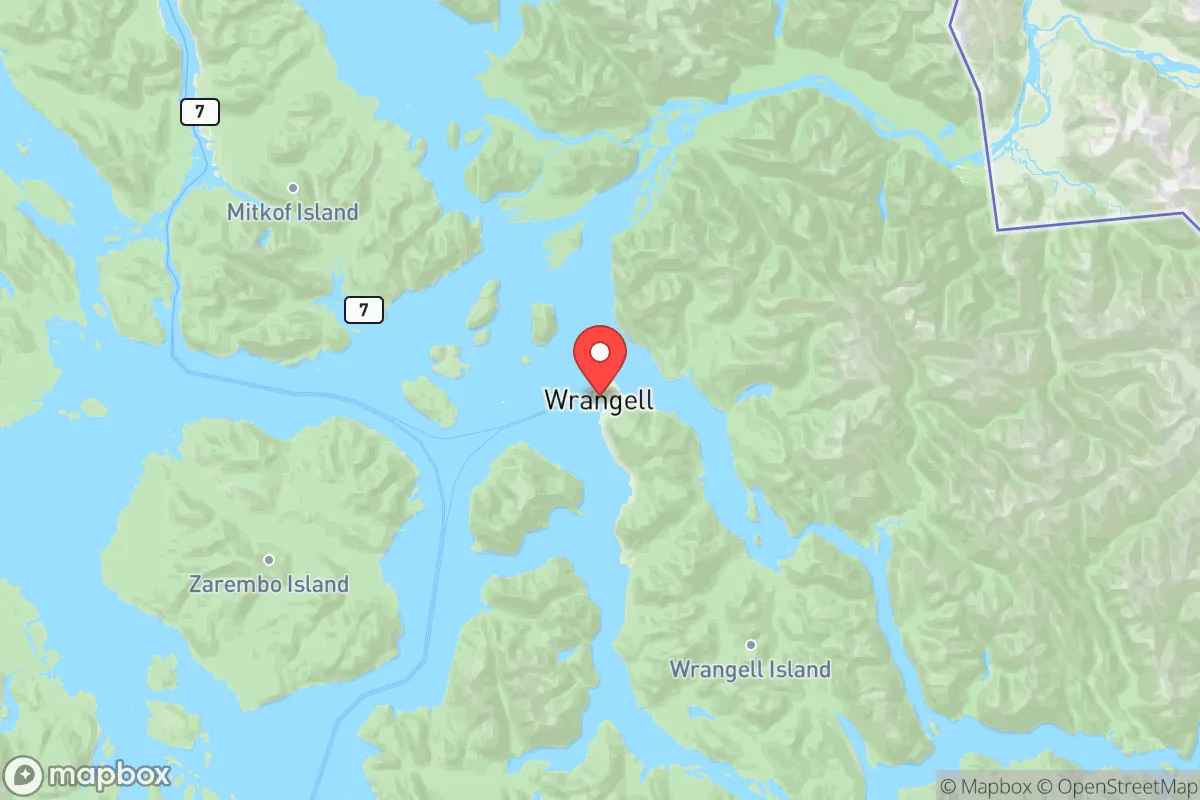
Wrangell is located on the northern tip of Wrangell Island, roughly 80 miles southeast of Juneau and 150 miles southwest of Whitehorse, Yukon. The borough encompasses the entire island plus a mainland strip along the Stikine River delta, giving residents access to both saltwater and freshwater systems. The area's defining natural advantage is its position at the mouth of the Stikine River, one of the largest undammed rivers in North America, which provides a reliable freshwater source and a corridor into the interior. The surrounding Tongass National Forest offers dense timber, abundant wildlife, and a buffer against outside disruption. Unlike many Southeast Alaska communities, Wrangell has a road system that connects the town to the airport, ferry terminal, and outlying residential areas, which improves internal mobility and defensibility. The deep-water port, capable of handling ocean-going vessels, is a strategic asset for receiving supplies or exporting goods if overland routes become compromised. The nearby Anan Creek bear viewing area and the Stikine-LeConte Wilderness further underscore the region's intact ecosystems, which can support subsistence hunting and fishing.
Risks, exposures, and proximity to fallout-relevant landmarks
Wrangell's primary risk profile is natural rather than man-made. The area sits within the Alaska-Aleutian subduction zone, meaning significant earthquake and tsunami risk is a real concern. The 1964 Good Friday earthquake generated a local tsunami that caused damage in Wrangell, and the community has since invested in tsunami evacuation routes and warning systems. Volcanic ashfall from the Wrangell Volcanic Field, including Mount Wrangell and Mount Churchill, is an intermittent hazard that can disrupt air travel and contaminate water supplies. For a relocator worried about man-made threats, Wrangell's advantages are substantial: it is over 600 miles from the nearest major military installation (Joint Base Elmendorf-Richardson in Anchorage) and more than 900 miles from the nearest major refinery or petrochemical complex (the Kenai Peninsula refineries). There are no nuclear power plants, major industrial facilities, or high-value military targets within the borough. The closest plausible fallout-relevant landmark is the Ketchikan shipyard, roughly 100 miles to the south, which is a modest facility focused on vessel repair rather than strategic military production. The Port of Wrangell itself handles fuel, seafood, and timber products but does not store or process hazardous materials at scale. For a reader assessing proximity to targets, Wrangell's isolation from the Lower 48's critical infrastructure grid is a clear positive.
Practical resilience for a relocator: food, water, energy, and defensibility
Wrangell's practical resilience is mixed but generally favorable for a prepared individual. Food security is the strongest pillar: the area supports year-round commercial and subsistence fishing for salmon, halibut, crab, and shrimp, while the Stikine River delta provides waterfowl and moose hunting. The maritime climate allows for extended growing seasons for cold-hardy vegetables, and several local greenhouses and community garden plots exist. However, the town relies heavily on barge and air freight for staples like grains, dairy, and fresh produce, meaning a disruption to the Alaska Marine Highway System or the Wrangell Airport could create shortages within two to three weeks. Water security is excellent: the borough draws from Shoemaker Bay and local reservoirs fed by mountain runoff, and the Stikine River offers a virtually unlimited backup source. Most homes have private wells or are connected to the municipal system, which is gravity-fed and does not require pumping. Energy security is the weakest link. Wrangell's electricity comes from diesel generators and a small hydroelectric plant at the nearby Falls Creek facility, but the hydro output is seasonal and insufficient to meet peak demand. The community is not connected to any regional grid, so a diesel supply disruption would force conservation measures within days. Solar potential is limited due to heavy cloud cover and short winter days, though some residents supplement with wood heat. Defensibility is high: Wrangell Island's perimeter is rugged and largely uninhabited, with only a handful of road access points into town. The population is small and socially cohesive, with a strong tradition of mutual aid and community emergency response. The local police force and volunteer fire department are capable of maintaining order in most scenarios, though they would be overwhelmed by a large-scale event.
The overall strategic picture for Wrangell is one of a remote, resource-rich outpost with clear trade-offs. It offers genuine isolation from the major risk corridors of the Lower 48 and even from Anchorage and Fairbanks, with abundant natural food and water sources that can sustain a prepared household indefinitely. The primary vulnerabilities are energy dependence on imported diesel and the real threat of seismic and tsunami events, which require active mitigation through planning and infrastructure investment. For a relocator who values self-sufficiency and is willing to invest in off-grid power and food storage, Wrangell represents one of the more defensible and resilient communities in the United States. It is not a place for those who need proximity to urban amenities or specialized medical care, but for a family or individual serious about long-term preparedness in a low-target environment, it merits serious consideration.

* Values derived from national, state, county, city and local statistics and may differ in a specific area. Last updated: 2026-07-24T13:55:02.000Z
Narrative content on this page is AI-generated and may contain mistakes. Verify any details that matter before acting on them.
ReloMaps may earn a commission from affiliate links at no extra cost to you.

