 Popular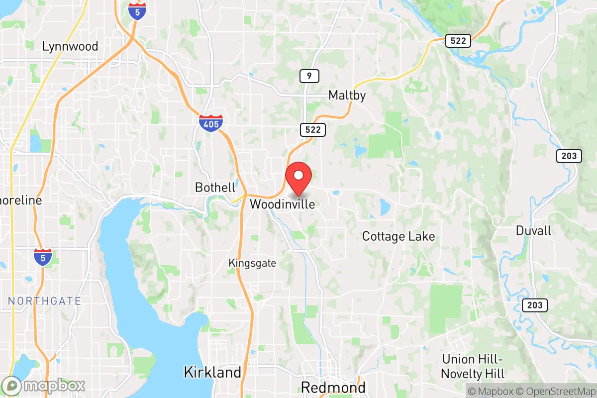
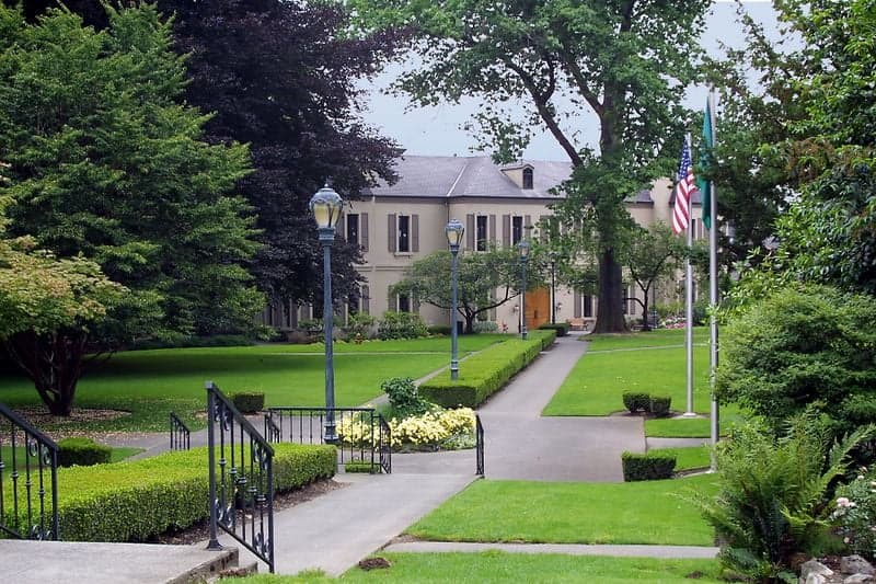
Photo: Wikipedia
Strategic Assessment of Woodinville, WA
Multiple tactical vulnerabilities. Population density, target proximity, or disaster risk are likely compounding. A retreat property and exit planning is required.
What does the Strategic Assessment tell us?
Our Strategic Assessment grades tactical survivability of an area. Major population centers, military targets, fallout zones, natural disasters, and border exposure all drive risk — lower exposure means a more defensible position in a crisis.
This is heavily inspired by Joel Skousen's Strategic Relocation book. Highly recommended you checkout the book ($)What does this tell us?
Our Strategic Assessment grades tactical survivability of an area. Major population centers, military targets, fallout zones, natural disasters, and border exposure all drive risk — lower exposure means a more defensible position in a crisis.
This is heavily inspired by Joel Skousen's Strategic Relocation book. Highly recommended you checkout the book ($)Strategic Pillars

Key Distances
Regional Safe Places
Below is our recommended "safe zones" in Washington and the surrounding area based on our strategic heuristics. For most people, it's unrealistic to live in a “safe zone” full-time due to work, family or other personal reasons. They tend to be more rural. However, many of these areas are perfect for second homes and retreat properties that double as a vacation home or even a short-term rental.
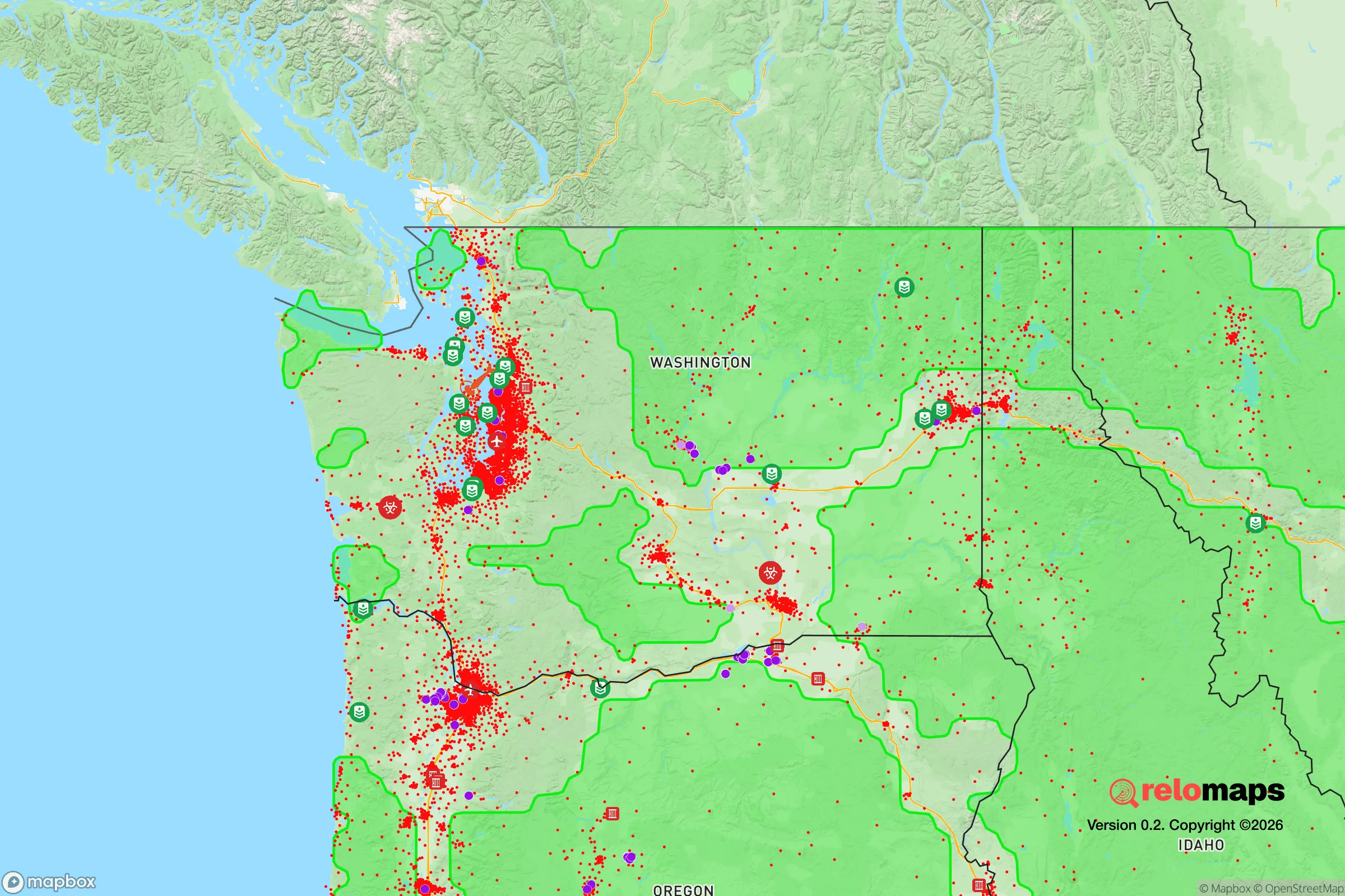
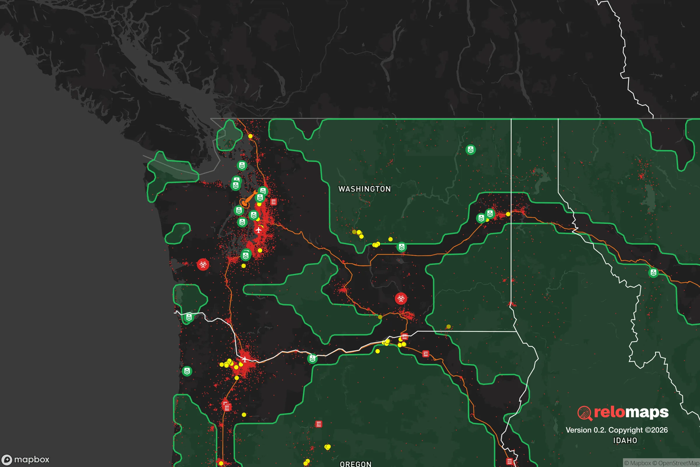


Important Note: For informational purposes only. This does not mean nothing bad ever happens in the green zones. Please use common sense. This is based on public data and modeled with AI. We tried to take a conservative approach but mistakes happen. We update this regularly as new information becomes available.
Solar Generator Recommendations
Backup power matters more here than in safer locations. We've picked three solar generators across budgets and capacity tiers — start with the budget unit if you only need a few essentials, or step up if you want to run a fridge and HVAC for days at a time.

Jackery Portable Power Station Explorer 300
Budget OptionPower on the Go: Weighing only 11 lbs, it's convenient to set up and store with book-sized foldable solar panels

BLUETTI Portable Power Station AC180
Designed for both indoor and outdoor scenarios, AC180 is highly capable as it has a robost capacity and continuous output power.

EF ECOFLOW DELTA Pro Ultra Power Station
Upgraded PickEcoFlow DELTA Pro Ultra is a whole-home energy system designed to grow with your family. Integrated with the Smart Home Panel 2, it scales to meet your evolving energy needs — keeping your home powered, intelligent, and secure through every stage of life.
We earn a commission, at no additional cost to you.
Strategic Assessment Analysis
Woodinville, Washington, occupies a strategic position that balances proximity to the economic engine of the Puget Sound region with a degree of geographic insulation that makes it a serious candidate for a resilience-minded relocator. Situated roughly 20 miles northeast of downtown Seattle, the city sits at the confluence of the Sammamish River and the northern edge of Lake Washington, offering a mix of suburban infrastructure and semi-rural pockets that support a self-sufficiency mindset. Its location within King County, while politically liberal, provides access to robust emergency services and regional supply chains, yet the area’s natural topography—rolling hills, dense forest, and river valleys—creates natural buffers that can slow the spread of urban chaos or contamination. For a conservative-leaning individual or family weighing disaster readiness, Woodinville presents a nuanced trade-off: it is not a remote redoubt, but it is far from a soft target, with enough local resources and defensible geography to warrant a serious look.
Geographic position and natural advantages for self-sufficiency
Woodinville’s geography is defined by its position in the Sammamish River Valley, flanked by the Cascade foothills to the east and the Lake Washington watershed to the west. This placement offers several resilience advantages. The surrounding terrain—including the 3,000-foot peaks of the Cascades visible from the city—provides natural barriers that complicate large-scale movement from the Seattle metro area, effectively creating a funnel that can be monitored or controlled. The city itself sits at an elevation of roughly 50 to 200 feet, well above the flood-prone lowlands of the Sammamish River, though some neighborhoods near the river do face periodic flooding during heavy rain events. The region’s temperate maritime climate, with annual rainfall averaging 37 inches, supports year-round food production, and the area’s rich volcanic soils (from the Cascade Range) are ideal for gardening and small-scale agriculture. Woodinville is also home to the Woodinville Water District, which draws from the Tolt River and the City of Seattle’s Cedar River watershed, providing a relatively reliable municipal water supply. However, for a self-sufficient relocator, the presence of numerous creeks, springs, and shallow aquifers—especially in the rural areas east of the city toward Maltby—offers opportunities for independent water sourcing. The city’s location also places it within a 30-minute drive of the Snoqualmie Pass (I-90) and the Stevens Pass (US-2) corridors, which are critical for evacuation or resupply routes into the interior of the state, though these passes are vulnerable to winter closures and seismic damage.
Risks, exposures, and proximity to fallout-relevant landmarks
Woodinville’s primary risk exposure comes from its proximity to the Seattle metropolitan area, which is a high-value target for both natural disasters and man-made events. The city lies roughly 20 miles from Boeing’s Everett assembly plant and 25 miles from the Port of Seattle and Sea-Tac Airport, all of which are potential targets for a sophisticated adversary. Additionally, the Puget Sound Naval Shipyard in Bremerton, about 40 miles west, and Joint Base Lewis-McChord near Tacoma, 50 miles south, are military installations that could draw secondary effects. In a nuclear exchange scenario, Woodinville is far enough from downtown Seattle to avoid the immediate blast zone (the city is outside the 5-psi overpressure ring for a 300-kiloton airburst over downtown), but it would be within the moderate fallout zone depending on wind patterns. The prevailing winds in the region are from the southwest, meaning fallout from a Seattle strike would likely drift northeast toward the Cascade foothills, potentially affecting Woodinville. The city’s location in a river valley also means that ground-level contamination could concentrate in low-lying areas. Natural disaster risks include seismic activity from the Cascadia subduction zone, which could produce a magnitude 9.0 earthquake. Woodinville sits on relatively stable glacial till and sedimentary deposits, but the nearby Seattle Fault (which runs roughly east-west through the city) poses a direct threat of a magnitude 7.0 event. Liquefaction is a concern in the river valley areas, particularly near the Sammamish River and along the 520 corridor. Wildfire risk is moderate, with the city’s urban growth boundary limiting dense forest, but the surrounding rural areas (especially east toward Duvall and Carnation) are classified as high-risk during dry summers. The 2023 Bolt Creek Fire near Skykomish, 30 miles east, demonstrated that wildfire smoke and evacuation orders can affect the region.
Practical resilience for a relocator: food, water, energy, and defensibility
For a relocator focused on practical self-sufficiency, Woodinville offers a surprisingly strong foundation. The city is home to over 100 wineries and breweries, which, while not a direct food source, indicate a local agricultural infrastructure that can be repurposed. The Woodinville Farmers Market operates seasonally, and the surrounding area includes several u-pick farms (e.g., Remlinger Farms in nearby Carnation) that provide fresh produce. The Maltby area, just east of Woodinville, is zoned for rural residential use with minimum lot sizes of 5 acres, allowing for substantial gardening, livestock, and rainwater catchment. The Woodinville Water District provides treated water, but for independent supply, the Sammamish River and Bear Creek are perennial sources, though they require filtration and boiling. The region’s hydroelectric power from the Skagit River dams and Boundary Dam provides a relatively stable grid, but a Cascadia earthquake could disrupt transmission lines. Solar potential is moderate—the area averages 152 sunny days per year, below the national average—but with battery storage, a 5-10 kW system can cover a household’s baseline needs. Wood heat is a viable option, with firewood readily available from local forests, though air quality regulations in King County restrict burning during winter inversions. Defensibility is a mixed picture: the city’s layout is suburban, with cul-de-sacs and winding roads that can be barricaded, but the Woodinville-Duvall Road and SR-522 corridors are major thoroughfares that could become evacuation chokepoints. The Bothell-Everett Highway (SR-527) provides a secondary route north. The King County Sheriff’s Office (Woodinville contracts for law enforcement) has a response time of roughly 10-15 minutes in suburban areas, but in a widespread event, that would extend significantly. The Woodinville Fire and Rescue station (Station 31) is well-equipped, but mutual aid from neighboring departments could be strained. For a family, the Northshore School District includes several schools that could serve as community gathering points, though their resilience plans are not publicly detailed. The Woodinville Library and City Hall are potential coordination hubs.
The overall strategic picture for Woodinville is one of calculated risk. It is not a bug-out location in the remote wilderness sense, but it is a defensible, resource-rich suburb that can support a prepared family through most contingencies short of a direct nuclear strike. Its proximity to Seattle is a double-edged sword: it provides access to medical facilities (the University of Washington Medical Center is 20 minutes away), supply chains, and a large labor market, but it also ties the area’s fate to the stability of a major metropolitan region. For a relocator who values community, local agriculture, and a temperate climate, and who is willing to invest in independent water, solar, and food storage, Woodinville offers a viable balance of convenience and resilience. The key is to treat it as a base of operations—not a fortress—and to have a secondary plan for evacuation east over the Cascades if the Seattle basin becomes untenable. In a world of increasing uncertainty, Woodinville is a solid B+ choice: not perfect, but far better than most.

* Values derived from national, state, county, city and local statistics and may differ in a specific area. Last updated: 2026-07-24T08:58:38.000Z
Narrative content on this page is AI-generated and may contain mistakes. Verify any details that matter before acting on them.
ReloMaps may earn a commission from affiliate links at no extra cost to you.

