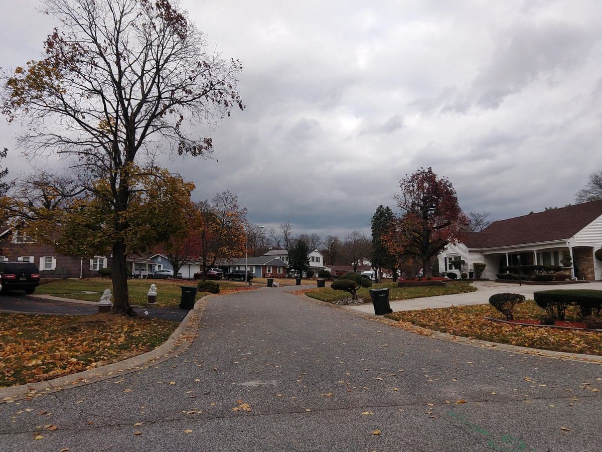
Photo: Wikipedia
Strategic Assessment of Willingboro, NJ
Multiple tactical vulnerabilities. Population density, target proximity, or disaster risk are likely compounding. A retreat property and exit planning is required.
What does the Strategic Assessment tell us?
Our Strategic Assessment grades tactical survivability of an area. Major population centers, military targets, fallout zones, natural disasters, and border exposure all drive risk — lower exposure means a more defensible position in a crisis.
This is heavily inspired by Joel Skousen's Strategic Relocation book. Highly recommended you checkout the book ($)What does this tell us?
Our Strategic Assessment grades tactical survivability of an area. Major population centers, military targets, fallout zones, natural disasters, and border exposure all drive risk — lower exposure means a more defensible position in a crisis.
This is heavily inspired by Joel Skousen's Strategic Relocation book. Highly recommended you checkout the book ($)Strategic Pillars

Key Distances
Regional Safe Places
Below is our recommended "safe zones" in New Jersey and the surrounding area based on our strategic heuristics. For most people, it's unrealistic to live in a “safe zone” full-time due to work, family or other personal reasons. They tend to be more rural. However, many of these areas are perfect for second homes and retreat properties that double as a vacation home or even a short-term rental.
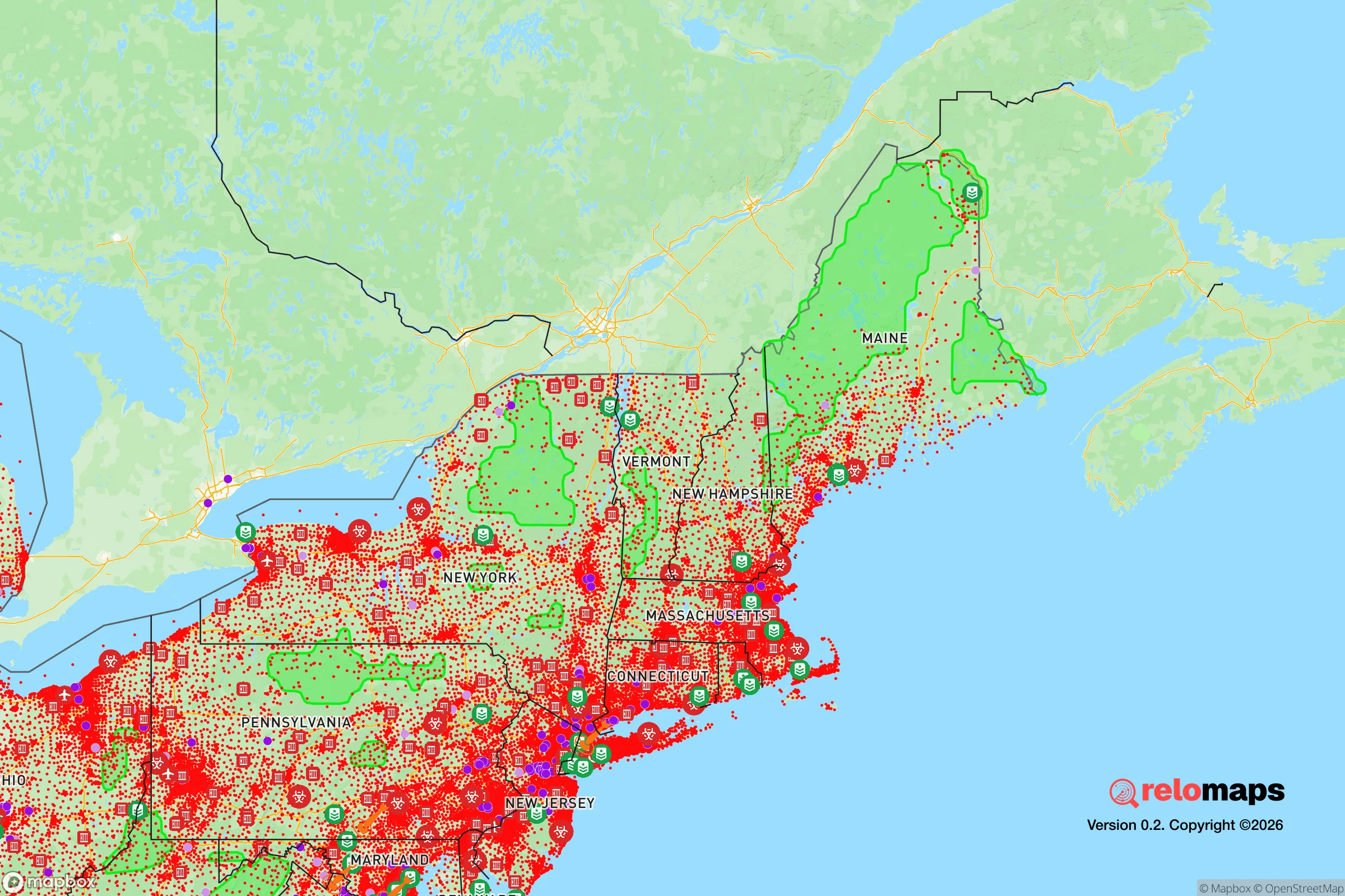
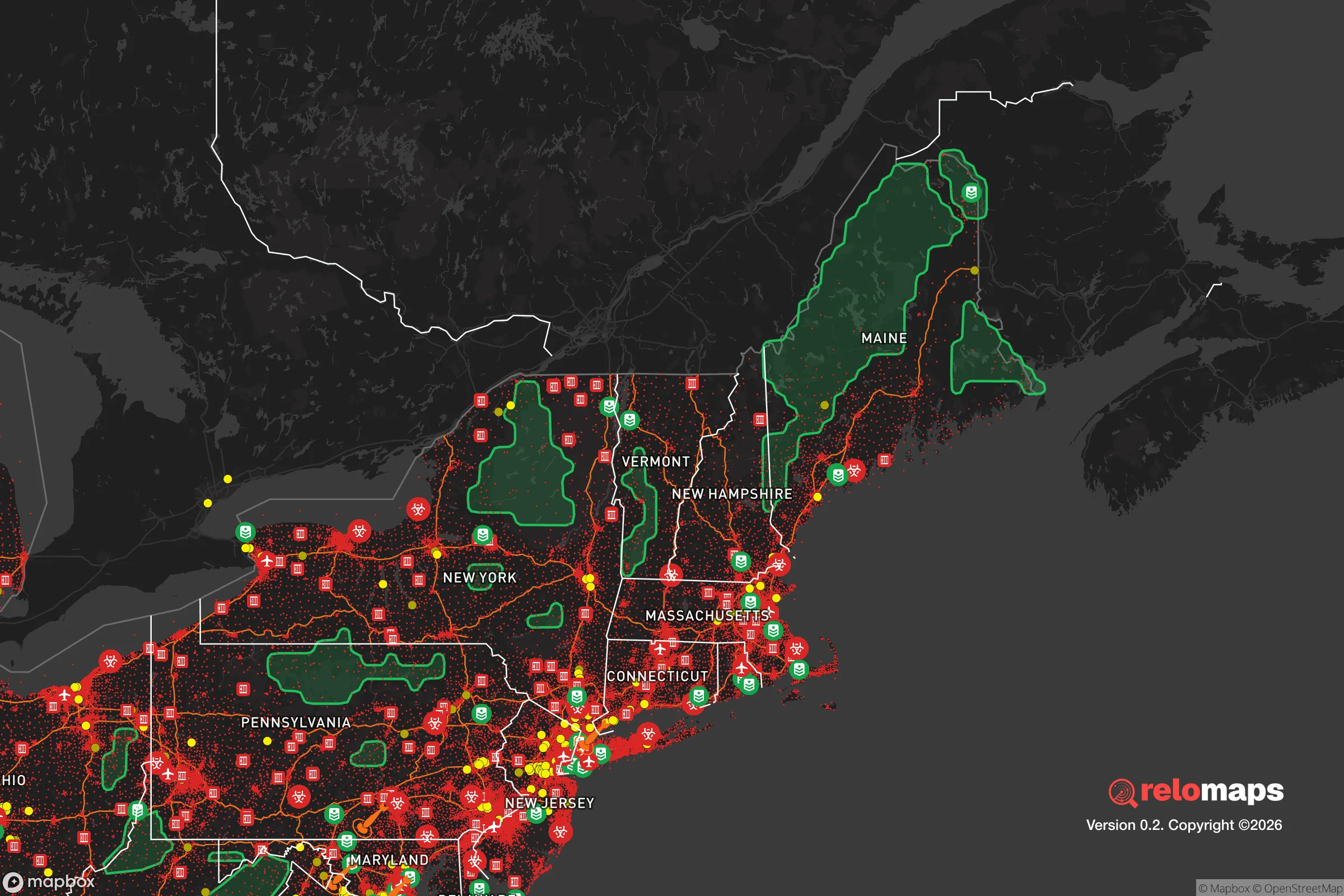


Important Note: For informational purposes only. This does not mean nothing bad ever happens in the green zones. Please use common sense. This is based on public data and modeled with AI. We tried to take a conservative approach but mistakes happen. We update this regularly as new information becomes available.
Solar Generator Recommendations
Backup power matters more here than in safer locations. We've picked three solar generators across budgets and capacity tiers — start with the budget unit if you only need a few essentials, or step up if you want to run a fridge and HVAC for days at a time.

Jackery Portable Power Station Explorer 300
Budget OptionPower on the Go: Weighing only 11 lbs, it's convenient to set up and store with book-sized foldable solar panels

BLUETTI Portable Power Station AC180
Designed for both indoor and outdoor scenarios, AC180 is highly capable as it has a robost capacity and continuous output power.

EF ECOFLOW DELTA Pro Ultra Power Station
Upgraded PickEcoFlow DELTA Pro Ultra is a whole-home energy system designed to grow with your family. Integrated with the Smart Home Panel 2, it scales to meet your evolving energy needs — keeping your home powered, intelligent, and secure through every stage of life.
We earn a commission, at no additional cost to you.
Strategic Assessment Analysis
Willingboro, New Jersey, presents a mixed picture for the relocation-minded individual or family prioritizing resilience and self-sufficiency. Its primary strategic advantage is its location within the Philadelphia-Camden metro area, which provides access to dense supply chains and emergency services, but this proximity is also its greatest liability in a serious disaster scenario. The township’s flat, suburban layout and heavy reliance on regional infrastructure mean that while daily life is convenient, a major grid-down event or regional crisis would quickly expose its vulnerabilities. For a reader thinking seriously about preparedness, Willingboro is best understood as a location with moderate baseline resilience that requires significant personal investment to become truly defensible or self-sufficient.
Geographic position and natural advantages for preparedness
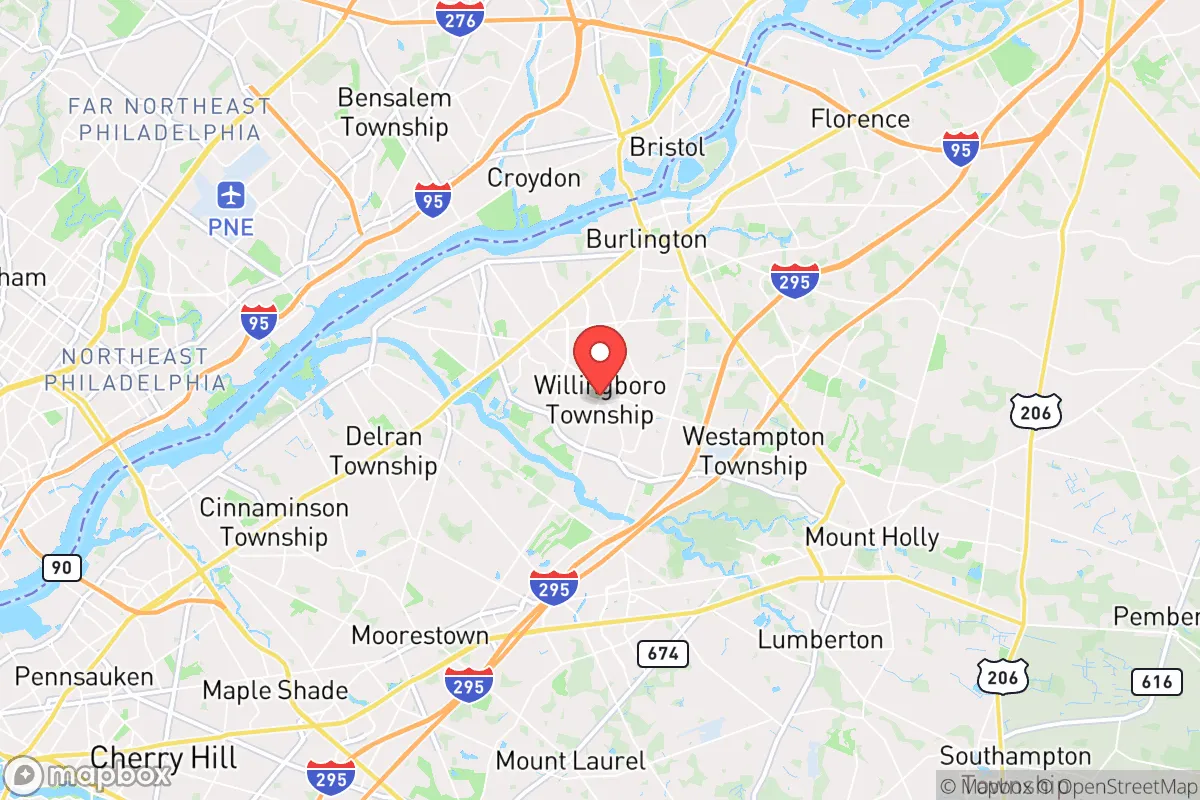
Willingboro sits in Burlington County, roughly 20 miles northeast of Philadelphia and 60 miles south of New York City, placing it squarely within the densely populated Northeast Corridor. The area is characterized by low-lying, flat terrain typical of the New Jersey coastal plain, with the Rancocas Creek forming its southern boundary. This creek and its associated wetlands provide a modest natural barrier to vehicle-based approach from the south, but the terrain offers no high ground or natural defensive chokepoints. The region’s climate is temperate, with four distinct seasons, which is favorable for year-round gardening and livestock management, though the growing season is shorter than in the mid-Atlantic or Southeast. Willingboro’s location within the Delaware River watershed means groundwater is generally accessible, but the area is not immune to drought conditions that have periodically affected the region. The lack of significant elevation change and the prevalence of suburban development mean that natural concealment or defensible terrain is virtually absent, making the township highly dependent on social and infrastructural systems for normal function.
Risks, exposures, and proximity to fallout-relevant landmarks
The most significant risk for Willingboro in a serious disaster scenario is its proximity to major population centers and critical infrastructure targets. Philadelphia, with its oil refineries, chemical plants, and major transportation hubs, is a likely target for both conventional and asymmetric attacks. The New Jersey Turnpike and I-95 corridor, which run within 10 miles of Willingboro, are high-value logistical targets that could be disrupted or destroyed, severing supply lines and complicating evacuation. Additionally, the Salem and Hope Creek nuclear generating stations are located approximately 40 miles southwest, within the 50-mile emergency planning zone that includes Willingboro. While a nuclear incident is a low-probability event, the township’s location downwind of prevailing westerlies means fallout from a Philadelphia-area incident or a nuclear plant accident could reach the area within hours. Natural risks include flooding from the Rancocas Creek and its tributaries during heavy rain events, as well as the potential for hurricane-related storm surge, though Willingboro is far enough inland to avoid direct coastal surge. The area is also prone to nor’easters and ice storms, which can cause prolonged power outages. The combination of high population density, proximity to strategic targets, and flat terrain makes Willingboro a location where the risks of a cascading regional disaster are elevated compared to more rural or remote areas.
Practical resilience for a relocator: food, water, energy, and defensibility
For a relocator focused on self-sufficiency, Willingboro presents significant challenges that require deliberate mitigation. The township is almost entirely suburban residential, with limited agricultural land within its borders. Community gardens and small-scale backyard gardening are feasible, but the average lot size is small, typically a quarter-acre or less, which restricts the volume of food production possible. Local farmers’ markets and nearby farms in Burlington County provide some access to fresh food under normal conditions, but in a crisis, these sources would be quickly depleted or inaccessible. Water is supplied by the Willingboro Municipal Utilities Authority, which draws from the Potomac-Raritan-Magothy aquifer system. In a grid-down scenario, electric pumps would fail, making private well ownership or rainwater catchment essential for any serious self-sufficiency plan. Most homes in Willingboro are connected to municipal water and sewer, meaning a long-term outage would render sanitation and water supply nonfunctional without backup systems. Energy resilience is similarly dependent on the grid; solar panel installations are permitted but not widespread, and natural gas is the primary heating fuel for most homes. Defensibility is poor due to the dense suburban layout, with homes in close proximity and multiple points of entry to the township via major roads like Route 130 and Route 541. The lack of natural barriers and the high number of potential evacuees from nearby cities make Willingboro a location that would be difficult to secure or hold in a widespread collapse scenario. For a relocator, the practical takeaway is that Willingboro requires a high level of personal preparedness—including backup power, water storage, and a robust security plan—to achieve even moderate resilience.
Overall, Willingboro offers a strategic position for those who need to remain connected to the Philadelphia metro area for work or family, but it is not a location that provides inherent resilience or self-sufficiency. Its flat, suburban terrain and reliance on regional infrastructure make it vulnerable to the same cascading failures that would affect the broader Northeast Corridor. For a reader serious about disaster readiness, Willingboro is a location that demands active preparation and investment in off-grid capabilities, rather than a place where resilience comes naturally. It is best suited for those who view preparedness as a personal project rather than a geographic given, and who are willing to accept the risks of proximity to major targets in exchange for the conveniences of suburban life.

* Values derived from national, state, county, city and local statistics and may differ in a specific area. Last updated: 2026-10-21T15:18:22.000Z
Narrative content on this page is AI-generated and may contain mistakes. Verify any details that matter before acting on them.
ReloMaps may earn a commission from affiliate links at no extra cost to you.

