Photo: Wikipedia
Strategic Assessment of Westlake Village, CA
Multiple tactical vulnerabilities. Population density, target proximity, or disaster risk are likely compounding. A retreat property and exit planning is required.
What does the Strategic Assessment tell us?
Our Strategic Assessment grades tactical survivability of an area. Major population centers, military targets, fallout zones, natural disasters, and border exposure all drive risk — lower exposure means a more defensible position in a crisis.
This is heavily inspired by Joel Skousen's Strategic Relocation book. Highly recommended you checkout the book ($)What does this tell us?
Our Strategic Assessment grades tactical survivability of an area. Major population centers, military targets, fallout zones, natural disasters, and border exposure all drive risk — lower exposure means a more defensible position in a crisis.
This is heavily inspired by Joel Skousen's Strategic Relocation book. Highly recommended you checkout the book ($)Strategic Pillars

Key Distances
Regional Safe Places
Below is our recommended "safe zones" in California and the surrounding area based on our strategic heuristics. For most people, it's unrealistic to live in a “safe zone” full-time due to work, family or other personal reasons. They tend to be more rural. However, many of these areas are perfect for second homes and retreat properties that double as a vacation home or even a short-term rental.




Important Note: For informational purposes only. This does not mean nothing bad ever happens in the green zones. Please use common sense. This is based on public data and modeled with AI. We tried to take a conservative approach but mistakes happen. We update this regularly as new information becomes available.
Solar Generator Recommendations
Backup power matters more here than in safer locations. We've picked three solar generators across budgets and capacity tiers — start with the budget unit if you only need a few essentials, or step up if you want to run a fridge and HVAC for days at a time.

Jackery Portable Power Station Explorer 300
Budget OptionPower on the Go: Weighing only 11 lbs, it's convenient to set up and store with book-sized foldable solar panels

BLUETTI Portable Power Station AC180
Designed for both indoor and outdoor scenarios, AC180 is highly capable as it has a robost capacity and continuous output power.

EF ECOFLOW DELTA Pro Ultra Power Station
Upgraded PickEcoFlow DELTA Pro Ultra is a whole-home energy system designed to grow with your family. Integrated with the Smart Home Panel 2, it scales to meet your evolving energy needs — keeping your home powered, intelligent, and secure through every stage of life.
We earn a commission, at no additional cost to you.
Strategic Assessment Analysis
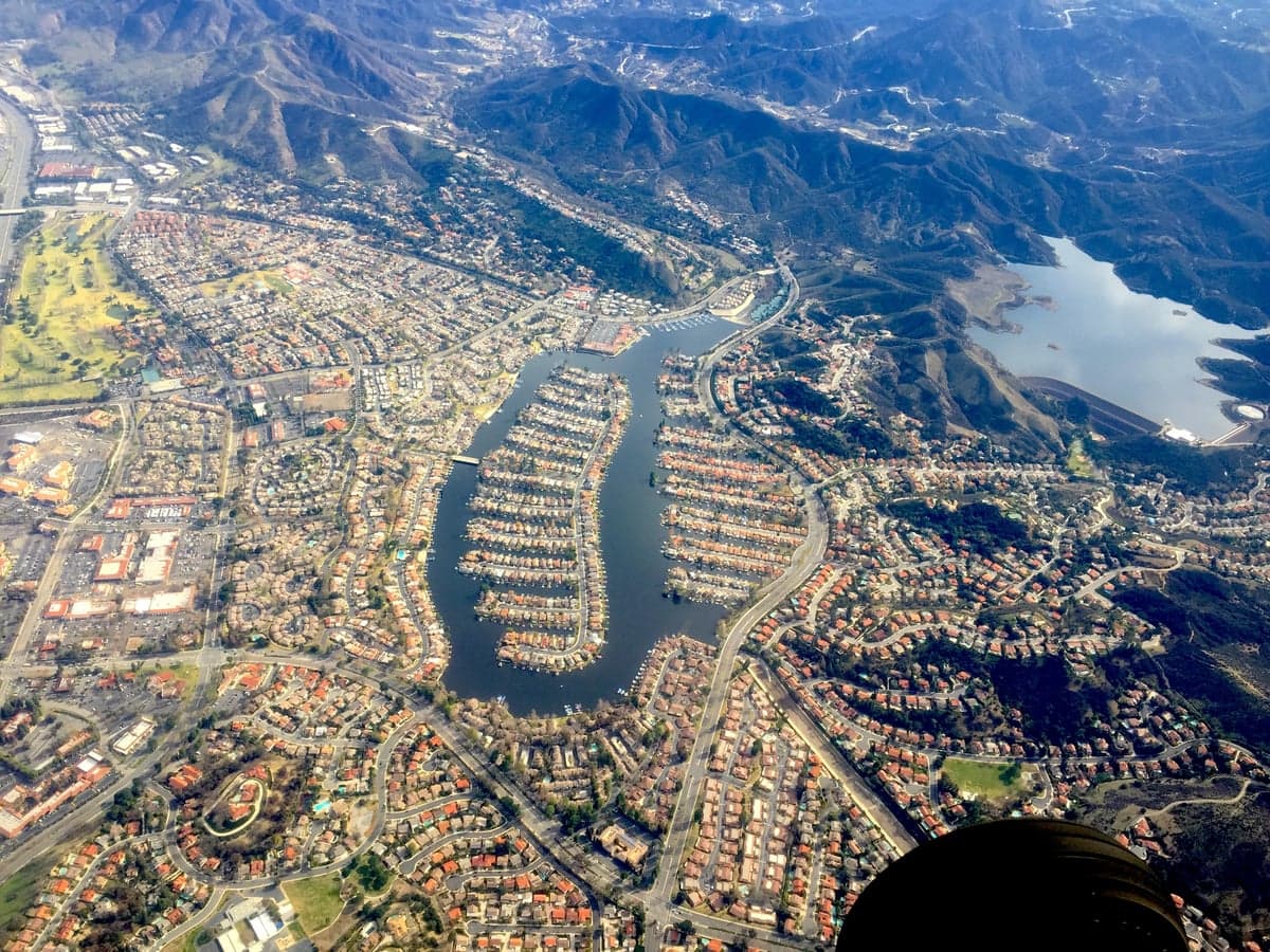
Westlake Village, California, sits in a sweet spot that few Southern California communities can claim: it’s close enough to the economic engine of Los Angeles to matter, but physically insulated by the Santa Monica Mountains and the Conejo Valley’s natural bowl. For a relocator thinking seriously about disaster readiness, this is a place where the strategic picture is genuinely mixed—strong on natural defensibility and local resources, but carrying real exposure to the region’s systemic risks. The city itself is a master-planned community straddling the Los Angeles–Ventura county line, and that dual-county status creates some unusual administrative advantages and complications worth understanding before you commit.
Geographic position and natural defensive advantages
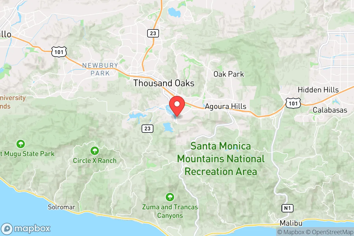
Westlake Village’s primary strategic asset is topography. The community sits at roughly 900 to 1,100 feet elevation in the Conejo Valley, ringed by the Santa Monica Mountains to the south and the Simi Hills to the north. That natural bowl provides a meaningful buffer against the chaotic sprawl of the San Fernando Valley, which lies just over the hill to the east. In practical terms, this means the area is not a natural thoroughfare—through-traffic has to funnel through a handful of canyon roads (Kanan, Mulholland, and the 101 corridor), which is a double-edged sword: it limits casual access, but it also creates choke points that could complicate evacuation or supply movement in a crisis.
The climate is Mediterranean, with hot, dry summers and mild, wet winters. Annual rainfall averages around 15–18 inches, most of it falling between November and March. That dry pattern is the region’s greatest natural vulnerability—wildfire risk is real and persistent, particularly in the wildland-urban interface along the northern and southern edges of the city. The 2018 Woolsey Fire burned to within a few miles of Westlake Village’s borders, and the 2025 Palisades Fire reinforced the lesson that the Santa Monica Mountains are a tinderbox under Santa Ana wind conditions. However, the city itself is largely built-out, with defensible space requirements and modern fire-resistant construction codes in place for newer homes. The built environment is a genuine advantage here: wide streets, cul-de-sacs, and a planned grid that gives fire crews room to work.
Risk exposure and proximity to fallout-relevant landmarks
Here is where the strategic assessment gets more sobering. Westlake Village is roughly 35 miles from downtown Los Angeles and about 30 miles from the Port of Los Angeles/Long Beach complex—the busiest container port in the Western Hemisphere. In a conflict scenario involving West Coast targets, those are the kinds of high-value assets that would draw attention. The city also sits within 40 miles of Naval Base Ventura County (Point Mugu) and the Naval Air Station at Port Hueneme, both of which are plausible military targets. The 101 Freeway corridor, which runs along the city’s southern edge, is a critical logistics artery connecting Los Angeles to Santa Barbara and points north—a vulnerability in any disruption scenario.
For a reader thinking about fallout and man-made risks, the honest assessment is that Westlake Village is not remote enough to escape the blast-and-fallout radius of a major strike on the LA basin. Prevailing winds in the region generally blow from the west and northwest, which means fallout from a detonation over downtown LA would likely drift toward the Inland Empire rather than toward the Conejo Valley—but that is a statistical tendency, not a guarantee. The Santa Monica Mountains provide some shielding from ground-level effects, but they are not a meaningful barrier to airborne particulate. The more immediate man-made risks are mundane but more probable: the 101 corridor is a known chokepoint for hazardous material transport, and the region’s aging water infrastructure is vulnerable to seismic disruption.
Practical resilience for a relocator: food, water, energy, and defensibility
On the practical resilience front, Westlake Village performs better than most of urban Southern California, but it is not a self-sufficient enclave. The city relies on imported water—roughly 70% of the region’s supply comes from the State Water Project and the Colorado River Aqueduct, both of which are seismically vulnerable at multiple points. A major earthquake on the San Andreas Fault, which runs about 60 miles to the northeast, could disrupt water delivery for weeks or months. The local groundwater basin (the Conejo Valley aquifer) exists but is limited and managed by the Calleguas Municipal Water District. A serious relocator should plan for at least two weeks of stored water per person, and ideally more.
Food security is a similar story. Westlake Village has no significant agricultural production of its own, but it sits within 20–30 miles of Ventura County’s fertile Oxnard Plain, one of the most productive agricultural regions in the country. That proximity is a genuine advantage—local farmers’ markets and direct-from-farm purchasing are viable options for building a resilient food network. The city itself has a strong grocery infrastructure (Vons, Ralphs, Gelson’s, and a well-regarded farmers’ market at the Thousand Oaks Civic Arts Plaza nearby), but all of it depends on just-in-time supply chains that could falter in a regional emergency.
Energy resilience is a bright spot. Southern California Edison serves the area, and the region has seen significant investment in grid hardening and microgrid development since the 2019 public safety power shutoffs. Rooftop solar adoption is high in the Conejo Valley—California’s building codes have required solar on new homes since 2020, and many existing homes in Westlake Village have already added panels and battery storage. Natural gas service is reliable, but a relocator serious about resilience should plan for electric heating and cooking alternatives, since gas lines are vulnerable to seismic disruption. The city’s defensibility is good by Southern California standards: it is a low-density, well-planned community with multiple access points, but those access points are limited and could be contested in a breakdown scenario. The neighboring community of Thousand Oaks provides a larger population base and additional resources, but it also means Westlake Village is not truly isolated.
The overall strategic picture for Westlake Village is one of qualified strength. It is a well-built, topographically sheltered community with good local infrastructure and proximity to agricultural resources, but it is not a bug-out location. For a relocator who wants a defensible home base within striking distance of urban resources—and who is willing to invest in water storage, backup power, and a serious emergency plan—Westlake Village offers a genuinely workable foundation. For someone seeking true self-sufficiency and distance from high-value targets, the Sierra foothills or the inland Pacific Northwest would be more honest answers. Westlake Village is a place to ride out regional disruptions, not a place to disappear.

* Values derived from national, state, county, city and local statistics and may differ in a specific area. Last updated: 2026-10-12T01:46:01.000Z
Narrative content on this page is AI-generated and may contain mistakes. Verify any details that matter before acting on them.
ReloMaps may earn a commission from affiliate links at no extra cost to you.

