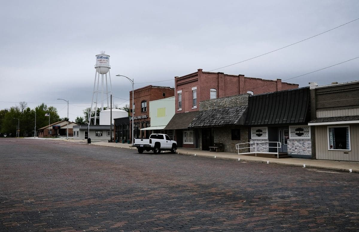
Photo: Wikipedia
Strategic Assessment of Wellsville, KS
Workable tactical position. Some exposure to population density or targets, but generally defensible in a crisis.
What does the Strategic Assessment tell us?
Our Strategic Assessment grades tactical survivability of an area. Major population centers, military targets, fallout zones, natural disasters, and border exposure all drive risk — lower exposure means a more defensible position in a crisis.
This is heavily inspired by Joel Skousen's Strategic Relocation book. Highly recommended you checkout the book ($)What does this tell us?
Our Strategic Assessment grades tactical survivability of an area. Major population centers, military targets, fallout zones, natural disasters, and border exposure all drive risk — lower exposure means a more defensible position in a crisis.
This is heavily inspired by Joel Skousen's Strategic Relocation book. Highly recommended you checkout the book ($)Strategic Pillars

Key Distances
Regional Safe Places
Below is our recommended "safe zones" in Kansas and the surrounding area based on our strategic heuristics. For most people, it's unrealistic to live in a “safe zone” full-time due to work, family or other personal reasons. They tend to be more rural. However, many of these areas are perfect for second homes and retreat properties that double as a vacation home or even a short-term rental.
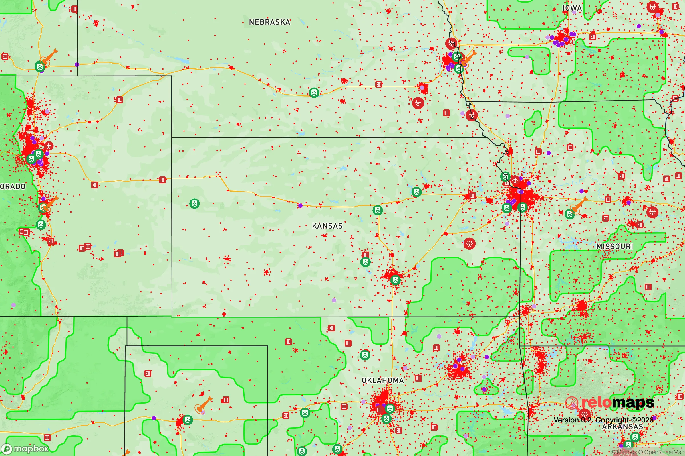
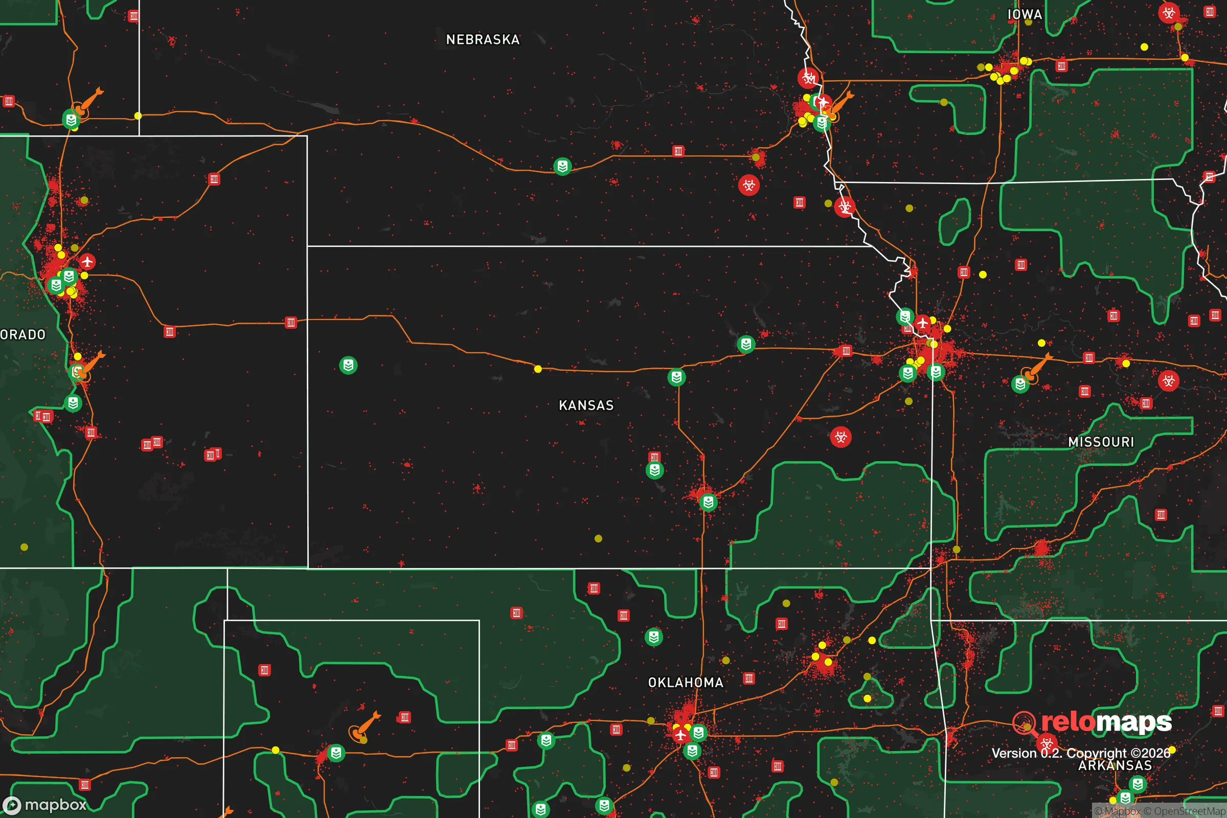


Important Note: For informational purposes only. This does not mean nothing bad ever happens in the green zones. Please use common sense. This is based on public data and modeled with AI. We tried to take a conservative approach but mistakes happen. We update this regularly as new information becomes available.
Solar Generator Recommendations
Backup power matters more here than in safer locations. We've picked three solar generators across budgets and capacity tiers — start with the budget unit if you only need a few essentials, or step up if you want to run a fridge and HVAC for days at a time.

Jackery Portable Power Station Explorer 300
Budget OptionPower on the Go: Weighing only 11 lbs, it's convenient to set up and store with book-sized foldable solar panels

BLUETTI Portable Power Station AC180
Designed for both indoor and outdoor scenarios, AC180 is highly capable as it has a robost capacity and continuous output power.

EF ECOFLOW DELTA Pro Ultra Power Station
Upgraded PickEcoFlow DELTA Pro Ultra is a whole-home energy system designed to grow with your family. Integrated with the Smart Home Panel 2, it scales to meet your evolving energy needs — keeping your home powered, intelligent, and secure through every stage of life.
We earn a commission, at no additional cost to you.
Strategic Assessment Analysis
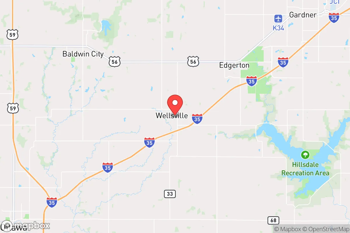
Wellsville, Kansas, offers a compelling mix of strategic advantages for those prioritizing resilience and self-sufficiency, primarily due to its position on the eastern edge of the state, roughly 45 miles southwest of the Kansas City metro area. This location provides a meaningful buffer from the immediate fallout and congestion of a major urban center while still granting access to its resources when needed. The town’s small population—around 1,800 residents—and its agricultural surroundings create a foundation for a quieter, more self-reliant lifestyle, though the proximity to larger infrastructure and potential targets requires careful consideration. For a relocator focused on disaster readiness, Wellsville represents a middle ground: close enough to civilization for supply runs and medical care, but far enough to avoid the worst of a metropolitan collapse.
Geographic position and natural advantages for long-term stability
Wellsville sits in Franklin County, a region characterized by rolling hills, mixed hardwood forests, and fertile river valleys, which together offer a more defensible and resource-rich environment than the flat, open plains further west. The area’s natural advantages include a reliable water supply from the Marais des Cygnes River and its tributaries, which flow through the county and provide a surface water source that can be tapped for irrigation or emergency use. The local topography—with its wooded draws and gentle ridges—offers natural cover and concealment, making it easier to secure a homestead or retreat than in more exposed terrain. The climate is temperate, with four distinct seasons, annual rainfall averaging around 40 inches, and a growing season of roughly 180 days, which supports year-round gardening and small-scale farming. This combination of water, soil, and moderate weather gives Wellsville a solid baseline for long-term self-sufficiency, especially compared to drier or more extreme environments elsewhere in the country.
Risks, exposures, and proximity to fallout-relevant landmarks
The primary risk for Wellsville is its proximity to the Kansas City metropolitan area, a major population and industrial hub that includes a large rail yard, several military installations (such as Fort Leavenworth and Whiteman Air Force Base), and critical infrastructure like the Truman Dam and the BNSF rail lines. In a major conflict or EMP event, these targets could draw secondary effects—such as refugee flows, supply chain disruptions, or localized fallout—that would reach Wellsville within hours or days. The town itself is not near any known nuclear power plants (the closest is Wolf Creek, about 90 miles southeast), but it lies within the broader fallout shadow of potential strikes on Kansas City or the nearby McConnell Air Force Base in Wichita. Natural disaster risks are moderate: tornadoes are a seasonal threat, as the area sits in the heart of Tornado Alley, and flash flooding can occur along low-lying creek beds. Earthquakes are rare, though the New Madrid Seismic Zone to the southeast could produce distant tremors. Overall, the man-made risks from urban proximity outweigh the natural ones, making a well-stocked retreat and a solid evacuation plan essential for any serious relocator.
Practical resilience for a relocator: food, water, energy, and defensibility
For a relocator aiming to build a self-sufficient homestead, Wellsville’s practical resilience is strong but requires upfront investment. The local soil is loamy and fertile, ideal for vegetable gardens, fruit orchards, and small livestock like chickens or goats. The growing season is long enough for two crops of many staples, and the surrounding farmland means seeds, tools, and agricultural knowledge are readily available from neighbors and county extension services. Water is the area’s biggest asset: shallow wells are common, and many properties have access to ponds or creeks, though testing for contaminants (especially agricultural runoff) is wise. Rainwater catchment is viable given the annual precipitation, and a simple cistern system can provide a backup supply. Energy independence is achievable through solar panels, as the region gets about 200 sunny days per year, though winter cloud cover can reduce output. Wood is abundant in the wooded areas, making wood stoves a practical heating and cooking backup. Defensibility is moderate: the rolling terrain and tree lines offer natural cover, but the town’s layout—with a few main roads and a compact downtown—means a determined group could be isolated. A rural property with a long driveway, a well, and a clear line of sight to approach routes would be ideal. The local community is small and tight-knit, which can be a double-edged sword: newcomers may face a period of trust-building, but once accepted, neighbors are likely to share resources and watch out for each other during emergencies.
In the broader strategic picture, Wellsville offers a balanced option for the disaster-conscious relocator who wants to stay within a few hours of urban amenities without being directly in the line of fire. Its agricultural base, water availability, and moderate climate provide a solid foundation for self-sufficiency, while the risks from Kansas City and regional infrastructure are real but manageable with proper planning—such as maintaining a 90-day supply of food, fuel, and medical gear, and having a secondary retreat further west (like the Flint Hills) if needed. The town’s small size and rural character mean less competition for resources during a crisis, but also fewer immediate services, so self-reliance is not optional—it’s a requirement. For a single individual or family willing to put in the work, Wellsville represents a defensible, resource-rich location that balances isolation with accessibility, making it a strong candidate for those serious about long-term resilience in the American heartland.

* Values derived from national, state, county, city and local statistics and may differ in a specific area. Last updated: 2026-10-06T17:35:13.000Z
Narrative content on this page is AI-generated and may contain mistakes. Verify any details that matter before acting on them.
ReloMaps may earn a commission from affiliate links at no extra cost to you.

