Photo: Wikipedia
Strategic Assessment of Waynesville, NC
Meaningful friction. Expect exposure to either population pressure, blast zones, or natural disaster risk. Consider buying a retreat property.
What does the Strategic Assessment tell us?
Our Strategic Assessment grades tactical survivability of an area. Major population centers, military targets, fallout zones, natural disasters, and border exposure all drive risk — lower exposure means a more defensible position in a crisis.
This is heavily inspired by Joel Skousen's Strategic Relocation book. Highly recommended you checkout the book ($)What does this tell us?
Our Strategic Assessment grades tactical survivability of an area. Major population centers, military targets, fallout zones, natural disasters, and border exposure all drive risk — lower exposure means a more defensible position in a crisis.
This is heavily inspired by Joel Skousen's Strategic Relocation book. Highly recommended you checkout the book ($)Strategic Pillars

Key Distances
Regional Safe Places
Below is our recommended "safe zones" in North Carolina and the surrounding area based on our strategic heuristics. For most people, it's unrealistic to live in a “safe zone” full-time due to work, family or other personal reasons. They tend to be more rural. However, many of these areas are perfect for second homes and retreat properties that double as a vacation home or even a short-term rental.

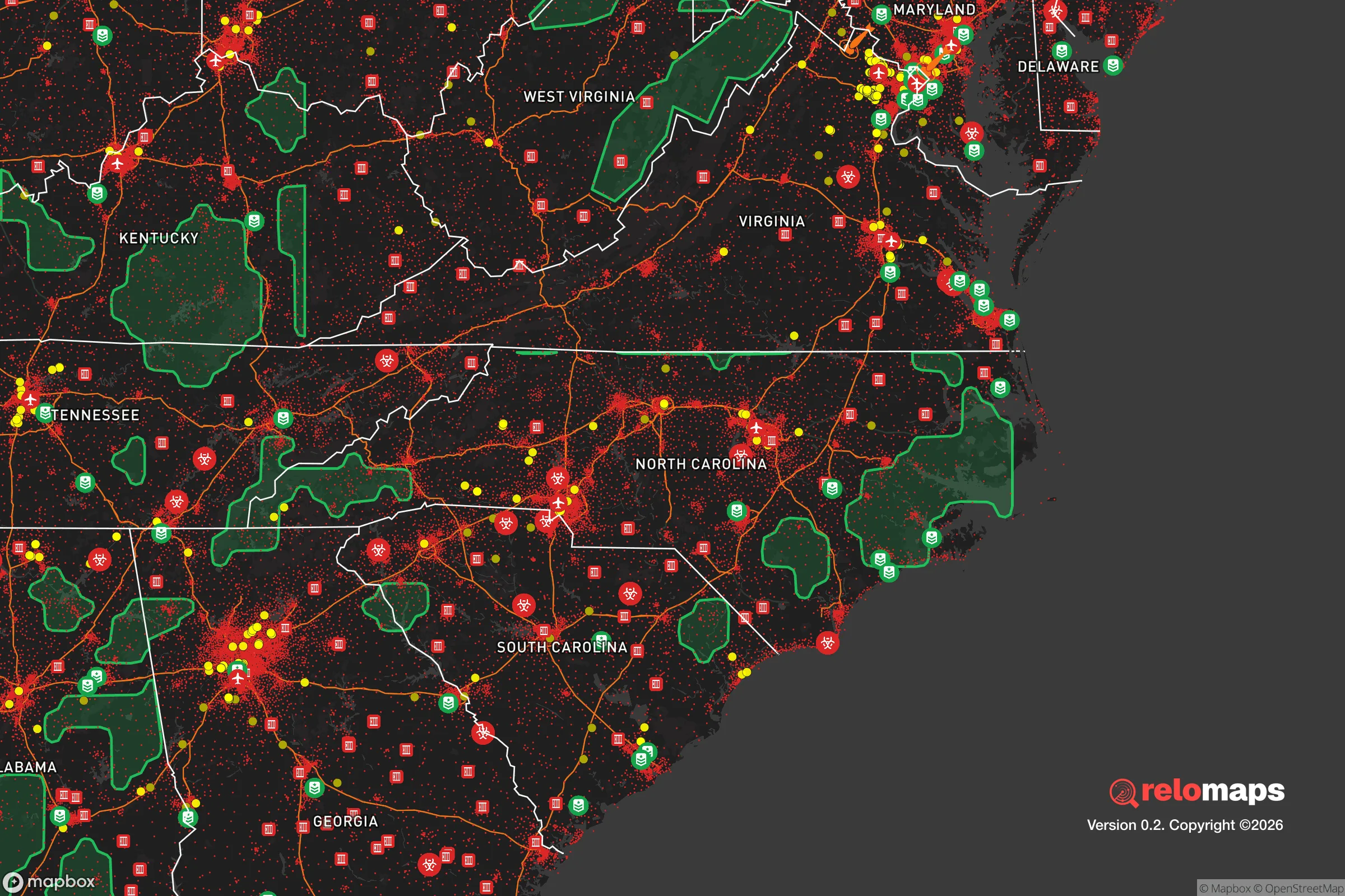


Important Note: For informational purposes only. This does not mean nothing bad ever happens in the green zones. Please use common sense. This is based on public data and modeled with AI. We tried to take a conservative approach but mistakes happen. We update this regularly as new information becomes available.
Solar Generator Recommendations
Backup power matters more here than in safer locations. We've picked three solar generators across budgets and capacity tiers — start with the budget unit if you only need a few essentials, or step up if you want to run a fridge and HVAC for days at a time.

Jackery Portable Power Station Explorer 300
Budget OptionPower on the Go: Weighing only 11 lbs, it's convenient to set up and store with book-sized foldable solar panels

BLUETTI Portable Power Station AC180
Designed for both indoor and outdoor scenarios, AC180 is highly capable as it has a robost capacity and continuous output power.

EF ECOFLOW DELTA Pro Ultra Power Station
Upgraded PickEcoFlow DELTA Pro Ultra is a whole-home energy system designed to grow with your family. Integrated with the Smart Home Panel 2, it scales to meet your evolving energy needs — keeping your home powered, intelligent, and secure through every stage of life.
We earn a commission, at no additional cost to you.
Strategic Assessment Analysis
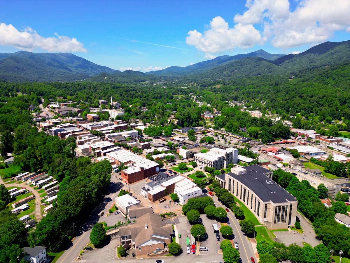
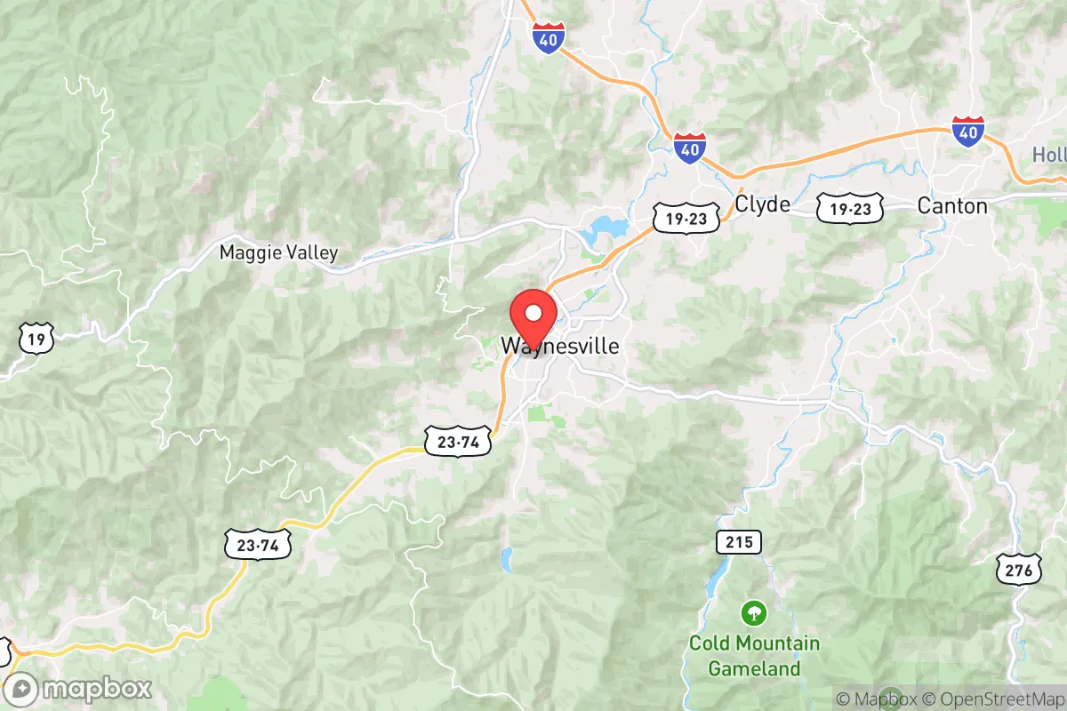
Waynesville, North Carolina, offers a compelling strategic position for those prioritizing disaster readiness and self-sufficiency, balancing genuine geographic advantages with real, calculable risks. Nestled in the Great Smoky Mountains at an elevation of roughly 2,800 feet, the town sits in a natural bowl formed by the Plott Balsam and Balsam Mountain ranges, providing a degree of physical isolation from major population centers while remaining within a practical distance of essential services. This location, roughly 30 miles west of Asheville and 150 miles northwest of Charlotte, places it far enough from primary target zones to avoid immediate fallout concerns from a major metropolitan strike, yet close enough to the Blue Ridge Parkway and national forest lands to offer viable retreat and resource options. For a relocator thinking seriously about long-term resilience, Waynesville represents a middle-ground choice: not a remote bunker, but a defensible, resource-rich community with a functioning local economy and infrastructure that could sustain a household through extended disruptions.
Geographic position and natural advantages for long-term survival
Waynesville’s primary strategic asset is its topography. The surrounding mountains create natural chokepoints on the major access routes—primarily US-23/74 and US-19—which could be controlled or blocked with relative ease in a crisis, slowing both opportunistic movement and large-scale refugee flows from the east. The town sits in the Pigeon River watershed, with numerous creeks and springs feeding into Richland Creek and the Pigeon River itself, providing a reliable surface water source that is less likely to be contaminated by upstream industrial or agricultural runoff compared to lower-elevation areas. The elevation also moderates temperatures: summers are mild (average highs in the low 80s°F) and winters are cold but not extreme (average lows in the mid-20s°F), reducing the energy burden for heating and cooling compared to the Piedmont or coastal plain. The surrounding Pisgah National Forest and Great Smoky Mountains National Park offer a massive buffer zone—over 1.5 million acres of public land—that limits suburban sprawl and preserves wildlife corridors for hunting and foraging. For a relocator, this means a lower population density per square mile than nearly any comparably sized town east of the Mississippi, with a county (Haywood) population of roughly 62,000 spread across 555 square miles.
Risks, exposures, and proximity to fallout-relevant landmarks
The most significant risk to Waynesville’s resilience is its proximity to Asheville, a regional hub of roughly 95,000 people (metro area ~470,000) that hosts a major federal data center, a National Guard armory, and the Asheville Regional Airport, which could be a secondary target in a conflict involving critical infrastructure. In a nuclear scenario, prevailing winds from the west-southwest would carry fallout from a strike on Asheville directly toward Waynesville, with a potential arrival time of 2-4 hours depending on wind speed. The town is also within 100 miles of the Oak Ridge National Laboratory in Tennessee—a high-value target for any adversary—and roughly 120 miles from the Savannah River Site in South Carolina, a nuclear weapons processing facility. While these are not immediate blast zones, the fallout plume from a ground burst at either site could reach Haywood County within 6-12 hours under typical weather patterns. Natural disaster risks are more immediate: the region sits in a moderate seismic zone (historical earthquakes up to magnitude 5.0), and the mountainous terrain creates flash-flood hazards along creek beds, particularly during tropical storm remnants (Hurricane Fred in 2021 caused significant flooding in nearby Cruso). Wildfire risk is moderate but increasing with drought cycles, though the dense hardwood forests are less fire-prone than western conifer forests. For a relocator, the key takeaway is that Waynesville is not a zero-risk location, but its risks are primarily natural and manageable, rather than the existential threat of being near a primary target like Washington DC or New York.
Practical resilience for a relocator: food, water, energy, and defensibility
Waynesville’s practical resilience is strong for a town of its size, but requires active preparation. The local water supply comes from the Waynesville Reservoir on Richland Creek and several deep wells, with a treatment plant that has backup generators—but in a prolonged grid-down scenario, residents relying on municipal water would need to have filtration or storage plans. The town’s elevation and forest cover mean that private wells are common in outlying areas, and many homes have access to springs or creeks, though testing for contamination after any seismic event or upstream incident is essential. Food resilience is bolstered by the Haywood County Farmers Market (one of the oldest in the state), a strong local farming community producing vegetables, livestock, and apples, and the presence of several small-scale mills and processors. The area has a growing number of homesteaders and permaculture practitioners, creating a knowledge network that a relocator can tap into. Energy resilience is mixed: Duke Energy provides grid power, but the mountainous terrain makes lines vulnerable to ice storms and wind, with outages lasting 3-7 days not uncommon in winter. Solar potential is moderate (roughly 4.5 peak sun hours per day), but tree cover on many lots limits rooftop generation unless trees are cleared. Propane is widely used for heating and cooking, and several local suppliers maintain bulk storage. Defensibility is the area’s strongest suit: the natural bowl shape of the valley, combined with the limited road access (only four primary routes into town), makes it relatively easy to monitor and control movement. The local sheriff’s office and a small police department provide law enforcement, but in a prolonged crisis, community-based security would be necessary—and the existing culture of hunting and firearm ownership in western North Carolina means that many households are already equipped. For a relocator, the practical recommendation is to secure a property with a private well, good southern exposure for solar, and at least 5-10 acres of defensible space, ideally with a creek or spring on the land.
Overall, Waynesville presents a balanced strategic picture for a relocator focused on resilience and self-sufficiency. It avoids the extreme isolation of deep wilderness locations (which can be logistically unsustainable for families) while offering genuine geographic protection from the worst-case scenarios of urban collapse or nuclear fallout. The risks are real—proximity to Asheville and Oak Ridge, natural hazards from flooding and ice storms—but they are calculable and mitigable with proper planning. The community’s existing infrastructure, local food system, and cultural readiness for self-reliance make it a viable long-term base for someone willing to invest in preparation rather than expecting the location to do all the work. For a conservative-leaning individual or family looking to balance access to civilization with a defensible, resource-rich home base in the eastern United States, Waynesville deserves serious consideration—not as a perfect refuge, but as a practical, defensible, and livable option in an uncertain future.

* Values derived from national, state, county, city and local statistics and may differ in a specific area. Last updated: 2026-10-20T17:11:34.000Z
Narrative content on this page is AI-generated and may contain mistakes. Verify any details that matter before acting on them.
ReloMaps may earn a commission from affiliate links at no extra cost to you.

