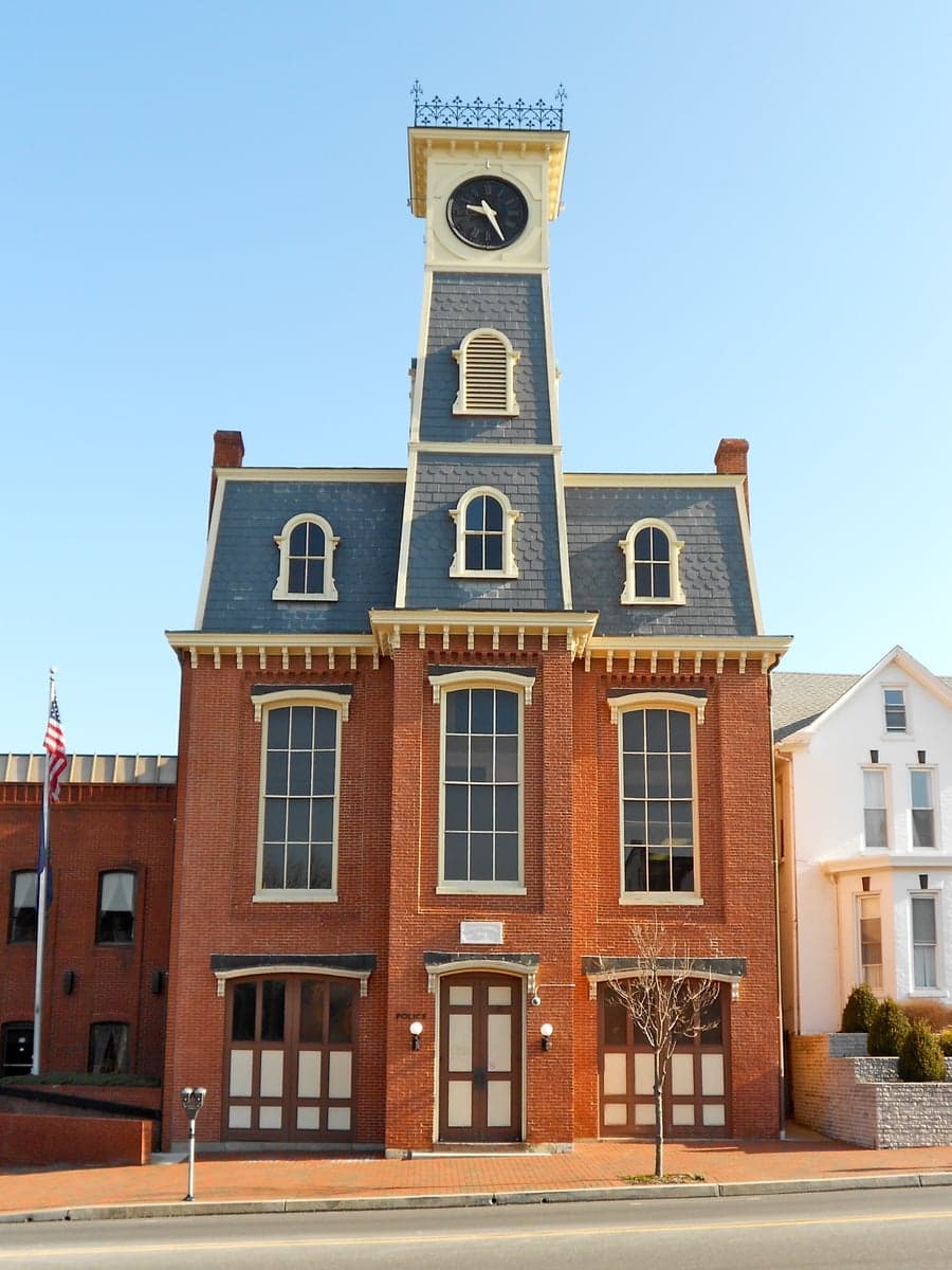
Photo: Wikipedia
Strategic Assessment of Waynesboro, PA
Meaningful friction. Expect exposure to either population pressure, blast zones, or natural disaster risk. Consider buying a retreat property.
What does the Strategic Assessment tell us?
Our Strategic Assessment grades tactical survivability of an area. Major population centers, military targets, fallout zones, natural disasters, and border exposure all drive risk — lower exposure means a more defensible position in a crisis.
This is heavily inspired by Joel Skousen's Strategic Relocation book. Highly recommended you checkout the book ($)What does this tell us?
Our Strategic Assessment grades tactical survivability of an area. Major population centers, military targets, fallout zones, natural disasters, and border exposure all drive risk — lower exposure means a more defensible position in a crisis.
This is heavily inspired by Joel Skousen's Strategic Relocation book. Highly recommended you checkout the book ($)Strategic Pillars

Key Distances
Regional Safe Places
Below is our recommended "safe zones" in Pennsylvania and the surrounding area based on our strategic heuristics. For most people, it's unrealistic to live in a “safe zone” full-time due to work, family or other personal reasons. They tend to be more rural. However, many of these areas are perfect for second homes and retreat properties that double as a vacation home or even a short-term rental.




Important Note: For informational purposes only. This does not mean nothing bad ever happens in the green zones. Please use common sense. This is based on public data and modeled with AI. We tried to take a conservative approach but mistakes happen. We update this regularly as new information becomes available.
Solar Generator Recommendations
Backup power matters more here than in safer locations. We've picked three solar generators across budgets and capacity tiers — start with the budget unit if you only need a few essentials, or step up if you want to run a fridge and HVAC for days at a time.

Jackery Portable Power Station Explorer 300
Budget OptionPower on the Go: Weighing only 11 lbs, it's convenient to set up and store with book-sized foldable solar panels

BLUETTI Portable Power Station AC180
Designed for both indoor and outdoor scenarios, AC180 is highly capable as it has a robost capacity and continuous output power.

EF ECOFLOW DELTA Pro Ultra Power Station
Upgraded PickEcoFlow DELTA Pro Ultra is a whole-home energy system designed to grow with your family. Integrated with the Smart Home Panel 2, it scales to meet your evolving energy needs — keeping your home powered, intelligent, and secure through every stage of life.
We earn a commission, at no additional cost to you.
Strategic Assessment Analysis
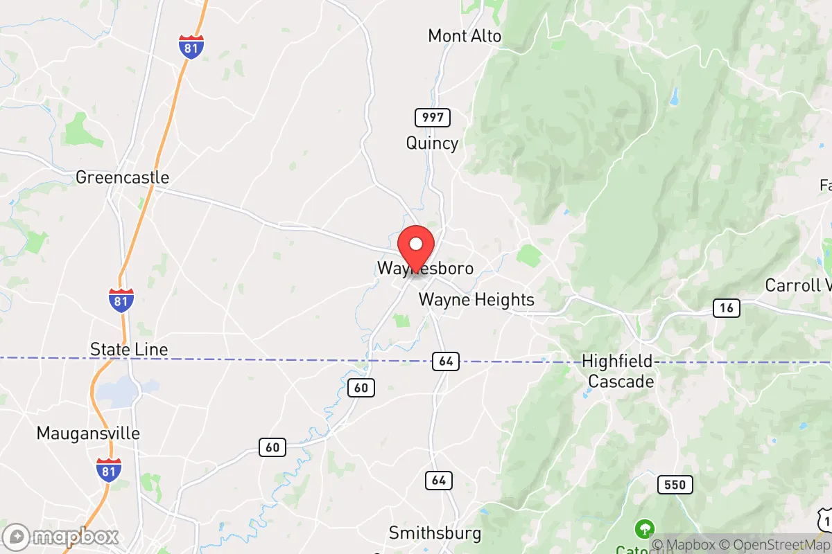
Waynesboro, Pennsylvania, offers a compelling mix of strategic depth and practical vulnerability for the relocation-minded reader focused on resilience and self-sufficiency. Situated in Franklin County, roughly 10 miles north of the Mason-Dixon Line and 50 miles southwest of Harrisburg, the borough benefits from a position that is close enough to major economic corridors (I-81, the Baltimore-Washington metro area) to access resources, yet far enough to avoid the immediate blast and fallout zones of a major urban target. The area’s historical manufacturing base, access to the Appalachian Trail corridor, and position within the fertile Cumberland Valley give it a foundation that is more defensible and resource-rich than many suburban or exurban alternatives, though it is not without significant exposure to both natural and man-made risks.
Geographic position and natural advantages for long-term stability
Waynesboro sits at the eastern edge of the Cumberland Valley, a broad, fertile lowland flanked by South Mountain to the east and the broader Appalachian ridge-and-valley system to the west. This geography provides several concrete advantages. The valley’s limestone-based soils are among the most productive in Pennsylvania, supporting local agriculture that can serve as a food-security buffer. The nearby Michaux State Forest and the Appalachian Trail corridor offer over 85,000 acres of public land for foraging, timber, and game, with white-tailed deer and turkey populations that are robust enough for subsistence hunting. Water access is a strong point: the Antietam Creek runs directly through the borough, and the Potomac River watershed is within a 15-minute drive south. Groundwater in the valley is generally plentiful and of good quality, though well-drilling costs in the area average $5,000–$10,000 depending on depth. The region’s elevation (roughly 700 feet) and inland position mean it is largely insulated from hurricane storm surge, sea-level rise, and the worst of coastal flooding. Tornado risk is low compared to the Midwest, though severe thunderstorms and occasional microbursts do occur. The area’s position along the I-81 corridor also provides a logistical advantage: it is a two-hour drive from Baltimore, 90 minutes from Washington D.C., and under three hours from Philadelphia, which means that in a non-crisis scenario, access to specialized medical care, supply chains, and employment is excellent. In a crisis, however, that same proximity becomes a liability.
Risks, exposures, and proximity to fallout-relevant landmarks
The most significant strategic risk for Waynesboro is its position relative to high-value man-made targets. The borough lies roughly 50 miles northwest of the Baltimore-Washington metropolitan area, a dense concentration of federal government, military, and intelligence infrastructure that would be a primary target in any large-scale conflict. Fallout patterns from a nuclear detonation in that corridor would depend heavily on wind direction, but prevailing winds in the region are from the west and southwest, which would push fallout northeast—away from Waynesboro in many scenarios. However, a shift to a southerly or easterly wind would place the borough directly in a potential fallout plume. The nearby Letterkenny Army Depot (roughly 20 miles northwest in Chambersburg) is a major storage and maintenance facility for munitions and missile systems, including the Patriot and HIMARS systems. This installation is a plausible secondary target or sabotage point. Additionally, the Three Mile Island nuclear plant (45 miles northeast) is decommissioned but still houses spent fuel in dry casks, which could be a radiological hazard in the event of a direct strike or major accident. Natural disaster risks are more mundane but real: the region lies in a moderate seismic zone (rare, but the 2011 Mineral, Virginia earthquake was felt here), and the Antietam Creek has a history of flash flooding during heavy rain events, particularly in low-lying parts of the borough near Main Street. Winter storms can be severe, with occasional ice storms that knock out power for days. The area is not in a designated wildfire risk zone, but the surrounding forests are dry enough in late summer to pose a minor threat. Overall, the risk profile is moderate: the area is not a primary target, but it is close enough to multiple high-value assets that a relocator should plan for secondary effects, including potential evacuation or shelter-in-place scenarios.
Practical resilience for a relocator: food, water, energy, and defensibility
For the individual or family serious about self-sufficiency, Waynesboro offers a mixed but workable baseline. Food security is above average: the surrounding Franklin County is a top-10 agricultural producer in Pennsylvania, with a strong concentration of poultry, dairy, and grain operations. The Waynesboro Farmers Market operates seasonally, and several local farms (e.g., Hickory Ridge Farm, Mountain View Farm) offer CSA shares and direct sales. For those looking to grow their own, the growing season runs roughly from mid-April to mid-October (Zone 6b), and soil quality in the valley is excellent. Deer and small game are abundant in the Michaux State Forest, but note that Pennsylvania requires a hunting license and has specific seasons and bag limits. Water security is a strength: the borough’s municipal water comes from the Antietam Creek and groundwater wells, and the system is generally reliable. For a rural property, a drilled well (typically 100–300 feet deep) is standard, and water quality is good, though testing for agricultural runoff (nitrates) is advisable. Energy resilience is a weaker point. The local grid is served by FirstEnergy (Met-Ed), and outages are common during storms—typically a few times per year, lasting from hours to a couple of days. Solar potential is moderate: the region averages about 200 sunny days per year, which is below the national average but workable with a properly sized off-grid system. Net metering is available in Pennsylvania, but the state’s solar incentives are modest compared to the Northeast. Wood heating is a practical option given the surrounding forests, and many rural homes already have wood stoves or fireplace inserts. Defensibility is situational. The borough itself is a dense, walkable town of roughly 10,000 people, with a grid street pattern that is not easily defensible. However, the surrounding countryside—particularly the areas east toward South Mountain and west toward the Conococheague Creek—offers rural properties with good fields of fire, natural barriers (ridges, creeks), and limited road access. The local law enforcement presence is small (Waynesboro Police Department has about 20 officers), and the Franklin County Sheriff’s Office covers the unincorporated areas. In a prolonged crisis, the area’s population density (roughly 2,500 people per square mile in the borough, much lower outside) and agricultural base would be assets, but the proximity to the I-81 corridor means that any large-scale evacuation from the East Coast would likely push refugees through the area, creating potential security and resource competition issues.
The overall strategic picture for Waynesboro is one of moderate resilience with clear trade-offs. It is not a remote bug-out location, nor is it a high-risk urban center. For the relocator who wants a balance of access to infrastructure and a reasonable baseline for self-sufficiency, it is a viable option—provided they are honest about the risks. The area’s agricultural strength, water availability, and position outside the immediate blast radius of major cities are genuine advantages. Its proximity to military targets, the I-81 refugee corridor, and the potential for fallout from a D.C.-area strike are real liabilities that require planning, not denial. A well-prepared household here would need a solid water filtration system, a backup power source (solar plus battery or generator), a wood heat option, and a plan for securing their property against transient pressure during a regional crisis. For the reader who wants to be part of a functioning community with a rural buffer, rather than a lone operator in the deep woods, Waynesboro deserves a serious look. It is not a fortress, but it is a defensible position in a fertile valley—and that counts for more than most people realize.

* Values derived from national, state, county, city and local statistics and may differ in a specific area. Last updated: 2026-08-24T22:36:30.000Z
Narrative content on this page is AI-generated and may contain mistakes. Verify any details that matter before acting on them.
ReloMaps may earn a commission from affiliate links at no extra cost to you.

