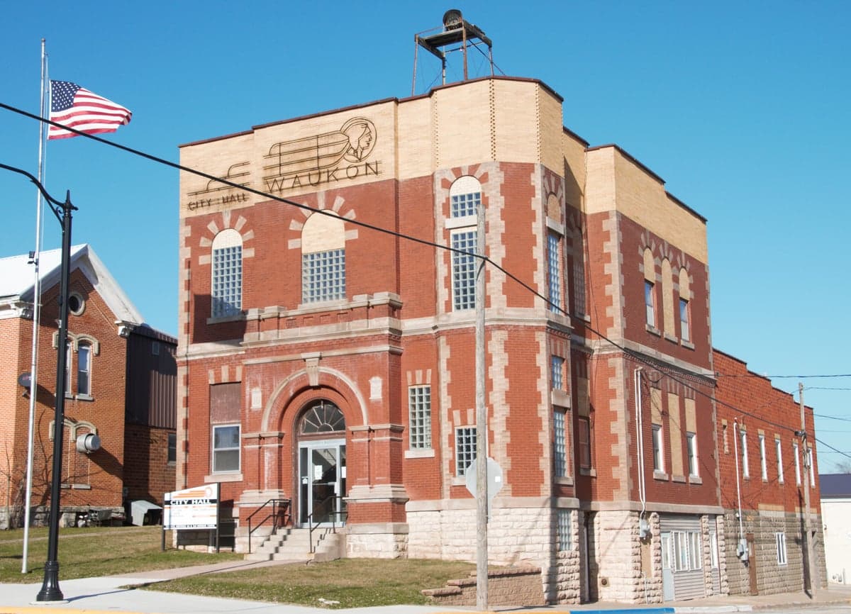
Photo: Wikipedia
Strategic Assessment of Waukon, IA
Workable tactical position. Some exposure to population density or targets, but generally defensible in a crisis.
What does the Strategic Assessment tell us?
Our Strategic Assessment grades tactical survivability of an area. Major population centers, military targets, fallout zones, natural disasters, and border exposure all drive risk — lower exposure means a more defensible position in a crisis.
This is heavily inspired by Joel Skousen's Strategic Relocation book. Highly recommended you checkout the book ($)What does this tell us?
Our Strategic Assessment grades tactical survivability of an area. Major population centers, military targets, fallout zones, natural disasters, and border exposure all drive risk — lower exposure means a more defensible position in a crisis.
This is heavily inspired by Joel Skousen's Strategic Relocation book. Highly recommended you checkout the book ($)Strategic Pillars

Key Distances
Regional Safe Places
Below is our recommended "safe zones" in Iowa and the surrounding area based on our strategic heuristics. For most people, it's unrealistic to live in a “safe zone” full-time due to work, family or other personal reasons. They tend to be more rural. However, many of these areas are perfect for second homes and retreat properties that double as a vacation home or even a short-term rental.
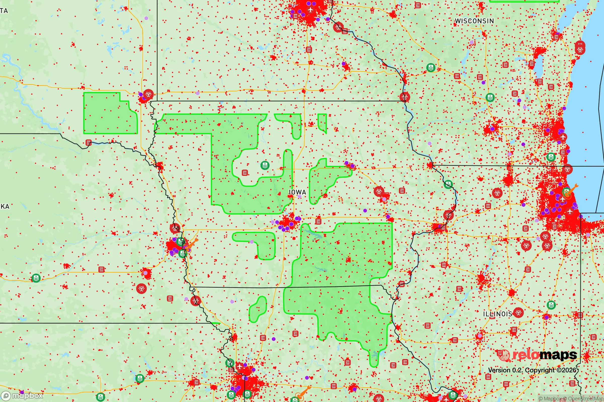
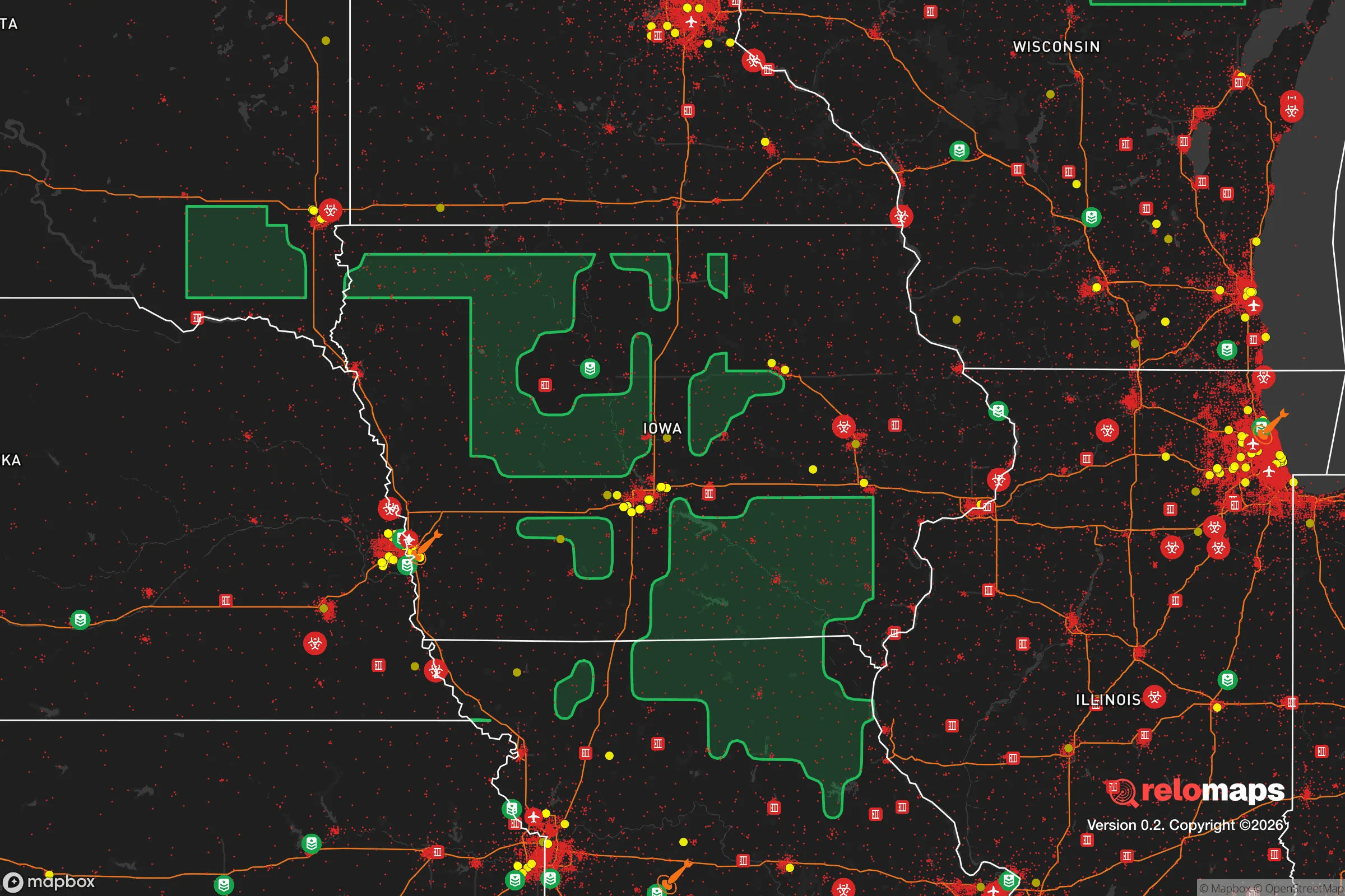


Important Note: For informational purposes only. This does not mean nothing bad ever happens in the green zones. Please use common sense. This is based on public data and modeled with AI. We tried to take a conservative approach but mistakes happen. We update this regularly as new information becomes available.
Solar Generator Recommendations
Backup power matters more here than in safer locations. We've picked three solar generators across budgets and capacity tiers — start with the budget unit if you only need a few essentials, or step up if you want to run a fridge and HVAC for days at a time.

Jackery Portable Power Station Explorer 300
Budget OptionPower on the Go: Weighing only 11 lbs, it's convenient to set up and store with book-sized foldable solar panels

BLUETTI Portable Power Station AC180
Designed for both indoor and outdoor scenarios, AC180 is highly capable as it has a robost capacity and continuous output power.

EF ECOFLOW DELTA Pro Ultra Power Station
Upgraded PickEcoFlow DELTA Pro Ultra is a whole-home energy system designed to grow with your family. Integrated with the Smart Home Panel 2, it scales to meet your evolving energy needs — keeping your home powered, intelligent, and secure through every stage of life.
We earn a commission, at no additional cost to you.
Strategic Assessment Analysis
Waukon, Iowa, offers a compelling strategic profile for the relocation-minded reader focused on resilience and self-sufficiency, primarily due to its position in the rugged, driftless region of northeast Iowa. This area, spared from glaciation, provides a natural topography of steep hills, deep valleys, and abundant water sources that create inherent defensibility and separation from major population corridors. While not entirely isolated, Waukon sits far enough from the major interstates and metropolitan hubs like Minneapolis, Des Moines, and Madison to offer a meaningful buffer against the cascading effects of a large-scale disruption, whether natural or man-made.
Geographic position and natural advantages for long-term stability
Waukon’s location in Allamakee County is its single greatest strategic asset. The area is part of the Driftless Region, a unique geological zone that escaped the flattening effects of the last Ice Age. This means the landscape is defined by steep bluffs, deep coulees, and narrow valleys, which naturally channel movement and provide numerous defensible positions. The Upper Iowa River and the Mississippi River are both within a short drive, offering reliable surface water sources that are less susceptible to drought than the shallow aquifers found in the flat, glaciated parts of the state. The region’s forest cover is also a significant advantage, providing a vast resource for timber, fuel, and concealment, as well as a rich habitat for game like deer and turkey. For a relocator, this terrain offers a natural barrier against the kind of rapid, uncontrolled movement that would plague flatter, more open areas during a crisis. The local economy is already grounded in agriculture and small-scale manufacturing, meaning a baseline of practical skills and local food production is already in place, not something that would need to be imported from scratch.
Risk exposure, fallout proximity, and man-made threat assessment
The primary risk in Waukon is not from natural disasters like hurricanes, earthquakes, or wildfires, which are virtually nonexistent here. The main threats are winter storms, which can be severe and cause prolonged power outages, and the potential for flooding along the Upper Iowa River in the spring. Both are manageable with proper preparation. The more significant strategic concern is proximity to man-made threats. Waukon is roughly 70 miles from the Prairie Island Indian Community’s nuclear generating plant near Red Wing, Minnesota, and about 90 miles from the Duane Arnold Energy Center near Cedar Rapids. While these distances are outside the most severe fallout zones for a major event, they are within the range of potential contamination plumes depending on wind patterns. A relocator should factor this into their planning, particularly regarding water collection and food storage strategies. On the positive side, Waukon is far from any major military installations, large chemical plants, or major rail hubs that would be primary targets in a conflict. The nearest city of significant size is La Crosse, Wisconsin, about 40 miles away, which is a moderate risk corridor but not a primary target. The area’s low population density—Allamakee County has roughly 14,000 people—means that in a widespread emergency, competition for local resources would be far less intense than in suburban or urban settings.
Practical resilience for a relocator: food, water, energy, and defensibility
For a relocator serious about self-sufficiency, Waukon presents a strong practical foundation. Water is abundant: the region’s high annual rainfall (around 35 inches) and numerous springs, creeks, and rivers mean that a well or a rainwater catchment system is highly viable. The local bedrock is largely limestone and sandstone, which filters water well but can also be prone to contamination from surface runoff, so proper filtration and testing are essential. Food production is the area’s strongest suit. The surrounding farmland produces corn, soybeans, and hay, but the real advantage is the prevalence of small, diversified farms, orchards, and Amish and Mennonite communities that practice traditional, low-tech agriculture. A relocator can source heirloom seeds, livestock, and practical knowledge from these communities, which are generally self-reliant and operate outside the industrial food system. Energy resilience is moderate. The grid is rural and prone to outages during ice storms, but the forested landscape makes wood heat a primary backup option for many residents. Solar potential is decent but not exceptional due to the hilly terrain and frequent cloud cover; a ground-mounted system on a south-facing slope would be ideal. Defensibility is excellent due to the terrain. A property situated in a valley with a single access road, or on a bluff with clear sightlines, offers natural security. The local culture is one of mutual aid and neighborly assistance, but also of strong property rights and a general wariness of outsiders, which can be a double-edged sword. Building genuine relationships before a crisis is critical.
The overall strategic picture for Waukon is one of a solid, if not perfect, haven for those prioritizing resilience. It lacks the extreme isolation of the Mountain West or the deep South, but it compensates with abundant water, fertile soil, a defensible landscape, and a community that still retains a degree of practical, pre-industrial knowledge. The trade-offs are real: harsh winters, limited access to specialized medical care (the nearest hospital is in La Crosse), and a local economy that offers fewer high-paying remote-work opportunities. For a single individual or family willing to invest in a wood stove, a well, a garden, and a network of local contacts, Waukon provides a realistic and grounded option for long-term stability. It is not a bunker mentality location, but rather a place where a thoughtful, prepared person can build a genuinely resilient life without the constant background noise of a major metropolitan area. The key is to arrive with skills, not just supplies, and to respect the existing community’s rhythms and knowledge.

* Values derived from national, state, county, city and local statistics and may differ in a specific area. Last updated: 2026-10-08T00:56:20.000Z
Narrative content on this page is AI-generated and may contain mistakes. Verify any details that matter before acting on them.
ReloMaps may earn a commission from affiliate links at no extra cost to you.

