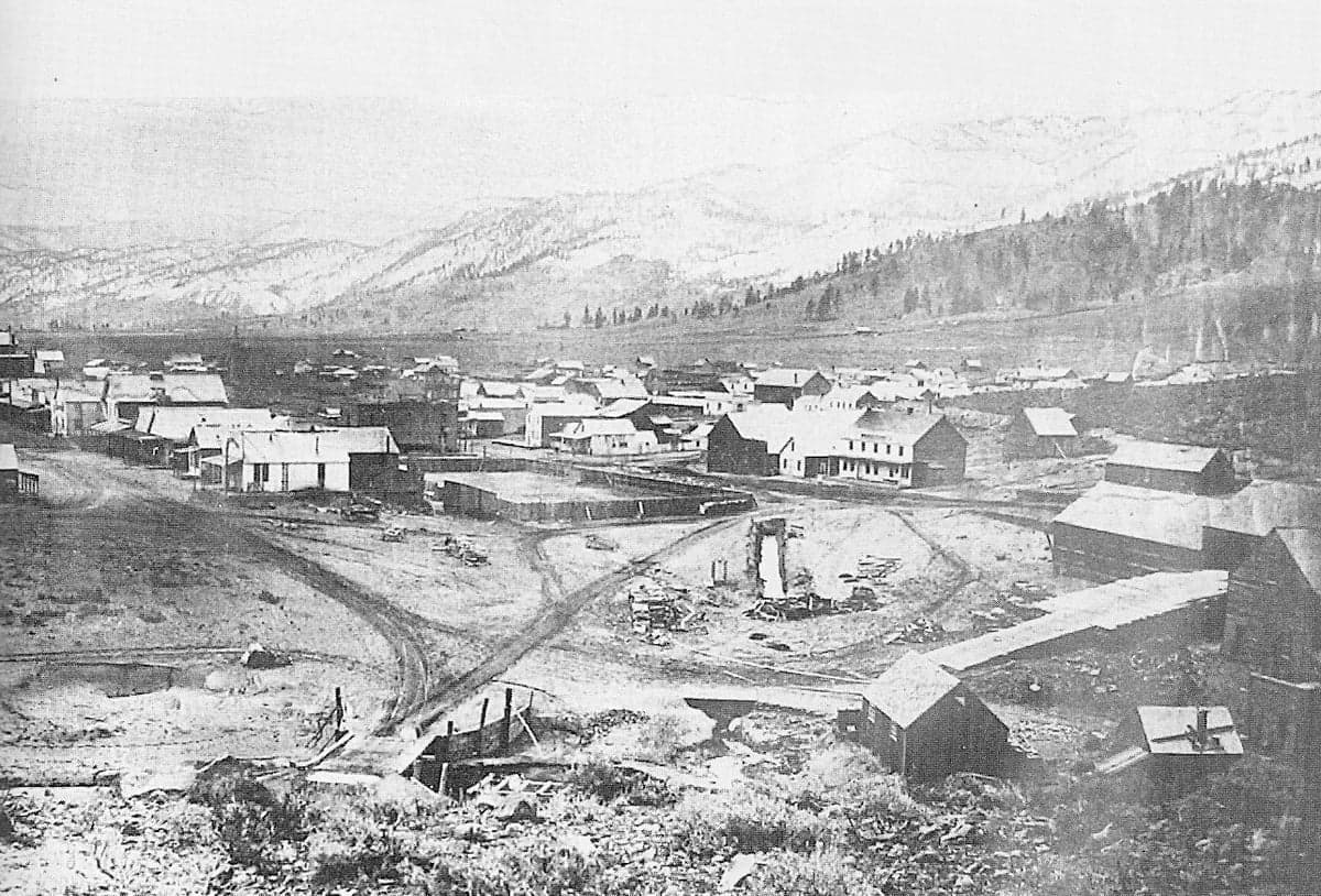
Photo: Wikipedia
Strategic Assessment of Washoe City, NV
Meaningful friction. Expect exposure to either population pressure, blast zones, or natural disaster risk. Consider buying a retreat property.
What does the Strategic Assessment tell us?
Our Strategic Assessment grades tactical survivability of an area. Major population centers, military targets, fallout zones, natural disasters, and border exposure all drive risk — lower exposure means a more defensible position in a crisis.
This is heavily inspired by Joel Skousen's Strategic Relocation book. Highly recommended you checkout the book ($)What does this tell us?
Our Strategic Assessment grades tactical survivability of an area. Major population centers, military targets, fallout zones, natural disasters, and border exposure all drive risk — lower exposure means a more defensible position in a crisis.
This is heavily inspired by Joel Skousen's Strategic Relocation book. Highly recommended you checkout the book ($)Strategic Pillars

Key Distances
Regional Safe Places
Below is our recommended "safe zones" in Nevada and the surrounding area based on our strategic heuristics. For most people, it's unrealistic to live in a “safe zone” full-time due to work, family or other personal reasons. They tend to be more rural. However, many of these areas are perfect for second homes and retreat properties that double as a vacation home or even a short-term rental.
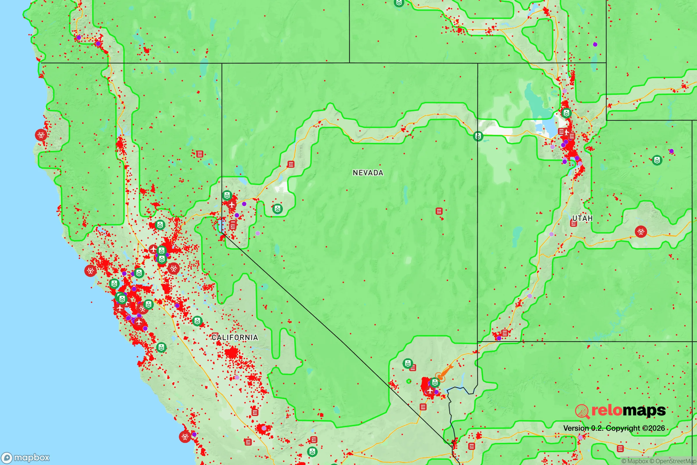
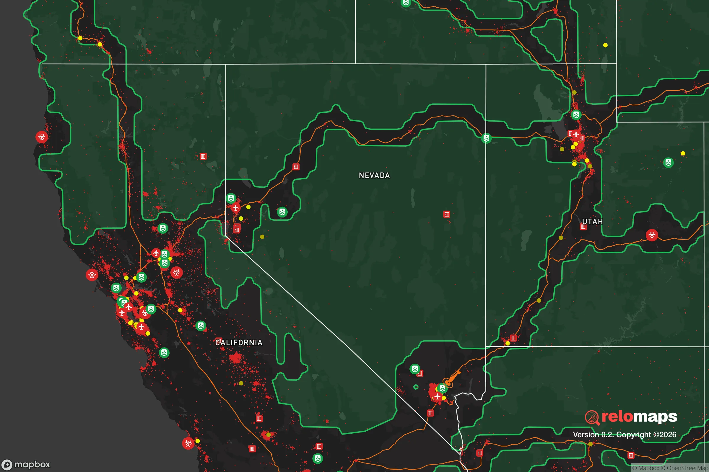


Important Note: For informational purposes only. This does not mean nothing bad ever happens in the green zones. Please use common sense. This is based on public data and modeled with AI. We tried to take a conservative approach but mistakes happen. We update this regularly as new information becomes available.
Solar Generator Recommendations
Backup power matters more here than in safer locations. We've picked three solar generators across budgets and capacity tiers — start with the budget unit if you only need a few essentials, or step up if you want to run a fridge and HVAC for days at a time.

Jackery Portable Power Station Explorer 300
Budget OptionPower on the Go: Weighing only 11 lbs, it's convenient to set up and store with book-sized foldable solar panels

BLUETTI Portable Power Station AC180
Designed for both indoor and outdoor scenarios, AC180 is highly capable as it has a robost capacity and continuous output power.

EF ECOFLOW DELTA Pro Ultra Power Station
Upgraded PickEcoFlow DELTA Pro Ultra is a whole-home energy system designed to grow with your family. Integrated with the Smart Home Panel 2, it scales to meet your evolving energy needs — keeping your home powered, intelligent, and secure through every stage of life.
We earn a commission, at no additional cost to you.
Strategic Assessment Analysis
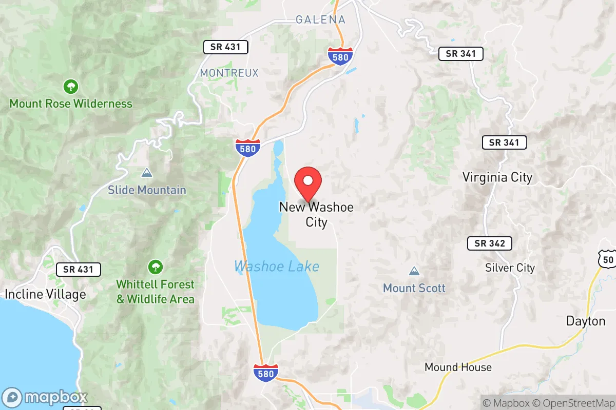
Washoe City, Nevada, occupies a strategic niche in the Great Basin that offers genuine resilience advantages for those prioritizing disaster readiness and self-sufficiency. Situated at the base of the Sierra Nevada foothills along the Truckee River corridor, this unincorporated community sits roughly 15 miles south of Reno and 30 miles north of Carson City, placing it close enough to urban resources but far enough to avoid the worst of metropolitan vulnerabilities. The area’s elevation of roughly 5,000 feet, combined with its position in a rain shadow east of the Sierra crest, provides a moderate climate that avoids the extremes of both the high desert and the wetter western slopes, making it a defensible middle ground for long-term preparedness.
Geographic position and natural advantages for long-term stability
Washoe City’s location is defined by its proximity to the Sierra Nevada range and the Truckee River, which together create a microclimate and resource base that few other Nevada communities can match. The Truckee River, flowing from Lake Tahoe through the valley, provides a reliable surface water source—a critical asset in a state where water rights are fiercely contested and groundwater is often deep or brackish. The surrounding hills, part of the Carson Range, offer natural defensibility: they limit line-of-sight from major highways and provide multiple escape routes into the Toiyabe National Forest or the remote areas of Washoe Valley. The community sits at the junction of U.S. 395 and State Route 429, giving residents access to both north-south and east-west corridors without being directly on a major interstate, which reduces the risk of being trapped by traffic or supply chain disruptions during a crisis. The valley’s agricultural history, including the historic Bowers Mansion and remaining ranches, indicates that the soil and microclimate can support small-scale farming, particularly with careful water management. For a relocator, this means the area offers a rare combination of water access, defensible terrain, and moderate climate that supports year-round food production—a foundation for self-sufficiency that is hard to find in most of the Intermountain West.
Risks, exposures, and proximity to fallout-relevant landmarks
No strategic assessment is complete without acknowledging the risks, and Washoe City has several that demand attention. The most immediate natural threat is wildfire: the area sits in a high-risk zone where the Sierra Nevada’s dry forests meet the sagebrush steppe, and the 2021 Tamarack Fire and 2022 Mosquito Fire demonstrated how quickly flames can move through the Carson Range. The community’s location in a valley with limited road access (primarily U.S. 395 and a few secondary roads) creates a potential bottleneck during an evacuation, especially if the highway is compromised. Earthquake risk is moderate but real, given the proximity to the Walker Lane seismic zone, which runs through western Nevada; a major quake could disrupt the Truckee River’s flow or damage the nearby hydroelectric infrastructure. From a man-made risk perspective, Washoe City’s proximity to Reno-Sparks (population ~500,000) and the Tahoe Reno Industrial Center (home to Tesla’s Gigafactory and other large-scale manufacturing) introduces vulnerabilities. The Gigafactory, while a major economic asset, is a potential target for both physical and cyber attacks, and its lithium-ion battery production involves hazardous materials. Additionally, the area lies within 100 miles of the Nevada National Security Site (formerly the Nevada Test Site) and the Hawthorne Army Depot, both of which store or handle materials that could be relevant in a fallout scenario. While Washoe City itself is not directly downwind of these facilities in most prevailing wind patterns, a major incident could still affect the region. The presence of Interstate 80 and U.S. 395 as major transportation corridors also means that any large-scale evacuation or supply chain disruption in the Reno area would quickly impact Washoe City’s access to goods and services.
Practical resilience for a relocator: food, water, energy, and defensibility
For someone serious about self-sufficiency, Washoe City offers a mixed but workable picture. Water is the strongest asset: the Truckee River provides a surface source that, with proper rights or a well, can support irrigation and household use. However, water rights in Nevada are complex and often tied to historical usage, so a relocator must verify access before purchasing property. The area’s shallow groundwater in the valley floor can support private wells, but depths vary and drilling costs are significant. Food production is feasible but requires effort: the growing season is short (roughly 100-120 frost-free days), but the valley’s soil, where not rocky, can support vegetables, fruit trees, and small livestock. The nearby agricultural areas of Smith Valley and Mason Valley offer additional food sources within a 30-minute drive. Energy resilience is a challenge: the grid is served by NV Energy, which has a mixed reliability record during winter storms and wildfire seasons. Solar potential is excellent—the area averages over 260 sunny days per year—but snow cover in winter can reduce output, and battery storage is essential for off-grid capability. Wood heating is common and practical, given the surrounding forests, but requires careful management of fire risk. Defensibility is moderate: the valley’s terrain offers natural chokepoints and limited access points, which can be an advantage for a prepared community. However, the area is not remote enough to deter determined intruders, and the presence of U.S. 395 means that any large-scale displacement from Reno or Carson City would funnel through the valley. The local population is small (roughly 1,500-2,000 residents in the immediate area), which means that community cohesion and mutual aid networks are critical—and likely stronger than in suburban sprawl. For a relocator, the key is to secure a property with its own water source, invest in solar and battery backup, and build relationships with neighbors who share a preparedness mindset.
The overall strategic picture for Washoe City is one of cautious optimism for the prepared relocator. It offers a rare combination of reliable surface water, defensible terrain, and moderate climate that supports a degree of self-sufficiency uncommon in the arid West. The risks—wildfire, earthquake, proximity to industrial and military targets—are real but manageable with proper planning, such as defensible space, seismic retrofitting, and a well-stocked emergency kit. The area’s location near Reno and Carson City is a double-edged sword: it provides access to medical facilities, supplies, and economic opportunities, but also ties the community’s fate to those urban centers in a major crisis. For a single individual or family willing to invest in water security, renewable energy, and community ties, Washoe City represents a viable base for long-term resilience. It is not a remote bunker, but a strategic outpost—close enough to civilization to thrive, far enough to survive.

* Values derived from national, state, county, city and local statistics and may differ in a specific area. Last updated: 2026-09-28T10:01:21.000Z
Narrative content on this page is AI-generated and may contain mistakes. Verify any details that matter before acting on them.
ReloMaps may earn a commission from affiliate links at no extra cost to you.

