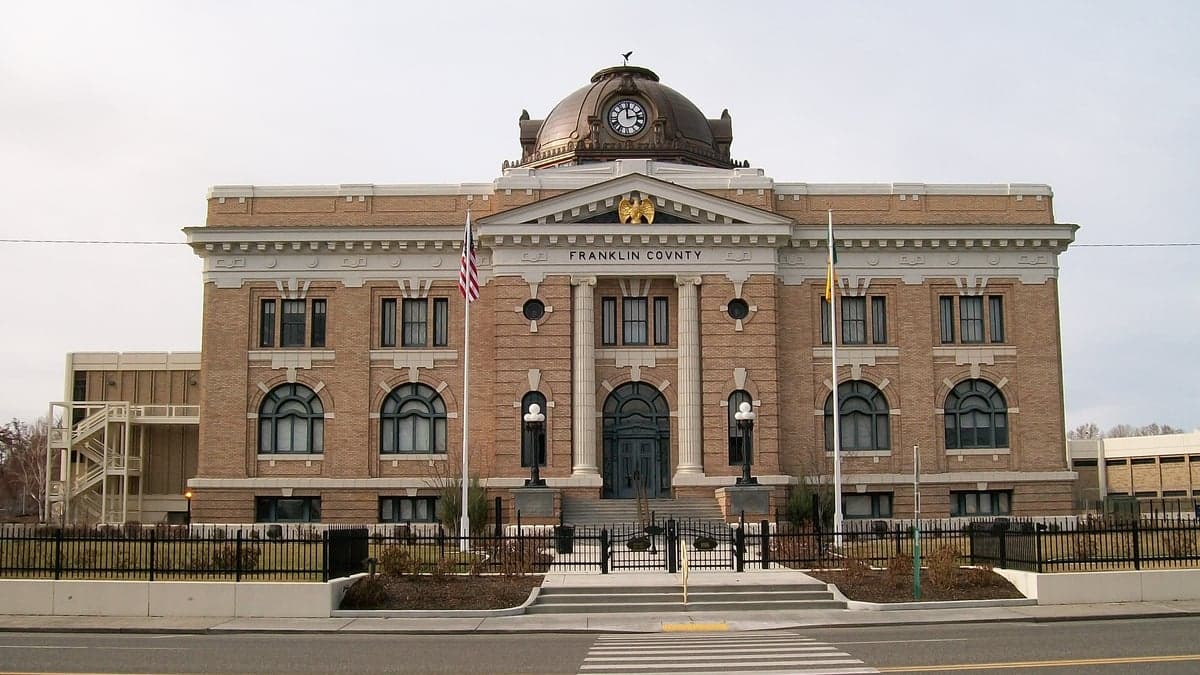
Photo: Wikipedia
Strategic Assessment of Franklin County
Strong survivability profile. Good buffer from population centers, with manageable environmental and tactical risks.
What does the Strategic Assessment tell us?
Our Strategic Assessment grades tactical survivability of an area. Major population centers, military targets, fallout zones, natural disasters, and border exposure all drive risk — lower exposure means a more defensible position in a crisis.
This is heavily inspired by Joel Skousen's Strategic Relocation book. Highly recommended you checkout the book ($)What does this tell us?
Our Strategic Assessment grades tactical survivability of an area. Major population centers, military targets, fallout zones, natural disasters, and border exposure all drive risk — lower exposure means a more defensible position in a crisis.
This is heavily inspired by Joel Skousen's Strategic Relocation book. Highly recommended you checkout the book ($)Strategic Pillars

Key Distances
Strategic Assessment Analysis
Franklin County, Washington, presents a mixed strategic picture for the relocation-minded reader focused on resilience and self-sufficiency. Its position in the semi-arid Columbia Basin offers genuine geographic advantages—abundant water, fertile volcanic soil, and relative isolation from major population centers—but it also sits within a region with significant industrial and military infrastructure that could become a liability in a crisis. For a single individual or family weighing long-term preparedness, the county’s strengths are real but require a clear-eyed understanding of the risks that come with living near the Hanford nuclear site and the transportation corridors of the Pacific Northwest.
Geographic position and natural advantages for long-term resilience
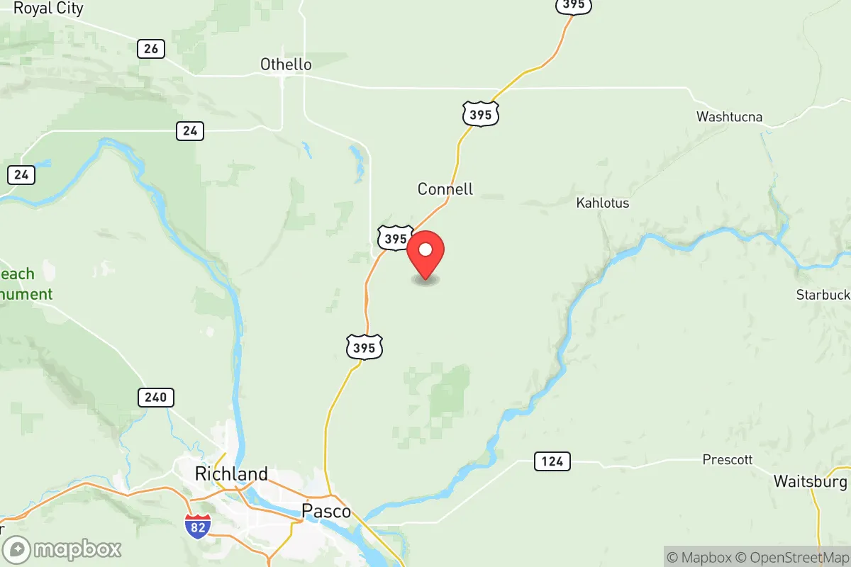
Franklin County’s most compelling asset is its location in the rain shadow of the Cascade Range, which gives it over 300 days of sunshine annually and a semi-arid climate that supports dryland farming without the mold, rot, and pest pressures common west of the mountains. The county sits at the confluence of the Snake and Columbia Rivers, providing a massive, reliable freshwater resource that is rare in the interior West. The city of Pasco, the county seat, lies at the heart of this water-rich corridor, while Connell and Kahlotus anchor the eastern agricultural stretches. The Columbia Basin Project, one of the largest irrigation networks in the United States, transforms the surrounding desert into some of the most productive farmland in the country—potatoes, wheat, corn, and alfalfa are grown in volume. For a relocator thinking about food security, this is not theoretical: the region is a net exporter of calories. The terrain is largely flat to gently rolling, which simplifies road access and construction, but also means defensibility is not a given—there are no natural chokepoints or high ground within the county itself. The nearest major population center, the Tri-Cities (Pasco, Kennewick, Richland), is a mid-sized metro area of roughly 300,000 people, which is large enough to provide services but small enough that a full-scale urban evacuation would not necessarily overwhelm the county’s rural roads.
Risks, exposures, and proximity to fallout-relevant landmarks
The single greatest risk factor in Franklin County is its proximity to the Hanford Site, a decommissioned nuclear production complex located just north of Richland, about 15 miles from Pasco. Hanford holds the largest concentration of radioactive waste in the Western Hemisphere, much of it stored in aging underground tanks. While the site is heavily monitored and the risk of a catastrophic release is low under normal conditions, a major earthquake, terrorist attack, or cascading infrastructure failure could create a contamination event that would render large portions of the county uninhabitable for years. The prevailing winds in the Columbia Basin blow from the southwest, meaning fallout from a Hanford incident would likely travel northeast—away from most of Franklin County’s population centers—but the Tri-Cities area, including Pasco, sits directly downwind of the site in certain weather patterns. Additionally, the county is crisscrossed by major rail lines and Interstate 82, which carry hazardous materials from the Port of Pasco and the region’s chemical fertilizer plants. A derailment or industrial fire at the port could disrupt water quality in the Columbia River for weeks. On the natural disaster front, the county is in a low-seismic-risk zone compared to western Washington, but the 2001 Nisqually earthquake was felt here, and the risk of a large quake on the Yakima Fold Belt is non-zero. Wildfire risk is moderate but growing: the 2020 Labor Day fires burned large areas of grassland in neighboring Benton County, and a dry, windy summer could push a fire into Franklin County’s agricultural zones, threatening homes in the rural fringe.
Practical resilience for a relocator: food, water, energy, and defensibility
For a relocator serious about self-sufficiency, Franklin County offers strong fundamentals. Water is the region’s trump card: the Columbia River alone carries enough volume to supply the entire state, and the county’s groundwater aquifers are well-recharged by irrigation return flows. A household with a well permit and a solar pump could have independent water access indefinitely. The county’s agricultural base means that even in a supply-chain disruption, local food production would continue—the Pasco Farmers Market and direct-from-farm sales are already established, and the surrounding farmland grows staple crops that store well. Energy is similarly robust: the county sits within the Bonneville Power Administration grid, which draws heavily from hydroelectric dams on the Columbia and Snake Rivers. These dams are hardened infrastructure, and the region has historically experienced fewer and shorter blackouts than the West Coast. Solar potential is excellent, with over 300 sunny days per year, making off-grid photovoltaic systems highly viable. Defensibility, however, is a weak point. The county’s flat, open terrain offers little natural cover or chokepoint advantage. A determined group could easily approach from multiple directions, and the rural road network, while adequate, is not designed for tactical defense. The county’s population density is low—about 50 people per square mile in the rural areas—which reduces the risk of social friction but also means that help from law enforcement could be hours away in a crisis. The Franklin County Sheriff’s Office is professional but small, and the nearest military installation of note is the Yakima Training Center, about 90 miles northwest, which is a National Guard facility and not a full-scale base. For a family, the practical takeaway is that Franklin County is an excellent place to stockpile supplies, grow food, and access water, but it is not a defensible redoubt in the way a mountainous or remote property might be.
The overall strategic picture for Franklin County is one of high potential tempered by a single, non-negotiable risk. The county’s agricultural wealth, water abundance, and energy stability make it one of the better-prepared areas in the Pacific Northwest for a gradual, long-term disruption. A relocator who establishes a well-watered property with solar panels, a root cellar, and a relationship with local farmers could ride out most scenarios with relative comfort. However, the Hanford Site casts a long shadow. A major incident there would not only threaten the county directly but could also trigger a mass evacuation from the Tri-Cities, overwhelming the rural roads and potentially bringing a wave of displaced people into the countryside. For a reader who prioritizes absolute safety from industrial and military targets, Franklin County is not the right choice. For someone who values food security, water independence, and a low-stress lifestyle in a region that is not a primary target, it is a strong contender—provided they have a plan for the Hanford variable. The county’s resilience is real, but it is not absolute, and the wise relocator will treat it as a calculated bet rather than a guaranteed safe harbor.

* Values derived from national, state, county, city and local statistics and may differ in a specific area. Last updated: 2026-07-03T06:29:24.000Z
Narrative content on this page is AI-generated and may contain mistakes. Verify any details that matter before acting on them.
ReloMaps may earn a commission from affiliate links at no extra cost to you.

