
Strategic Assessment of Newport News City County
Multiple tactical vulnerabilities. Population density, target proximity, or disaster risk are likely compounding. A retreat property and exit planning is required.
What does the Strategic Assessment tell us?
Our Strategic Assessment grades tactical survivability of an area. Major population centers, military targets, fallout zones, natural disasters, and border exposure all drive risk — lower exposure means a more defensible position in a crisis.
This is heavily inspired by Joel Skousen's Strategic Relocation book. Highly recommended you checkout the book ($)What does this tell us?
Our Strategic Assessment grades tactical survivability of an area. Major population centers, military targets, fallout zones, natural disasters, and border exposure all drive risk — lower exposure means a more defensible position in a crisis.
This is heavily inspired by Joel Skousen's Strategic Relocation book. Highly recommended you checkout the book ($)Strategic Pillars

Key Distances
Strategic Assessment Analysis
Newport News City County, Virginia, occupies a unique strategic position at the confluence of the James River and the Chesapeake Bay, offering a blend of maritime access, industrial depth, and military presence that few mid-Atlantic locations can match. For a relocator weighing disaster readiness and self-sufficiency, the area presents a mixed picture: it benefits from the logistical backbone of the Hampton Roads region but sits within a dense corridor of high-value targets, including the world's largest naval base and critical energy infrastructure. The city's resilience is tied directly to its role as a hub for shipbuilding, defense, and port operations, which means both economic stability and elevated risk in any major conflict or natural event.
Geographic position and natural advantages for long-term stability
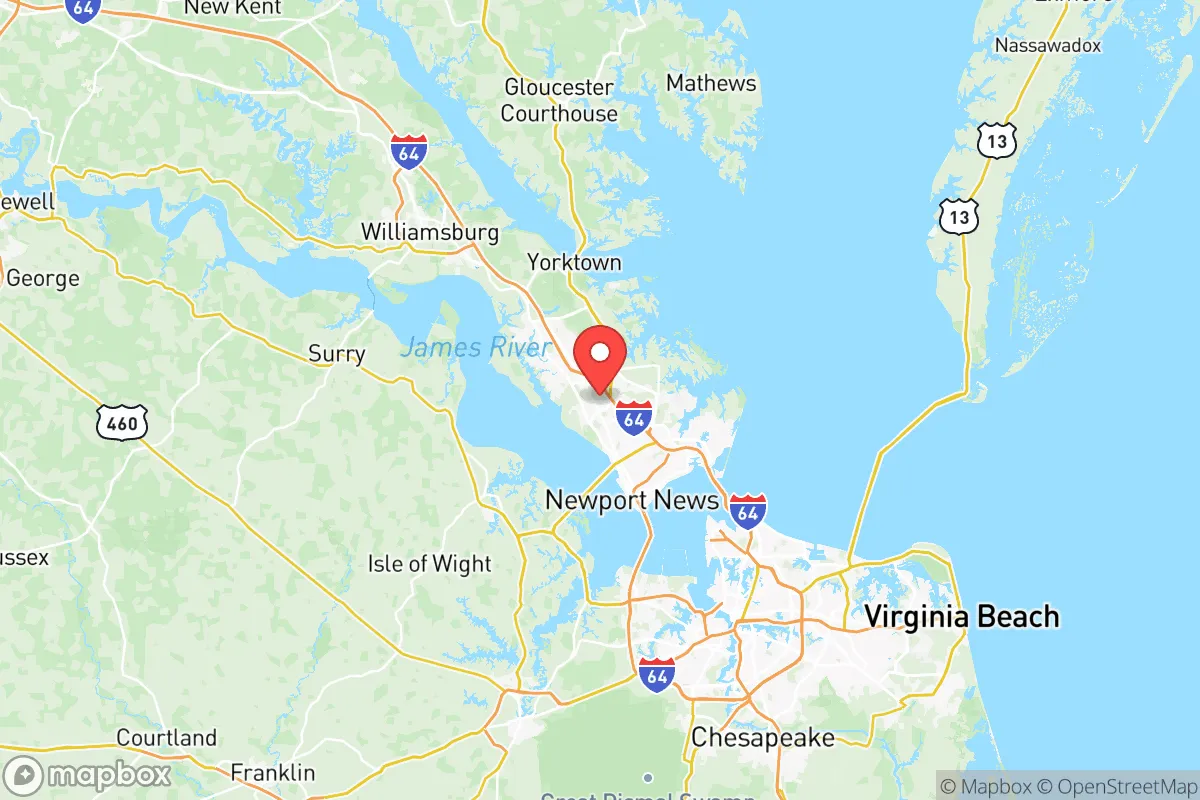
Newport News sits on the Virginia Peninsula, bounded by the James River to the south and the York River to the north, giving it a defensible, water-adjacent layout with multiple evacuation routes via Interstates 64 and 664. The city's location roughly 70 miles southeast of Richmond and 25 miles northwest of Virginia Beach places it within a region that has historically avoided the worst of hurricane landfalls, though it remains vulnerable to storm surge and flooding from nor'easters. The area's temperate climate supports year-round agriculture, with the surrounding Hampton Roads region containing some of Virginia's most productive farmland in counties like Isle of Wight and Southampton. Freshwater access is abundant via the James River and multiple reservoirs, including the Lee Hall Reservoir and the Warwick River watershed, which supply the city's water treatment plants. For a relocator, the natural advantages include relatively mild winters, a long growing season, and proximity to the Chesapeake Bay's marine resources, which could supplement food supplies in a prolonged disruption.
Risks, exposures, and proximity to high-value targets
The most significant strategic liability for Newport News is its proximity to an extraordinary concentration of military and industrial assets that would be primary targets in any major conflict. Naval Station Norfolk, the world's largest naval base, lies just 15 miles southeast across the James River, while Langley Air Force Base in Hampton is less than 10 miles east. Within Newport News itself, Newport News Shipbuilding—a division of Huntington Ingalls Industries—is the only facility in the United States capable of building and refueling nuclear-powered aircraft carriers, making it a uniquely high-value target. The Yorktown Naval Weapons Station, located just north of the city, stores and loads munitions for the Atlantic Fleet. Additionally, the Port of Virginia terminals in Newport News handle containerized cargo and breakbulk shipments, adding another layer of strategic importance. Natural disaster risks include hurricane storm surge, which can push water up the James River and flood low-lying areas like the Southeast Community and parts of Denbigh. The city also sits near the Eastern Virginia Seismic Zone, though earthquake risk remains low compared to the West Coast. For a relocator, the concentration of targets within a 20-mile radius means that any large-scale conflict or terrorist action would likely produce cascading effects on transportation, power, and communications in Newport News.
Practical resilience for a relocator: food, water, energy, and defensibility
Newport News offers a mixed but workable foundation for practical self-sufficiency. The city's water supply comes primarily from the Lee Hall Reservoir and the Warwick River, both of which are managed by Newport News Waterworks, a regional utility serving over 400,000 customers across four cities. In a prolonged outage, residents with access to the James River or smaller tributaries could treat water with portable filters, though tidal salinity near the mouth of the river limits freshwater availability in the southern part of the city. Food resilience is moderate: the city itself is urbanized, but the surrounding counties of James City, York, and Isle of Wight contain working farms, farmers' markets, and u-pick operations that could serve as local food sources. The Virginia Peninsula Food Bank in Hampton provides a regional distribution network, but individual gardening space is limited in denser neighborhoods like Hilton Village and Oyster Point. Energy infrastructure is robust but centralized: Dominion Energy's Surry Nuclear Power Station sits about 20 miles northwest across the James River, providing reliable baseload power, while the Yorktown Power Station (natural gas and oil) is just north of the city. However, both facilities are potential targets or single points of failure. For defensibility, the city's layout along the James River creates natural chokepoints at the Monitor-Merrimac Memorial Bridge-Tunnel and the James River Bridge, which could be controlled by a prepared community. The presence of a large active-duty and retired military population means a higher-than-average concentration of individuals with tactical training and emergency response experience, which could be an asset in organizing neighborhood defense or mutual aid networks.
The overall strategic picture for Newport News is one of high capability paired with high exposure. The city's economic engine—shipbuilding, defense, and port operations—makes it a resilient place in peacetime, with strong infrastructure and a skilled workforce. But those same assets place it squarely in the crosshairs of any adversary targeting U.S. military and industrial capacity. For a relocator who values proximity to military resources, maritime access, and a temperate climate, Newport News offers a defensible peninsula with multiple water sources and nearby farmland. The trade-off is living within a 20-mile radius of the most concentrated set of strategic targets on the East Coast. A prudent approach would involve selecting a home in the northern or western parts of the city—areas like Denbigh or Lee Hall—which are farther from the shipyard and naval base, have better access to rural evacuation routes via Route 60 and I-64, and sit on higher ground less prone to storm surge. For those willing to accept the risk for the sake of economic opportunity and community preparedness, Newport News can be a viable base of operations—provided one has a solid plan for evacuation or shelter-in-place when the next crisis hits.

* Values derived from national, state, county, city and local statistics and may differ in a specific area. Last updated: 2026-07-23T18:21:16.000Z
Narrative content on this page is AI-generated and may contain mistakes. Verify any details that matter before acting on them.
ReloMaps may earn a commission from affiliate links at no extra cost to you.

