Photo: Wikipedia
Strategic Assessment of Vashon, WA
Meaningful friction. Expect exposure to either population pressure, blast zones, or natural disaster risk. Consider buying a retreat property.
What does the Strategic Assessment tell us?
Our Strategic Assessment grades tactical survivability of an area. Major population centers, military targets, fallout zones, natural disasters, and border exposure all drive risk — lower exposure means a more defensible position in a crisis.
This is heavily inspired by Joel Skousen's Strategic Relocation book. Highly recommended you checkout the book ($)What does this tell us?
Our Strategic Assessment grades tactical survivability of an area. Major population centers, military targets, fallout zones, natural disasters, and border exposure all drive risk — lower exposure means a more defensible position in a crisis.
This is heavily inspired by Joel Skousen's Strategic Relocation book. Highly recommended you checkout the book ($)Strategic Pillars

Key Distances
Regional Safe Places
Below is our recommended "safe zones" in Washington and the surrounding area based on our strategic heuristics. For most people, it's unrealistic to live in a “safe zone” full-time due to work, family or other personal reasons. They tend to be more rural. However, many of these areas are perfect for second homes and retreat properties that double as a vacation home or even a short-term rental.
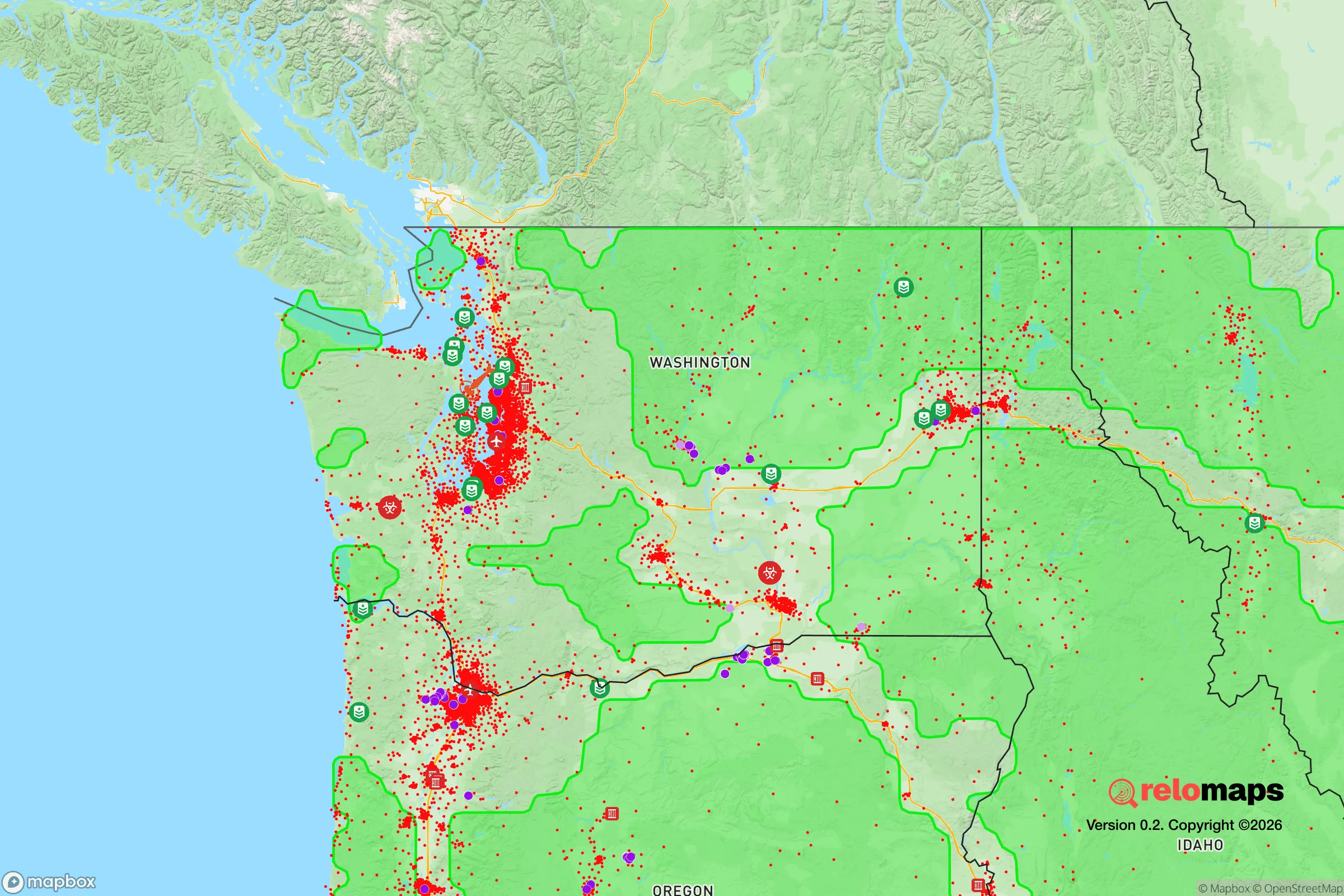
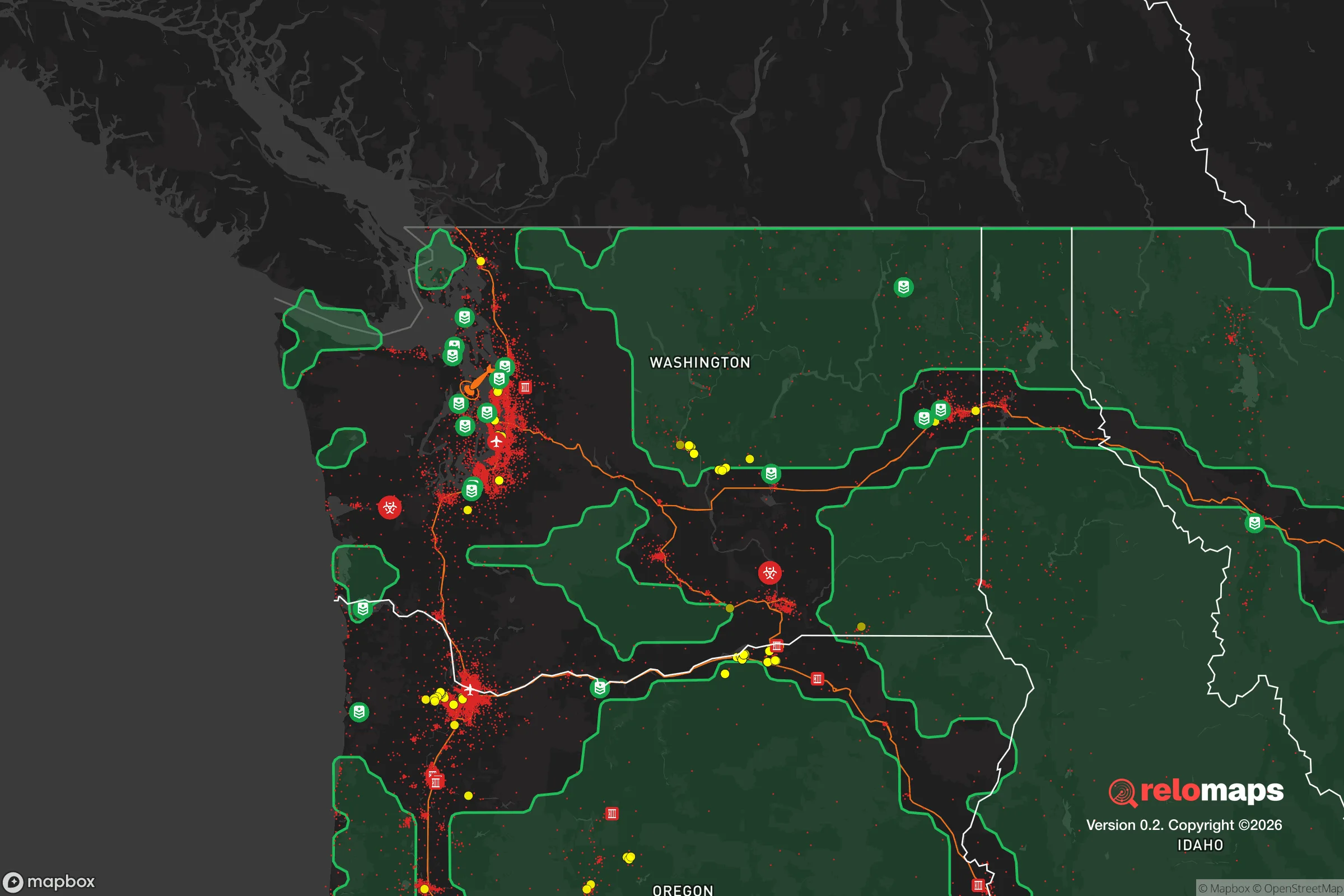


Important Note: For informational purposes only. This does not mean nothing bad ever happens in the green zones. Please use common sense. This is based on public data and modeled with AI. We tried to take a conservative approach but mistakes happen. We update this regularly as new information becomes available.
Solar Generator Recommendations
Backup power matters more here than in safer locations. We've picked three solar generators across budgets and capacity tiers — start with the budget unit if you only need a few essentials, or step up if you want to run a fridge and HVAC for days at a time.

Jackery Portable Power Station Explorer 300
Budget OptionPower on the Go: Weighing only 11 lbs, it's convenient to set up and store with book-sized foldable solar panels

BLUETTI Portable Power Station AC180
Designed for both indoor and outdoor scenarios, AC180 is highly capable as it has a robost capacity and continuous output power.

EF ECOFLOW DELTA Pro Ultra Power Station
Upgraded PickEcoFlow DELTA Pro Ultra is a whole-home energy system designed to grow with your family. Integrated with the Smart Home Panel 2, it scales to meet your evolving energy needs — keeping your home powered, intelligent, and secure through every stage of life.
We earn a commission, at no additional cost to you.
Strategic Assessment Analysis
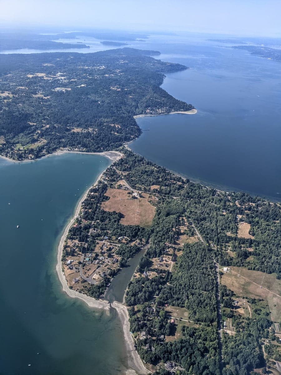
Vashon Island offers a distinctive strategic profile for relocation, balancing strong natural resilience and ready access to the Salish Sea with proximity to major urban targets that are unavoidable in the Puget Sound region. Its status as an island with ferry-only access creates a natural buffer against many cascading failures of a grid-down or crisis scenario, yet that same geography presents clear constraints on self-reliance and defensibility. For the reader weighing disaster readiness and long-term self-sufficiency, Vashon delivers structural advantages in isolation and abundance of local water, but demands serious pre-positioning for energy independence, food security, and medical access.
Geographic position, natural buffers, and relative isolation
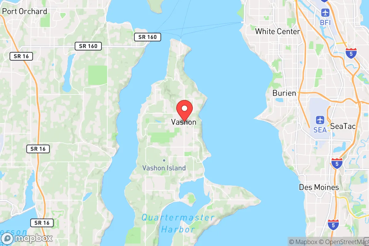
Vashon Island sits in the middle of Puget Sound, separated from the Seattle metropolitan area by approximately 15 miles of open water on its east side (accessed via the Point Defiance–Vashon ferry) and from the Tacoma metropolitan area by a similar distance on its south and west via the Southworth ferry route. This water barrier provides an organic moat effect—no bridges or tunnels connect the island to the mainland. Its 0.8-mile-wide northern isthmus at the town of Burton is a chokepoint of note, but the island's total land area of 37 square miles (with 50% of its 2,500 acres of parks and natural areas) gives room for dispersal. Elevation ranges from sea level to 600 feet, with the interior rising to moderate hills; no single point is far from tidal influence. The soil is a mix of sandy loam and glacial deposits—suitable for small-scale vegetable production but limited for row crops requiring heavy irrigation. The island sits within the Cascadia subduction zone, and the 5.2 magnitude Nisqually earthquake in 2001 caused little damage there, but consensus models confirm the island would experience strong shaking in a magnitude 9 event—geologic analysis from the USGS and local plane table surveys confirm the island’s glacial till soil loses cohesion in liquefaction-prone areas, particularly the central slopes. That said, Vashon is not within the tsunami inundation zone outlined in the WA DNR tsunami model because the sound’s shallow sill protects deep-ocean wave amplification; no historical tsunami has caused more than minor damage.
Risks, exposures, and proximity to fallout-relevant landmarks
Vashon Island is squarely within the secondary risk radius for any man-made or accidental radiological event involving the Puget Sound Naval Shipyard in Bremerton (over the water, 12 miles west) or the Boeing supply chain facilities in Everett, Tacoma, and Port of Seattle (15–25 miles east). The prevailing westerly winds push maritime air—typically from the Pacific across the Olympic Peninsula and into the sound—meaning any plume from Bremerton would first hit Vashon before Seattle. The JPALMON or EPA dispersion models for a 1-2 kt nuclear device detonation near the shipyard show that the island lies under the southwest-to-northeast fallout corridor for the first 12 hours, with a 50% hazard distance zone covering the island’s southern half. The ferry terminal for the main island—Point Defiance—is one of two active disaster-managed marine gates (the other being the ferry to the Olympic Peninsula) and is a designated state emergency staging zone for fuel and supplies; in an event, you would likely compete with evacuated mainland residents for berths and priority. Wildfire risk is moderate but non-negligible in island forests; DNR wildland-urban interface maps place Vashon’s central and northern forests at class 3 (moderate) fuel loading. The most serious anthropogenic risk comes from the Bremerton Navy base’s two nuclear-capable aircraft carriers, the USS John C. Stennis piered directly visible to western shore. In a large-scale conflict scenario, the sound is a high-value target, not a safe refuge.
Practical resilience for a relocator: food, water, energy, defensibility
Vashon has one community well (at the 400-foot depth in the glacial till) that serves the central Vashon Island Water District; the rest is private bedrock or shallower wells. Groundwater yields average 5-15 gallons/minute at a 150-foot depth—acceptable for a household, but insufficient for irrigation** of any scale beyond a large garden. The island’s surface water is limited to a few streams (including Ellis Creek) but total flow volume is negligible. Rain capture is the most practical backup: the island gets 38 inches of rain annually, meaning a 2,000-square-foot roof yields ~45,000 gallons/year—enough for domestic and crop use. But storage requires filtration and containment; most island homes have basements that could serve as cistern spaces for 2,000-3,000 gallons easily.
Local food production is plentiful but not trade-ready. The island has 7 commercial farms (including two U-pick berry operations and a greenhouse) plus a network of community gardens—enough to feed perhaps 5,000 of its 10,000 year-round residents sustainably, per the Vashon-Maury Island Agriculture Protection District assessment—but processing and preservation infrastructure is nearly absent. There is one community cannery at the Vashon Island Grange, but no commercial milling or cold storage on-island. Game density is moderate—the island has healthy deer and rabbit populations—but hunting pressure is high per square mile. Acquiring a small boat for coastal foraging would significantly increase protein options: the sound is rich in salmon, flounder, and shellfish, though pollution concerns (heavy metals—legacy from Asarco smelter in Tacoma decades ago) are moderate; the WA Department of Health recommends limiting consumption of bottom-feeding fish and clams to 2-3 meals/month from this area. Fuel: the island has one gas station at Vashon Center, with above-ground storage of 10,000 gallons—a bluff supply that drains fast. No natural gas pipeline reaches the island; heating is either propane, wood, or oil. The advantage here is that the most accessible fuel is firewood from island forests: an estimated 110,000 air dry cord potential (US Department of Forestry assessment of private woodlots), enough for ~30% of winter heat for all households if deployed. Defensibility: the 30-minute ferry delay and single road network (SW 25 & SR160) are the two choke points; a determined group could set up roadblocks at either of the two road junctions leading to the central valley, but the island is laced with 20+ miles of unpaved private roads—hard for controlled access but porous for defenders. The terrain is not militarily defensible—no natural elevated firing positions—but the sea is a barrier that would disincentivise random looting compared to mainland neighborhoods.
Overall strategic picture: Vashon is excellent for a defensible retreat scenario with a lifestyle adjustment but fails that test for high-volume self-sufficiency. Its isolation from road-borne collapse is genuine, but its dependence on ferries for full connectivity, small propellant base for fuel, and limited groundwater make it a place that requires serious prepositioning: a six-month food cache, a 100+ gallons of stored water, a wood-heated home, and a rain barrel system are the baseline. The shadow of the Navy yard and the occasional reality of living inside a sound-sized area mean that any wide-area bomb or industrial accident will affect air and water in ways than cannot be ignored. For a prepared individual willing to invest in a septic expansion, a wood boiler, and a small PV array designed for island weather patterns, Vashon is a solid, defensible with trade-offs—much better than a dense suburb but distinctly not an independent, if you need uninterrupted state infrastructure. This is an area for a serious connector, not a catastrophic flake—move here with your team, not your hopes. The ferry schedule, the water table, and the single tank of gas at the central gas station will all be dictates in a real disruption; prepare for them, and you will find no better island off the West Coast.

* Values derived from national, state, county, city and local statistics and may differ in a specific area. Last updated: 2026-09-12T19:13:52.000Z
Narrative content on this page is AI-generated and may contain mistakes. Verify any details that matter before acting on them.
ReloMaps may earn a commission from affiliate links at no extra cost to you.

