Photo: Wikipedia
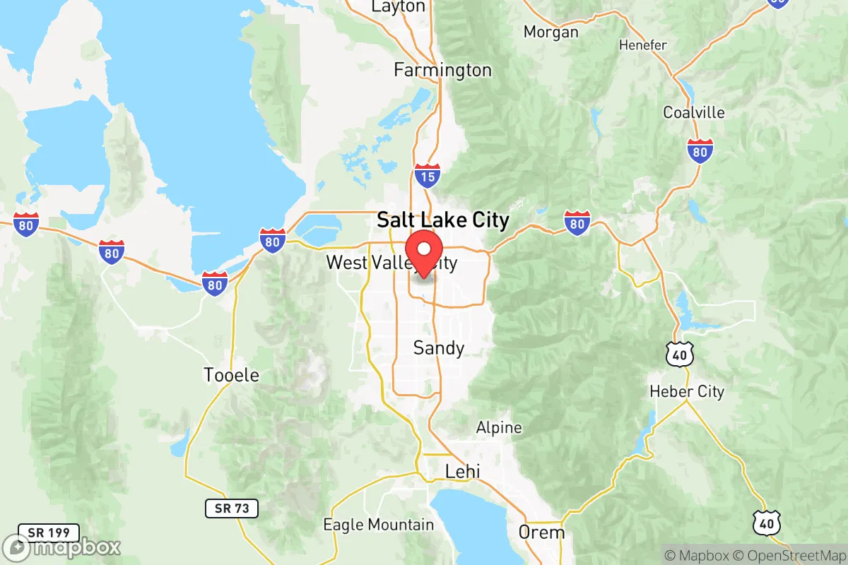
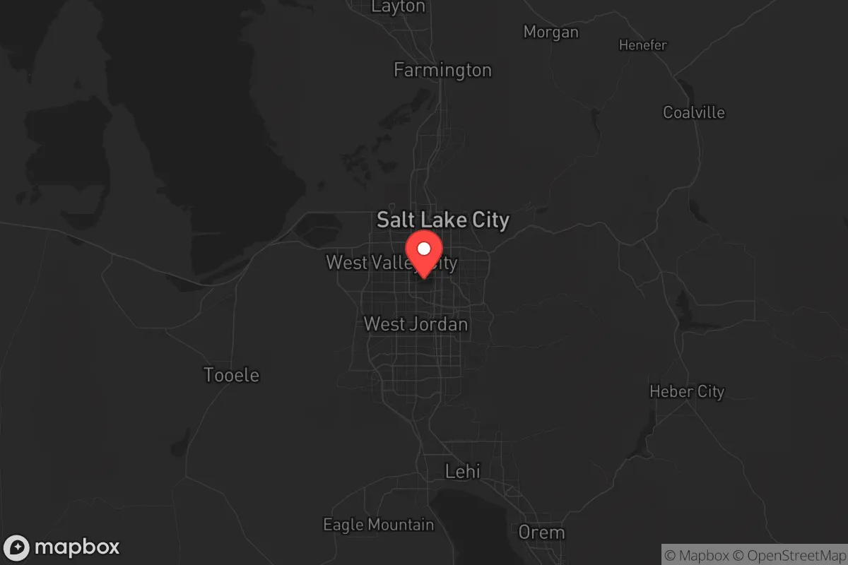
Strategic Assessment of Salt Lake County
Meaningful friction. Expect exposure to either population pressure, blast zones, or natural disaster risk. Consider buying a retreat property.
What does the Strategic Assessment tell us?
Our Strategic Assessment grades tactical survivability of an area. Major population centers, military targets, fallout zones, natural disasters, and border exposure all drive risk — lower exposure means a more defensible position in a crisis.
This is heavily inspired by Joel Skousen's Strategic Relocation book. Highly recommended you checkout the book ($)What does this tell us?
Our Strategic Assessment grades tactical survivability of an area. Major population centers, military targets, fallout zones, natural disasters, and border exposure all drive risk — lower exposure means a more defensible position in a crisis.
This is heavily inspired by Joel Skousen's Strategic Relocation book. Highly recommended you checkout the book ($)Strategic Pillars

Key Distances
Strategic Assessment Analysis
Salt Lake County offers a genuinely mixed strategic picture for the relocator who thinks in terms of resilience rather than just lifestyle. The county sits at the heart of the Wasatch Front, a 120-mile urban corridor that concentrates both opportunity and vulnerability into a narrow mountain valley. For the prepper-minded conservative who is watching the steady fraying of national stability, this area provides legitimate natural advantages — mountain water, high desert defensibility, distance from the coasts — but also carries real exposure risks tied to its population density, industrial targets, and single-point-of-failure infrastructure. The key is knowing which pockets of the county offer genuine buffer and which are merely suburban sprawl with a mountain view.
Geographic position and natural advantages for long-term stability
The Wasatch Mountains form a literal wall on the county's eastern edge, and that is not just scenic. These mountains create a natural barrier that limits approach corridors, channeling movement and supply routes into a handful of canyon roads and the I-15 corridor. For someone thinking about civic unrest or regional supply chain disruption, that terrain works in favor of those who know it. The county's position in the Intermountain West places it roughly 500 miles from any coastline and 300 miles from the nearest major border crossing, which means it is far removed from the kind of coastal evacuation chaos or border-related instability that could ripple outward. The Great Salt Lake to the northwest provides a buffer zone of open, largely uninhabitable terrain that limits approach from that direction. Water access is a genuine asset here — the county sits atop significant groundwater reserves in the Jordan River aquifer, and the mountain watersheds from Little Cottonwood Canyon, Big Cottonwood Canyon, and Parleys Canyon provide reliable seasonal snowmelt that feeds reservoirs like Mountain Dell and Deer Creek. For a relocator thinking about water independence, that is a structural advantage most of the country simply does not have. The elevation — roughly 4,200 feet in the valley floor — and the arid climate also mean that many of the biological and insect-borne disease risks common in wetter, lower-elevation areas are minimized. Summer heat is dry, winter cold is manageable with proper preparation, and the growing season, while short, supports productive gardening in the southern and western parts of the county.
Risks, exposures, and proximity to fallout-relevant landmarks
The same geography that provides natural defense also creates a funnel. Salt Lake County is home to roughly 1.2 million people, and most of them live within a narrow strip no more than ten miles wide between the mountains and the lake. That density is the primary vulnerability. The I-15 corridor through the county is a single chokepoint that, if compromised by a major incident, earthquake, or civil disruption, would effectively isolate the valley from north-south movement. The county also sits within a few miles of several high-value target zones. The Kennecott Copper Mine at Bingham Canyon, just southwest of the county line, is one of the largest open-pit mines on the planet and a critical domestic source of copper and molybdenum — it is the kind of industrial asset that would be a priority target in any serious conflict scenario. Just northwest of the county, across the lake from Tooele County, sits the Tooele Army Depot, a major chemical weapons storage and demilitarization site. The prevailing wind patterns in the valley run from south to north in the summer and north to south in the winter, meaning any airborne release from that facility could potentially drift into the southern parts of the county depending on conditions. Hill Air Force Base, roughly 30 miles north of Salt Lake City, is a major logistics and maintenance hub for the F-35 fleet and a probable target set in any peer-level conflict. The county also hosts the state's primary fuel infrastructure — refineries and tank farms in the North Salt Lake and Woods Cross area — which are visible from the interstate and sit close to major population centers. For the prepper weighing fallout risks, it is worth noting that the urban core of Salt Lake City itself, along with the industrial belt stretching from North Salt Lake through the airport and into the western parts of West Valley City and Magna, represents the highest concentration of target-adjacent exposure. The southeastern suburbs — Draper, Sandy, Cottonwood Heights, and Holladay — sit farther from these industrial and military assets and offer somewhat better standoff distance.
Practical resilience for a relocator: food, water, energy, and defensibility
For the person actually planning to dig in and build household resilience, Salt Lake County offers a workable foundation but requires deliberate effort. Water is the strongest asset — the county's municipal water systems draw from mountain canyons, and many homes in the eastern bench areas have irrigation rights or access to secondary water systems that reduce dependence on treated municipal supply. For those buying property, a home with a well or private water rights in the southeast valleys of Draper, the Avenues area, or the foothills of Cottonwood Heights is significantly more defensible than a suburban lot in West Jordan that relies entirely on city connections. The Utah Division of Water Rights maintains records that are publicly searchable, and a serious relocator should verify water rights before purchase. On the food side, the county has a growing network of local agriculture, particularly in the southern end around Riverton and Bluffdale, where small-scale farms and CSAs still operate. The growing season runs roughly from May to September, which is tight for row crops but sufficient for root vegetables, greens, tomatoes, and storage crops with proper planning. Soil quality varies widely — the bench areas tend toward rocky, well-drained soil that requires amendment, while the valley floor has heavier clay. Greenhouses or high tunnels are almost mandatory for serious food production. Energy resilience is mixed. The county is served by Rocky Mountain Power, and grid reliability is generally good, but the valley experiences periodic winter storms that can knock out power in the upper canyons and foothill neighborhoods. Solar potential is excellent — the county averages over 220 sunny days per year, and net metering is available through the utility, though the regulatory landscape for solar incentives has been shifting. Battery storage paired with solar makes sense here. For defensibility, the southeastern bench neighborhoods offer the best combination of terrain advantage and standoff — the canyons behind them provide limited access points, and the elevation gives visual coverage of the valley floor. Any relocator serious about hard-site selection should focus on the area from roughly 7200 South in Cottonwood Heights south through Draper, sticking to the east side of I-15.
The overall strategic picture for Salt Lake County is one of conditional viability. The natural resource base — water, defensible terrain, distance from coastlines, solar potential — is genuinely strong by continental standards. The county sits inland enough to avoid the worst of coastal disruption, and the mountain watershed provides a buffer that most of the interior West lacks. But the population density, the concentration of industrial and military targets along the Wasatch Front, and the single-threaded transportation network introduce real risk. This is not a place to buy blind. The difference between a solid position in the southeast bench and a vulnerable position in the western valley floor or the urban core is the difference between genuine resilience and mere suburban exposure. For the relocator who chooses carefully — prioritizing water independence, standoff from infrastructure targets, and access to mountain egress routes — Salt Lake County can work as a staging area for the long haul. For those who buy into the sprawl without understanding the exposure, it is just another city with a view.
* Values derived from national, state, county, city and local statistics and may differ in a specific area. Last updated: 2026-06-01T11:05:45.000Z
Narrative content on this page is AI-generated and may contain mistakes. Verify any details that matter before acting on them.
ReloMaps may earn a commission from affiliate links at no extra cost to you.