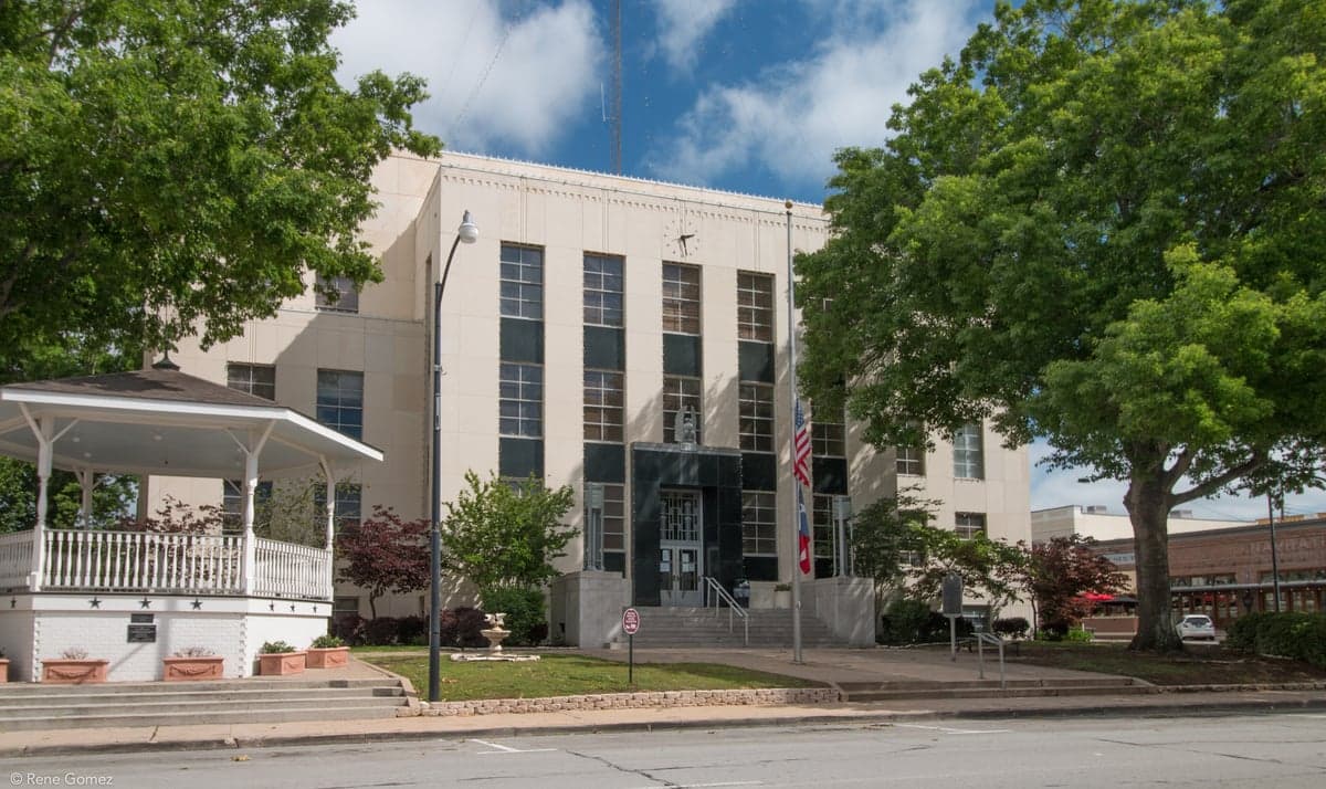
Photo: Wikipedia
Strategic Assessment of Washington County
Meaningful friction. Expect exposure to either population pressure, blast zones, or natural disaster risk. Consider buying a retreat property.
What does the Strategic Assessment tell us?
Our Strategic Assessment grades tactical survivability of an area. Major population centers, military targets, fallout zones, natural disasters, and border exposure all drive risk — lower exposure means a more defensible position in a crisis.
This is heavily inspired by Joel Skousen's Strategic Relocation book. Highly recommended you checkout the book ($)What does this tell us?
Our Strategic Assessment grades tactical survivability of an area. Major population centers, military targets, fallout zones, natural disasters, and border exposure all drive risk — lower exposure means a more defensible position in a crisis.
This is heavily inspired by Joel Skousen's Strategic Relocation book. Highly recommended you checkout the book ($)Strategic Pillars

Key Distances
Strategic Assessment Analysis
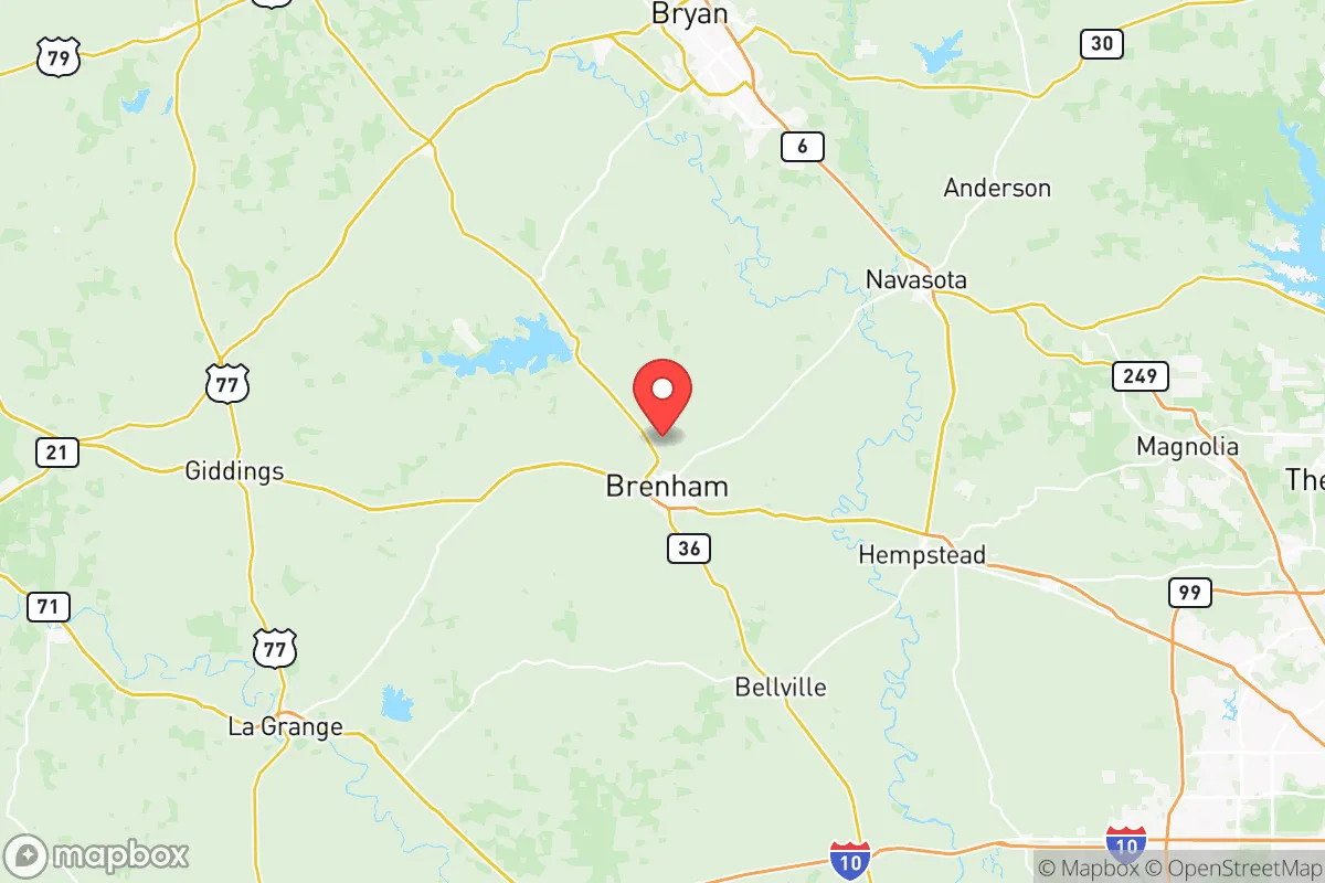
Washington County, Texas, offers a compelling mix of deep-rooted stability and strategic positioning for those prioritizing resilience and self-sufficiency. Located roughly 70 miles northwest of Houston and 90 miles east of Austin, the county—anchored by the historic town of Brenham—sits in a sweet spot: close enough to major job markets and medical hubs, yet far enough to avoid the worst of urban sprawl, hurricane storm surge, and the immediate fallout of a major industrial or grid-down event. Its agricultural base, strong local governance, and relatively low population density make it a serious contender for families and individuals who want to be prepared without living off-grid in a remote wilderness.
Geographic position and natural advantages for long-term stability
Washington County’s geography is its first line of defense. Sitting atop the rolling Post Oak Savannah, the land is well-drained, with elevations ranging from 200 to 400 feet—high enough to be safe from the catastrophic flooding that plagues Houston’s coastal plain, yet low enough to have reliable groundwater. The county is crisscrossed by the Brazos River and its tributaries, including the Navasota River along the eastern border, providing ample surface water for irrigation and livestock. The local climate is humid subtropical, with an average of 40 inches of rain per year, meaning drought is less of a concern here than in West Texas. For a relocator thinking about long-term food production, the growing season stretches from March to November, and the soil—primarily sandy loam and clay—supports everything from corn and cotton to vegetables and pecans. The county’s 600 square miles hold a population of just over 37,000, with Brenham (population ~17,000) as the only real town; the rest is open farmland, small communities like Burton and Chappell Hill, and scattered ranches. That low density is a major resilience asset: fewer people means less competition for resources in a crisis, and more room for private gardens, solar arrays, and rainwater catchment.
Risks, exposures, and proximity to fallout-relevant landmarks
No place is risk-free, and Washington County has its own set of vulnerabilities. The most obvious natural threat is severe weather: the area sits in the heart of Tornado Alley’s southern extension, and violent storms—including hail, straight-line winds, and the occasional tornado—are a seasonal reality. The county has experienced several EF-2 and EF-3 tornadoes in the past two decades, most notably the 1997 Jarrell-style storm that hit near Chappell Hill. Flooding along the Brazos River is another concern, though it’s typically confined to low-lying farmland rather than populated areas. On the man-made side, the county’s location is a double-edged sword. It lies about 50 miles northwest of the Houston Ship Channel and its massive refinery corridor—a prime target for any major geopolitical disruption or terrorist attack. A worst-case event at the ExxonMobil Baytown complex or the Port of Houston could send a toxic plume or cause a regional grid collapse that would ripple into Washington County. Similarly, the county is roughly 100 miles south of Fort Cavazos (formerly Fort Hood), a major Army base that could become a target or a staging area during a national emergency. While the county itself has no nuclear plants, chemical plants, or major military installations, its proximity to these high-value assets means that a regional crisis—whether natural or man-made—would almost certainly affect supply chains, fuel availability, and population movement. The good news: the county is far enough from Houston’s urban core that a sudden evacuation of the city (as seen during Hurricane Rita) would likely bypass Brenham, with evacuees heading west on Highway 290 toward Austin rather than north into Washington County.
Practical resilience for a relocator: food, water, energy, and defensibility
For someone serious about self-sufficiency, Washington County delivers on the basics. Food: The county is one of Texas’s top producers of corn, sorghum, and hay, and it has a strong local food infrastructure. The Brenham Farmers Market operates year-round, and the area is dotted with small dairies, poultry farms, and cattle ranches. Blue Bell Creameries, headquartered in Brenham, is a local institution, but more importantly, the county has multiple feed stores, seed suppliers, and agricultural co-ops that make small-scale farming feasible. Water: The Brazos River Authority manages the county’s water supply, and most rural properties rely on private wells tapping into the Carrizo-Wilcox Aquifer, which is deep but abundant. For a relocator, a property with a well and a backup generator is a major advantage—municipal water in Brenham is treated and reliable, but a grid-down event would leave well owners unaffected. Energy: The county is served by Bluebonnet Electric Cooperative, a member-owned utility that has a strong track record of storm hardening and rapid restoration. Solar potential is good—the area averages 215 sunny days per year—and many rural homes already have propane tanks for heating and cooking. For defensibility, the county’s layout works in its favor. Brenham is a compact town with a historic courthouse square and a grid of streets that could be easily secured in a localized emergency. The outlying areas—Burton, Independence, and the rural stretches along Highway 105—offer natural chokepoints: narrow farm-to-market roads, creek crossings, and long sightlines across open fields. The local sheriff’s office is well-regarded, and the county has a strong tradition of volunteer fire departments and community emergency response teams (CERT). That said, the area is not a fortress: it’s a working agricultural community, not a prepper compound. The social fabric is what provides the real resilience—neighbors know each other, church networks are active, and the local economy is diversified enough (healthcare, education, manufacturing, agriculture) that a single disruption won’t collapse the whole system.
The overall strategic picture for Washington County is one of balanced, grounded preparedness. It lacks the dramatic isolation of the Texas Panhandle or the rugged terrain of the Hill Country, but it compensates with reliable water, fertile soil, a stable local economy, and a community that still operates on a handshake. For a relocator who wants to be ready for a range of scenarios—from a prolonged power outage to a regional supply chain disruption—without living in a bunker, this county offers a realistic middle path. The key is to choose a property wisely: avoid the floodplain along the Brazos, invest in a well and solar backup, and get to know your neighbors before you need them. Washington County won’t make you immune to disaster, but it gives you a fighting chance—and in the world of resilience, that’s more than most places can offer.

* Values derived from national, state, county, city and local statistics and may differ in a specific area. Last updated: 2026-10-24T19:48:10.000Z
Narrative content on this page is AI-generated and may contain mistakes. Verify any details that matter before acting on them.
ReloMaps may earn a commission from affiliate links at no extra cost to you.

