Photo: Wikipedia
Strategic Assessment of Waller County
Meaningful friction. Expect exposure to either population pressure, blast zones, or natural disaster risk. Consider buying a retreat property.
What does the Strategic Assessment tell us?
Our Strategic Assessment grades tactical survivability of an area. Major population centers, military targets, fallout zones, natural disasters, and border exposure all drive risk — lower exposure means a more defensible position in a crisis.
This is heavily inspired by Joel Skousen's Strategic Relocation book. Highly recommended you checkout the book ($)What does this tell us?
Our Strategic Assessment grades tactical survivability of an area. Major population centers, military targets, fallout zones, natural disasters, and border exposure all drive risk — lower exposure means a more defensible position in a crisis.
This is heavily inspired by Joel Skousen's Strategic Relocation book. Highly recommended you checkout the book ($)Strategic Pillars

Key Distances
Strategic Assessment Analysis
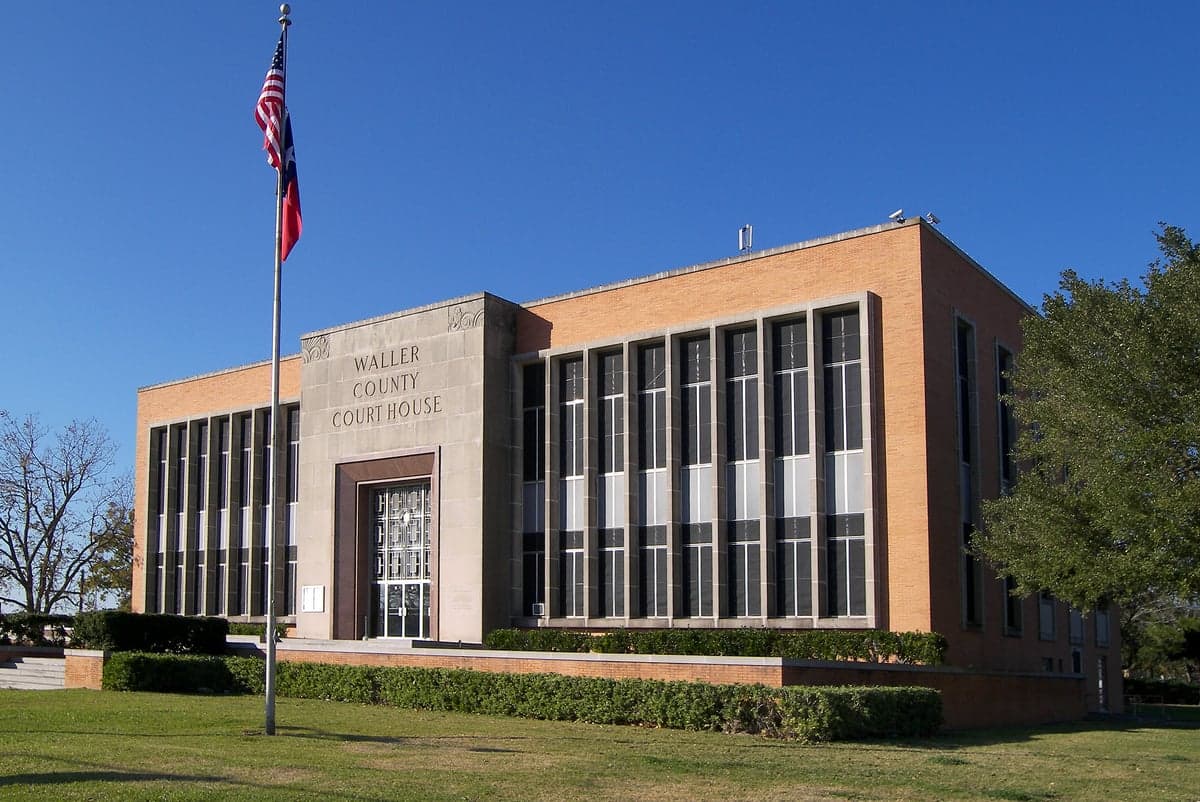
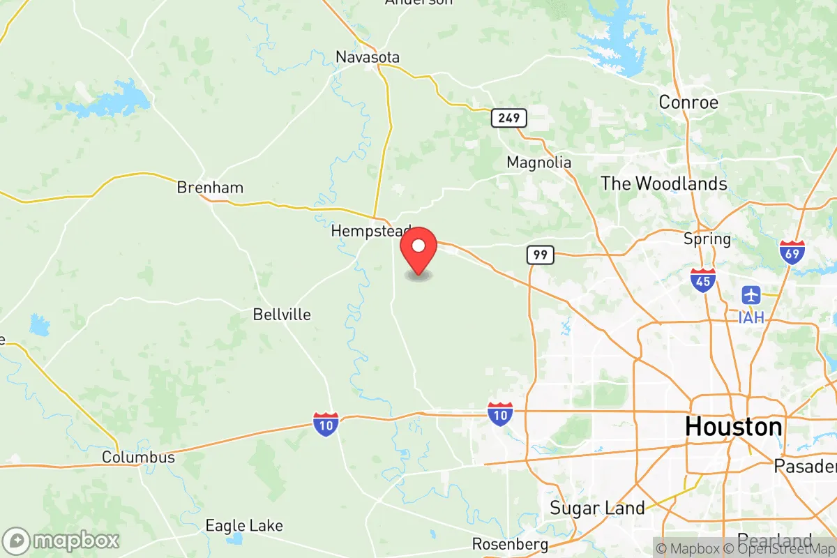
Waller County, Texas, offers a compelling strategic position for relocators prioritizing resilience and self-sufficiency, balancing proximity to Houston’s economic engine with a distinctly rural character that provides natural buffers. Located roughly 45 miles west of downtown Houston and 30 miles from the Katy suburbs, the county’s unincorporated communities—including Hempstead (the county seat), Prairie View, Brookshire, and Pattison—sit at a critical inflection point between the sprawling Houston metroplex and the sparsely populated Brazos River Valley. This geographic placement gives residents access to urban infrastructure while maintaining enough distance to mitigate many of the risks associated with dense population centers, making it a serious contender for those evaluating disaster readiness and long-term sustainability.
Geographic position and natural advantages for self-sufficiency
Waller County’s location along the Brazos River corridor provides both strategic benefits and practical assets for a self-sufficient lifestyle. The county spans roughly 518 square miles of rolling coastal plains, with the Brazos forming its western boundary and the San Bernard River touching its southern edge. This riverine geography means reliable surface water sources—a critical factor for long-term resilience that many inland Texas counties lack. The area’s clay-loam soils, while requiring careful management, support small-scale farming and livestock operations, and the county’s agricultural heritage is evident in its working ranches and hay fields. Hempstead, with a population around 8,000, serves as the commercial hub, while Prairie View (home to Prairie View A&M University) adds institutional stability. The county’s position along U.S. Highway 290 and State Highway 6 provides two major evacuation routes, though these same roads can become congested during emergencies. For a relocator, the key advantage is the ability to tap into Houston’s medical and supply networks (Texas Medical Center is about an hour east) while maintaining a buffer that reduces exposure to urban cascading failures—grid collapse, civil unrest, or disease spread—that would affect closer-in suburbs like Katy or Cypress.
Risk exposures and proximity to fallout-relevant landmarks
No strategic assessment is honest without acknowledging Waller County’s real vulnerabilities, particularly its proximity to Houston’s industrial and energy infrastructure. The county sits roughly 30 miles northwest of the Houston Ship Channel and its refinery corridor—the nation’s largest petrochemical complex, including facilities in Texas City, Pasadena, and Baytown. A major industrial accident, intentional attack, or natural disaster triggering chemical releases at these sites could send plumes across the region, though prevailing winds typically carry emissions southeast toward the Gulf. More immediately, Waller County itself hosts several industrial facilities: a large natural gas processing plant near Brookshire, multiple pipeline corridors (including the Seaway Pipeline and Enterprise Products lines), and a rail line running through Hempstead that carries hazardous materials. The county is also within 90 miles of the San Jacinto River Waste Pits Superfund site and the former Pantex nuclear weapons plant (though Pantex is 500 miles northwest near Amarillo—a common confusion). Natural disaster risks are significant: Waller County lies in a high-risk zone for flash flooding, particularly along the Brazos River bottoms, as demonstrated by Hurricane Harvey in 2017 when the Brazos crested at 54.7 feet in Hempstead, flooding hundreds of homes. The county also sits in Tornado Alley’s southern fringe, with a moderate risk of tornadoes and severe thunderstorms. For the resilience-minded relocator, these risks mean that property selection is critical—elevated homes away from floodplains and with defensible space are essential, and a robust emergency plan must account for both natural disasters and industrial incidents originating from the Houston metroplex.
Practical resilience for a relocator: food, water, energy, and defensibility
Waller County offers above-average practical resilience for those willing to invest in infrastructure, though it is not a turnkey survivalist paradise. Water security is the county’s strongest asset: the Brazos River provides a perennial surface water source, and the underlying Gulf Coast Aquifer system supplies most rural wells with reliable groundwater at depths of 100-400 feet. However, water quality varies—some areas have high salinity or iron content, requiring filtration. The county’s agricultural base means local food production is feasible: there are active farmers’ markets in Hempstead and Brookshire, and the surrounding region supports cattle, poultry, and row crops. For energy independence, solar potential is good—the county averages 200+ sunny days per year—and many rural properties already use propane or diesel generators as backup. The electric grid is served by Entergy Texas, which has a mixed reliability record; during Winter Storm Uri in 2021, parts of Waller County experienced rolling blackouts for up to 72 hours. Defensibility is moderate: the county’s low population density (roughly 60 people per square mile) and dispersed settlement pattern make it harder to target than dense suburbs, but the flat, open terrain offers little natural cover. The county sheriff’s office has about 40 deputies for 60,000 residents, meaning response times in rural areas can exceed 20 minutes. For a relocator, the practical strategy is to buy acreage with a well, solar panels, and a septic system—preferably in the western part of the county near Pattison or along the Brazos—and to build a community network with neighbors, as formal emergency services are thin. The proximity to Houston’s medical resources (Memorial Hermann in Katy is 25 minutes from Brookshire) is a genuine advantage for non-emergency healthcare, but for disaster scenarios, a well-stocked medical kit and training are non-negotiable.
The overall strategic picture for Waller County is one of calculated trade-offs. It offers genuine resilience advantages—water access, agricultural potential, distance from urban core risks—that make it a strong candidate for a relocator who wants to be within striking distance of Houston’s economy while maintaining a self-sufficient buffer. The county’s position along major transportation corridors (U.S. 290, State 6, and the Union Pacific rail line) provides both evacuation options and supply chain access, but also introduces vulnerability to industrial incidents and evacuation bottlenecks. For the conservative-leaning reader focused on family security and long-term preparedness, Waller County represents a middle path: not as remote as the Texas Hill Country (which offers better defensibility but worse water access), nor as exposed as the immediate Houston suburbs. The key is to choose your specific location carefully—avoid the Brazos floodplain, verify well water quality, and invest in backup power—and to recognize that no location in Texas is fully insulated from the risks of hurricanes, industrial accidents, or grid failures. Waller County’s resilience is real, but it requires active preparation, not passive assumption of safety.

* Values derived from national, state, county, city and local statistics and may differ in a specific area. Last updated: 2026-08-08T14:26:24.000Z
Narrative content on this page is AI-generated and may contain mistakes. Verify any details that matter before acting on them.
ReloMaps may earn a commission from affiliate links at no extra cost to you.

