
Photo: Wikipedia
Strategic Assessment of Palo Pinto County
Workable tactical position. Some exposure to population density or targets, but generally defensible in a crisis.
What does the Strategic Assessment tell us?
Our Strategic Assessment grades tactical survivability of an area. Major population centers, military targets, fallout zones, natural disasters, and border exposure all drive risk — lower exposure means a more defensible position in a crisis.
This is heavily inspired by Joel Skousen's Strategic Relocation book. Highly recommended you checkout the book ($)What does this tell us?
Our Strategic Assessment grades tactical survivability of an area. Major population centers, military targets, fallout zones, natural disasters, and border exposure all drive risk — lower exposure means a more defensible position in a crisis.
This is heavily inspired by Joel Skousen's Strategic Relocation book. Highly recommended you checkout the book ($)Strategic Pillars

Key Distances
Strategic Assessment Analysis
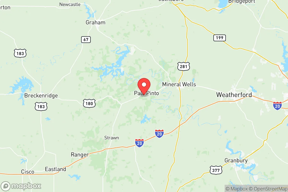
Palo Pinto County offers a compelling strategic position for relocators prioritizing resilience and self-sufficiency, balancing proximity to major metro areas with the practical advantages of a less-dense, resource-rich landscape. Located roughly 60 miles west of Fort Worth and 90 miles southwest of the Dallas-Fort Worth metroplex, the county sits at the edge of the Cross Timbers region, where the rolling plains meet the Palo Pinto Mountains. This geography provides natural buffers—hills, limestone bluffs, and the Brazos River watershed—that create defensible terrain and reduce exposure to the worst fallout patterns from a major urban or industrial incident. For a reader thinking seriously about disaster readiness, Palo Pinto County is not a remote bunker, but a strategically positioned base with real assets and manageable liabilities.
Geographic position and natural advantages for self-sufficiency
The county’s location is its primary strategic asset. It lies outside the immediate blast and fallout zones of the Dallas-Fort Worth metroplex, while still being close enough for supply runs or medical access in normal times. The terrain is varied—steep hills, wooded draws, and open ranchland—which offers multiple defensible positions and natural cover. Possum Kingdom Lake, a 17,000-acre reservoir on the Brazos River, provides a reliable freshwater source and supports local agriculture. The lake’s dam and surrounding state park also create a buffer zone that limits development and preserves open space. The county seat, Palo Pinto, and the largest town, Mineral Wells, sit on the western edge of the Barnett Shale formation, which has historically supported natural gas extraction. This energy infrastructure, while not without risk, means local access to fuel and power generation capacity that many rural counties lack. The Brazos River itself, running through the county’s southern half, offers both water and a natural barrier to movement, which could be valuable in a grid-down scenario.
Risks, exposures, and proximity to fallout-relevant landmarks
No location is without risk, and Palo Pinto County has several exposures a relocator should weigh. The most significant is its proximity to the Dallas-Fort Worth metroplex, a major population and industrial center that would be a primary target in a conflict. Fallout patterns from a strike on DFW could reach the county, depending on wind direction, though the distance and intervening hills reduce the severity compared to closer suburbs. The county also sits within 100 miles of Naval Air Station Joint Reserve Base Fort Worth, a strategic military installation that could be a secondary target. Additionally, the Barnett Shale natural gas fields contain numerous wellheads, pipelines, and processing facilities near Mineral Wells and Strawn. A conventional attack or industrial accident at one of these sites could create localized hazards. On the natural disaster front, the county is in Tornado Alley, with a moderate risk of severe storms, hail, and flash flooding along the Brazos River. Wildfire risk is elevated during drought years, particularly in the wooded hills around Possum Kingdom Lake. The county’s infrastructure—roads, power lines, and cell towers—is less redundant than in urban areas, meaning a major event could disrupt services for days or weeks. Relocators should plan for self-sufficiency in terms of backup power, water storage, and medical supplies.
Practical resilience for a relocator: food, water, energy, and defensibility
For someone serious about preparedness, Palo Pinto County offers a strong baseline. Water is the most critical resource, and the county has it in abundance. Possum Kingdom Lake is the primary reservoir, but smaller lakes like Lake Palo Pinto and numerous stock ponds and creeks provide distributed sources. Groundwater is accessible via wells in most areas, though depth varies. The county’s agricultural heritage means local food production is viable; there are working ranches, hay farms, and small-scale vegetable operations around Gordon, Mingus, and Santo. The local climate supports a 200-day growing season, and the soil, while rocky in places, is workable for gardens. Energy resilience is a mixed picture. The Barnett Shale infrastructure means natural gas is locally available, and many rural properties already have propane tanks or backup generators. Solar potential is good, with over 230 sunny days per year, though the hilly terrain can create shading issues. Defensibility is a key advantage: the county’s topography—steep hills, narrow valleys, and dense brush—makes it harder for large groups to move through undetected. The low population density (roughly 28 people per square mile) means fewer neighbors to compete with for resources, but also fewer people to form mutual-aid networks. The towns of Mineral Wells and Palo Pinto have local law enforcement and volunteer fire departments, but response times in remote areas can exceed 30 minutes. For a family or individual, the best approach is to secure a property with its own water source, south-facing solar exposure, and a defensible perimeter—ideally on a hill with good sightlines.
The overall strategic picture for Palo Pinto County is one of balanced opportunity. It avoids the worst fallout risks of the Dallas-Fort Worth metroplex while retaining access to its resources and markets. The natural advantages—water, terrain, energy, and agricultural potential—are real and measurable. The risks—proximity to military and industrial targets, tornadoes, and infrastructure fragility—are manageable with proper planning. For a relocator who values self-sufficiency and is willing to invest in off-grid capabilities, this county offers a solid foundation. It is not a perfect sanctuary, but it is a defensible, resource-rich position that allows a family to thrive in normal times and survive in bad ones. The key is to choose a location carefully, build redundancy into water and power systems, and connect with the local community of ranchers and homesteaders who already live this way. Palo Pinto County rewards preparation and punishes complacency—which is exactly what a strategic relocation requires.

* Values derived from national, state, county, city and local statistics and may differ in a specific area. Last updated: 2026-07-03T01:27:09.000Z
Narrative content on this page is AI-generated and may contain mistakes. Verify any details that matter before acting on them.
ReloMaps may earn a commission from affiliate links at no extra cost to you.

