
Photo: Wikipedia
Strategic Assessment of Montgomery County
Multiple tactical vulnerabilities. Population density, target proximity, or disaster risk are likely compounding. A retreat property and exit planning is required.
What does the Strategic Assessment tell us?
Our Strategic Assessment grades tactical survivability of an area. Major population centers, military targets, fallout zones, natural disasters, and border exposure all drive risk — lower exposure means a more defensible position in a crisis.
This is heavily inspired by Joel Skousen's Strategic Relocation book. Highly recommended you checkout the book ($)What does this tell us?
Our Strategic Assessment grades tactical survivability of an area. Major population centers, military targets, fallout zones, natural disasters, and border exposure all drive risk — lower exposure means a more defensible position in a crisis.
This is heavily inspired by Joel Skousen's Strategic Relocation book. Highly recommended you checkout the book ($)Strategic Pillars

Key Distances
Strategic Assessment Analysis
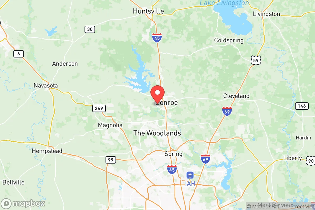
Montgomery County has become a strategic destination for relocators prioritizing resilience and self-sufficiency, offering a balance of natural resources and inland positioning that mitigates some risks of coastal Texas, yet its proximity to Houston's critical infrastructure and high-growth corridors introduces exposure that must be weighed carefully. The county sits in the Piney Woods region, roughly 40 miles north of downtown Houston, and its land area of 1,044 square miles includes the major towns of Conroe, The Woodlands, Willis, Magnolia, and the historic town of Montgomery — each offering a different mix of suburban convenience and rural buffer. While the area has seen explosive population growth (approaching 700,000 residents as of the mid-2020s), the fundamental geography and resource base still provide a foundation for relocation that is more defensible than many options directly along the Gulf Coast.
Where Montgomery County sits: geographic buffer and natural assets
The primary resilience advantage of Montgomery County is its inland location. Unlike Galveston or Houston’s flood-prone southeastern suburbs, the county sits on the western edge of the Gulf Coastal Plain with elevations mostly ranging from 100 to 250 feet. This elevation, combined with sandy loam soils, means that flash flooding is far less severe than in Harris County, though the Trinity River basin on the county’s eastern border can swell during prolonged rain events. The county also contains the Sam Houston National Forest — a 163,000-acre managed woodland that spans parts of Montgomery, San Jacinto, and Walker counties. This forest is a significant natural asset: it offers firewood, small-game hunting, foraging, and a physical barrier that slows movement and development. The centerpiece of the region’s water security is Lake Conroe, a 21,000-acre reservoir created by the damming of the West Fork of the San Jacinto River. It supplies municipal water to Conroe and parts of The Woodlands and also supports irrigation and recreation. For a relocator, access to a major surface water source within a few miles of population centers is a practical advantage few inland Texas counties can claim. The presence of the national forest and the lake gives Montgomery County a natural buffer and a self-reliance base that suburban sprawl alone cannot replicate.
Risks and exposures: what’s within fallout range of Montgomery County
The same proximity that makes Montgomery County attractive for employment and logistics also creates a cascade of man-made and natural risks that a resilience-minded relocator must factor in. The county lies directly in the path of hurricane winds that can push the Houston Ship Channel’s vapor clouds and chemical releases northward. In a major storm event, the Houston refinery corridor — stretching from Texas City to Baytown and up the Ship Channel — is a likely target for both natural and man-made incidents. Depending on wind direction, noxious plumes or ash could reach southern Montgomery County within a few hours. More concerning is proximity to the George H.W. Bush Intercontinental Airport (IAH), which sits less than 20 miles south of The Woodlands. IAH is a primary hub for air travel and cargo, and in any conflict or high-consequence event, it would be a likely target. The Port of Houston, the busiest port on the Gulf Coast, is roughly 50 miles from northern Montgomery County — a distance that puts the county inside the heavy fallout zone if that port were struck with a conventional or small nuclear device. Additionally, the county is bisected by Interstate 45, the primary evacuation and supply corridor between Houston and Dallas. In a crisis, I‑45 is a predictable choke point that could be overwhelmed or blocked, effectively trapping those in The Woodlands and Conroe. While Montgomery County is not directly exposed to coastal surge, it is exposed to the secondary and tertiary effects of disasters originating in the greater Houston metroplex — a reality that drives the decision to look farther north or east for absolute isolation.
Practical resilience on the ground: water, food, energy, and defensibility
For a relocator trying to assess day‑to‑day survivability, Montgomery County offers some genuine advantages but also clear trade-offs. Water is the strongest card: Lake Conroe is a drought‑resistant surface source, and many rural parcels in the northern part of the county (especially around Willis and the town of Montgomery) have historic well water that can be developed with a private drilling permit. The Sam Houston National Forest also supports deer, turkey, and small game populations, and the Trinity River bottomlands offer additional hunting access. Food production is viable on larger lots: the sandy soil works for vegetables with irrigation, and a number of local farms in the Magnolia and Montgomery areas sell produce, eggs, and meat at farmers’ markets year‑round. Energy is the weak link. Montgomery County relies entirely on the ERCOT grid, which has demonstrated fragility during winter storms and summer heat waves. Solar panels are legal and increasingly common, but net metering policies can be restrictive. Some residents have installed propane generators or small wind turbines, but the county’s suburban subdivisions — particularly in The Woodlands and Conroe — limit the ability to maintain full off‑grid operations due to homeowners association rules and density. Defensibility varies dramatically by location. The unincorporated areas of northern Montgomery County offer more than 5‑acre lots, long driveways, and wooded natural borders, making them far more defensible than the grid‑pattern subdivisions of southern Conroe. The town of Montgomery itself, with its historic square and low population density, provides a natural rally point, but it has no organized preparedness infrastructure. The Woodlands, for all its amenities, is a liability in a long‑term crisis: high population density, limited agricultural land, and only two major road exits. For anyone serious about self‑sufficiency, a parcel near Willis, northeast of Lake Conroe, or along the Trinity River in the eastern part of the county offers the best combination of water access, isolation, and defensible property.
The overall strategic picture for Montgomery County is one of calibrated opportunity. It has real natural advantages — a large lake, a national forest, moderate elevation, and a position inland that avoids the worst of coastal surge and saltwater intrusion. Those advantages, however, sit within a region of immense critical‑infrastructure density, from refineries and chemical plants to a major international airport and the country’s busiest port. Relocation here makes sense for someone who wants to be close enough to Houston for work or supply runs but who

* Values derived from national, state, county, city and local statistics and may differ in a specific area. Last updated: 2026-06-17T03:45:16.000Z
Narrative content on this page is AI-generated and may contain mistakes. Verify any details that matter before acting on them.
ReloMaps may earn a commission from affiliate links at no extra cost to you.

