
Photo: Wikipedia
Strategic Assessment of Burnet County
Workable tactical position. Some exposure to population density or targets, but generally defensible in a crisis.
What does the Strategic Assessment tell us?
Our Strategic Assessment grades tactical survivability of an area. Major population centers, military targets, fallout zones, natural disasters, and border exposure all drive risk — lower exposure means a more defensible position in a crisis.
This is heavily inspired by Joel Skousen's Strategic Relocation book. Highly recommended you checkout the book ($)What does this tell us?
Our Strategic Assessment grades tactical survivability of an area. Major population centers, military targets, fallout zones, natural disasters, and border exposure all drive risk — lower exposure means a more defensible position in a crisis.
This is heavily inspired by Joel Skousen's Strategic Relocation book. Highly recommended you checkout the book ($)Strategic Pillars

Key Distances
Strategic Assessment Analysis
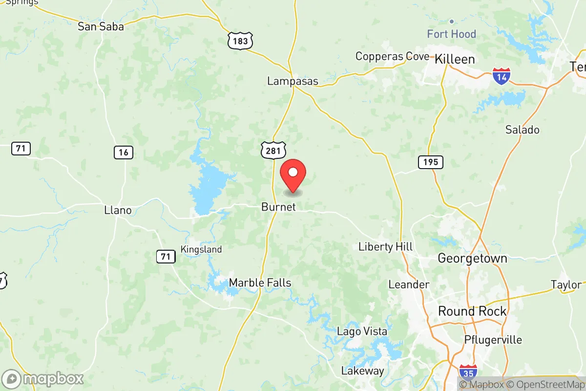
Burnet County, Texas, offers a compelling strategic profile for relocators prioritizing resilience and self-sufficiency, anchored by its position in the Texas Hill Country roughly 50 miles northwest of Austin. The county seat of Burnet and the lakeside community of Marble Falls serve as the primary population centers, providing essential services without the congestion and vulnerability of a major metro area. The region’s underlying granite geology, reliable water sources from the Colorado River chain of lakes, and distance from coastal hurricane zones make it a standout location for those assessing long-term stability and disaster readiness.
Geographic position and natural advantages for long-term stability
Burnet County sits atop the Llano Uplift, a geological formation of ancient granite and limestone that provides a stable foundation largely immune to the subsidence and soil instability issues plaguing Houston and other Gulf Coast areas. The terrain is rolling hills with elevations ranging from 800 to 1,600 feet, offering natural drainage and defensible positions. The county is bounded by Lake Buchanan to the north and Lake LBJ to the south, part of the Highland Lakes chain managed by the Lower Colorado River Authority. These reservoirs provide a significant freshwater buffer — Lake Buchanan alone holds nearly 1 million acre-feet of water — that is rare for inland Texas. The area’s distance from the Gulf Coast, roughly 200 miles, eliminates direct hurricane storm surge risk, while its inland position reduces tornado frequency compared to North Texas. The Balcones Escarpment, which runs through the county’s eastern edge, creates a natural rain shadow that moderates extreme weather patterns.
Risks, exposures, and proximity to fallout-relevant landmarks
While Burnet County avoids many coastal and urban hazards, it is not without strategic risks. The county lies roughly 60 miles northwest of Austin-Bergstrom International Airport and 70 miles from the Texas State Capitol, placing it within the outer fallout zone of a potential urban-target event. To the north, Fort Cavazos (formerly Fort Hood) is about 70 miles away, a major military installation that could be a secondary target. The county itself contains no major refineries or chemical plants, but the I-35 corridor, a critical north-south logistics artery, runs 30 miles east and carries hazardous materials daily. Wildfire risk is moderate, particularly in drought years, given the juniper and oak brushlands. The area’s granite geology means limited groundwater availability in some parts, making surface water from the lakes the primary long-term resource. Flash flooding can occur along creeks and low-water crossings during heavy rain events, though the hilly terrain generally sheds water quickly.
Practical resilience for a relocator: food, water, energy, and defensibility
For a relocator focused on self-sufficiency, Burnet County offers several structural advantages. Water access is the strongest asset: residents on Lake Buchanan, Lake LBJ, or Inks Lake have direct surface water rights, while those on well water tap into the Ellenburger-San Saba aquifer, which yields moderate volumes at depths of 200-400 feet. The county has multiple feed stores, livestock supply outlets, and a growing network of small-scale farms producing meat, eggs, and produce — the Burnet Farmers Market and Marble Falls Farmers Market operate seasonally. Energy resilience is supported by the LCRA’s hydroelectric dams on the Highland Lakes and the South Texas Project Nuclear Generating Station roughly 150 miles south, though the local grid remains connected to ERCOT and subject to the same winterization vulnerabilities seen in 2021. Defensibility is naturally strong: the county’s low population density (roughly 50,000 residents across 1,000 square miles), limited highway access points (primarily US 281 and TX 29), and hilltop terrain offer strategic depth. The Burnet County Sheriff’s Office and local constables provide law enforcement coverage, but response times in rural areas can exceed 20 minutes, making community preparedness and private security measures relevant considerations.
The overall strategic picture for Burnet County is one of balanced resilience with manageable trade-offs. Its combination of granite geology, abundant surface water, moderate climate, and distance from major urban and industrial targets places it among the more defensible locations in Central Texas. The primary vulnerabilities — proximity to the Austin metro area and I-35 corridor, moderate wildfire risk, and reliance on a single power grid — are well-understood and can be mitigated with proper planning. For a relocator seeking a base that balances access to regional resources with genuine geographic separation from high-risk zones, Burnet County represents a solid, data-backed choice that avoids the extremes of both remote isolation and urban exposure.

* Values derived from national, state, county, city and local statistics and may differ in a specific area. Last updated: 2026-06-23T20:04:54.000Z
Narrative content on this page is AI-generated and may contain mistakes. Verify any details that matter before acting on them.
ReloMaps may earn a commission from affiliate links at no extra cost to you.

