Photo: Wikipedia
Strategic Assessment of Terra Bella, CA
Workable tactical position. Some exposure to population density or targets, but generally defensible in a crisis.
What does the Strategic Assessment tell us?
Our Strategic Assessment grades tactical survivability of an area. Major population centers, military targets, fallout zones, natural disasters, and border exposure all drive risk — lower exposure means a more defensible position in a crisis.
This is heavily inspired by Joel Skousen's Strategic Relocation book. Highly recommended you checkout the book ($)What does this tell us?
Our Strategic Assessment grades tactical survivability of an area. Major population centers, military targets, fallout zones, natural disasters, and border exposure all drive risk — lower exposure means a more defensible position in a crisis.
This is heavily inspired by Joel Skousen's Strategic Relocation book. Highly recommended you checkout the book ($)Strategic Pillars

Key Distances
Regional Safe Places
Below is our recommended "safe zones" in California and the surrounding area based on our strategic heuristics. For most people, it's unrealistic to live in a “safe zone” full-time due to work, family or other personal reasons. They tend to be more rural. However, many of these areas are perfect for second homes and retreat properties that double as a vacation home or even a short-term rental.

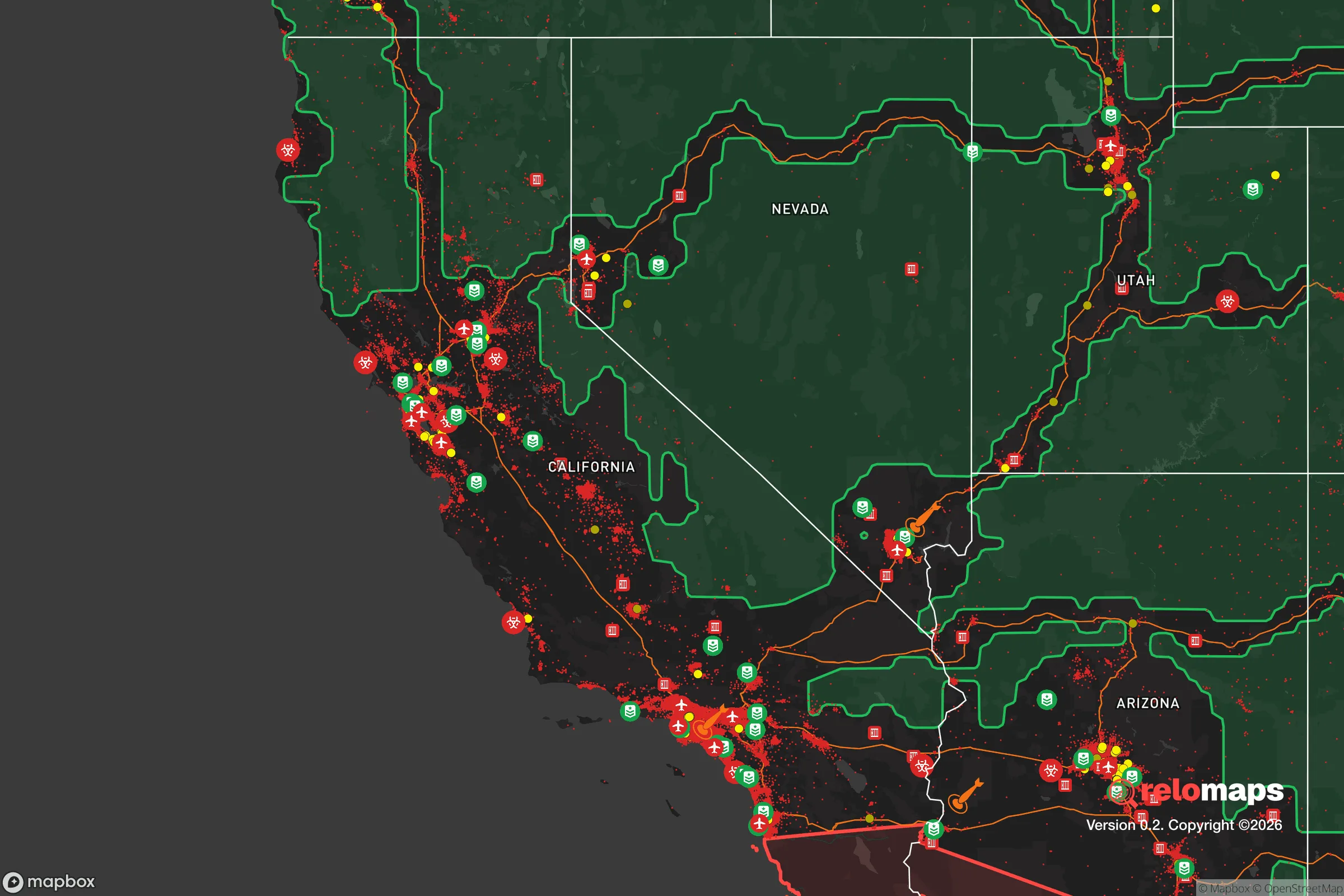


Important Note: For informational purposes only. This does not mean nothing bad ever happens in the green zones. Please use common sense. This is based on public data and modeled with AI. We tried to take a conservative approach but mistakes happen. We update this regularly as new information becomes available.
Solar Generator Recommendations
Backup power matters more here than in safer locations. We've picked three solar generators across budgets and capacity tiers — start with the budget unit if you only need a few essentials, or step up if you want to run a fridge and HVAC for days at a time.

Jackery Portable Power Station Explorer 300
Budget OptionPower on the Go: Weighing only 11 lbs, it's convenient to set up and store with book-sized foldable solar panels

BLUETTI Portable Power Station AC180
Designed for both indoor and outdoor scenarios, AC180 is highly capable as it has a robost capacity and continuous output power.

EF ECOFLOW DELTA Pro Ultra Power Station
Upgraded PickEcoFlow DELTA Pro Ultra is a whole-home energy system designed to grow with your family. Integrated with the Smart Home Panel 2, it scales to meet your evolving energy needs — keeping your home powered, intelligent, and secure through every stage of life.
We earn a commission, at no additional cost to you.
Strategic Assessment Analysis
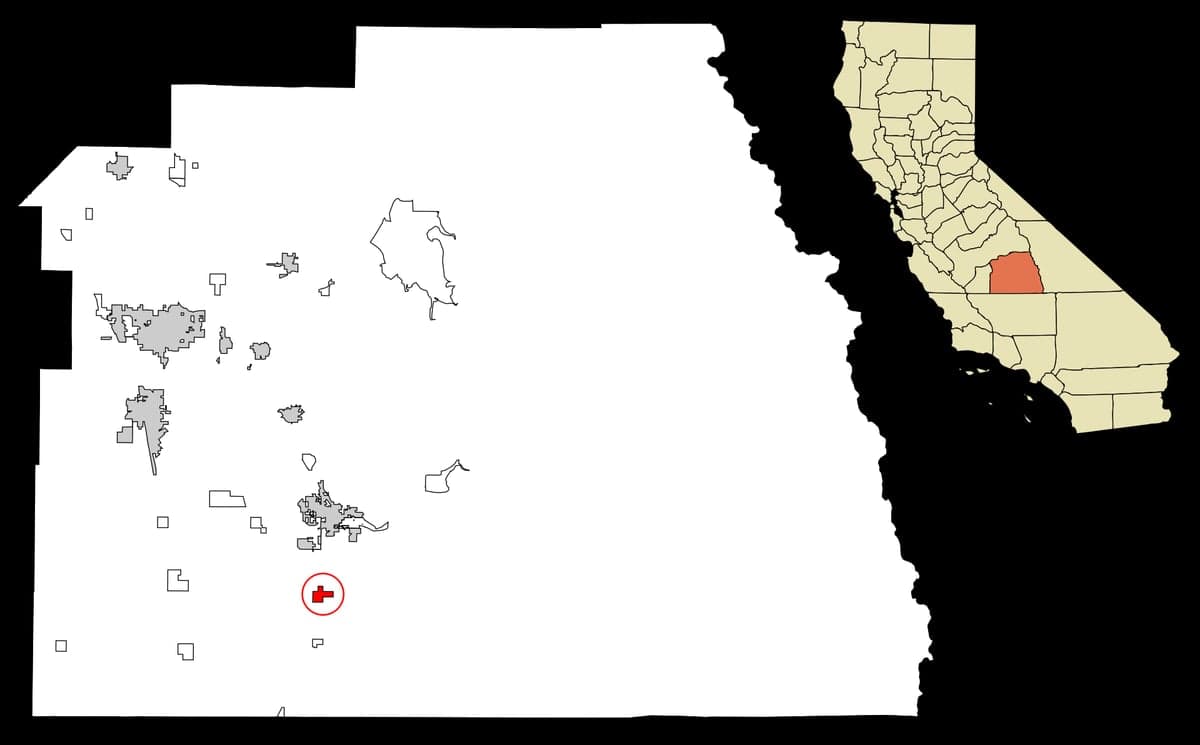
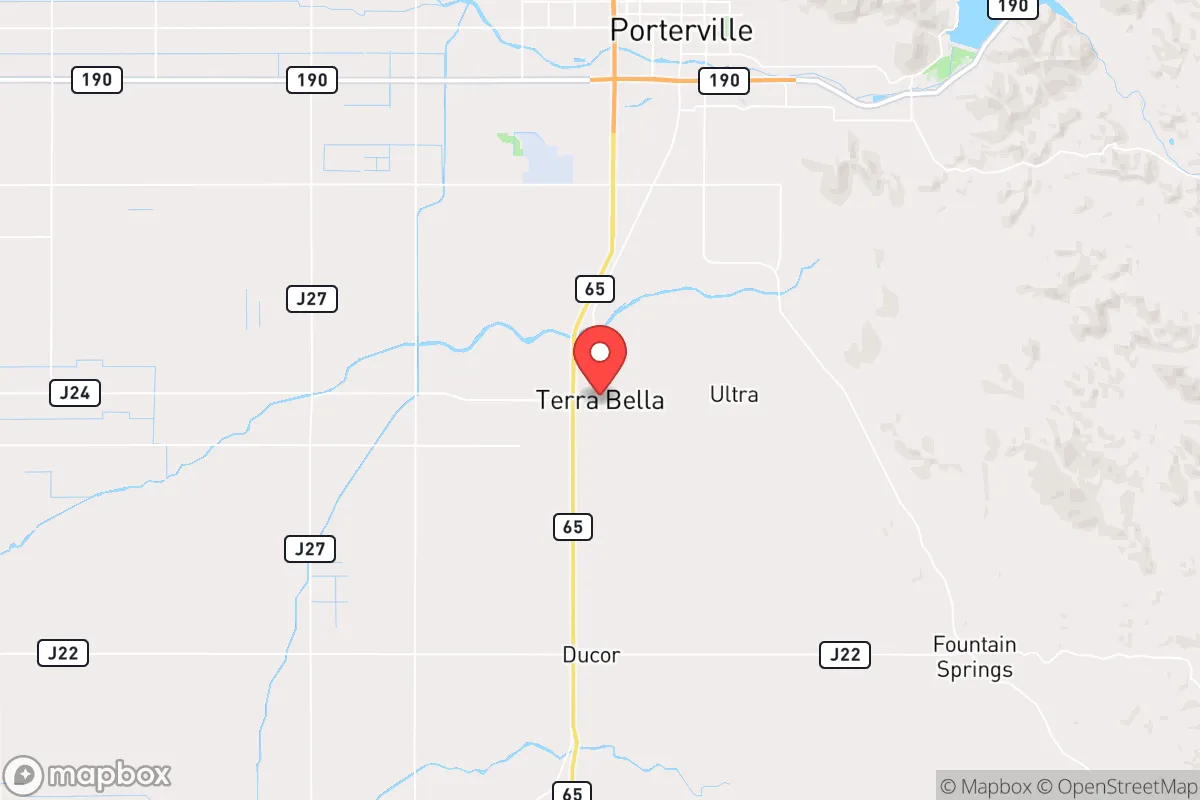
Terra Bella, California, sits in a strategic pocket of Tulare County that offers a mix of quiet isolation and practical access to resources, making it a location worth serious consideration for those prioritizing resilience and self-sufficiency. This unincorporated community of roughly 2,800 people lies along State Route 190, roughly 15 miles east of Porterville and about 40 miles north of Bakersfield, placing it within a day's drive of major urban centers while remaining firmly off the beaten path. Its position in the southern San Joaquin Valley, near the foothills of the Sierra Nevada, provides a buffer from the densest population corridors of coastal California, though proximity to certain infrastructure and natural hazards requires careful evaluation.
Geographic position and natural advantages for long-term stability
Terra Bella's primary geographic advantage is its location at the transition zone between the flat agricultural floor of the San Joaquin Valley and the rising terrain of the Sierra Nevada foothills. This positioning offers several practical benefits for a relocator focused on resilience. The area sits at an elevation of roughly 480 feet, which is above the deepest valley fog zones and provides slightly cooler summer temperatures than the valley floor, though summer highs still regularly exceed 100°F. The proximity to the Sierra Nevada means access to higher-elevation terrain for potential retreat or resource gathering, with the Sequoia National Forest and Giant Sequoia National Monument roughly 30–40 miles to the east. Water availability is a significant consideration here: Terra Bella lies within the Tulare Lake Basin, historically a rich agricultural zone, but groundwater overdraft and subsidence are ongoing concerns. The community is served by the Terra Bella Irrigation District, which draws from the Friant-Kern Canal and local groundwater wells, but long-term water security is tied to state and federal water allocation politics. For a relocator, the area's agricultural land—primarily citrus, almonds, and olives—offers potential for small-scale food production, though soil quality varies and irrigation is essential. The region's Mediterranean climate, with mild, wet winters and hot, dry summers, supports year-round growing with careful water management, a key advantage for self-sufficiency.
Risk exposure: natural hazards and proximity to fallout-relevant landmarks
No resilience assessment of Terra Bella is complete without a frank look at its risk profile, and there are several factors that demand attention. Earthquake risk is moderate to high, as the area lies near the White Wolf Fault and is within 50 miles of the San Andreas Fault system. A major rupture could disrupt road access, particularly along the mountain routes east and the valley highways north and south. The 1952 Kern County earthquake (magnitude 7.3) caused significant damage in the region, and modern building stock in Terra Bella is mixed, with older homes potentially less resilient. Flood risk is a real concern: the community sits near the Tule River and Deer Creek, and while the area has not seen catastrophic flooding in recent decades, the flat valley terrain can pond water during heavy winter storms. The 2023 atmospheric river events caused flooding in nearby Porterville and Tulare, and Terra Bella's low-lying agricultural zones are vulnerable. Wildfire risk is moderate but increasing, particularly in the foothills to the east; the 2020 Castle Fire and 2021 KNP Complex fires burned large areas of the Sierra Nevada, and smoke impacts are common during fire season. For a relocator concerned about man-made risks, Terra Bella's proximity to several high-value targets is a notable negative. The community is roughly 40 miles from Naval Air Weapons Station China Lake, a major research and testing facility for munitions and electronic warfare systems, and about 60 miles from Vandenberg Space Force Base on the coast. The San Joaquin Valley's concentration of oil and gas infrastructure, including the Kern River oil fields and refineries near Bakersfield, adds to the risk profile. Interstate 5 and Highway 99, both major logistics corridors, run within 20–30 miles, making the area a potential secondary target or chokepoint in a conflict scenario. The Diablo Canyon Nuclear Power Plant, roughly 100 miles to the west, is a distant but non-trivial consideration for fallout patterns depending on wind direction.
Practical resilience for a relocator: food, water, energy, and defensibility
For someone serious about self-sufficiency, Terra Bella offers a mixed but workable foundation. Food production potential is strong due to the agricultural character of the area. Local farms produce citrus, nuts, and stone fruits, and the nearby Porterville Farmers Market provides access to fresh produce. For a relocator looking to grow their own food, the growing season is long (roughly 250–300 frost-free days), and small-scale orchards and vegetable gardens are feasible with irrigation. However, water is the limiting factor. Groundwater levels in the Tulare Basin have dropped significantly due to decades of agricultural pumping, and the Sustainable Groundwater Management Act (SGMA) is forcing reductions in pumping that could affect small users. A relocator should plan for rainwater catchment (annual rainfall averages about 10–12 inches, mostly November–March) and consider drilling a private well, though well depths in the area often exceed 500 feet and costs are substantial. Surface water from the Friant-Kern Canal is allocated and not reliably available for new users. Energy resilience is achievable but requires investment. The area has excellent solar potential, with over 260 sunny days per year, and net metering is available through Southern California Edison. Battery storage is advisable given the risk of Public Safety Power Shutoffs (PSPS) during fire season, which can last days. Propane is widely used for heating and cooking in rural areas, and wood-burning stoves are common for backup heat. Defensibility is a relative strength of Terra Bella. The community is small and spread out, with limited through-traffic, which reduces the risk of large-scale civil unrest spilling in from urban areas. The terrain is flat to gently rolling, offering good visibility, and the surrounding agricultural land provides a natural buffer. However, the area is not easily defensible in a tactical sense—there are no natural chokepoints or high ground for observation, and the open terrain means any approach is visible but also hard to interdict. The nearest law enforcement presence is the Tulare County Sheriff's substation in Porterville, response times in rural areas can be 20–30 minutes or longer. For a relocator, building a resilient property means investing in perimeter fencing, secure water storage, and a community network of like-minded neighbors, which is feasible given the area's existing rural culture.
The overall strategic picture for Terra Bella is one of cautious opportunity. Its location offers genuine advantages in terms of agricultural potential, climate, and separation from the most densely populated and politically volatile coastal zones. The risks—earthquake, flood, water scarcity, and proximity to military and industrial targets—are real but manageable with proper planning and investment. For a relocator who values quiet, space, and the ability to produce their own food, Terra Bella represents a solid option in California's Central Valley, provided they come with realistic expectations about water, infrastructure, and the need for self-reliance. It is not a prepper's paradise, but it is a place where a determined individual or family can build a resilient life with careful preparation and a clear-eyed understanding of the trade-offs involved.

* Values derived from national, state, county, city and local statistics and may differ in a specific area. Last updated: 2026-10-21T10:05:32.000Z
Narrative content on this page is AI-generated and may contain mistakes. Verify any details that matter before acting on them.
ReloMaps may earn a commission from affiliate links at no extra cost to you.

